Almost £20,000 will be spent protecting the Carse of Gowrie from flooding, the Government has announced.
Communities won cash to help them map drainage after recent rain caused a spate of floods.
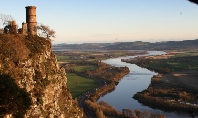
The Carse has been identified as one of the most “at-risk” areas in Scotland as persistent deluges carry a constant threat to homes.
The pioneering project will map the series of drainage ditches which criss-cross the Carse to carry water back to the Tay.
Minister for environment and climate change Paul Wheelhouse announced the Carse of Gowrie Sustainability Group, supported by Perth and Kinross Council, will receive £19,650.
It will allow them to use the latest technology to draw together vital information and produce modern maps which will transform local knowledge.
Traditionally, the farmlands have been drained through a network of “pows” or man-made drainage ditches, some of which date back to the 18th century.
In recent years it is thought that many of these pows have fallen into disrepair or are inadequate to cope with the additional pressures created by new housing and commercial development.
Mapping them is the vital first step in protecting the lowlands around the Tay from future floods.
The sustainability group plans to map the pows and other drainage systems to ascertain which are still fit for purpose and which require maintenance or repair.
The innovative method will use smart phones and online maps so the whole community can play a part.
The group’s Fiona Ross said: “We’re interested in mapping the pows, which were made, ad-hoc, for 200 to 300 years to drain water from the land into the Tay.
“They are vital to how we are going to deal with flooding but we don’t know where they are or their condition.
“We can also use the technology to alert people to extreme weather and at-risk areas and the challenges of climate change we are already facing.
“The skills are transferable once you learn the technology, so it could used by the orchards project or wildlife groups or even just to map all the small businesses there are in the Carse.
“And the good thing is, you don’t have to be tech-savvy. Anyone can do this, from ages 12 to 112.”
It is one of four Scottish community projects given money yesterday to undertake projects as part of the Climate Change Adaption Pilots.
Mr Wheelhouse said: “As recent weather events have shown the impacts of climate change including flash flooding, transport disruption and damage to agricultural production are increasing and affecting an increasing number of people’s daily lives.
“That is why it’s important to look at new ways of dealing with the consequences in order to support our communities like those across the Carse of Gowrie to adapt to the challenges they face and develop projects which will make a real difference to people’s lives.
“The Climate Challenge Fund already empowers local communities, helping them implement innovative and sustainable solutions which support a low-carbon future.”
In recent months Carse residents in Leetown, Cottown and Grange have had to deal with flooding, while swathes of agricultural ground have been left underwater.
Conditions are only expected to worsen as climate change continues to take a toll on the weather.
A series of workshops will be held to teach locals how to get involved in the mapping project. The first will be at 6pm in the Inchture Hotel on February 20. Participants are asked to take a smartphone or laptop.