Calendar An icon of a desk calendar. Cancel An icon of a circle with a diagonal line across. Caret An icon of a block arrow pointing to the right. Email An icon of a paper envelope. Facebook An icon of the Facebook "f" mark. Google An icon of the Google "G" mark. Linked In An icon of the Linked In "in" mark. Logout An icon representing logout. Profile An icon that resembles human head and shoulders. Telephone An icon of a traditional telephone receiver. Tick An icon of a tick mark. Is Public An icon of a human eye and eyelashes. Is Not Public An icon of a human eye and eyelashes with a diagonal line through it. Pause Icon A two-lined pause icon for stopping interactions. Quote Mark A opening quote mark. Quote Mark A closing quote mark. Arrow An icon of an arrow. Folder An icon of a paper folder. Breaking An icon of an exclamation mark on a circular background. Camera An icon of a digital camera. Caret An icon of a caret arrow. Clock An icon of a clock face. Close An icon of the an X shape. Close Icon An icon used to represent where to interact to collapse or dismiss a component Comment An icon of a speech bubble. Comments An icon of a speech bubble, denoting user comments. Comments An icon of a speech bubble, denoting user comments. Ellipsis An icon of 3 horizontal dots. Envelope An icon of a paper envelope. Facebook An icon of a facebook f logo. Camera An icon of a digital camera. Home An icon of a house. Instagram An icon of the Instagram logo. LinkedIn An icon of the LinkedIn logo. Magnifying Glass An icon of a magnifying glass. Search Icon A magnifying glass icon that is used to represent the function of searching. Menu An icon of 3 horizontal lines. Hamburger Menu Icon An icon used to represent a collapsed menu. Next An icon of an arrow pointing to the right. Notice An explanation mark centred inside a circle. Previous An icon of an arrow pointing to the left. Rating An icon of a star. Tag An icon of a tag. Twitter An icon of the Twitter logo. Video Camera An icon of a video camera shape. Speech Bubble Icon A icon displaying a speech bubble WhatsApp An icon of the WhatsApp logo. Information An icon of an information logo. Plus A mathematical 'plus' symbol. Duration An icon indicating Time. Success Tick An icon of a green tick. Success Tick Timeout An icon of a greyed out success tick. Loading Spinner An icon of a loading spinner. Facebook Messenger An icon of the facebook messenger app logo. Facebook An icon of a facebook f logo. Facebook Messenger An icon of the Twitter app logo. LinkedIn An icon of the LinkedIn logo. WhatsApp Messenger An icon of the Whatsapp messenger app logo. Email An icon of an mail envelope. Copy link A decentered black square over a white square.

Freezing temperatures will bring snow to ‘pretty much everywhere’ in Tayside and Fife, forecasters warn

Snow on the A9.
Snow on the A9.

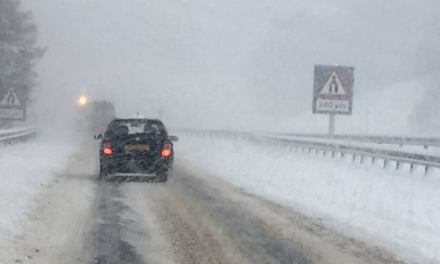
Freezing air from Scandinavia will combine with a weather front to bring snow to almost all of Tayside and Fife tonight, forecasters have warned.

Plummeting conditions will cause the mercury to drop from Monday night into Tuesday morning, with the Arctic conditions expected to continue throughout the next week.

The Met Office said the only parts of Tayside and Fife which may escape snowfall into Tuesday are communities within one to two miles of the sea.

Cold air from Scandinavia will cause the mercury to drop to lows of -4C or -5C in the most eastern parts of Tayside and Fife; while inland areas could experience even worse conditions.

Freezing air from Canada will simultaneously affect the West Coast overnight; while a weather front will move from the north-west to the south-east of Scotland, bringing snowfall with it.

At low levels 1.2in of the white stuff could land, while ground above 656ft could experience more than 2in.

A yellow warning of snow and ice is in place for Fife and Tayside from 8pm on Monday until 3pm on Tuesday.

Met Office meteorologist Martin Bowles said: “On Monday night you have cold air on either side of the country coming from Scandinavia and from Canada. A front is coming through in between and it is going to fall as snow.

“Pretty much everywhere will get snow tonight. The cold air is coming from both sides, with the front coming from the north-west to the south-east. It will be coming in from the Western Isles tonight at about 6pm tonight, reaching your part of the world at about 10pm.

“A band of snow is coming through from about 10pm, continuing until about 3am in the morning. There will be 1cm-3cm (04.in – 1.2in) of snow at low level, but not quite by the sea – within one to two miles of the sea.

“Anywhere above 200m (656ft) could see about 5cm (2in) approximately. There will be sleet even down by the sea. If you live by the sea, you won’t have to go that far before getting some settling on the ground.

“There will be very low temperatures. There are warnings for snow and ice. There could be slippery surfaces where there are untreated footpaths and country roads.”

He added the wintry conditions would continue for another week, with the Met Office “uncertain” what may happen come the weekend.

Tuesday into Wednesday is expected to be the coldest night this week. Temperatures could plummet to -8C locally.

Mr Bowles said: “We are expecting the cold weather to continue for another week. A significant front is coming through on Thursday night.

“There will be warmer air so it is more likely to be rain.

“There will be strong frost and ice every single night. Tuesday into Wednesday is expected to be the coldest night.

“At the moment we are uncertain what will happen at the weekend, we do think there will be some cold air about.”