After travelling south through Fife to admire the newly opened, ultra-modern Queensferry Crossing, I took a step back in time and headed upriver to a pair of villages that hark back to a much earlier era.
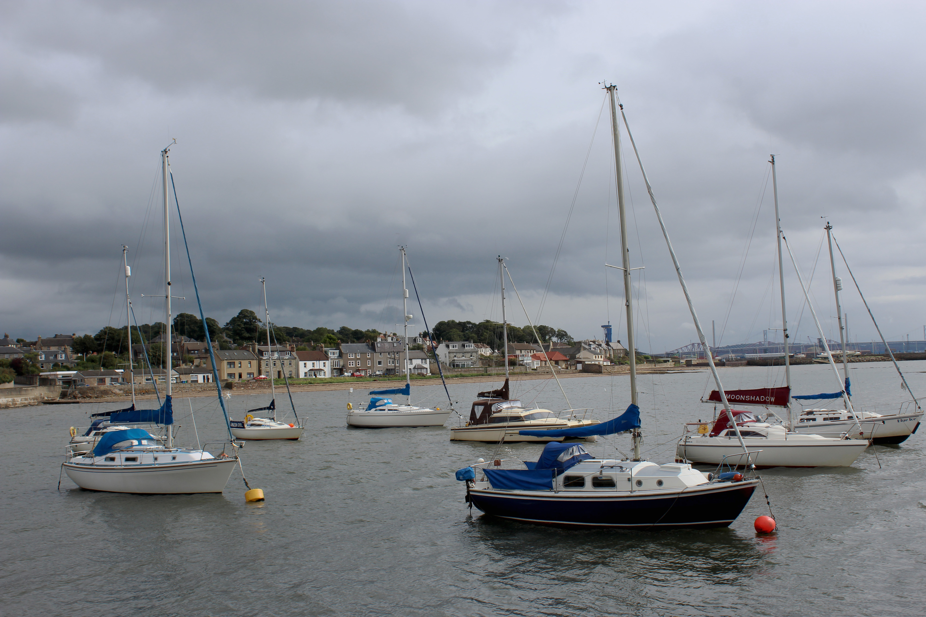
Wedged between the naval dockyard at Rosyth and the piers of the munitions depot at Crombie, Limekilns and Charlestown in Fife were founded on the coal mining and lime extraction industries of the 18th Century, the quays on the river vital to the success of these early enterprises.
Charlestown sits above its harbour, the coarse stone wharf dominated by a bank of derelict limekilns, in use until the 1950s, while the cottages at Limekilns cluster around an old pier – the medieval port of Dunfermline, and my starting point.
Joining the Fife Coastal Path, I followed the way-marked trail east along the riverside promenade before branching on to Red Row, pretty houses – one with a fascinating collection of seaside knick-knacks decorating the windows – peering out across the broad estuary of the Forth.
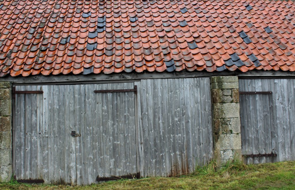
The path weaves through narrow lanes to a neighbouring harbour at Bruce Haven – where, beyond the local Scout hut, a row of pan-tiled sheds with weathered wooden doors caught my eye – before continuing above a strip of sand to meet the southern end of Windylaw Path.
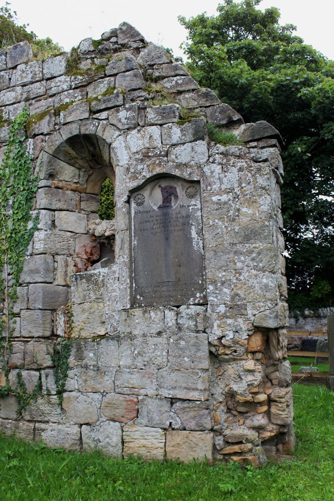
This centuries’ old right of way was originally used to convey coffins from as far away as Dunfermline down to the tiny cemetery at 12th Century Rosyth Church.
After exploring the jumbled kirkyard and now ruinous church that sits at its heart, a surfaced path led me up and around the periphery of Windylaw Edge woodland, the blue gantry crane used in the construction of the Queen Elizabeth class aircraft carriers at Rosyth a very visible landmark, to another cemetery, this one across the busy A985 at Douglasbank.
My onward route skirted the western edge of the graveyard, climbing below trees and between fields to a circle of woodland at Bellknowes.
Heading through and then around this peaceful deciduous copse and then a neighbouring plantation, the way meets a track leading first to Wester Gellet Farm and then up to the B9156, known locally as Limekilns Road.
A footpath kept me clear of the traffic as I continued a little further north before turning west over Gallowridge Hill, a surfaced track taking me as far as a farmstead where the trail deviates north around the sheds before descending by a strip of trees to join another road.
Once again, my time on the tarmac was brief, for a track signed for Charlestown guided me west beyond Glendevon Farm, the way turning south by the policies of Pitliver House, returning me to the A985 and the Fife Coastal Path.
Passing to the left of an industrial unit and crossing the remnants of a former railway line laid to serve Charlestown, the trail passes the workshops of the Scottish Lime Centre Trust, a charity set up to promote the appropriate repair of Scotland’s historic buildings, before descending by a former quarry into the village.
With traditional workers’ cottages flanking the green to my left, I branched right beyond the Elgin Hotel, to a steep path known as The Run, dropping to the harbour and limekilns – there were originally 14 in total, quarried into the cliffs – around which this historic and industrious community was built.
ROUTE
- Walk east along Promenade, turn right on Red Row and follow Fife Coastal Path (FCP).
- Continue ahead on FCP, passing Rosyth Church, and ascend to A985.
- Cross and follow minor road (signed Grange Road) then track north to cemetery. Branch left (signed Grange Road) and follow path north.
- Pass through broken wooden gate and continue ahead on woodland path to meet track. Turn right to Wester Gellet then go left by farm sheds to B9156.
- Turn right and walk 250m north on B9156.
- Turn left and follow track west over Gallowridge Hill, bearing right past farm.
- Emerging on to road beyond metal gate, turn right, passing Glen Devon Farm, then go left along track (signed Path to Charlestown), bearing left past East Lodge.
- Cross A985, go right then left, following FCP south to Charlestown.
- Pass Elgin Hotel then go right, descending path (signed The Run) to harbour. Turn left and follow shoreline road east to Limekilns Pier.
INFORMATION
Distance: 11.6km/7¼ miles
Ascent: 150m/495ft
Time: 3-4 hours
Grading: Moderate route following paths and tracks along coast and through farmland. Some sections can be wet and muddy underfoot and great care should be taken crossing A985. Keep dogs under close control and, near farm buildings, on the lead.
Start/finish: Limekilns Pier car park, Promenade, Limekilns (Grid ref: NT 075835)
Map: Ordnance Survey 1:50,000 Landranger sheet 65; Ordnance Survey 1:25,000 Explorer sheet 367
Tourist Information: Dunfermline iCentre, 1 High Street, Dunfermline KY12 5DL (Tel 01383 720999)
Public transport: Stagecoach bus service 6 from Dunfermline to Crombie stops in Limekilns