The A93 ski road through Glen Shee offers access to an enticing array of mountains, including (thanks to the route’s elevation at The Cairnwell) some of the most accessible Munros in the country.
With a spell of fine weather tempting me towards the tops, after a spot of swithering, I set a bearing for Carn an Tuirc and Cairn of Claise, a pair of Munros on the eastern side of the Cairnwell Pass.
Foregoing some of the height advantage the pass offers, I began in Glen Clunie below, hiking out along the Monega Road, an ancient high level route crossing the Mounth between Glen Isla and Braemar.
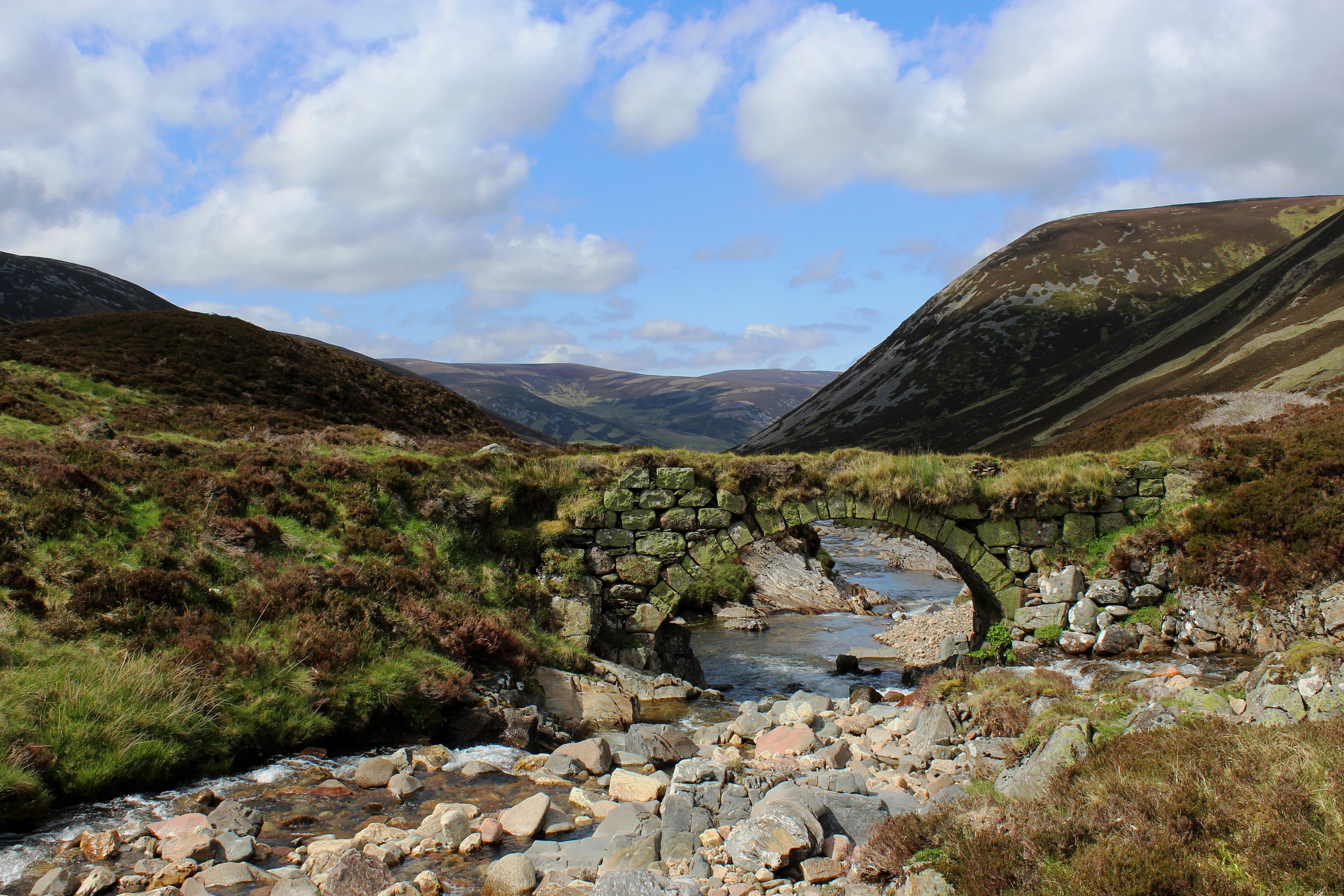
It led me less than a kilometre up the Clunie Water (although I would re-join it later in the day on higher ground) to an old stone bridge, a remnant of a former military road through the valley, where I turned east for Carn an Tuirc.
With the peak in clear view ahead, a slim trail rises through the heather by the Allt a’Gharbh-choire, passing a succession of small bubbling falls and then, in a rocky gorge further upstream, an altogether more spectacular tumble of white water.
Above this, the scattered stone footprints of a clutch of long-abandoned shielings occupies a hollow in the glen and here the path becomes less distinct as it negotiates boggier, grassy ground.
However, bearing left, I picked up the scent once again and girded my loins for a more strenuous ascent of Carn an Tuirc’s western flank, first through heather, then up a broad strip of grass to a peaty lip.
Stonier ground beckoning above, I curved right with the path, contouring the slope briefly before branching left on a fairly well established trail. Various routes roam across the slope here but as long as you keep going up, the summit will eventually appear.
Clambering across the rocky hillside, a pair of ptarmigan took me by surprise, the gamebirds perfectly camouflaged in the jumble of white and grey granite. Belching their displeasure at my disturbance, they took to the air.
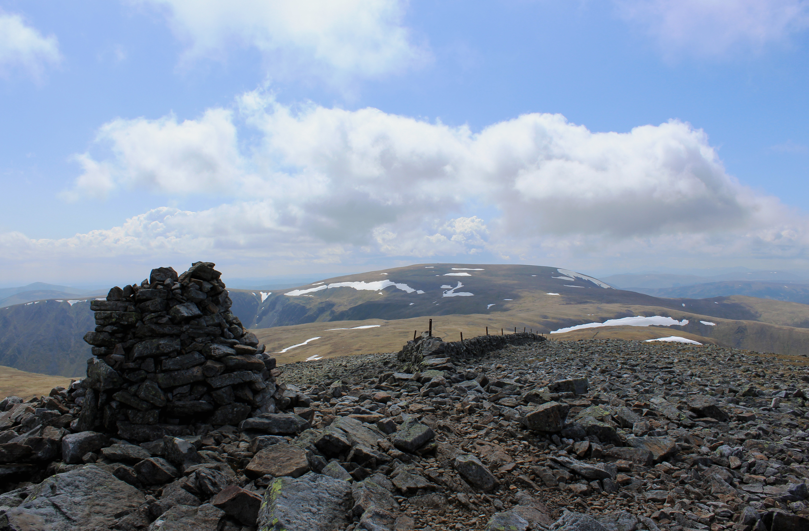
Carn an Tuirc’s sturdy cairn is flanked by various makeshift windbreaks and shelters, unsurprising perhaps given the amount of rock and stone strewn over the mountain.
The clack of granite underfoot stayed with me as I ambled west across the plateau towards a distant cairn before dipping into a broad grassy col where I embarked upon a more leisurely ascent of Cairn of Claise, the path conveying me comfortably to the top of the higher of the day’s peaks.
Blessed with a fine view of Glas Maol to the south, I carefully picked my way off the stony summit, joining a track below that skirted around the rim of Garbh-choire, leading towards this neighbouring Munro.
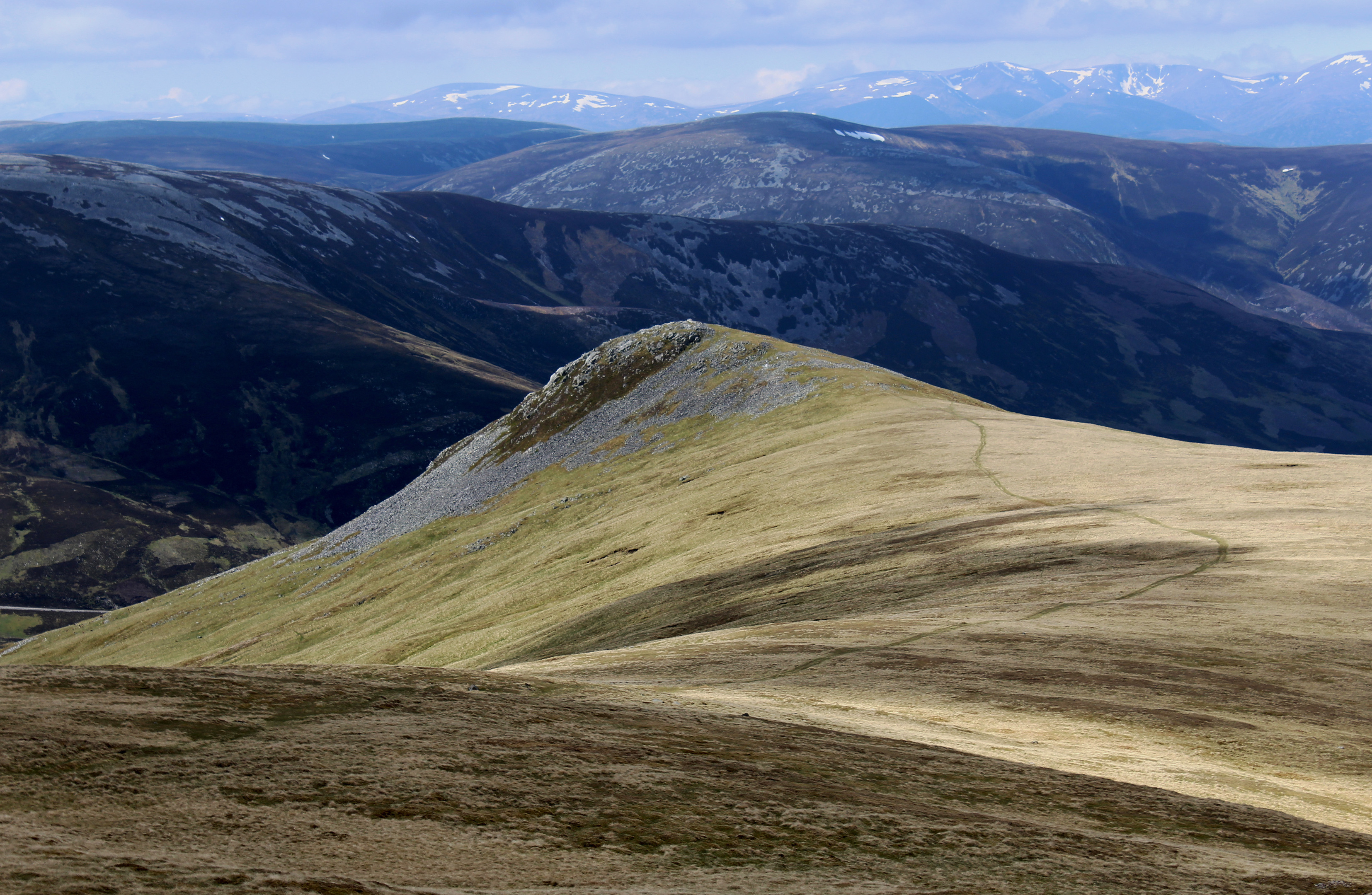
Passing a succession of stone-crowned pimples, I branched off the Glas Maol track, joining a slimmer path leading down the long, well-defined shoulder towards the prominent peak of Sron na Gaoithe.
The grassy trail follows the line of the Monega Road, the highest of the old Mounth roads, once busy trade and smuggling routes crossing the hills between Angus with Deeside.
As I neared the end of the ridge, I could not resist a quick hike to the top of Sron na Gaoithe, a final high point in the day ahead of the steep descent into Glen Clunie.
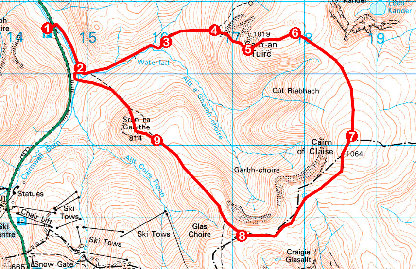
ROUTE
- Cross road bridge over Clunie Water and, at end of metal barrier, go right on footpath signed Glen Isla.
- At junction by stone bridge, continue ahead on path by stream, curving left up glen.
- Pass old shielings and ascend path east, through heather and up grassy strip.
- Ascend through heather and over stony ground to summit of Carn an Tuirc.
- Walk east over summit plateau to cairn.
- Bear right, descending south-east to pick up path crossing col and ascend Cairn of Claise.
- Branch right along wall to summit. Descend south to pick up track running south-west.
- Where track curves left towards Glas Maol, branch right and descend shoulder north-west towards Sron na Gaoithe.
- Branch left up to summit of Sron na Gaoithe then descend north-west steeply to cross metal bridge over Cairnwell Burn. Bear right to cross stone bridge then turn left, retracing steps to car park.
INFORMATION
Distance: 12km/7½ miles
Ascent: 660m/2180ft
Time: 4-5 hours
Grading: Challenging hike over two Munros following paths for the majority of the way. Go equipped for all weather conditions and pack sufficient food and drink to keep you going. Keep dogs on lead at request of estate
Start/finish: Car park two miles north of Glenshee Ski Area by bridge carrying A93 over Clunie Water (Grid ref: NO 144806)
Map: Ordnance Survey 1:50,000 Landranger sheet 43; Ordnance Survey 1:25,000 Explorer sheet OL52
Tourist Information: Blairgowrie Information Centre, 26 Wellmeadow, Blairgowrie PH10 6AS (Tel 01250 872960)
Public transport: None