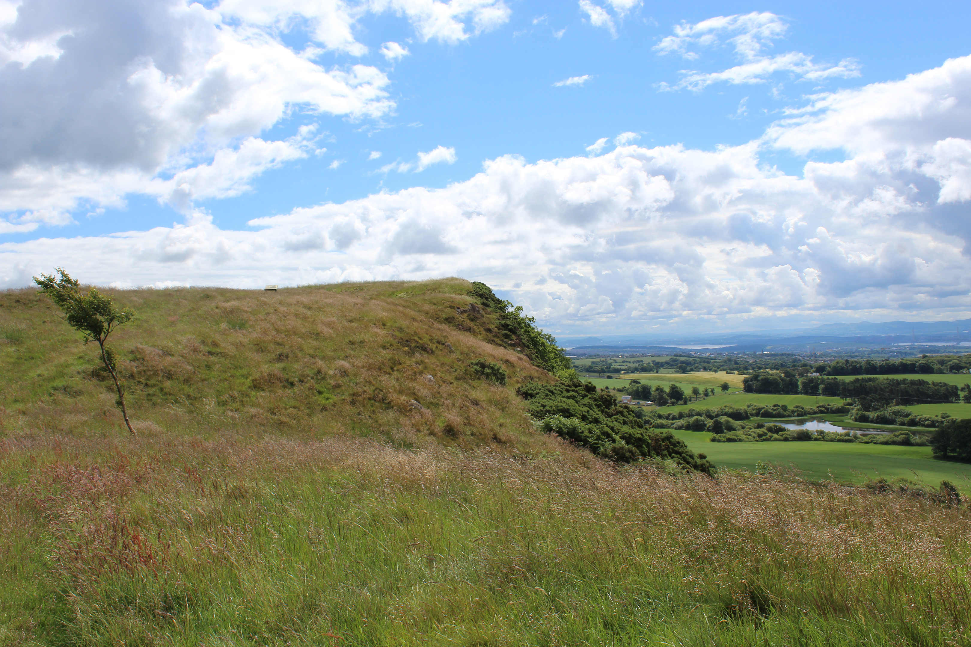
Craigluscar Hill may be a low peak but it boasts commanding views over the surrounding countryside, something that has been apparent to those who have wandered on to this escarpment since the Iron Age, when a hill fort was constructed here.
The ancient defensive structure has long since succumbed to the annals of history but the vista is as appealing today as it must have been all those centuries ago.
The hike up to the fort begins at a small car park sitting by a pair of huge water tanks. Access is by a rough track that forks left at the end of the equally pot-holed Craigluscar Road, rising through a gate and past a cow byre towards the tanks at Glassiebarns.
Surviving the approach with suspension and tyres intact, I donned my boots and a short stretch of path led me past a pair of stone plinths and through a couple of gates into woodland cloaking the slopes of Castle Craigs.

A few metres into the trees, the way forks and I opted to go left, a grassy path climbing quite steeply through a pleasant mix of pine, oak, sycamore and silver birch.
The way meets a more distinct path further up the slope and this contours round the western flank of the hill to a junction. Bear right here and the path climbs over the summit of Castle Craigs, another fine viewpoint, and, as the name suggests, site of another hill fort.
It dips to re-join the other trail (which runs below the top) just short of the col between Castle Craigs and neighbouring Craigluscar Hill.
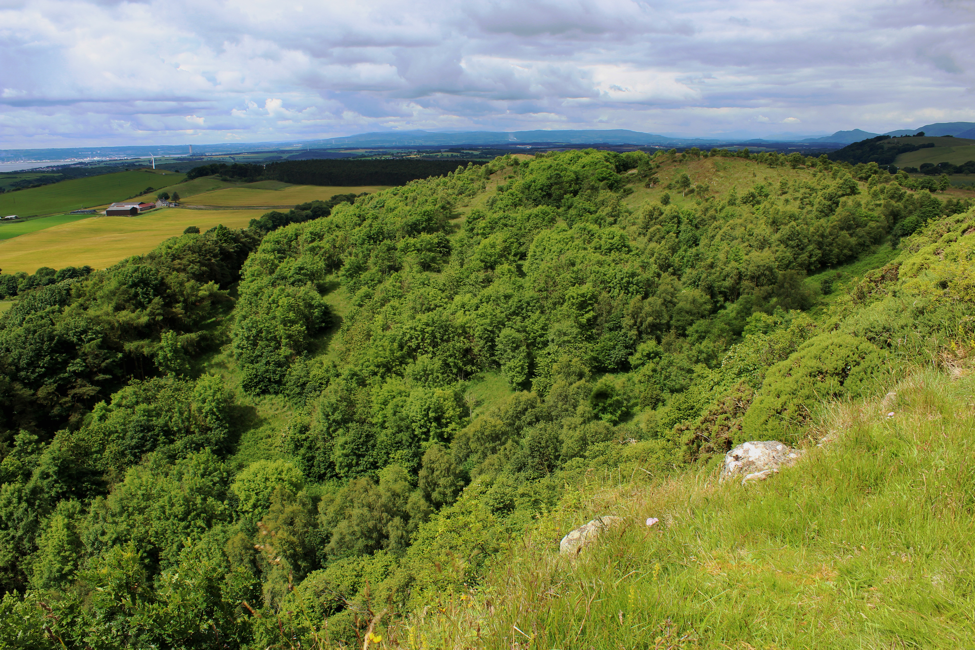
Heading out on to the edge of the escarpment, an abrupt drop lying beyond the buffer of gorse and foxgloves to my right, I hiked up to an exposed information board pin-pointing the fort’s elevated location.
Constructed over 2000 years ago by a local chieftain, the stronghold was encircled by ramparts on all but the west side, where the sheer drop of the scarp provided defence enough.
Archaeological investigations have revealed that the heart of the fort contained at least two large timber round houses, which, at some point in time, were destroyed by fire.
Amid the long summer grass, it was difficult to find trace of the fort but from the top of the hill I could share the chieftain’s view south, over Craigluscar’s two reservoirs and across the valley of the River Forth.
The path undulates along the top of the escarpment, an airy hike leading to a wall where, bearing left, I descended to meet a track that meanders west over grassland and through copses of woodland carpeting the less precipitous northern flank of the hill.
The land here is used by quad bikes and there are numerous trails, the most distinct of these leading me down into the base of the glen where, beyond a gateway in a wall, a grassy track cuts a line between Castle Craigs and a forestry plantation to the north.
Hugging the base of the hill, the way strikes west before curving south and then east, entering woodland where a slim trail runs along the edge of the plantation, bordering farmland below.
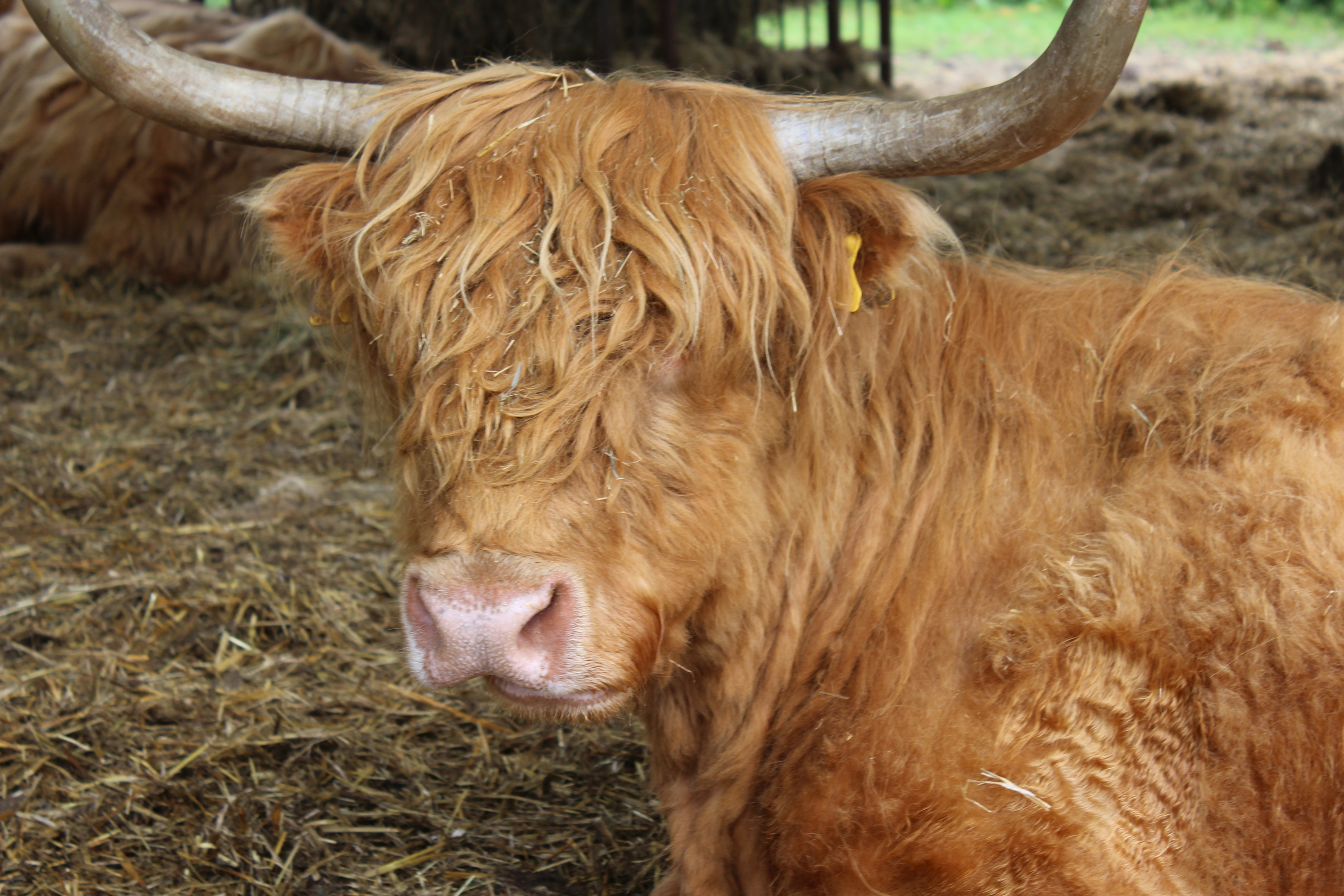
Grazed by Highland cattle, these fertile fields were once dotted with small farmsteads, all enjoying the protection afforded by the fort above.
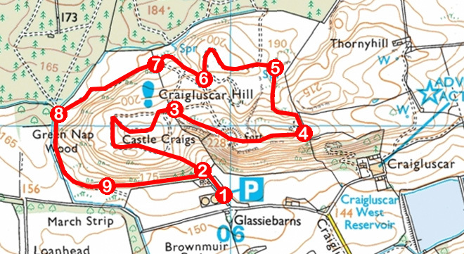
ROUTE
1. Walk north on path, passing through two gates.
2. Entering woodland, bear left where path forks and ascend to meet wider path. Turn left, following path west then north to junction. Take either branch as they soon converge.
3. Pass through gap in wall, branch right on narrow trail to meet more distinct path then turn left, ascending past information board and along escarpment.
4. Bear left and descend by wall to gate. Turn left, following earthy track west then north to junction below knoll.
5. Turn left, ascending track west. Loop right, then left, ignore track branching left and swing right to junction in dip.
6. Go right and descend track through shallow valley.
7. Pass through gateway in wall and follow track west.
8. Turn left and follow track south, curving left to enter woodland.
9. Follow woodland path east to point 2.
INFORMATION
Distance: 3.6km/2¼ miles
Ascent: 120m/390ft
Time: 1-2 hours
Grading: Easy route with some short but strenuous ascents, passing through woodland and over heath. Stout footwear recommended. Keep dogs under close control to protect livestock and wildlife
Start/finish: Craigluscar Hill car park, accessed via minor road and rough track (Grid ref: NT 059907)
Map: Ordnance Survey 1:50,000 Landranger sheet 58; Ordnance Survey 1:25,000 Explorer sheet 367
Tourist Information: Dunfermline Information Centre, 1 High Street, Dunfermline KY12 7DL (Tel 01383 720999)
Public transport: None


