Tentsmuir Forest, North-east Fife
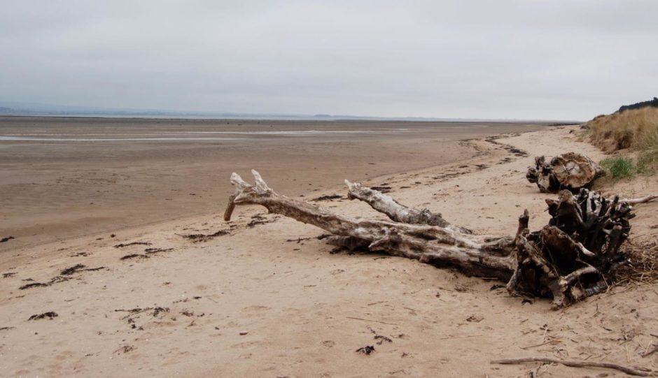
The static grey had rendered the lines between the shoreline and the water irrelevant and leached the colour from the landscape yet it was hard to fault the stark beauty.
The car park at Lundin Bridge at the edge of Tayport was almost full, but within minutes of crossing the little bridge and heading east along the sand there was scarcely another soul to be seen.
It was low tide on the Tay, and the sweep of emptiness stretching along the coast was the reward for choosing my time well. This was beach walking at its best, just me and my footprints.
Endless Tentsmuir Forest walks
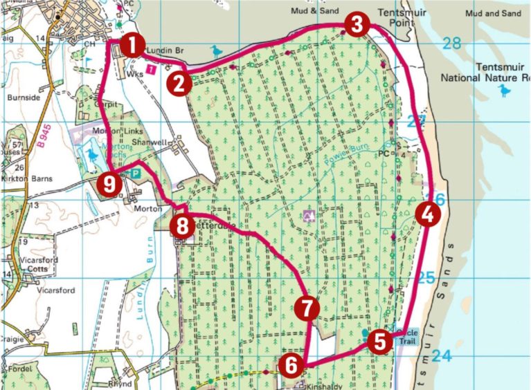
Tentsmuir Forest covers around 13 square kilometres, and the huge network of paths and trails offers so many options for walkers and cyclists that you could have a different route combination every day for weeks and still not cover them all.
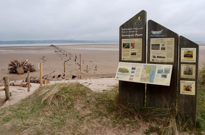
There are signs and information boards everywhere, including a comprehensive display detailing the history of the area.
There are three main starting points: Morton Lochs to the west, the big parking area at Kinshaldy to the south and from Tayport, my choice for making the full 9.5-mile circuit.
The track which goes east and then south through the forest is part of the Fife Coastal Route. I stayed to the outside of the trees, however, walking parallel with the line of huge concrete blocks which were installed during World War II as a defence barrier against possible invasion.
When the water is high, you can follow the same line beside the trees. Remember: the tides can be fast moving – don’t get caught out if you are walking further out on the sands.
Sampling shore life
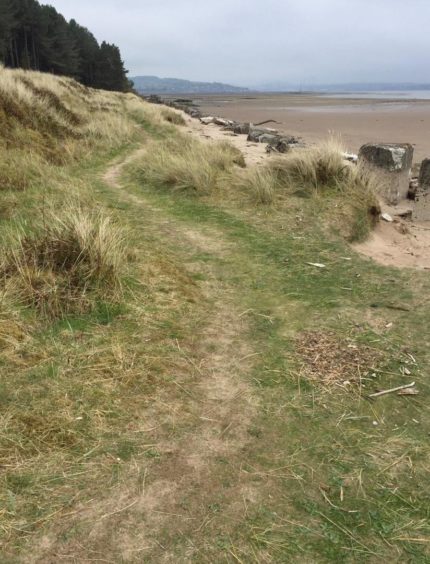
A fence and gate at Tentsmuir Point marked the entrance to the nature reserve, and a parting of ways with the treeline.
The path wove its way through the dunes for a bit before I dropped on to the wide sands again where the noise of oystercatchers and gulls cut through the air.
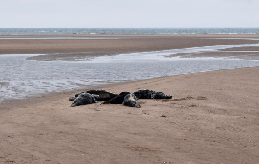
This is a good place to see seals, and I soon spotted around a hundred basking out on the sandbars. A few minutes later, after rounding a corner, I had a closer encounter with half a dozen huddled together enjoying the burgeoning sun. I carefully retreated to leave them in peace.
Another gate led out of the reserve and over boggier ground between the dunes. When the path started to lose its way, it was time to turn right into the big car park at Kinshaldy, where there are toilets and refreshments.
This is the point where you can cut short the circuit and take one of the many tracks north if you have had enough for the day.
I continued through the car park and followed the treelined entrance drive west before turning right into a muddy lane along the edge of a field of horses.
After passing a property and garden filled with mannequins and other colourful curios, I kept following the forestry track signed as Grocer’s Road.
This led on a curving line for nearly 3km before emerging at a T-junction at Fetterdale, the only sign of life the whole way a few hoofprints.
Morton Lochs
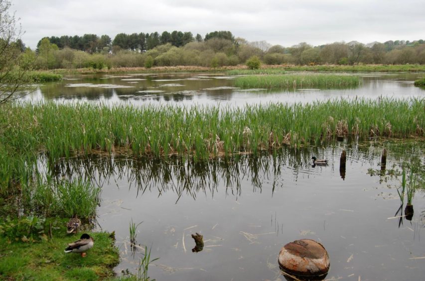
The signposts led round to Morton Lochs, a wetland created in the early 1900s and an important habitat for wildfowl. There are a series of hides along the water’s edge from which to observe the bird life and you may also catch a glimpse of a red squirrel in the trees.
After a short detour to the hides, I got back on the well signed path which led via a few gates and over the golf course out to the road. The car park is just a short distance away.
Route
1. From car park head east to cross Lundin Bridge and further on, where path forks, take left branch along the shore running parallel with treeline.
2. Follow for 3km to reach fence and go through wooden gate into nature reserve at Tentsmuir Point.
3. Leave treeline and head south, following path through dunes at first then down on to sands.
4. After leaving the fenced reserve bounds at another wooden gate, keep going south on path before heading right into big car park at Kinshaldy.
5. Walk west down car park drive past entrance barrier, and a little further on take a right up muddy lane along edge of horse fields.
6. Stay with track as it goes into trees, passing colourful property and grounds on right.
7. Keep following main track (signed: Grocer’s Road) as it curves to left, ignoring all minor branches, until it comes to a T-junction.
8. Turn right here then quickly left again to emerge at Fetterdale and go right following signposts to Morton Lochs.
9. Turn north on path through woods past lochs, and keep following signed path round Garpit and through golf course to emerge on road. Turn right for short walk back to parking.
Information
Distance: 15.5km/9.5miles
Ascent: 30m/100ft
Time: 4-5 hours
Grading: Woodland tracks and paths, beach walking, farm tracks and minor roads. Suitable for all ages. Can be wet and muddy in places. Dogs under close control on reserve due to ground nesting birds and seals and near farm livestock.
Start/finish: Lundin Bridge parking, Tayport (Grid ref: NO 465280).
Map: Ordnance Survey 1:50,000 Landranger Map 59 (St Andrews); Ordnance Survey 1:25,000 Explorer sheet 371.
Tourist Information: VisitScotland, St Andrews iCentre, 70 Market Street, St Andrews, KY16 9NU (Tel 01334 472021).
Public transport: Bus services to Tayport: Dundee/St Andrews route (42).