Loch an Eilein and Loch Gamhna, Aviemore
The network of paths and tracks in and around the lochs of Rothiemurchus Forest offer something for everyone at any time of year.
This is child-friendly territory, even when the weather is being less than friendly; the thick tree cover provides a barrier against the worst of the elements and there’s the added bonus of lots of lovely mud for the kids to enjoy.
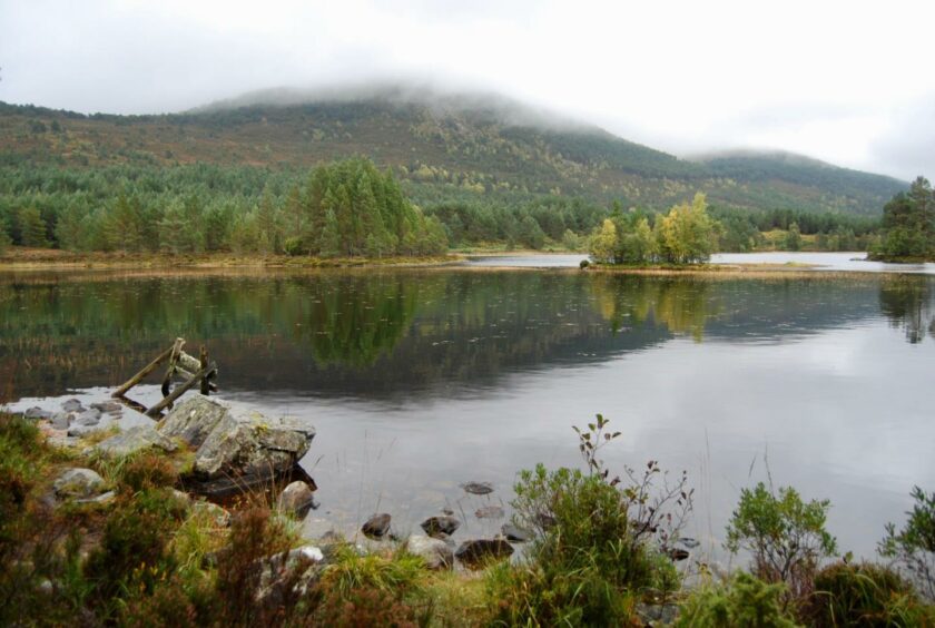
Loch an Eilein is rightly regarded as one of Scotland’s jewels, and the addition of its smaller neighbour, the delightful and more peaceful Loch na Gamhna, makes for an excellent short excursion that will exercise young minds. There’s also the option of a short climb to the summit of Ord Ban, the small tree-covered hill above the car park.
The track around Loch an Eilein is obvious, and although there are branches going off everywhere, there’s little chance of going astray here. It’s popular with dog walkers, cyclists and runners, and the huge Scots pines, offer many sheltered picnic spots all along the way.
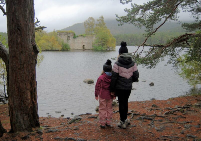
The island which gives the loch its name provided the first burst of enthusiasm from my granddaughters Ava and Lily, the ruined castle which has sat astride it for hundreds of years stirring their vivid imaginations.
This defenders of this fortress managed to fight off a Jacobite attack shortly after the Battle of Cromdale in 1690. The crumbling battlements and lush vegetation later also provided a safe haven for ospreys until the early 1900s.
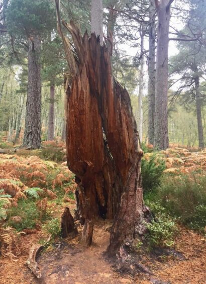
The incredible natural sculptures of the Scots pines also gave the girls plenty entertainment on the way round, a constant guessing game as to what the shapes suggested. The variety in size and colour of the fungi also proved a big hit.
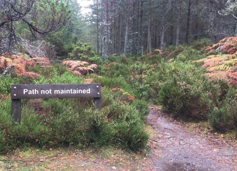
A narrow path heading into the trees (sign: Path not maintained) suggested a more difficult circuit around Loch na Gamhna but despite a couple of heavily muddied and waterlogged sections there was no problem. Besides, when did you ever hear of a youngster who didn’t like mud?
It was far quieter around these shores, the majority of walkers preferring to stick to the main track. Don’t let the path signs put you off, this is a peaceful and very beautiful spot.
Loch na Gamhna is the ‘loch of the stirks’ which refers to young cattle, and just north of here is the Thieves Road, used centuries ago by cattle raiders as a passage to Strathspey. It is said that locals would tether a few cows to the trees as an offering in the hope this would satisfy the thieves and keep them away from the main herds.
All too soon, the walk was over, and two muddied kids were passed back to their parents. I tried to persuade the girls to join me on the climb to Ord Ban but with the grey folding in and the drizzle increasing, they seemed less than keen. I even tried to tempt Lily with the short walk to nearby Lochan Mor, known as the Lily Loch, but that would have to wait for another day.
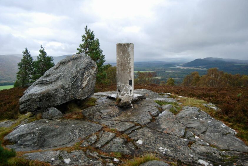
The ascent of Ord Ban is fast on a fine path rising through the trees, and despite a small band of crags that have to be tackled just below the heathery summit, it is largely trouble-free.
The only part which may give pause for thought is the high wooden stile at the start of the walk: with no footplate at the top and the rungs wet and slippery, it needed a delicate balancing act before I was back on terra firma.
Once over, head right on a vague path through bracken for a short distance until you link with the hill path running up to your left. Remember to take note of this turn for the return journey – I met a group of walkers who had had to squeeze through a gap in the fence, unaware of the stile was further along.
Despite the low height, the summit view is extensive in every direction, the drifting mists merely adding to the drama of the landscape. Adventurous kids of all ages will love it.
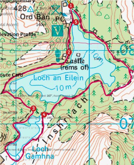
ROUTE
1. Exit parking at south end and follow track along western shore of Loch an Eilein for about 1km until you see on your left small island with its ruined castle.
2. Continue on track which now swings west until end of loch, then turn left until reaching sign on your right for narrow path leading to Loch na Gamhna.
3. Make the anti-clockwise circuit of this delightful little loch before emerging back on the main track.
4. Follow track as it swings around the eastern shore to arrive back at car park.
5. To add Ord Ban, start by crossing high stile behind and to right of toilet block then head north through bracken on vague path for short distance and pick up good path rising on left which goes all the way to summit. Return by reversing the route.
INFORMATION
Distance: 7.5km/4.7miles
Ascent: 140m/460ft
Time: 2-3 hours (Ord Ban add 60-90mins, an extra 1.8km and 258m ascent).
Grading: Child-friendly walking for all abilities on woodland tracks and paths, some rough and uneven ground, exposed tree roots which can be slippery. The path around Loch na Gamhna is not maintained and can be very muddy in places so good footwear recommended. Dogs should be under close control and on path (there is also separate dog exercise area).
Start/finish: Loch an Eilein car park, Rothiemurchus Forest (Grid ref: NH 896085). Charges (pp) adults £1.50, child 50p.
Map: Ordnance Survey 1:50,000 Landranger Map 36 (Grantown & Aviemore); Ordnance Survey 1:25,000 Explorer sheet 57.
Tourist Information: VisitScotland, Aviemore iCentre, 7 The Parade, Grampian Road, Aviemore, PH22 1RH (Tel 01479 810930).
Public transport: Regular bus and train services to Aviemore from Perth and Inverness.


