Bishop Hill, Perth & Kinross
Bishop Hill may be slightly down the pecking order in the Lomonds, but it’s a lovely hill in its own right and when climbed from the west it has the additional bonus of having Loch Leven by its side the whole way.
The route from just outside the village of Scotlandwell is short and sweet, perfect for a morning or afternoon outing when time is pressing.
Taking advantage of a beautiful weather window between grey days, I started from the car park at Portmoak Parish Church where there are signs welcoming visitors.
I crossed the busy road and headed back along the narrow ‘pavement’ and climbed wooden steps leading into Kilmagad Wood. After turning left at a junction, it was simply a case of following the path and track right then left on gentle switchback ramps before it rises through the trees to reach a gate in a wall.
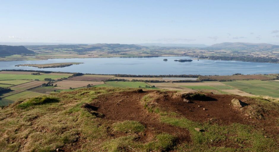
There are a couples of benches and seats en route, and most were occupied by locals enjoying the sunshine and the view over the sparkling waters of Loch Leven. At one point, I stood and watched a skein of geese making their final dipping approach.
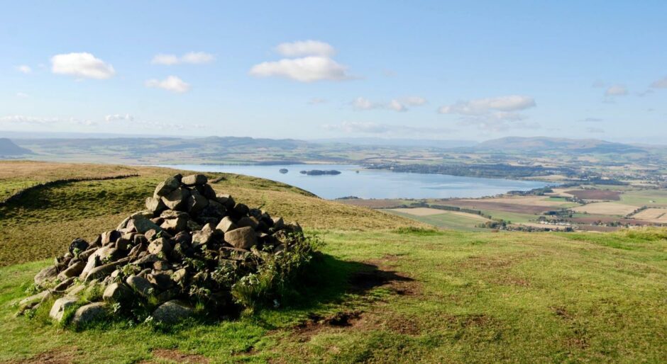
Staying with the main track leads uphill and the right-hand branch will take you to the flat top of Munduff Hill where there are fine views down to the loch and north to West Lomond. Just off to the right is the white ‘golf ball’ of the radar station which sits amongst the pines.
Bishop Hill looks a fair way off across the undulating plateau where cattle and sheep were grazing, but following the main path leads you there in quick time. There are a couple of gates to go through, and then one short final climb to the sizeable summit cairn.
I retraced my steps to the last gate, and once through turned right on a faint grassy path which leads along the fringe of the plateau, offering deep views across Kinnesswood to the loch. As I passed through a gap in an old wall, I noticed a number of figures milling about on the top of the grass mound ahead.
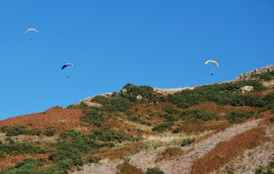
As I grew closer, the colours started filling in, the chutes of paragliders laid out ready for take-off and more were heading up the steep path from Kinnesswood. This is a popular spot from which to catch the thermals.
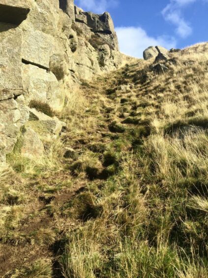
The descent route is obvious on a good day but still needs some care and it could be tricky to locate its exact line in thick weather. It starts as a grass path leading to a platform above crags, then twists down a rocky gully before continuing steeply on grass.
If in doubt, it would be prudent to reverse the walk from Bishop Hill or continue over to Munduff Hill and then descend into the wood by the initial ascent paths.
Safely through the craggy section, I turned left when the path hit a junction and followed the way back across the lower slopes of the hill. A wooden bench with another plaque featuring the work of feted Loch Leven poet Michael Bruce offered a fine lunch spot where I watched the blue sky filling up with colour as the paragliders rose en masse.
All that remained was to follow the path as it contoured round the golf course to a gate into the woods for the final leg down to the steps and the car park.
ROUTE
1. From car park cross road to narrow pavement, then take wooden steps (signed for Kinnesswood and Bishop Hill) uphill to Kilmagad Wood.
2. Pass gate on left and continue to path junction. Go left, then bend back right at signpost (to Glen Vale) just above picnic bench and follow track uphill.
3. Stay with track as it loops left then bends uphill through trees to reach pedestrian gate in stone wall on left.
4. Go through gate and follow main track and higher up take eastern path branch. It goes along edge of plantation then by fence on right to Munduff Hill.
5. Head north from summit over plateau on muddy path. After going through gate, the track goes west then swings north to another metal gate before short rise to big cairn on Bishop Hill.
6. Retrace steps to last gate and shortly after going through, take grassy path on right and follow along edge of plateau above crags. Pass through gap in old wall and climb to top of grassy mound.
7. Continue towards next grassy mound, but on descent watch for path on right going downhill, grassy at first then through rocky gully. The path then continues steeply down grass to junction.
8. Turn left and follow path running across hillside and round golf course to wooden gate which leads back into woods. When you reach track at picnic bench seen earlier, retrace inward route to start.
INFORMATION
Distance: 6.75km/4.25miles
Ascent: 420m/1370ft
Time: 2.5-3.5 hours
Grading: Woodland and hill paths, steady ascent and steep descent through rocky terrain which needs care especially in less than clear conditions. Suitable for relatively fit walkers and older children. Muddy, sturdy footwear advised. Cattle and sheep grazing on plateau, dogs under close control.
Start/finish: Portmoak Parish Church car park (Grid ref: NO 182019), but please keep free until 11.30am on Sundays and for services at other times if requested. There is also street parking in Scotlandwell and Kinnesswood.
Map: Ordnance Survey 1:50,000 Landranger Map 58 (Perth & Alloa); Ordnance Survey 1:25,000 Explorer sheet 370.
Tourist Information: VisitScotland, St Andrews iCentre, 70 Market Street, St Andrews, KY16 9NU (Tel 01334 472021).
Public transport: Buses to Scotlandwell, No 201 Glenrothes-Kinross service.
