Pitcarmick Loch, Perth & Kinross
The picture postcard village of Kirkmichael is the starting point for a series of waymarked loops which offer delightful walks amidst mixed woodland and rolling heather moorland.
The tranquillity of the area is reflected in all the circuits, and whether it’s a short riverside stroll or longer routes over rougher ground there is a distinct feeling that time is an irrelevance.
Kirkmichael dates back over a thousand years, and was once an important cattle market where various drove roads converged. In Victorian times, it gained popularity as a holiday destination, especially with the grouse shooting fraternity.
I had originally been looking at the Kindrogan loop to the north, but recent heavy tree felling there sparked my decision to head south instead and explore the land around lonely Pitcarmick Loch.
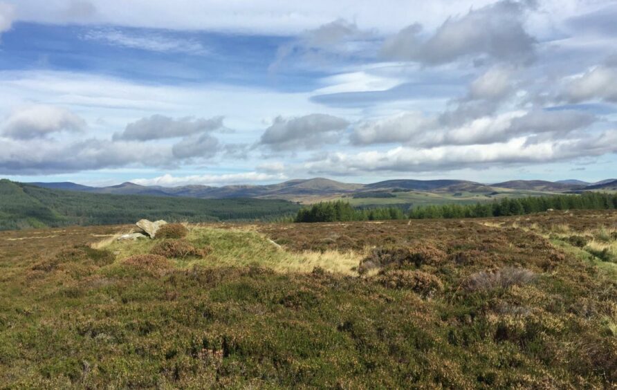
This private fishing loch lies in the heart of a relatively wide sweep of empty moorland and rough little hills but there is a good track all the way and there are multiple sites of hut circles, field systems and ancient cairns sprinkled throughout.
The walk starts from the car park just over the bridge as you pass north through the village. It is situated next to the Bannerfield, where James Erskine, the 6th Earl of Mar, raised his flag in support of the 1715 Jacobite uprising. These days it is the venue for the annual Strathardle Highland Gathering.
I headed uphill past the primary school then followed the road round to the left before taking another left down a lane beside the old Duff Memorial Church. Built in 1890 by the breakaway Free Church of Scotland and closed in the 1950s, it has lain in sad state of disrepair since a recent failed property development.
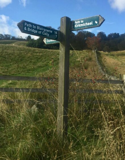
The route follows the line of the winding River Ardle – the strath is named after the Pictish warrior Ardle who was killed in battle at Enochdhu in the 12th Century – and is part of the Cateran Trail. After passing between some cottages the way opens out with fields on either side. There are signposts every so often to confirm your progress on this section, and one shortly after passing the house at Dalvey tells you it’s time to leave the main track and head right.
Before taking this grass strip, it’s worth going through a wooden gate on the right to take a look at the little loch hidden in the trees. The narrow path crosses a stream by stepping stones then emerges to reach twin metal gates, one either side of a pristine track. This is where you part company with the Cateran Trail.

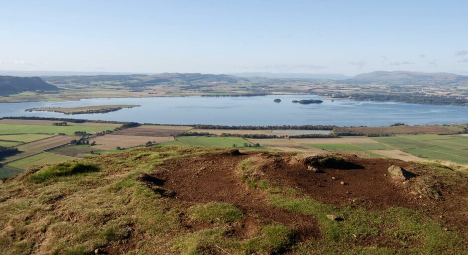
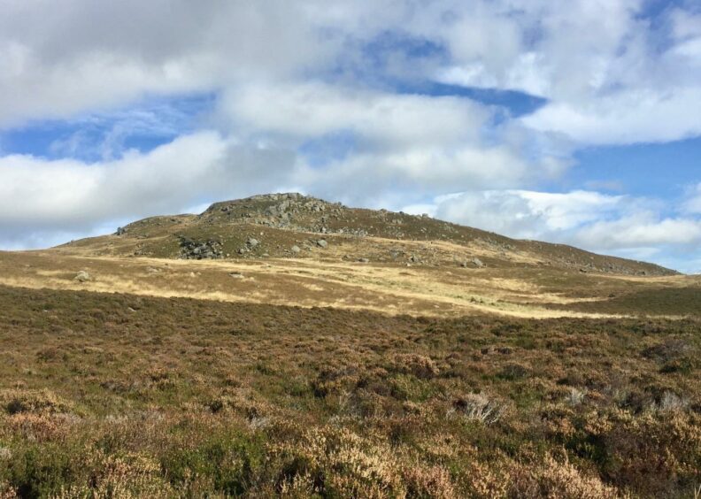
This track now weaves its way west through more barren, open moorland dotted with small rugged rises before dropping towards the blue slash of Pitcarmick Loch. It skirts the northern edge of the water before heading gently back uphill towards an obvious nick in the skyline between Creag Gharbh on the left and the lower slopes of Creag na h-Iolaire and its rocky outcrops to the right.
The path becomes more overgrown and boggy on the other side but the views to the west are unceasing over a vast carpet of dark heather, so deep that a handful of roe deer were bouncing rather walking through it.
This rougher section is short-lived, easing as the route swings away from Glen Derby and heads downhill to the east towards a large cairn on a prominent rise to reach a gate into woodland. A short descent brought me out on the inward route just above Dalvey.
My appearance seemed to spark a buzzard into action, its echoing cry bouncing around the trees as it circled high above. From here it was a casual walk back to Kirkmichael.
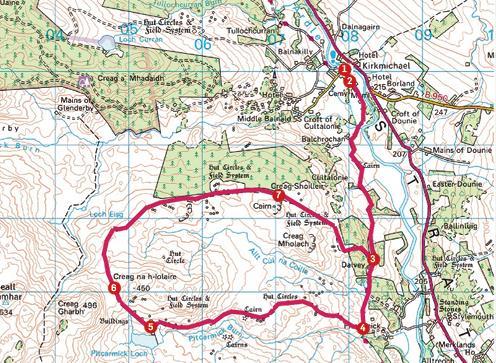
ROUTE
1. Leave car park and take road uphill. After it swings left, turn down lane on left just before the old church, following Cateran Trail sign for Bridge of Cally.
2. The track goes between several cottages then opens out, passing the entrances to farms of Balchrochan and Cultalonie and continuing to Dalvey, where it dips downhill over stone bridge and past hidden lochan on right.
3. Leave track at marker post and head right (Cateran sign) on slim path into trees, crossing stream by stepping stones then exiting trees to reach twin metal gates on either side of estate track running east-west.
4. Go through first gate and turn right heading west over moorland as track follows line of Pitcarmick Burn until you reach Pitcarmick Loch.
5. Pass above loch and head gently uphill on now a grassier track, aiming for nick in skyline between Creag Gharbh and Creag na h-Iolaire.
6. From this gap, path heads north-west along a more overgrown and muddier line, curving north then east and leading alongside plantation towards big cairn on small rise to right.
7. Keep following track to wooden gate and go through short section of woodland to come out just above Dalvey. Turn left to follow track back to Kirkmichael.
INFORMATION
Distance: 16km/10miles
Ascent: 340m/1115ft
Time: 4-5 hours
Grading: Wood and moorland paths and farm tracks including part of Cateran Trail, suitable for most abilities. Can be muddy in places and there’s some rough ground, good footwear recommended. Dogs under close control – farm livestock and ground nesting birds.
Start/finish: Car park in Kirkmichael (Grid ref: NO 080600).
Map: Ordnance Survey 1:50,000 Landranger Map 52 (Pitlochry & Crieff); Ordnance Survey 1:25,000 Explorer sheet 52.
Tourist Information: VisitScotland, Perth iCentre, 45 High Street, Perth, PH1 5TJ (Tel 01738 450600)..
Public transport: Buses to Kirkmichael on Blairgowrie to Pitlochry route (No 71).


