Correen Hills, Aberdeenshire
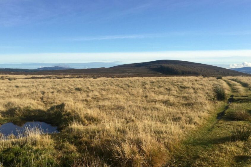
The rolling heather-clad terrain of the Correen Hills offers a fine circuit for those seeking gentle walking where solitude is a likely companion.
These quiet hills occupy the high ground a few miles north-west of Alford, and are accessed along a succession of minor roads which end at Dubston Farm, near the hamlet of Tullnessle.
The highest point is Lord Arthur’s Hill, named after Lord Arthur Forbes, who was killed at the nearby Battle of Tillyangus in 1571 during the conflict between the followers of Mary, Queen of Scots, and her son, King James VI, known as the Marian Civil War.
A party under the command of Sir Adam Gordon, loyal to the Queen, was on its way to Edinburgh to join forces with the Earl of Huntly when it encountered a force led by Forbes, dubbed ‘Black Arthur’, near White Hill of Tillyangus. The Gordons were victorious, and Forbes was killed. His body was later carried across the moorland by the survivors.
The walk starts from a grassy parking spot just before the entrance track to Dubston farm. To the right is the entrance to Terpersie Castle, and as we made our way around the farm buildings and on to a rough track, we could see the bright pink of its walls through the trees.
The Z-plan manor house – a main block with towers at opposite corners – was built by the Gordon family in 1561. Over the centuries it has been burned down, restored, then abandoned for nearly 100 years before a further restoration in the 1980s.
One particularly grisly tale is that of Charles Gordon, a victim of the purge that followed the 1745 Jacobite rising. He had been hiding in the hills above his home, and his capture, trial and gruesome execution were recorded in The Scots Magazine at the time.
The track continued along the side of a plantation, passing through a couple of metal gates, before it reached a small burn where a pair of wooden sleepers to the right allowed dry feet.
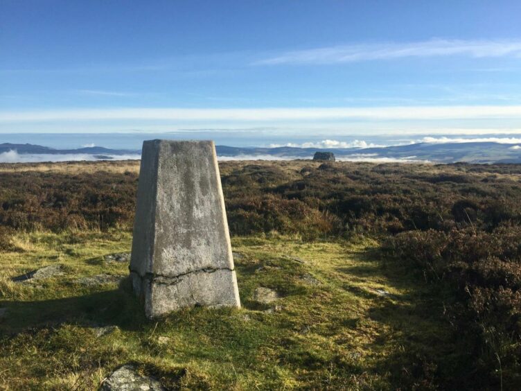
Just beyond, where the track forked, we went straight on, climbing steadily and directly to the large cairn on Lord Arthur’s Hill. A trig pillar a little to the right marks the true summit.
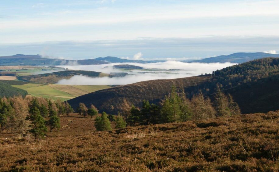
Behind us, stubborn layers of cloud remained in the glens, verdant fields and mixed stands of trees topped with cotton wool, while above we had flawless blue and a brilliant sun.
It’s a fine spot for a game of Guess the Summit: from Bennachie and Morven, to The Buck and Tap o’ Noth, each competing for your attention.
The route continues on track through the heather, rougher at times with a bit of dodging off to the sides to avoid the worst of the standing water, passing just below the tops of Edinbanchory Hill – where our track made a sharp right turn – Brux Hill and Badingair Hill. Any can be reached by a short diversionary tramp through the heather.
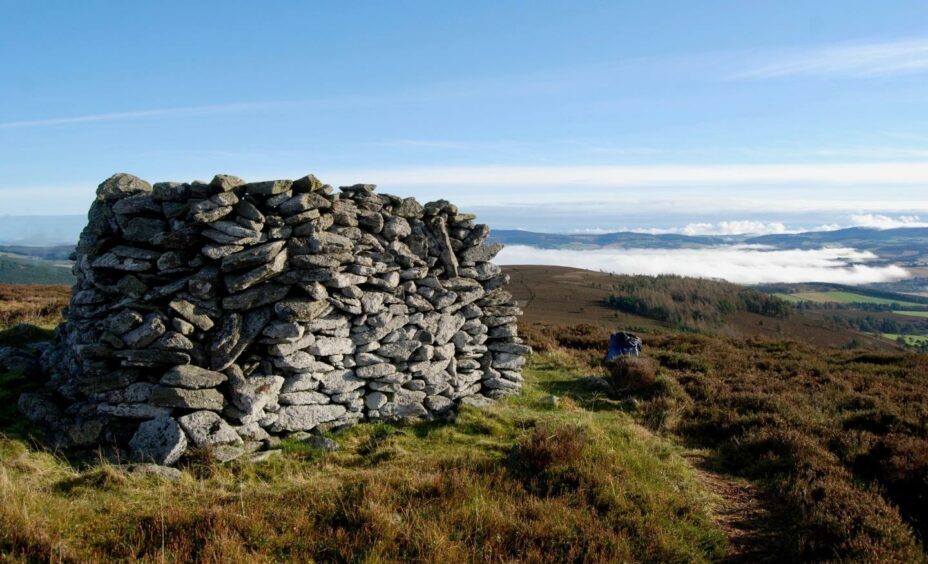
We made the effort on the first, then had a lunch stop at the cairn on Brux Hill, another chance to familiarise ourselves with the surrounding tops. After passing along the edge of Badingair Hill, we doubled back on the track branch which heads south-east, eventually reaching the old Correen quarry.
This was in operation for more than four decades until the late 19th Century, providing large slabs of stone used for buildings and pavements. The little red-roofed hut sitting in the dip is more modern, most likely a shelter for hunting parties.
The grassy track weaves its way down to the Esset Burn, a crossing that could prove surprisingly awkward in wet conditions. There are stones for placing your feet, but they are not ideally placed and are slippery.
Once over the water, the track rises to emerge at the fork passed early in the walk, and it’s simply a case of retracing your steps to the finish line.
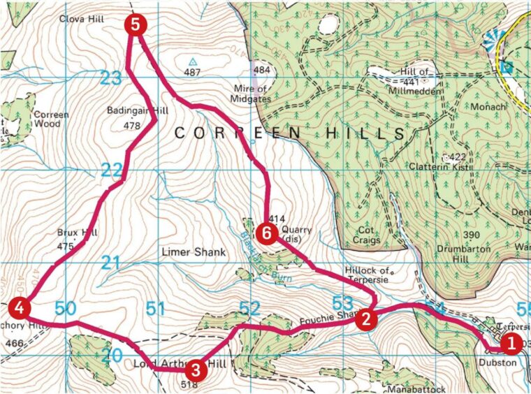
ROUTE
1. Take track on left passing to left of farm buildings then heading right to metal gate. Continue alongside plantation to second gate, cross small burn to reach fork in track.
2. Keep left, climbing steadily on the Fouchie Shank. Ignore first branch left and keep climbing to next turn which leads directly to large cairn on Lord Arthur’s Hill. The summit is marked by trig pillar to right.
3. Continue west to col then past trees to track junction on Edinbanchory Hill (unmarked summit off to left).
4. Turn north following track across side of Brux Hill (cairned summit to left) and then along Badingair Hill watching for right turn where the route doubles back.
5. Descend gently with huge sweep of forestry off to left to reach old quarry.
6. Grassier track now continues down to Esset Burn. Cross and rejoin inward route at fork and follow back to start.
INFORMATION
Distance: 16km/10miles
Ascent: 450m/1475ft
Time: 4-6 hours
Grading: Mostly gentle ascents on tracks across rounded heathery hills, suitable for all walkers with reasonable level of fitness. Very muddy and some heavily waterlogged sections, one stream crossing could prove troublesome in very wet weather. Route is on farmland with sheep on hill, dogs under close control.
Start/finish: Parking on grass verge before entrance to Dubston farm (Grid ref: NJ 548200) reached by minor road from Tullynessle (signed for Terpersie) 3.5 miles north of Alford.
Map: Ordnance Survey 1:50,000 Landranger Map 37 (Strathdon & Alford); Ordnance Survey 1:25,000 Explorer sheet 62.
Tourist Information: VisitScotland Aberdeen iCentre, 23 Union Street, Aberdeen, AB11 5BP (01224 269180).
Public transport: None to start point.


