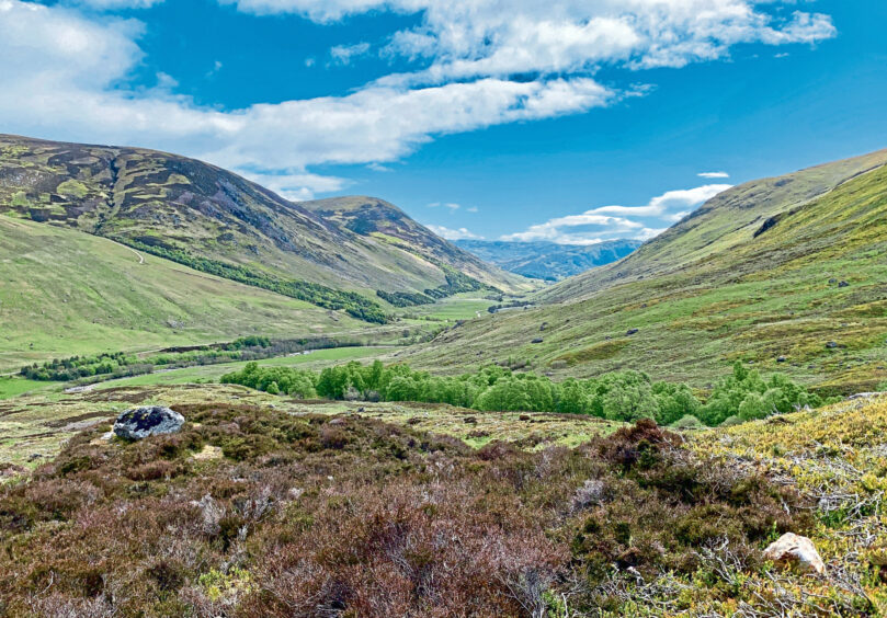
Journeying through the beautiful Sma’ Glen is an uplifting experience.
The pass is often labelled as Glen Coe in miniature, where rough slopes and craggy faces squeeze in from either side and the horizon is a constant procession of V-shapes.
I was heading for Newton Bridge and an ascent of Auchnafree Hill, the highest point of a vast rolling plateau of heather, peat bog and many tops which sits between Loch Turret and Glen Almond.
Reaching a height of 789 metres, the “hill of the field of the deer forest” is a popular summit for those bagging Corbetts, and is more commonly tackled from the Crieff side in tandem with its Munro neighbour Ben Chonzie.
That was the approach I took last time, but a wander along Glen Almond offers a rougher perspective, an absorbing verdant mix of the pastoral and the precipitous, lush grasses and gentle waters juxtaposed with cliff edges and ravines where clumps of trees cling on precariously.
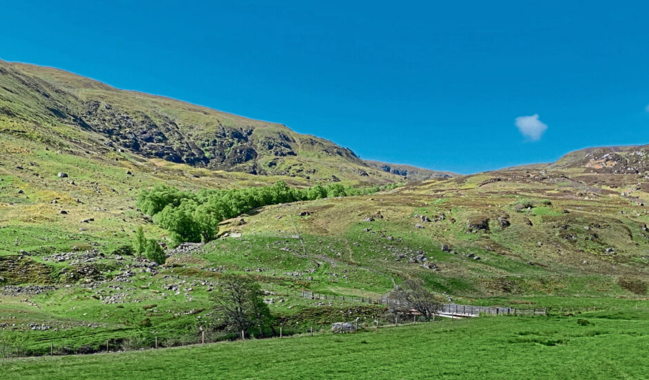
The track that mirrors the River Almond continues all the way through to Loch Tay in one form or another and sections are also part of the Rob Roy Way.
It is farm country and dog owners should be aware of the presence of sheep and cattle which graze openly a good way round the circuit. If anyone is short of a lead, there is an honesty box at the start of the track offering assistance.
The initial walk-in was shared with an army of hairy caterpillars and bustling black beetles. The alarm cries of oystercatchers pierced the air as they wheeled overhead, their sound interspersed with the more measured offerings of curlew and the call of a cuckoo lurking somewhere in the trees.
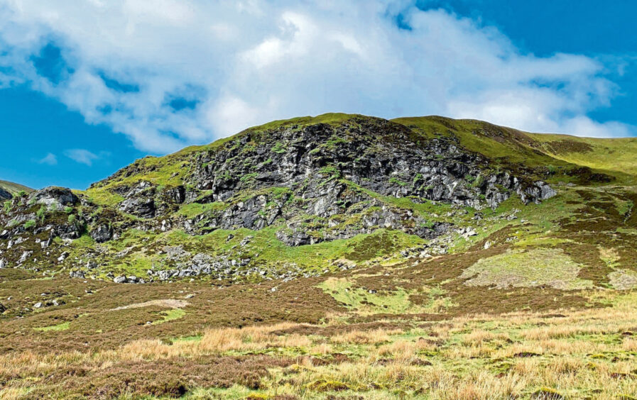
After about an hour of easy walking, I broke off right to the Wade bridge giving access to Coire Chultrain. High in this corrie among a jumble of rocks lies the remains of the lair of a notorious robber, Andrew Christie.
His gang preyed on travellers and cattle drovers passing on the road below, and they were also said to have resorted to cannibalism during lean times. The location of their hideout – strangely marked on the map as “Thiefs Cave” – is hard to pinpoint.
There are several contenders in the massive jumble of rocks, hollows and trees on the back wall of the corrie, the most likely spot being where there has been a fall of a huge boulder which has collapsed the cave and blocked the entrance.
To add to the mystery, there have been suggestions the cave is located to the south-west on the impressive Eagle’s Rock, and even that it may be a standalone outcrop you pass further down the corrie, although it’s hard to see how anyone could manage to remain unseen for long in that shallow gap.
The slopes beyond the cave area felt remote but they were mainly grassy and the going was never difficult. As I rose, I watched a golden eagle circling above the ridge-line, there one minute, gone the next.
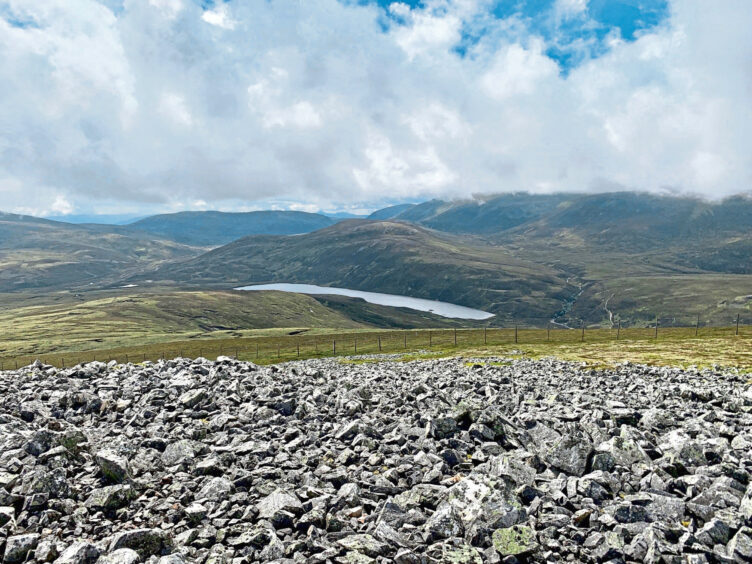
It doesn’t take long to reach flatter ground at the edge of the plateau where you are faced with a short hop across black bog and ankle-deep heather laced with cloudberry and primrose. Whichever line you take, there will inevitably be some zigging and zagging before you arrive at the two cairns marking the summit where Ben Chonzie puts on a fine show.
The emptiness of the plateau over to the subsidiary height of Choinneachain Hill is in stark contrast to the rugged approach, the bulldozed track a thin artery cutting through the drabness. The track dropped north and, once over the lip of the plateau, it steepened and twisted to the floor of the glen. All that remained was to cross the river and then perform the long march out.
ROUTE
1From parking area east of Newton Bridge, walk across stone bridge and take track on left running parallel with the River Almond for 4.5km.
2Leave track via metal farm gate on left, head down through grassy field to bridge, cross and take path heading south-west uphill by Allt Coire Chultrain.
3When path runs out, stay on same bearing until reaching rocky face where Thiefs Cave is reputed to be found among boulders.
4Continue round this huge outcrop on the left (or right if you prefer) rising west on grass slopes by stream branch to emerge on plateau for 1km walk over open terrain to Auchnafree Hill summit. There are two cairns close together.
5Leave summit by heading north on track. This passes over the shoulder of Crom Chreag before twisting steeply downhill to eventually cross a wooden bridge then pass the house at Larichfraskhan.
6Beyond the house, cross bridge over River Almond and turn right along track passing between farm buildings and then following the flow of the water all the way back to Newton Bridge.
Information
Distance: 22.5km/14miles
Ascent: 758m/2486ft
Time: 7-9 hours
Grading: Long day for experienced and well-equipped walkers with good hill fitness and relevant skills mostly on estate tracks and hill paths but with some rough, pathless sections. Open grazing for sheep and cattle, dogs should be under close control at all times (dog leads available via honesty box at start of walk).
Start/finish: Newton Bridge on A822 (Grid ref: NN 890315).
Map: Ordnance Survey 1:50,000 Landranger Map 52 (Pitlochry & Crieff); Ordnance Survey 1:25,000 Explorer sheet OL47.
Tourist Information: VisitScotland, Pitlochry iCentre, 22 Atholl Road, Pitlochry, PH16 5BX (Tel 01796 472215).
Public transport: Effectively none. There is only one bus per day (Mon-Fri) between Crieff and Newton Bridge (896).


Conversation