Lucklaw Hill, north-east Fife
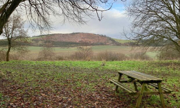
Little Lucklaw Hill holds a prominence that far outstrips its modest height due to the working quarry which present a bright orange-pink southern face that can be pinpointed from miles away.
Sitting above the former weaving village of Balmullo and the adjoining hamlet of Lucklawhill in North-east Fife, it was a welcome sight on a winter day when grey was dominant, a splash of colour to brighten the mood.
The hill itself is not the most adventurous, but it is a target centrepiece for a pleasant short circuit which meanders through three separate woodland stretches, and being the highest point around it offers good views across St Andrews and along the North Sea coast.
The starting point is the Burnside Hall in Balmullo, a community facility where there is plenty space for parking. Walk across the grass area beside a high hedge to join a red ash path which passes the back of houses before swinging round to the left where the bright south face of Lucklaw Hill dominates the view.
Much of the quarried stone is used as chips for paths, sports surfaces and harling, but it’s thought some of the older buildings in the village were constructed from local stone.
The popular path takes a straight line but I turned first left on a track between fields, and then right at the top of the track heading towards Cuplahills. After passing the entrance to holiday cottages and just before reaching the farm, I doubled back for access (signed) to the first venture into the trees.
This is Willie’s Wood, one of two community woodlands – the other is Lucklaw Wood – created by local man Willie Melville, a legacy of his life at Cuplahills. A gentle push uphill leads to picnic tables with extensive views over to Lucklaw Hill.
The path continued through the trees, dropping by an old wall before rising again to enter a tree tunnel, the exit ‘door’ at the far end shining through the gloom.
I emerged on a track which turned by an alternative parking spot for the woods and then followed the minor road east. Those wishing faster progress to the hill top can follow the signed route along the edge of a field, but I ignored this option, preferring to head back into woodland a little further on.
Again the path climbed gently, and at the first split I went left and then stuck with it until reaching a crossroads higher up. A right turn leads downhill towards the quarry road, a left to two wooden gates and entrance to an open field for the brief push up to Lucklaw Hill.
The summit with its trig point and cairn and a few communications masts was soon reached with the best views to the south, the improving weather now revealing the blues eating into the distant shoreline around St Andrews.
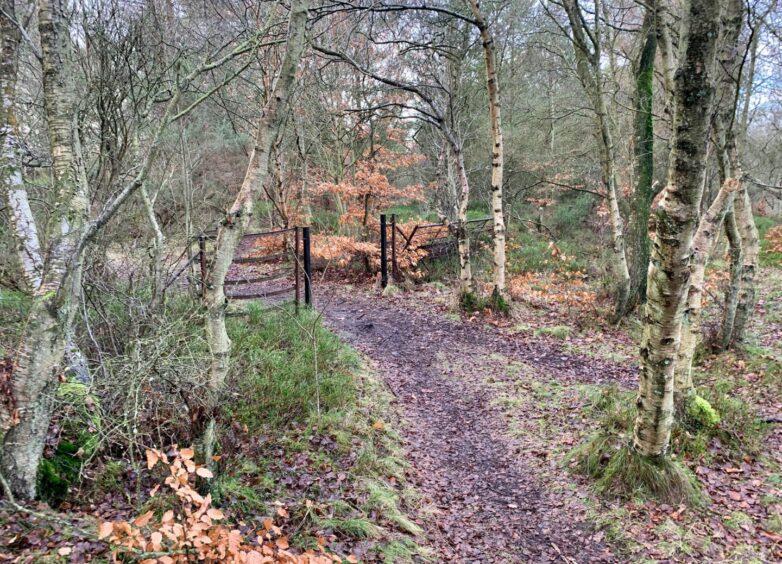
An obvious path dropped through the heather to an old wall, where another sharp turn, this time to the left, took me back into woodland for the third time. Old Scots pines were the dominant feature here, the path red with fallen needles as it skirted the old fence line.
Upon reaching a black metal gate, there was a choice of route. I went right, dropping down to reach the minor road for the final walk back to Balmullo but I really wanted to keep going left, to stay in the wood as long as possible. Next time, perhaps.
ROUTE
1. Cross grass area behind Burnside Hall and walk beside high hedge to join red ash path which passes houses then bends left (sign for Willie’s Wood).
2. Turn left on track between fields, then right to Cuplahills. Pass entrance to holiday chalets (purple core path arrow) and just before farm, turn sharp right to Willie’s Wood and almost immediately take path left into trees.
3. Head uphill to reach picnic area and turn left to follow path through trees. This dips slightly to pass old wall, rising to the left into ‘tree tunnel’ before emerging near cottages.
4. Take track on left, then right and walk up to minor road junction to turn first right.
5. Ignore sign on left for route which heads through field, instead staying on road to pass entrance to cottages then swinging left. Head into woods at next sign on left.
6. At first path split keep left heading uphill, and stick with main line until reaching path junction where you should turn left to reach two wooden pedestrian gates.
7. Go through gate on right (green arrow sign) and walk up field by fence to reach metal farm gate. Go through and follow path right to top of Lucklaw Hill.
8. Descend on narrow path until reaching wall. Turn sharp left to head into woods, following path by old fence. When you reach metal gate in wall, turn to right on path going downhill to emerge at houses.
9. Turn right on to minor road, then right again back to Balmullo.
INFORMATION
Distance: 7.5km/4.7miles
Ascent: 215m/705ft
Time: 2-3 hours
Grading: Pleasant, well-signed circuit over minor hill which passes through three woodland sections on good paths, quiet lanes and roads. Some ascent, but should be suitable for all fitness levels. Very muddy in places, exposed tree roots may be slippery, sturdy footwear advised. Sheep and cattle may be encountered – dogs under close control.
Start/finish: Burnside Hall, Balmullo (Grid ref: NO 426209).
Map: Ordnance Survey 1:50,000 Landranger Map 59 (St Andrews); Ordnance Survey 1:25,000 Explorer sheet 371.
Tourist Information: VisitScotland, St Andrews iCentre, 70 Market Street, St Andrews, KY16 9NU (Tel 01334 472021).
Public transport: Bus service to Balmullo (No.92).




Conversation