Rising from the north-east shoreline of Loch Tay, Drummond Hill is a sturdy little peak lost to forestry. Engulfed by evergreens, the regimented rows of conifers ensure views from its slopes are scant.
There is, however, one craggy bluff protruding from the trees – Black Rock – where the vista over Loch Tay and the picturesque village of Kenmore ranks among the best in Highland Perthshire.
Drummond Hill has long languished under woodland. It was probably the site of Scotland’s first managed forest, originally planted out with Scots pine, oak and birch by Sir Duncan Campbell, 7th Laird of Glenorchy, back in the 17th Century. Today, it remains a source of timber, one now managed by the Forestry Commission.
It was also the place chosen for the re-introduction to Scotland of the capercaillie in 1837. Over hunting and the loss of forest habitat drove the bird to extinction in the mid-18th Century.
Teetering on the brink of annihilation once again, Drummond Hill is one of the few places in the country where this elusive member of the grouse family clings precariously to existence.
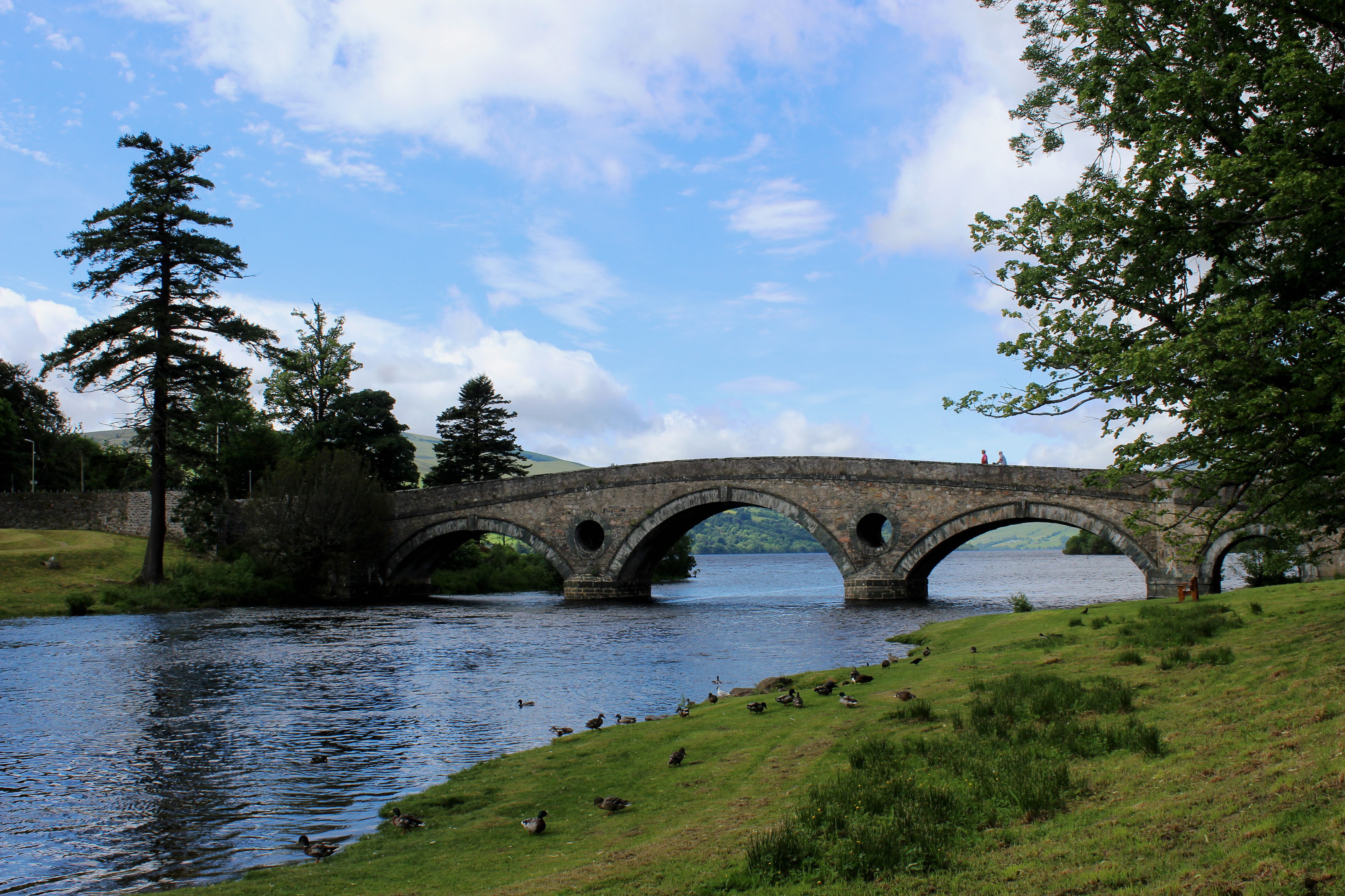
The direct ascent from Kenmore to Black Rock Viewpoint is short but strenuous and I opted instead for a longer, more leisurely approach, following the River Tay downstream from 18th century Kenmore Bridge before entering the plantation at Peeler Gate.
Wandering along the grassy riverbank, the way rises into the wooded policies of Taymouth Castle, the 19th century mansion sitting across the water.
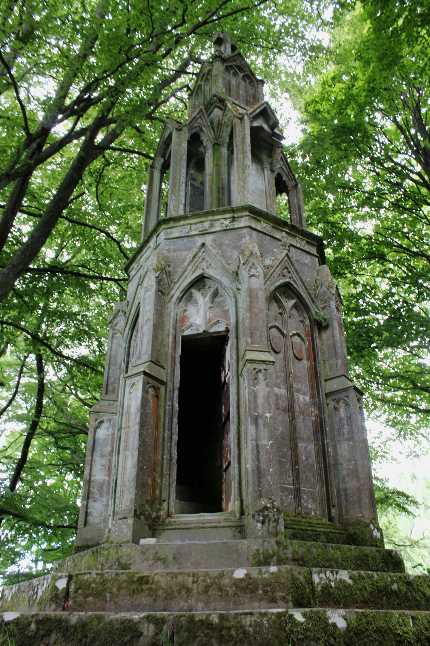
Lurking amid the trees on this side of the river, Maxwell’s Temple is one of several follies to be found scattered through the grounds. It was erected in 1831 by the fourth Earl of Breadalbane as a memorial to his wife, Mary, and was inspired by the Eleanor crosses commissioned by King Edward I as a tribute to his late wife.
Ahead, running through a band of oak, beech, sycamore and rhododendron, the path, perched on a terrace above the river, offered Victorian visitors to the estate a pleasant promenade.
Following in the footsteps of the gentry, I passed above the currently closed Chinese Bridge – a crossing point to Taymouth Castle – and proceeded round to Star Battery, a viewpoint with crenellated walls that, in its day, posted a very agreeable vista over the castle and its gardens. Today, the battery is slowly crumbling and trees obscure the scene.
The path swings left at this point and, beyond a quaint little wooden cabin, strays away from the Tay, crossing farmland to the base of Drummond Hill. Peeler Gate, at the northern end of the hill, offers access to the forest, the track looping up past a small parking area to a rather messy intersection above a gate.
Keep left, ignoring tracks branching right, and the plantation road leads south-west, a couple of lengthy inclines eventually topping out at a crossroads above Kenmore where a sign confirms the onward route to the viewpoint.
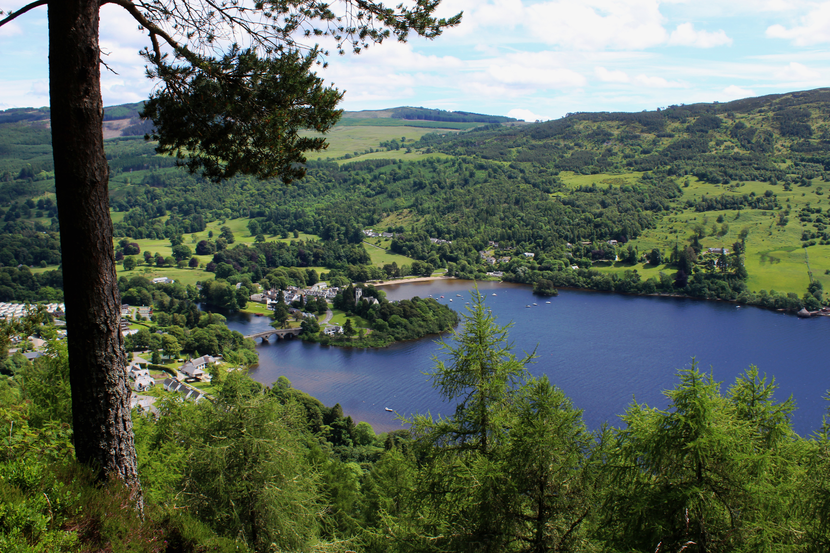
Lying just off the track, and helpfully signed once again, the walled lookout sits atop a rocky outcrop, a window framed by Scots pine and larch offering nothing short of a breath-taking bird’s eye view.
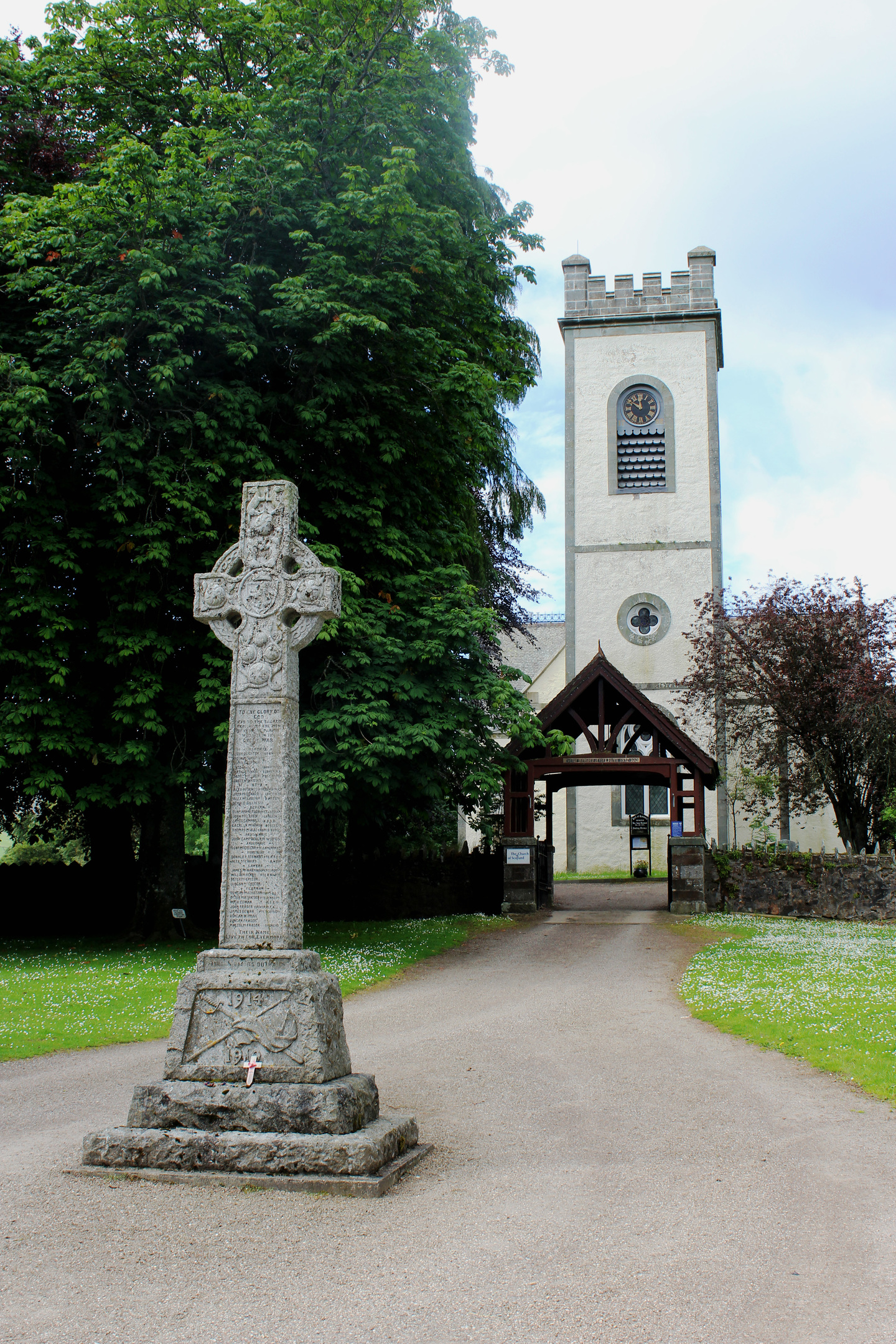
Far below me, Loch Tay shimmered in the sunlight, Kenmore, with its white kirk, white-washed cottages and well-tended greens, a perfect village in miniature from my elevated vantage point.
ROUTE
1. Follow Aberfeldy Road (A827) through Kenmore and over Kenmore Bridge.
2. At northern end of bridge, turn right along riverside path (signed for Comrie Bridge and Aberfeldy). Pass chalet park on left and ascend into woodland, ignoring path branching right.
3. Ignore path branching left (signed Drummond Hill Paths) and continue ahead on path running above river.
4. Pass round locked gate and, approaching road, bear right along parallel path.
5. Go through gap in wall, cross road and ascend forest track to Peeler Gate car park. Continue up track to junction.
6. Ignoring tracks branching right, bear left and continue ahead on forest track.
7. At track crossroads, continue ahead to Black Rock Viewpoint (signed).
8. Return to point 7, turn right and descend to car park.
9. Branch right at gate, descend path to road and turn right, following minor road then A827 back to Kenmore.
INFORMATION
Distance: 10.5km/6½ miles
Ascent: 350m/1155ft
Time: 3 hours
Grading: Moderately easy, low level route following riverside paths and forest tracks with some strenuous and prolonged ascent on the latter. Stout footwear recommended as some parts can be muddy underfoot
Start/finish: Public car park (Pay and Display) on Pier Road, Kenmore (Grid ref: NN 773453)
Map: Ordnance Survey 1:50,000 Landranger sheet 52; Ordnance Survey 1:25,000 Explorer sheet 379
Tourist Information: Aberfeldy iCentre, The Square, Aberfeldy PH15 2DD (Tel 01877 820276)
Public transport: Caber Coaches bus service 91 links Aberfeldy and Kenmore on Mondays, Thursdays and Fridays only


