Kennoway Den, Fife
The broad-leaved woodland of Kennoway Den is a hidden gem, its peaceful trails well used by local people but tucked away from the rest of the world behind the village’s streets and houses.
Lurking in this secret glade are caves, an ancient bridge, an old well and remnants of bygone industries that relied on the flow of the Kennoway Burn to keep the wheels of commerce turning.

There are various ways into the den, but the best signed route is via Denhead, which branches off Kennoway’s main thoroughfare just north of the village centre, so I wandered this way after picking up some supplies from the local bakery to sustain me on my journey.
Branching left through a gap in the wall, a path dips into the valley, looping down past a lone cottage to the stream that would accompany me south.
In the 18th and 19th centuries, Kennoway Burn powered at least four mills, although the only clues to this once industrious scene that remain hidden in the undergrowth today are some sections of former sluices and lades. In its heyday, at either end of the den there was a corn mill and, in between, a sawmill and flax mill provided employment for villagers.
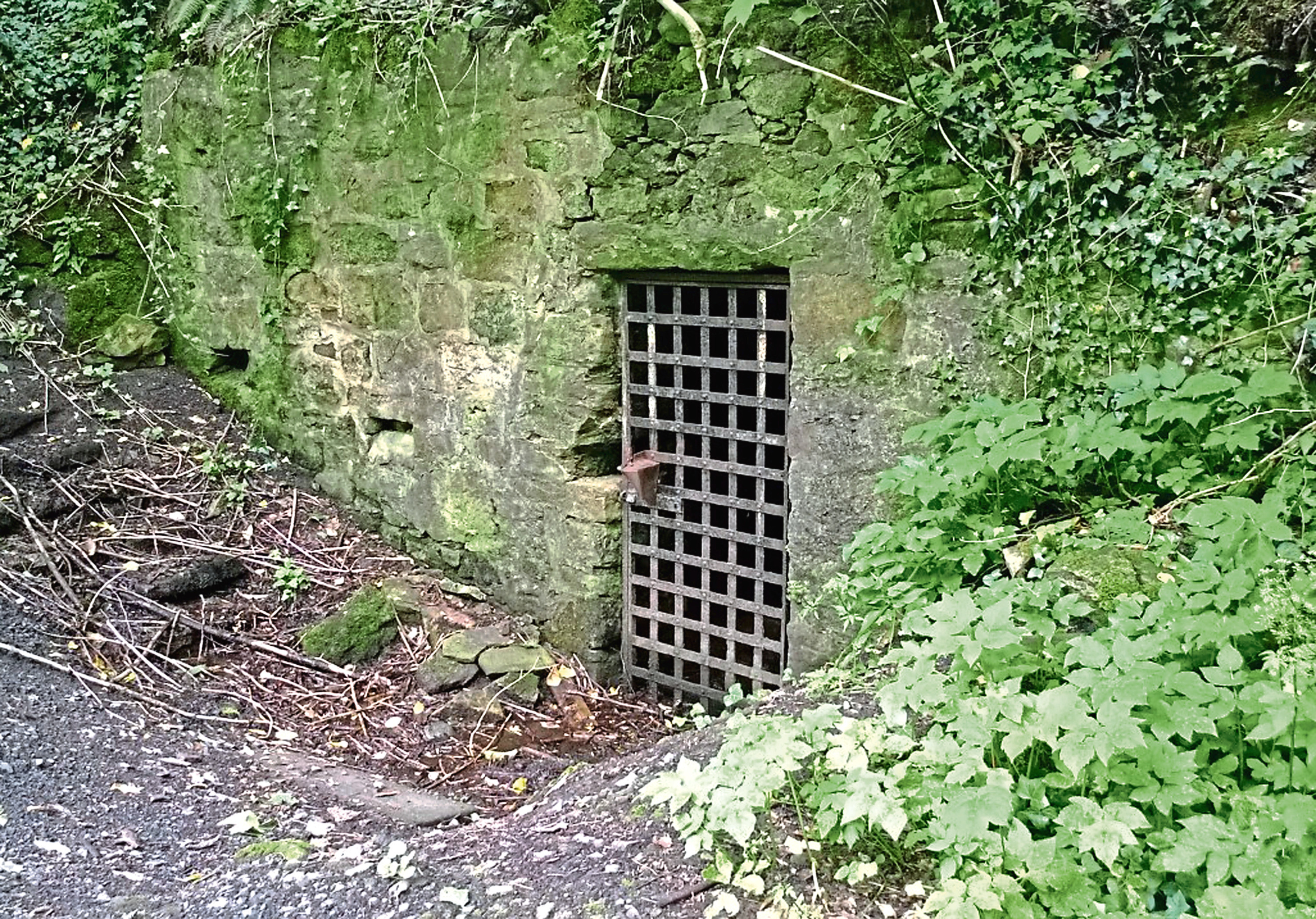
Better preserved is Caurdy Well, concealed behind a stone wall and heavy metal gate built into the slope, and, as I headed downstream below a canopy of elm, sycamore and beech, a simple stone footbridge dating from 1704.
Across the water, there are caves cut into the sandstone and, continuing south on the main path, the way passes bluffs of overhanging rock, one protruding outcrop of stone resembling a face.
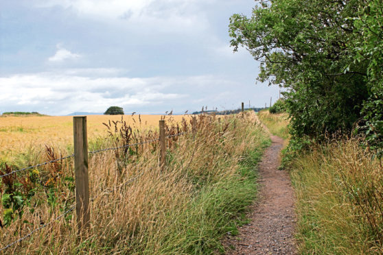
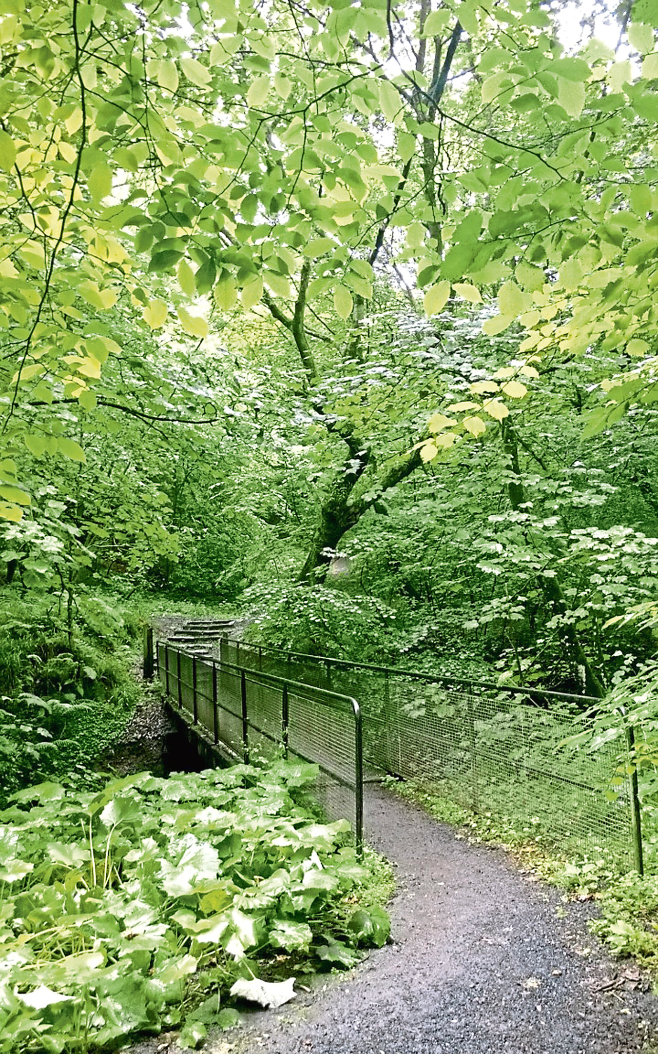
Along the way, various bridges span the burn, but I stayed on the west bank, emerging from the trees briefly to skirt the edge of a field, before finally leaving the den by the site of the old King’s Mills.
A brief trot along the road took me below a pylon line to the edge of the village where I turned west, pot-holed Fa-Latch Road passing scattered houses, steadings and pony paddocks to the hamlet of Balcurvie.
The route here follows part of a newly developed long-distance trail, the Fife Pilgrim Way, which, once complete, will run from Culross and North Queensferry via Dunfermline to St Andrews, connecting medieval landmarks, ecclesiastical sites and historic villages.
I trod in the footsteps of the pilgrims to a yard of wooden garages at the end of the lane, a track leading from here to a house aptly named The Temple where a right of way strikes out across farmland.
Forking right off the religious route, I hiked on between fields, spotting the Lomond Hills to the west as I dipped to cross Markinch Burn, before climbing past the wooded policies of Newton Hall, where Largo Law appeared across fields to the east.
A minor road led me back towards Kennoway and, while the rural byway is normally fairly quiet, the verge offers sanctuary from any oncoming vehicles, although particular care should be taken through the corner approaching Auchtermairnie Farm.
However, it is here, as traffic crosses Kennoway Burn, that walkers step off the asphalt and descend into the wilder northern section of the den, the path skirting between trees and fields before dropping below the canopy to meet the stream once again.
ROUTE
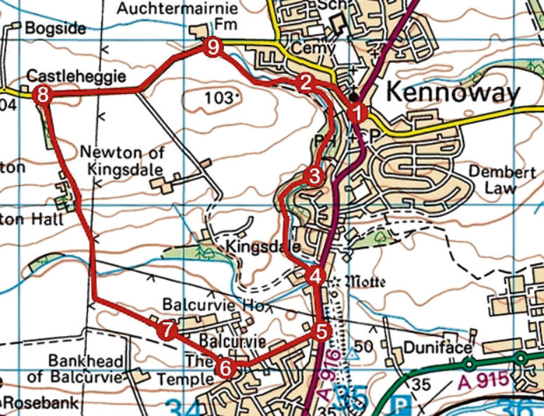
1. Exit car park on to Leven Road and go right to Cupar Road. Cross, bear right and continue along Denhead (signed Kennoway Den) to roundabout. Go left for 120m.
2. Turn left (signed Kennoway Den) and loop down past cottage. Go right, down steps, then left, following den path by stream, crossing at next bridge.
3. Fork left at waymarked junction beyond old bridge and follow path south to meet track. Turn left to A916.
4. Turn right and walk 400m south on A916.
5. Turn right and walk 600m west along Fa-Latch Road.
6. Continue ahead on track to The Temple. Turn right up track then path to junction and fork right (signed Castleheggie).
7. Continue ahead on track then path, dipping to cross stream. Ascend track past Newton Hall to road.
8. Turn right and walk 1.1km along road.
9. Turn right (signed Kennoway Den), follow path through den to point 2 then retrace steps to start.
INFORMATION
Distance: 7.25km/4½ miles
Ascent: 110m/360ft
Time: 2-3 hours
Grading: Easy low-level route following good tracks and paths through wooded den and farmland with some road walking
Start/finish: Cotland Park car park, Leven Road, Kennoway (Grid ref: NO 351025)
Map: Ordnance Survey 1:50,000 Landranger sheet 59; Ordnance Survey 1:25,000 Explorer sheet 370
Tourist Information: St Andrews iCentre, 70 Market Street, St Andrews KY16 9NU (Tel 01334 472021)
Public transport: Kennoway is on Stagecoach bus routes 9A from Leven, 41 from Kirkcaldy and 41B from Cupar or Leven