Dug out in the 12th Century, Perth’s Town Lade began its working life as an offshoot of the River Almond, the water drawn off and funnelled down through bleachworks at Huntingtower and Ruthvenfield, a dye works at Tulloch and then the mills of Perth before flowing into the River Tay.
The Upper and Lower Mills, in the centre of the city, are the most robust reminders of this industrial heritage. Dating from 1774 and 1808 respectively, they used the power of the water to process flour and oatmeal until their closure in 1966.
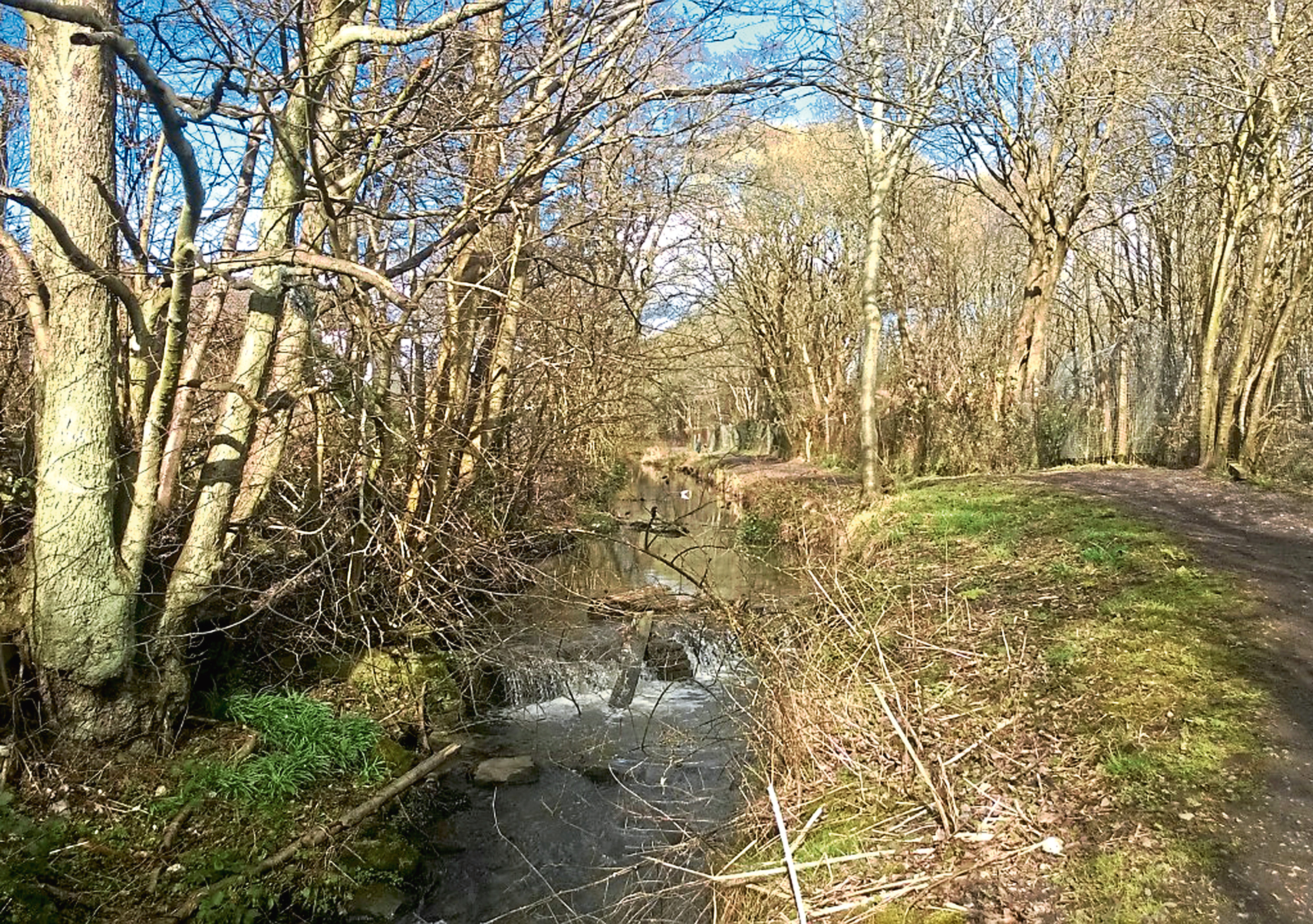
Restored, the Upper Mill is a hotel while the adjacent granary houses apartments. The Lade, now less energetic in retirement, maintains, for the most part, its original course and, with its accompanying footpath, is a pleasant and peaceful corridor through the urban jungle.
The walk follows The Lade north through the city before returning along the banks of the River Almond and River Tay and route-finding is easy enough – just keep the stream to your left.
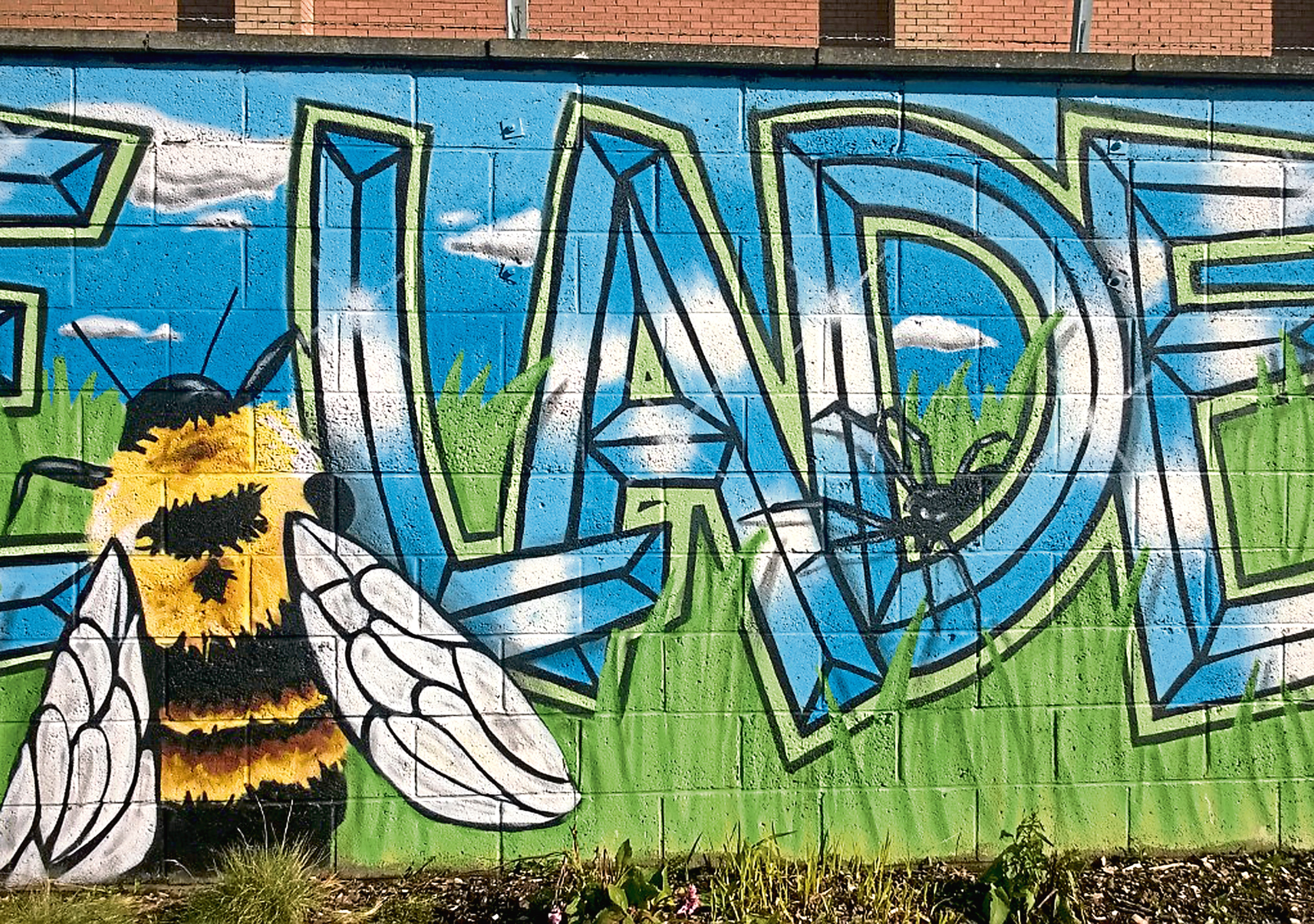
Joining the channel above Upper Mill, where it disappears beneath the complex, I followed the flow upstream, over Caledonian Road and through St Catherine’s Retail Park where walls of brightly coloured street art illustrate some of the creatures that live on The Lade.
Tree-lined in parts, the banks of the stream bristle with plants and wildflowers, creating a habitat for birds like the wren and heron. They may be reclusive, but the local ducks are far more forward, particularly if there are crumbs of bread to be had.
Approaching Crieff Road, the waterside path ends abruptly but, just ahead of this point, branch right through a gateway in the fence between apartment blocks and steps climb the roadside embankment, the stream beckoning once again beyond a playpark on the opposite side of the thoroughfare.
Weaving on towards a railway line, a footbridge conveys walkers over the track, the path ahead skirting by the town’s former railway marshalling yard which, at its peak in the 1960s, handled some 1300 wagons a day.
Passing a remnant of the former Tulloch Bleachworks, The Lade continues north before swinging west past houses and gardens to reach Inveralmond Skywalk Footbridge, a prominent new landmark affording safe passage over the busy A9.
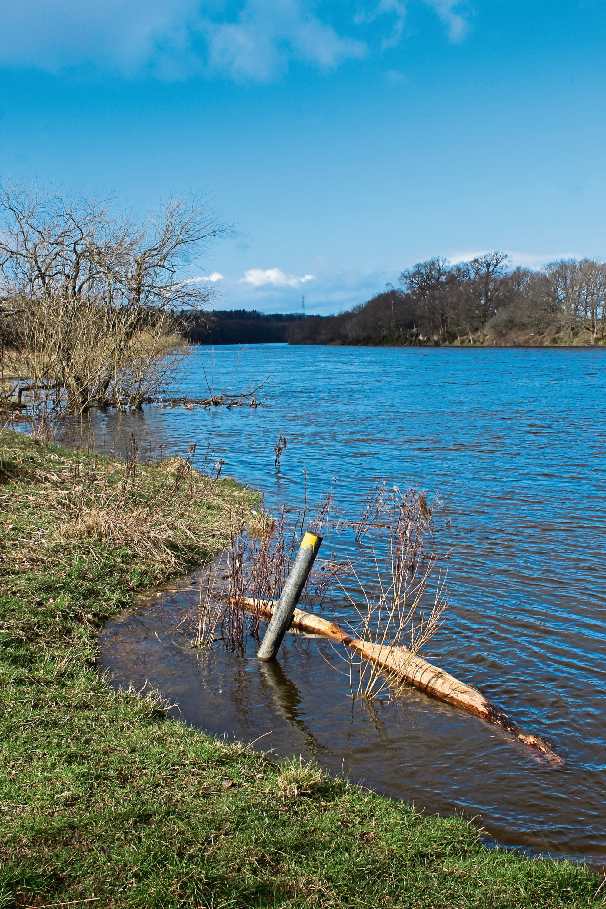
On the other side, The Lade is broader and more open and I stayed with it as far as the Bertha Park link road, my connection to the River Almond, where I turned east, joining the riverside footpath for the last leg of the Almond’s journey towards its convergence with the River Tay.
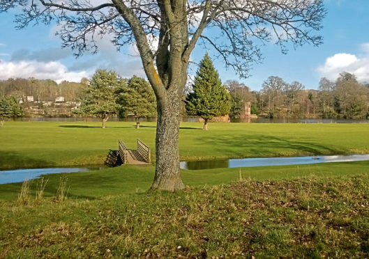
Passing under Almond Bridge, built in 1827 on the Great North Road but bypassed in the 1970s by the neighbouring A9, the footpath led me below the adjacent railway and on towards the Tay where, spotting Scone Palace across the water, I turned south past the trees of Woody Islands and hiked downstream to the North Inch.
Taking a step or two back from the river, a surfaced path crosses the golf course here, proceeding through parkland and playing fields beyond towards Perth Bridge and monuments raised to commemorate the military service of the 90th Light Infantry and the 51st Highland Division.
Across Charlotte Street, I passed the Fair Maid’s House, believed to be the oldest non-religious building in Perth, en route back to the City Mills.
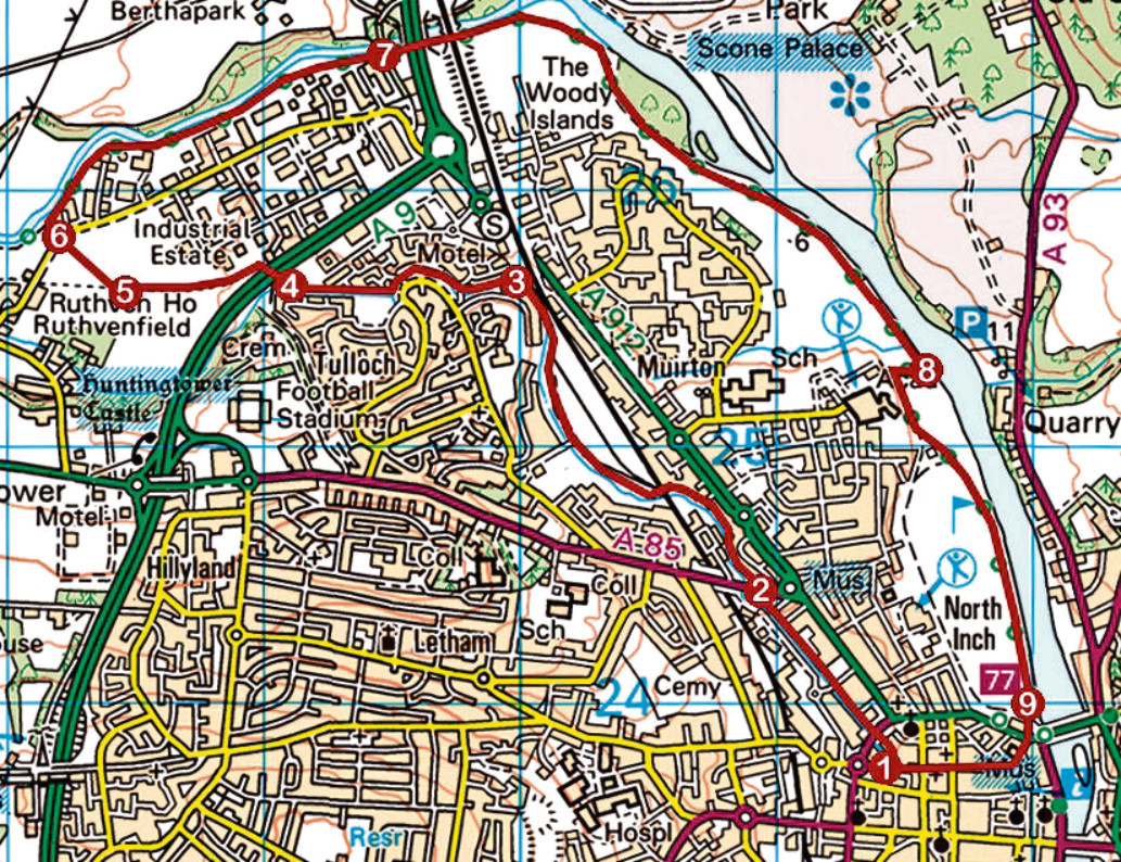
ROUTE
1. Walk along lane at No Entry sign (signed To Parmelia Court) then bear left to the Lade and follow it to Caledonian Road. Cross and continue ahead on Lade path.
2. Approaching Crieff Road, where path ends, go right through gap in high wooden fence and ascend steps to Crieff Road. Cross, descend to playpark and continue along Lade path.
3. At junction where Lade curves left, stay with stream, ignoring path branching right to Inveralmond.
4. Bear right to cross A9 by bridge and continue by stream. Approaching underpass, go right up to road.
5. Go right along pavement to Ruthvenfield Roundabout.
6. Cross Ruthvenfield Road, bear right initially then go left (signed City Centre) to River Almond. Turn right and follow riverside path east.
7. Pass under Almond Bridge, the A9 and railway and continue ahead on surfaced path to North Inch.
8. Go right initially then left, forking left at next junction and continue south to Charlotte Street.
9. Cross then follow Bridge Lane, Mill Street and Murray Street to Lower City Mill.
INFORMATION
Distance: 11.2km/7 miles
Ascent: 80m/260ft
Time: 3-4 hours
Grading: Easy, low-level route following footpaths and pavements, primarily alongside stream and rivers, through a mixed urban landscape including commercial and residential areas and parkland. Stout footwear recommended
Start/finish: Lower City Mill, West Mill Street, Perth (Grid ref: NO 114237). Nearest parking (charged) at Thimblerow, Paul Street
Map: Ordnance Survey 1:50,000 Landranger sheet 58; Ordnance Survey 1:25,000 Explorer sheet 369
Tourist Information: Perth iCentre, 45 High Street, Perth PH1 5TJ (Tel 01738 450600)
Public transport: Perth railway and bus stations are a short walk from the start point