In recent weeks I have been lucky enough to work in the Alps and Dolomites where the mountain passes offer a real vertical challenge for cyclists wanting to scale their heights.
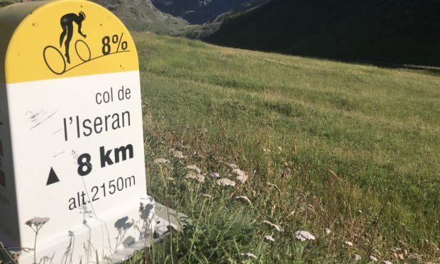
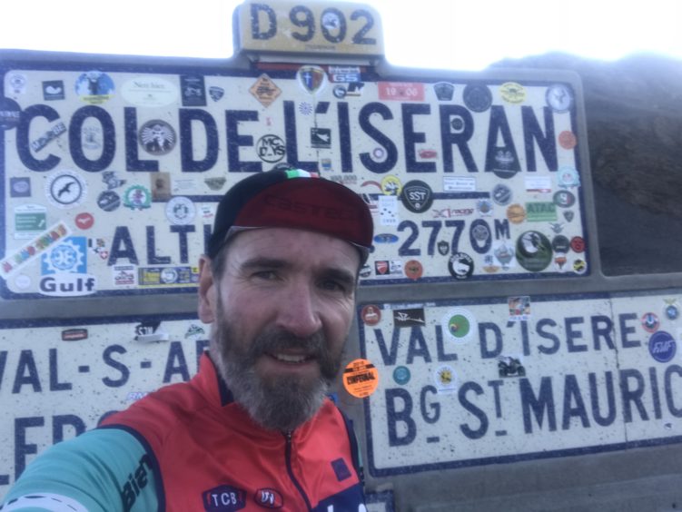
Among those cols I visited were the Col de l’Iseran (2,764m) and the Cîme de la Bonnette (2,802m) both of which, contentiously, lay claim to being the highest paved road in Europe. The Bonnette has a sign at the bottom of the climb verifying this boast.
Amusingly, but perhaps unsurprisingly, these claims are taken quite seriously by the French and in particular, those who live in the departments of the Bonnette and Iseran. In fact, there are higher paved roads in Europe. The Pico del Veleta in the Spanish Sierra Nevada is 3,380m high and not far behind the Ötzal Glacier road in Austria peaks at 2,830m.
However, as the French would claim, these roads may be the highest, but they are dead ends and riders must descend the way they have just come up. This minor detail is enough to bolster French pride that they do have the highest pass (a through road that goes over the col and continues to another destination).
Now, this is where it starts to get a bit complicated, and if I am being honest, a bit silly too. The Col de l’Iseran is actually the highest paved pass in Europe, despite being 38 metres lower than the Cîme de la Bonnette, however the actual col on the Bonnette only peaks at 2,715m, The Cîme was an extra road loop built between 1960 and 1961 to add extra height to the climb, but as fans of the Iseran will tell you, that disqualifies it from being an actual mountain pass. I told you it was all a bit silly. It’s all a bit of a moot point, but what is inarguable is the spectacular feats of engineering that allowed the construction of these roads through the jaw-dropping mountain terrain.
Quite simply, these mountain roads are just begging to be cycled and watching professional cyclists race up and over them on television does nothing to prepare you for their grandeur in real life.
I love the mountains and spend a lot of time supporting cyclists on the sinewy routes upwards, but find sometimes that the ease of access for motorised transport makes them a “honey-pot” for traffic, especially on the summit and trying to get that “summit photo” can be a challenge as you manoeuvre your way among the scores of motorbikes parked directly in front of the col altitude sign. So, I often find myself making early morning pilgrimages to the tops, well before the motor cyclists and campervan drivers have even had their breakfast.
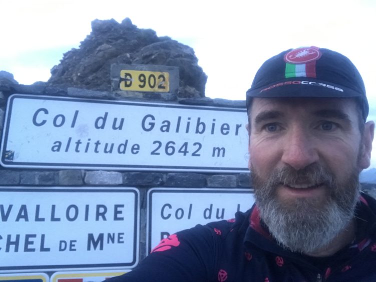
A recent excursion saw me leave my hotel at 4.30am in the dark, and under a full moon make my way to the summit of the Col du Galibier (the eighth highest road in Europe at 2,645 metres). It took me one hour and 45 minutes to reach the top, arriving at 6am and then only 18 minutes to descend, but I had the road to myself.
It was a rare moment of tranquillity in my working day and as I stood at the summit and watched the sunrise over the glaciers to the south, I smiled to myself.
Even in these highly frequented tourist areas it was still possible to have silence and a feeling of wilderness.
Where to Ride: Great Dun Fell, North Pennines (835m) OS Landranger Map 91 NY 710321
Distance: 7.4km with an average gradient of 8%
Details: With its radar station on the summit, Great Dun Fell has been dubbed the Mount Ventoux of the Pennines. It is the highest road in the UK, but like Pico del Veleta in Spain it is an out and back route (the Cairnwell Pass in Glenshee at 670m is the highest pass in the UK). To add to the attraction for cyclists motorised vehicles are not allowed to travel beyond the village of Knock.


