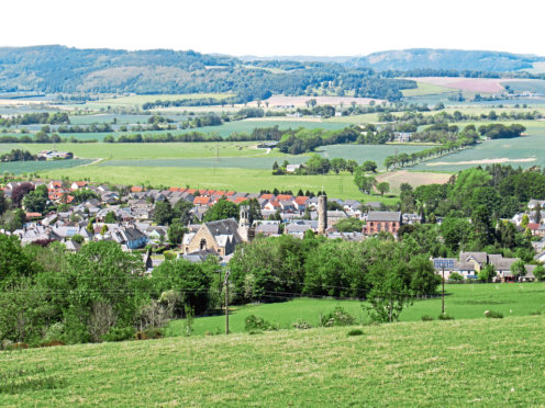
The Perthshire village of Abernethy – famous for its historic round tower – nestles between the northern slopes of the Ochil Hills and the flat arable lands of Strathearn, the meandering River Earn just a stone’s throw away.
Setting out from the tower, this circuit explores the contrasting terrain, rising through leafy Abernethy Glen and crossing the flank of Castle Law before finding level gradients on lower ground for the return.
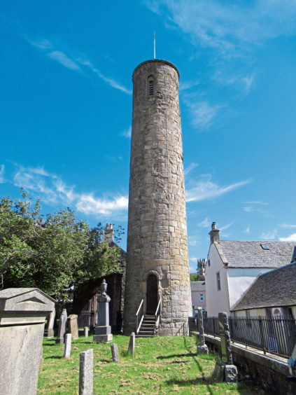
Located in the cemetery of the parish church at the heart of the community and believed to be at least 1000 years old, the famous Irish-style round tower is one of only two such structures in Scotland (the other is in Brechin).
It is the perfect place to start for, just east of the tower and neighbouring Mercat Cross, Kirk Wynd, a narrow lane of cottages, offers direct access to open country, climbing north towards Loanhead Quarry, last worked over half a century ago and now largely lost to nature.
Here the way branches right into Abernethy Glen, following the Witches Road, so called because, in the 16th century, a coven of suspected witches was marched this way, up on to Abernethy Hill, where they were burned to death.
The route’s history may be dark, but in these more enlightened times, it is a delightfully peaceful journey through the mixed woodland and wildflowers of sheltered Abernethy Glen, passing below the towering bluffs of quarried rock.
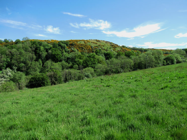
Higher up, the foliage parts briefly to reveal Castle Law – site of an Iron Age hill fort – across the valley before the trail dips by a flight of wooden steps to cross Ballo Burn.
Steps down are closely followed by steps up and, from a wooden kissing gate at the top of the staircase, the path runs anti-clockwise around the edge of a field, rising to meet the Glenfoot to Strathmiglo road.
An optional ascent of Castle Law can be made from here, a signed path clambered up to the exposed site of the fort, marked by a cairn perched on a rocky outcrop, and the less distinct hill summit, hidden away amongst trees to the west.
It is a short, strenuous ascent but the sweat and toil is well rewarded with excellent views while information boards interpret the local history.
Adopting a more leisurely gradient, the road descends over the northern flank of Castle Law, passing through the hamlet of Glenfoot, to meet the A913 at the foot of the hill, a roadside footway leading east to farm sheds at Broadwell.
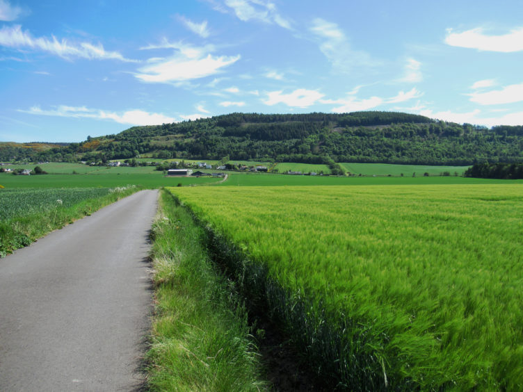
Leaving the road here and cutting a course between fields of crops, a surfaced track strikes north towards the prominent line of a railway embankment, Moncreiffe Hill in view beyond, the distant folly atop Binn Hill just visible to its right.
Passing under the railway, the route swings right, waymarker arrows guiding walkers around the back of the house at Carey before progressing towards the farm at Hatton.
Branch left here, rounding the sheds, and the track continues across the fertile plain towards Provost Mains where, turning south, Abernethy beckons.
A tree-lined lane quickly closes in on the village, running back under the railway, and, across the A913, School Wynd rises past the Museum of Abernethy to the tower where those with enough energy left can climb to the top, entry by a key available from the neighbouring tea rooms.
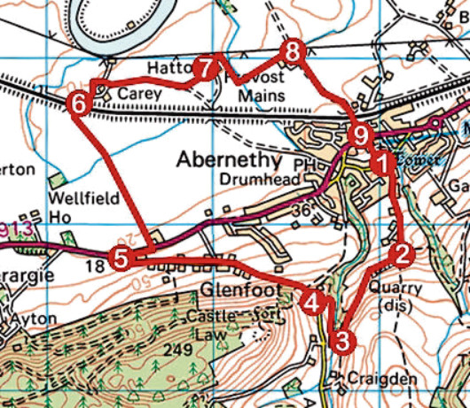
ROUTE
1. Walk east along Main Street, turn right up Kirk Wynd (signed Glen Road) and, following signs for Craigden and Abernethy Glen, fork left higher up to reach signed junction.
2. Turn right (signed Abernethy Glen) and ascend path through glen.
3. Descend steps, cross footbridge (signed Castlelaw), ascend steps, pass through kissing gate, and bear right, descending path to signed junction. Go left (signed Castlelaw) up path to road.
4. Turn right and descend road through Glenfoot to A913.
5. Cross A913, go right to Broadwell then turn left (signed Abernethy via Carey) and follow track towards railway.
6. Pass under railway, turn right (signed Abernethy via Carey) and follow track east past Carey to Hatton.
7. Go left (signed Abernethy via Provost Mains) around farm sheds and continue along track to Provost Mains.
8. Turn right and follow track to Abernethy, ascending below railway to meet A913.
9. Cross A913 at pelican crossing and ascend School Wynd to tower.
INFORMATION:
Distance: 6.4km/4 miles
Ascent: 115m/380ft
Time: 2 hours
Grading: Moderately easy walk following good paths and tracks and a section of minor road through woodland and across farmland with some short sections of strenuous ascent. Stout footwear recommended
Start/finish: Abernethy Round Tower, Main Street, Abernethy (Grid ref: NO 190163). Parking available in small public car park signed off Main Street
Map: Ordnance Survey 1:50,000 Landranger sheet 58; Ordnance Survey 1:25,000 Explorer sheet 370
Tourist Information: Perth iCentre, 45 High Street, Perth PH1 5TJ (Tel 01738 450600)
Public transport: Stagecoach bus service 36 from Perth
Please adhere to government guidelines on exercise outdoors.