Amulree may feel a wee bit off the beaten track today but it was once a much busier spot, sitting on the intersection of two historic drove roads and later one of General George Wade’s military routes.
Linking Crieff with Dalnacardoch, in Glen Garry, his highway paused briefly at the hamlet’s 18th century coaching inn, where weary travellers doubtless indulged in some much needed refreshment, before pushing north through Glen Cochill to Aberfeldy.
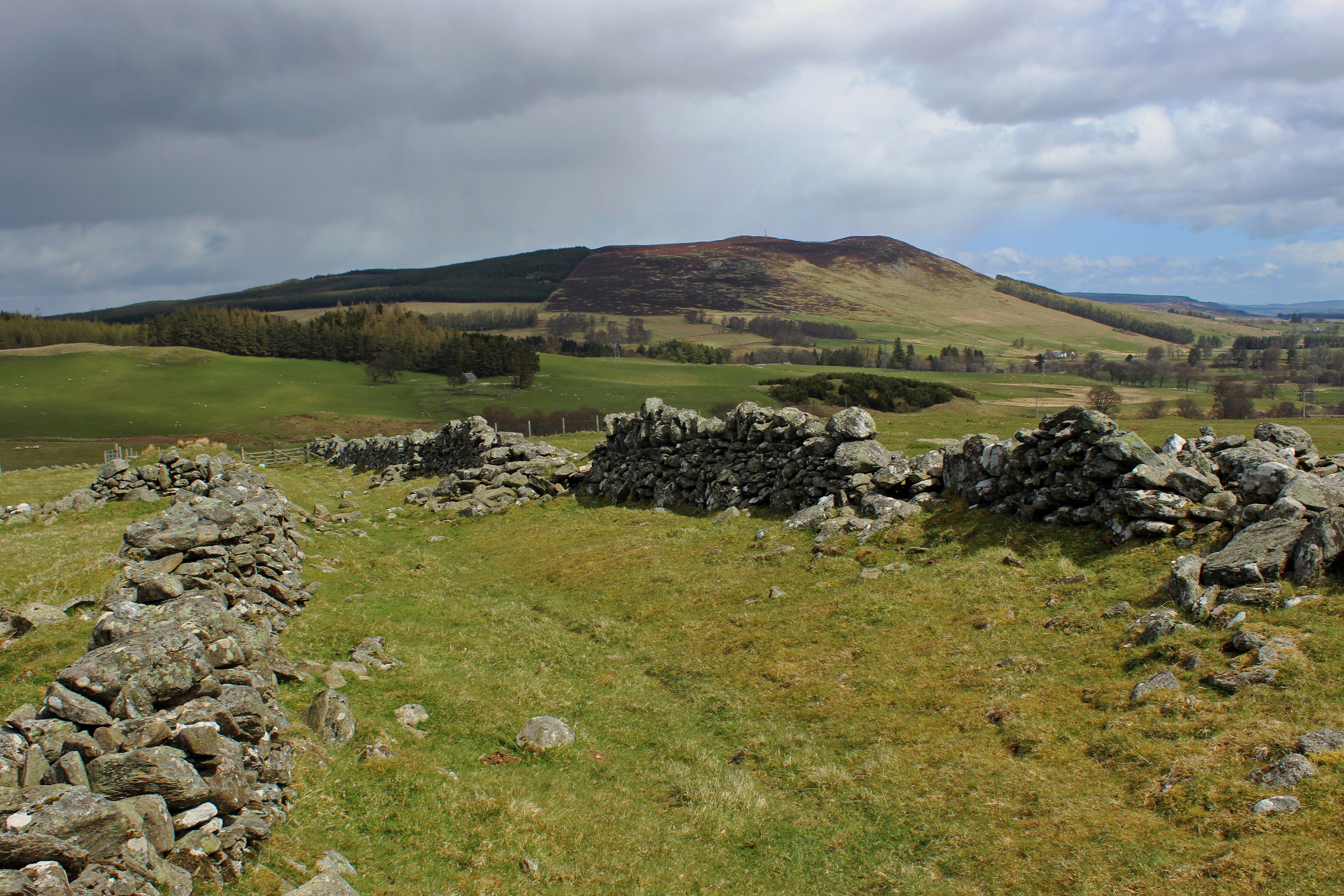
Heading from the village hall down the A822 to North Amulree Farm, Wade’s road lost beneath my feet for the moment and the inn closed for renovation, I soon found more tangible evidence of his work as the farm track beyond entered open country.
By woodland on the right, a grassy path follows the line of the road over rough pasture, running between the tumbledown remnants of walls that originally flanked the stone carriageway.
Constructed in 1730, the route is remarkably well preserved here, although the same cannot be said for Wade’s bridge over Glenfender Burn which has succumbed to the passage of time.
Fortunately, just below the crumbling stone abutments, a more recent wooden footbridge offers safe passage over the water and the road rises into Glen Fender, crossing a ladder stile before meeting an estate track further up the slope.
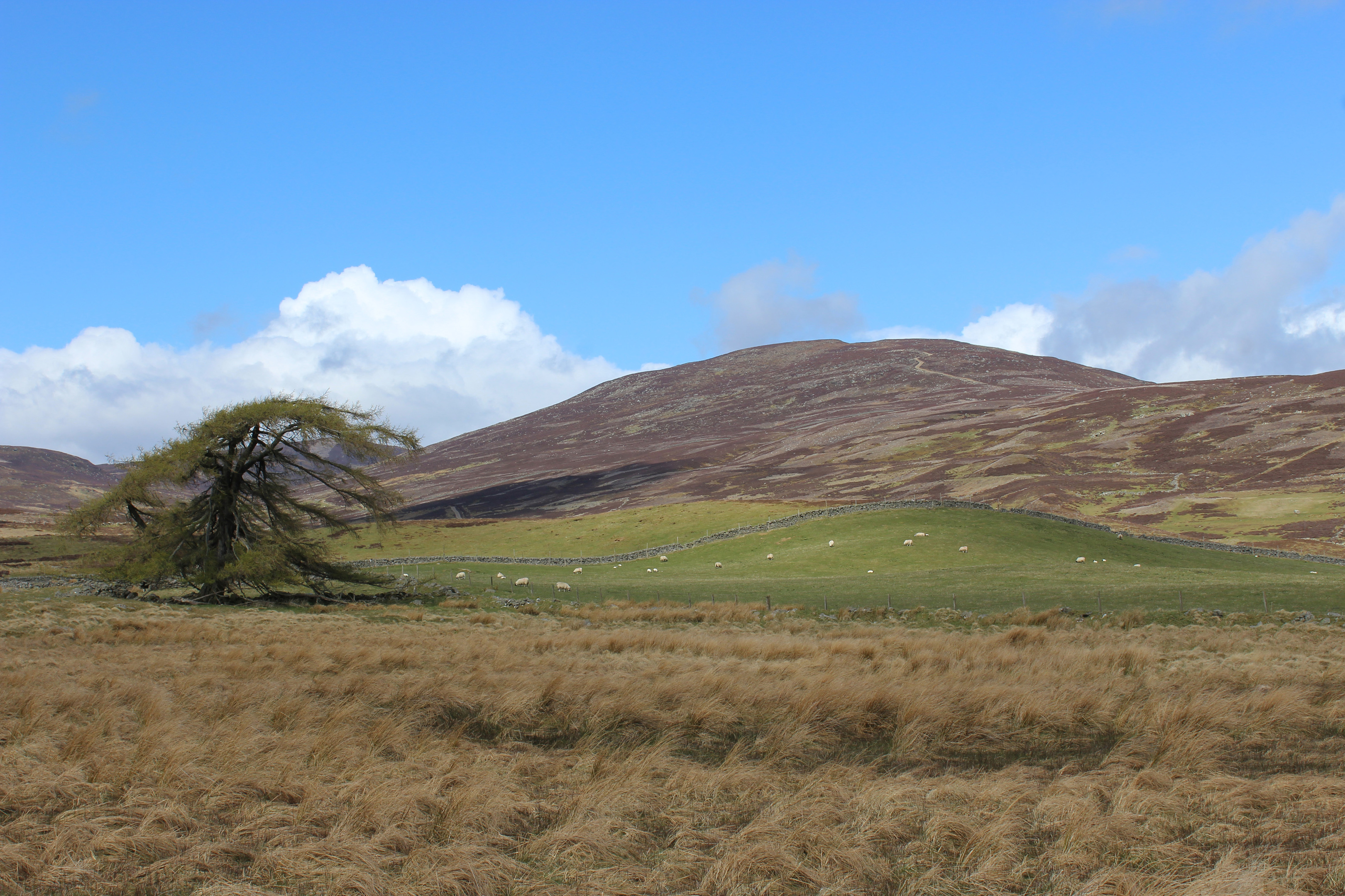
Alighting here, I turned west, embarking upon my ascent of the valley, grazing sheep paying little heed to my presence as they picked over patches of grass flanked by wiry heather.
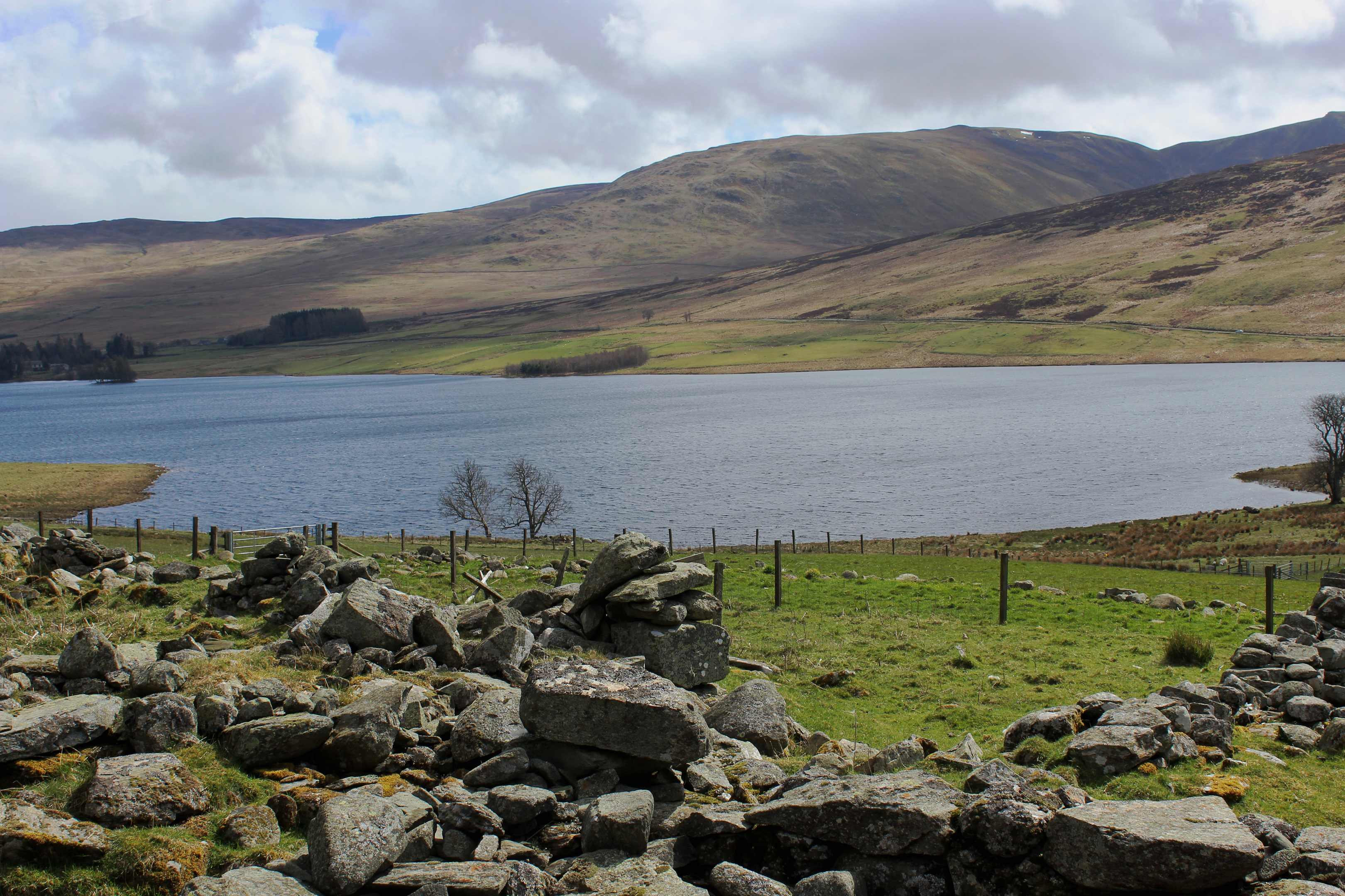
Along the way, various trails branch right, serving the grouse moors on Beinn Liath, but I continued ahead, crossing Glenfender Burn, which is fed by Loch Fender, a secluded stretch of water nestling in the folds of Meall Dearg, up to the right.
Above the stream, the track arcs left, skirting below rugged outcrops of rock in the upper reaches of the glen before finally emerging on to the shoulder of Creag nan Gabhar.
After the long haul up, I needed little encouragement to stop, admire the view and catch breath at an elevated intersection of moorland tracks ahead of the final bit of ascent, the track curving west before the descent into Glen Quaich finally begins.
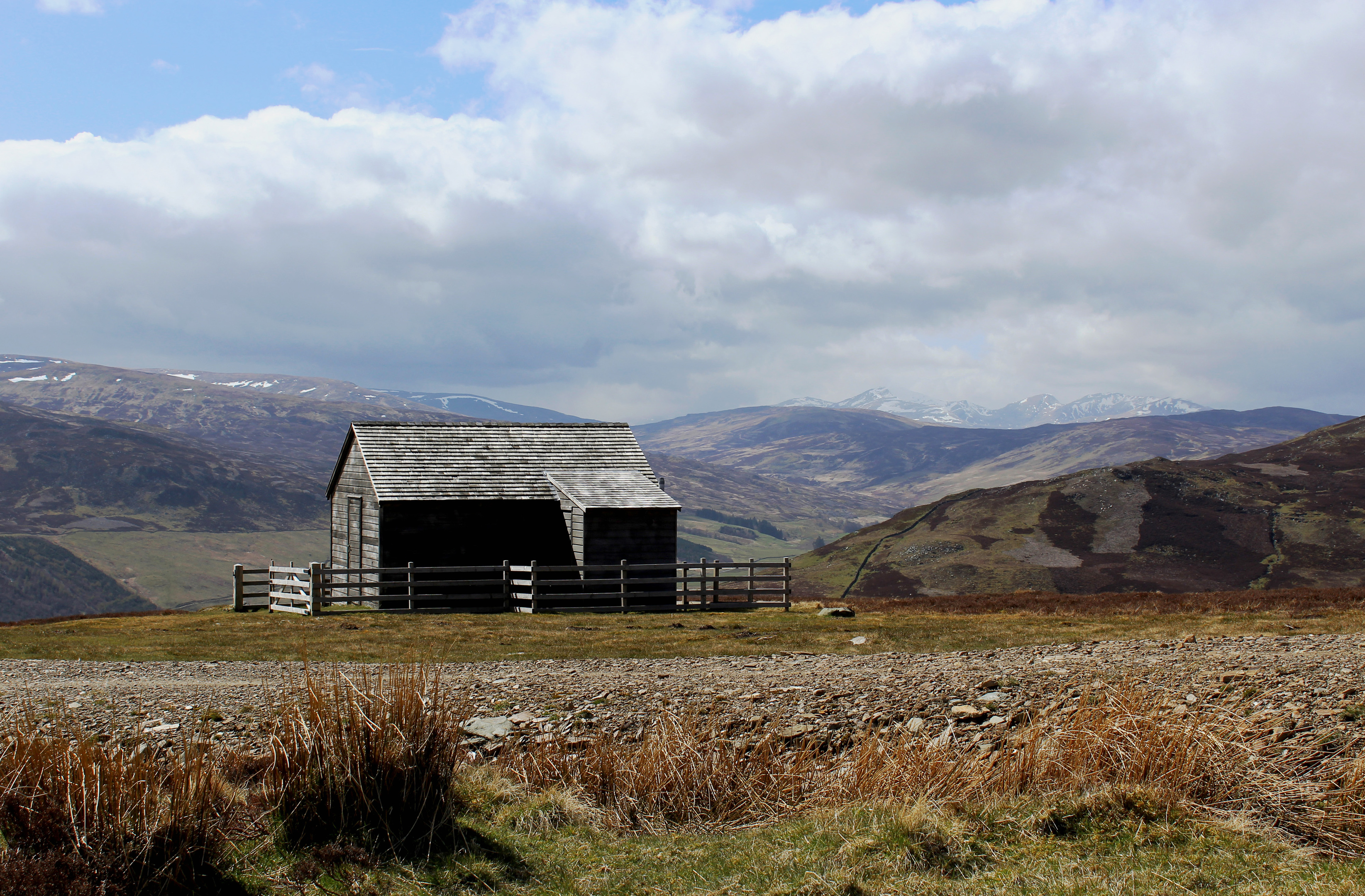
On the way down, the route passes close to a pair of estate huts, sitting on the opposite side of a bridge spanning Allt na Moine. Both enjoy an excellent vista over the valley and this is as good a spot as any to break for lunch.
The track drops steadily from here, passing a line of grouse butts as it curves down across moorland and pasture to an old corn mill sitting by the Turrerich Burn.
The granary was part of a small township called Wester Turrerich, the ruins of which sit forlornly by the track back to Amulree.
Like most of the glen’s indigenous people, the hamlet was cleared by the Second Marquis of Breadalbane in the mid-1830s to make way for sheep and cattle. A similar fate befell the residents of Easter Turrerich, a little further along the way.
Today the once busy drove road linking these and other lost settlements on the northern side of Loch Freuchie is used only by local farmers and walkers following the Rob Roy Way, a long distance trail roaming through the famous outlaw’s former territory. And it was in his steps that I made my way back to Amulree.
Route
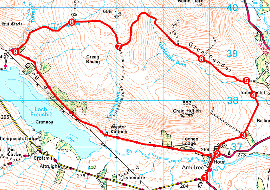
1. Walk 600m north on A822 to North Amulree Farm.
2. Ascend track past farm and Keeper’s Cottage. Pass through gate and follow track to junction.
3. Step over pedestrian crossing by gate and continue ahead on grassy path following line of Wade’s Road. At junction beyond wooden gate, continue ahead, descending to cross Glenfender Burn by bridge.
4. Bear left, ascending grassy path. Cross ladder stile and continue up slope to meet track.
5. Turn left and walk 1.1km west up track to junction just beyond wall.
6. Continue straight ahead on main Glen Fender track, ignoring tracks branching right further on, and ascend to junction on shoulder, ignoring a dead-end track on the left.
7. Turn right, ignore next track on right and follow track north then west.
8. Detour right over bridge to huts then descend track into Glen Quaich.
9. Turn left and follow Rob Roy Way east through Glen Quaich to Amulree.
Information
Distance: 14.4km/9 miles
Ascent: 450m/1485ft
Time: 4 hours
Grading: Moderately challenging route following good paths and tracks through farmland and over moor with some prolonged sections of ascent. Keep dogs under close control due to livestock and ground nesting birds
Start/finish: Amulree Village Hall, at southern end of village (Grid ref: NN898362)
Map: Ordnance Survey 1:50,000 Landranger sheet 52; Ordnance Survey 1:25,000 Explorer sheet 379
Tourist Information: Dunkeld Information Centre, The Cross, Dunkeld PH8 0AN (Tel 01350 727688)
Public transport: Ring of Breadalbane Explorer bus service from July to September (www.breadalbane.org) or school day service 896 (www.dochertysmidlandcoaches.co.uk) from Aberfeldy


