Alan Rowan takes a hike along the Glen Ogle Trail, Lochearnhead, Stirlingshire.
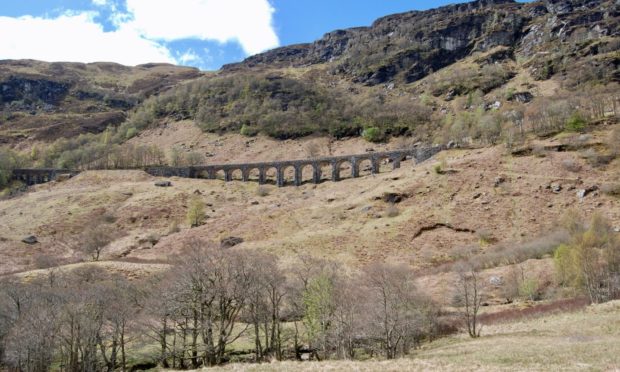
Anyone who has travelled through rugged Glen Ogle can’t help but admire the impressive rail viaduct which serves as a reminder of the days when trains ran between Callander and Oban.
This section of the railway was closed in 1965 due to a substantial rockfall, and its transformation into a cycling and walking route provides a day out that should suit all ages and abilities, whether on two legs or two wheels.
Starting point
The most convenient starting point for this circuit is from the large parking area in Lochearnhead.
A short walk west along the road, a right turn at the junction and a careful crossing of the busy A85 leads to a sign for the Glen Ogle Trail.
Another sign points right (left is for the Scout Station) to a rough woodland path which twists steeply uphill, passing through a high gate, to reach the old trackbed.
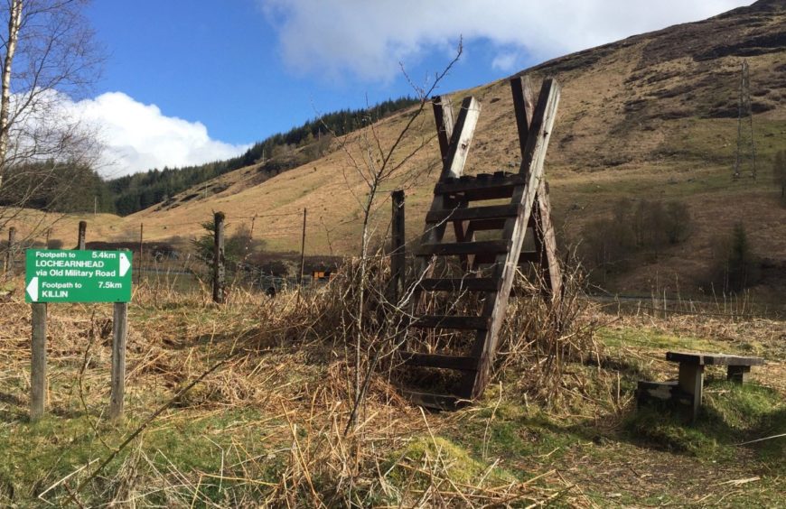
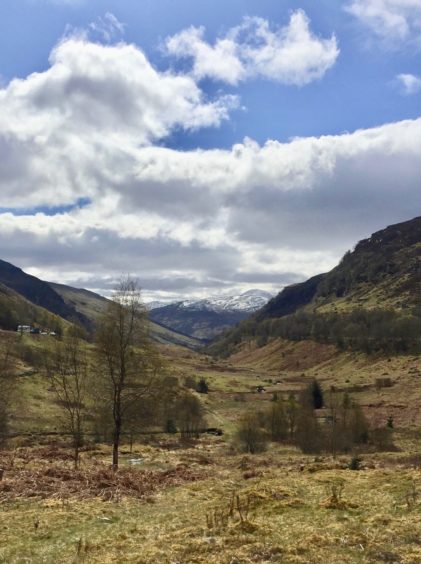
From there the first part of the route is obvious, the compact surface heading north for some four kilometres until reaching a large wooden stile, and you can just relax and enjoy the views.
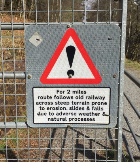
There is a spectacular line of sight south over the waters of Loch Earn, while the soaring, rocky slopes on either side of the glen have a wild and rugged feel, highlighted by regular warning signs reminding of the potential for landslides and rockfall.
Landslips
Back in 2004, torrential rains triggered two major landslips on the eastern side of the A85 which blocked the road and resulted in some stranded motorists having to be airlifted to safety.
The smoothness of the walking surface makes it easy to forget the engineering feat of creating this high-level rail line cutting across the hillside.
A glance up to the left every so often reveals trees clinging on to steep, eroded ground, water dripping everywhere and a chaos of huge boulders jumbled below craggy faces.
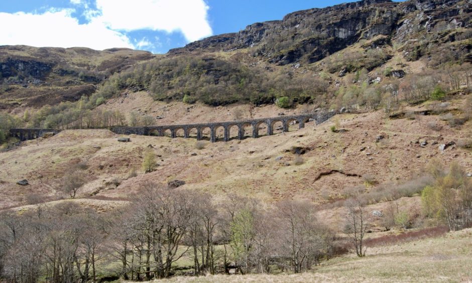
Most of the old stations and bridges that once straddled the length of the rail line have long gone, either removed or destroyed, but the viaduct has survived, and it is the highlight of the walk north.
Its curving line is best seen from either extreme, but it could be argued the finest view comes from below on the inward leg, the arches a perfect centrepiece for the rugged skyline behind.
The turning point lies just beyond, where a sign points to a high wooden stile.
The line, which is part of the national cycle route and the Rob Roy Way, continues on towards Killin and round into Glen Dochart, and there is a variety of options for anyone wishing to lengthen the day.
Rabbits
Long before the upgrade, I used the grassy track to approach the Corbett Creag MacRanaich from this glen and was delighted by the sight of hundreds of rabbits scampering about the line as the early morning mist rose from the ground.
The path which drops down Glen Ogle is muddy in places, but it gives grand views of the viaduct as it runs beside a lively stream, passing over little bridges where the stones have been conquered by moss and lichens.
The Munro twinset of Ben Vorlich and Stuc a’ Chroin fills the horizon ahead. At one point, I turned to see a family of wild goats having lunch, completely oblivious to my presence.
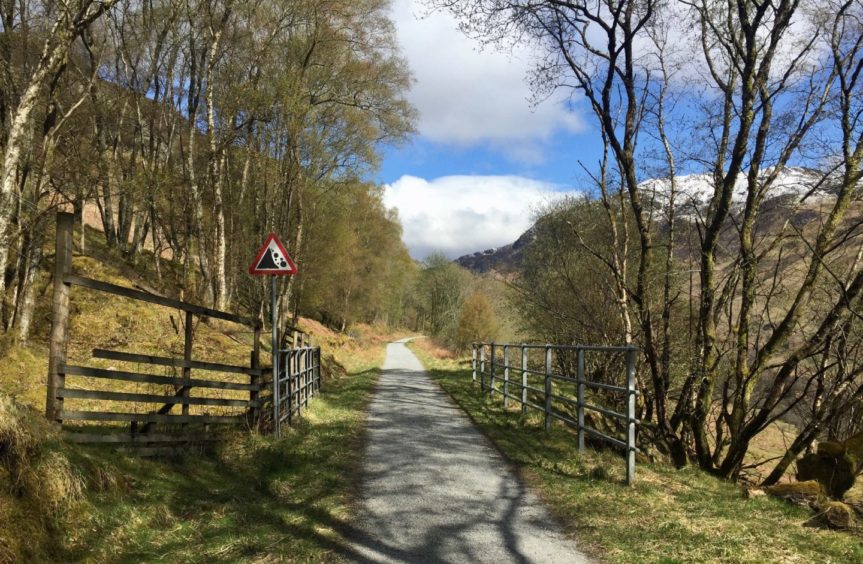
After passing through some straggling woodland via a couple of wooden walkways, the path starts to climb to the A85.
The crossing point is signed, as is the route on the other side, but care is needed as the traffic is fast and the visibility not ideal.
Once over the road, the path becomes a little vague in places as it crosses grazing land and sheep fields, but keep looking out for the signs to keep you right all the way back to Lochearnhead.
During lambing season, there can be restrictions on parts of this section but don’t be tempted to try and walk down the road.
Instead, I would recommend you retrace your steps from the point where the route crosses the road.
You could even stay on the track for an extra stop at Craggan and then make the short walk back along the main road from there.
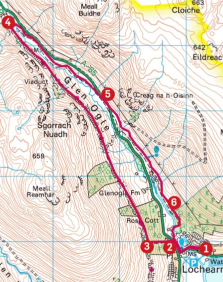
ROUTE
1. Head west from car park along pavement and across bridge, then turn right for short distance before crossing road and taking signed path on track.
2. Keep right at next sign (Glen Ogle Trail) and head steeply uphill through trees on good path to reach rail trackbed.
3. Turn right and follow this for some 4km, crossing Glen Ogle viaduct en route, until reaching high wooden stile on right.
4. Now take path which turns south, dropping to follow line of burn. After passing through small stands of trees and over couple of wooden walkways, path rises to meet A85.
5. Cross road and follow path (vague at times, but there are markers) through grazing land and sheep fields until reaching wooded section.
6. Continue through trees to gate for track which leads back to A85. Turn left and left again to return to car park.
INFORMATION
Distance: 10km/6miles
Ascent: 280m/920ft
Time: 3-4 hours
Grading: Cycle track, woodland and grassy paths. Suitable for all abilities, one short, fairly steep climb to rail track. Wet and muddy sections on return leg, good footwear advised. Dogs under close control due to farm livestock. NB: There may be restrictions on some sections during lambing season.
Start/finish: Car park at Lochearnhead (Grid ref: NN 593237) off A85.
Map: Ordnance Survey 1:50,000 Landranger Map 51 (Loch Tay & Glen Dochart); Ordnance Survey 1:25,000 Explorer sheet OL46.
Tourist Information: VisitScotland, Stirling iCentre, Old Town Jail, St John St, Stirling, FK8 1EA (Tel 01786 475019).
Public transport: Buses to Lochearnhead from Perth and Stirling routes.


