Den of Alyth (or more traditionally Den O’Alyth) is a wooded valley on the outskirts of Alyth, a popular local beauty spot boasting a network of paths and bridges perfect for peaceful riverside roaming below mature oak, ash, beech and birch.
Poke a toe out from under the trees and the surrounding countryside is equally as enticing, as I discovered on a wander west from the market town.
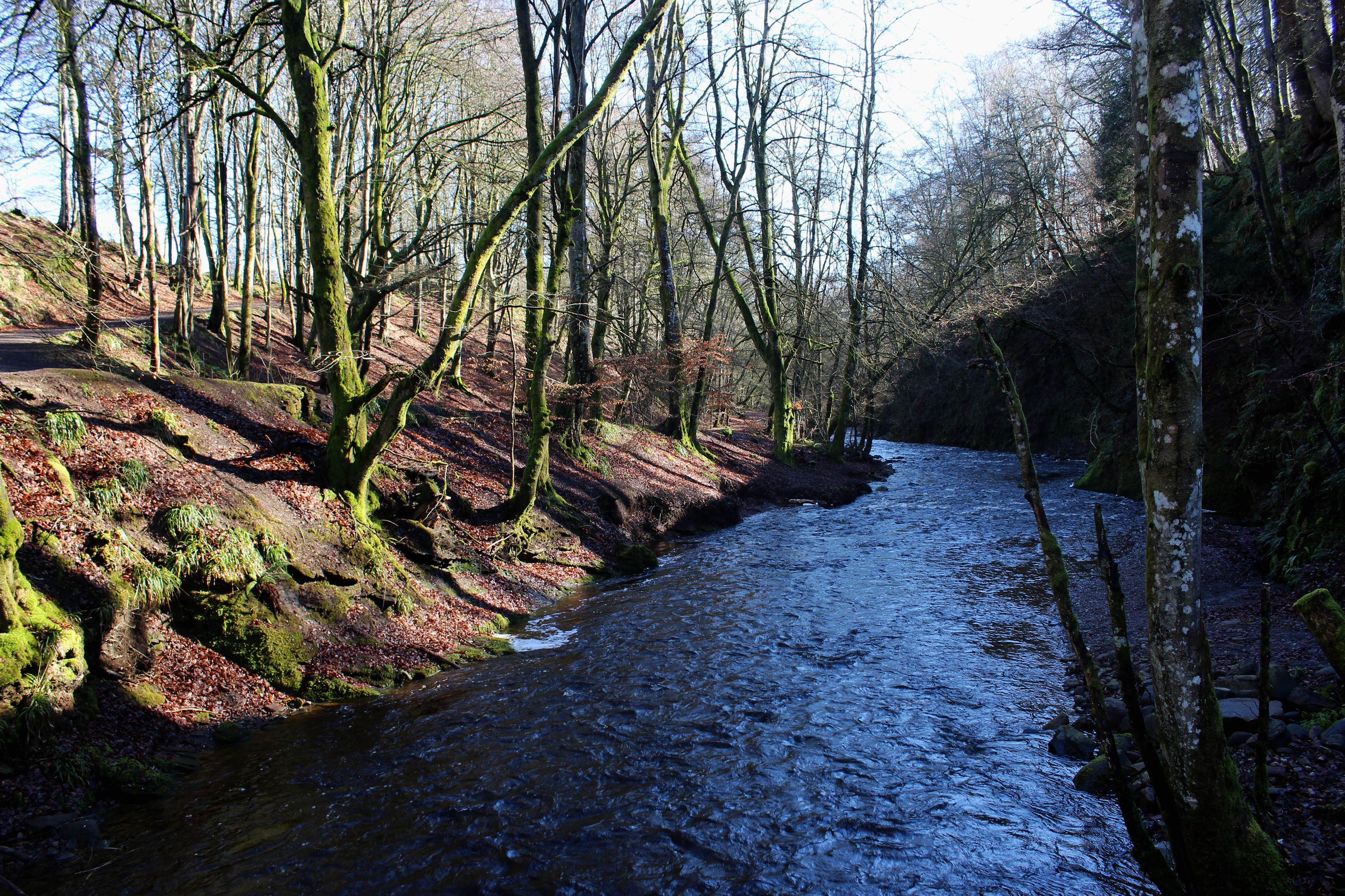
A short hop from the centre of Alyth, the Den car park offers easy access to its woody delights, a path leading between two rocks down to Alyth Burn, a waterway that historically powered local textile mills.
Mills gone, the burn shows no sign of its power waning and, after overnight rain, it was tumbling headlong through the glen, bounding over an old weir and coursing below steep cliffs across the water.
Thankfully the right bank is less precipitous, affording space enough for a good path that I followed upstream, passing one footbridge and then another, the way narrowing briefly before broadening out, the flow now slower and more curvaceous.
At Bridge of Tully, the path meets a minor road and here I left the den, crossed the old stone arch and walked west along the road.
Flanked by fields, the rural byway climbs steadily, kinking by East Tullyfergus en route to West Tullyfergus, where the road swings left. Leaving the asphalt here, I walked straight ahead, the incline continuing through a gate, a track leading into the woodlands of Tullyfergus Estate.
Rising past a couple of huts and passing stands of conifers and copses of ash, oak and other broadleaves, the way finally flattens off before descending along the course of a former drove road that runs ultimately to Blairgowrie.

I trod the ghostly footsteps of the old cattle drovers only as far as Glendams, a cluster of small pools that nestle in grassy folds between Tullyfergus and the Forestry Commission’s Drimmie Wood plantation.
Approaching the first pond, a heron took flight. The ducks on the water, however, were rather less troubled by my presence and I didn’t feel quite so guilty about exploring this quiet, wildlife-rich nook further. The pond to the north of the track is the most accessible while one to the south, at the foot of a grassy slope, is largely silted up. A third lies to the west.
Heading back into the trees, another drove road – a grassy path initially and then a more robust farm track – led me south-east, above McSourie’s Den, and views soon opened out over Strathmore to the Sidlaw Hills.
Descending to a minor road, I crossed the tarmac and continued down the track, through a cluster of cottages and steadings and then on between fields.
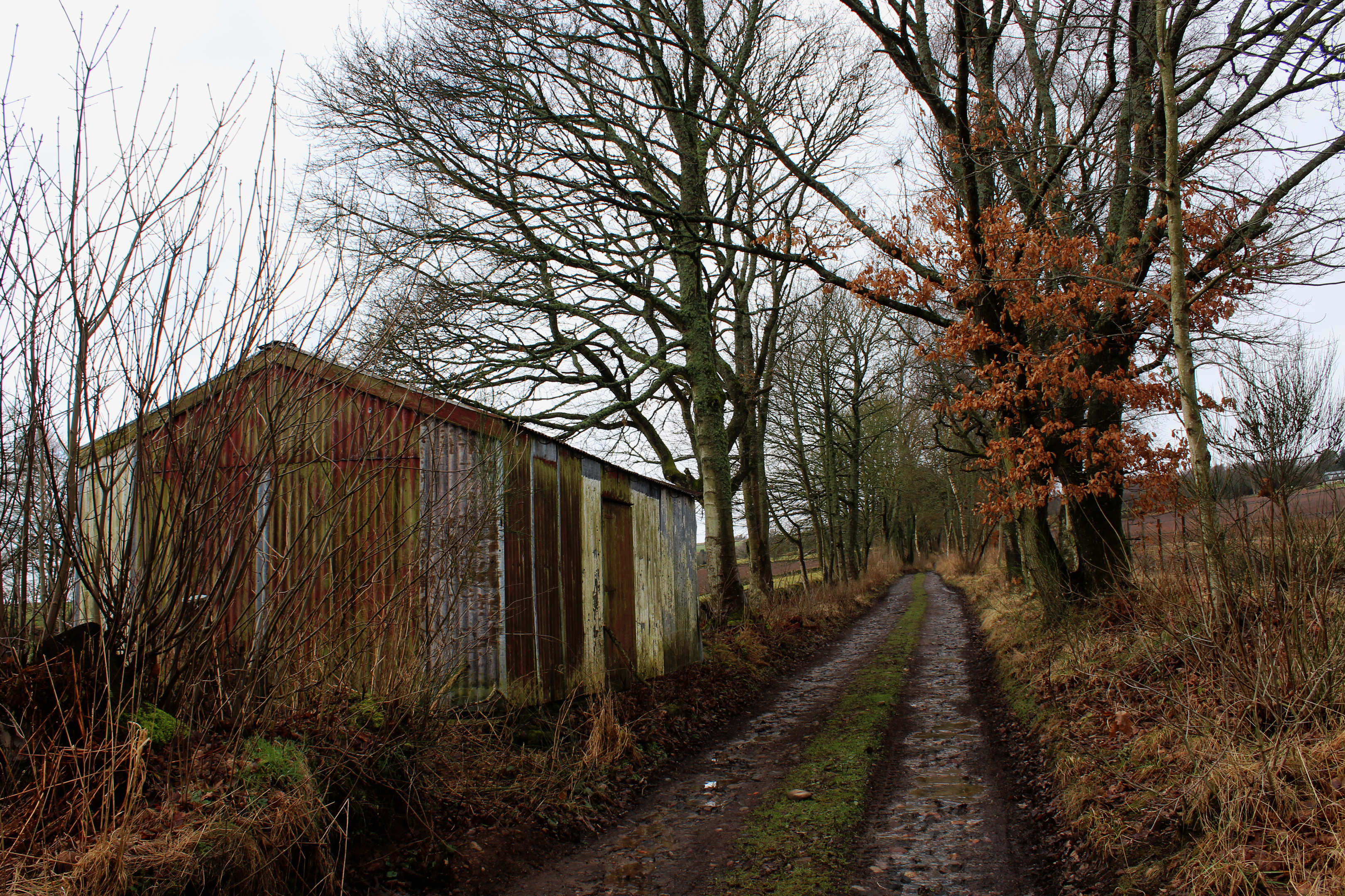
A signed path to Alyth via Johnshill Farm branched left but I stayed on the tree-lined track, passing an old corrugated iron shed, before making my turn east for home, the way passing through the yard of Muirton Farm and skirting by berry fields.
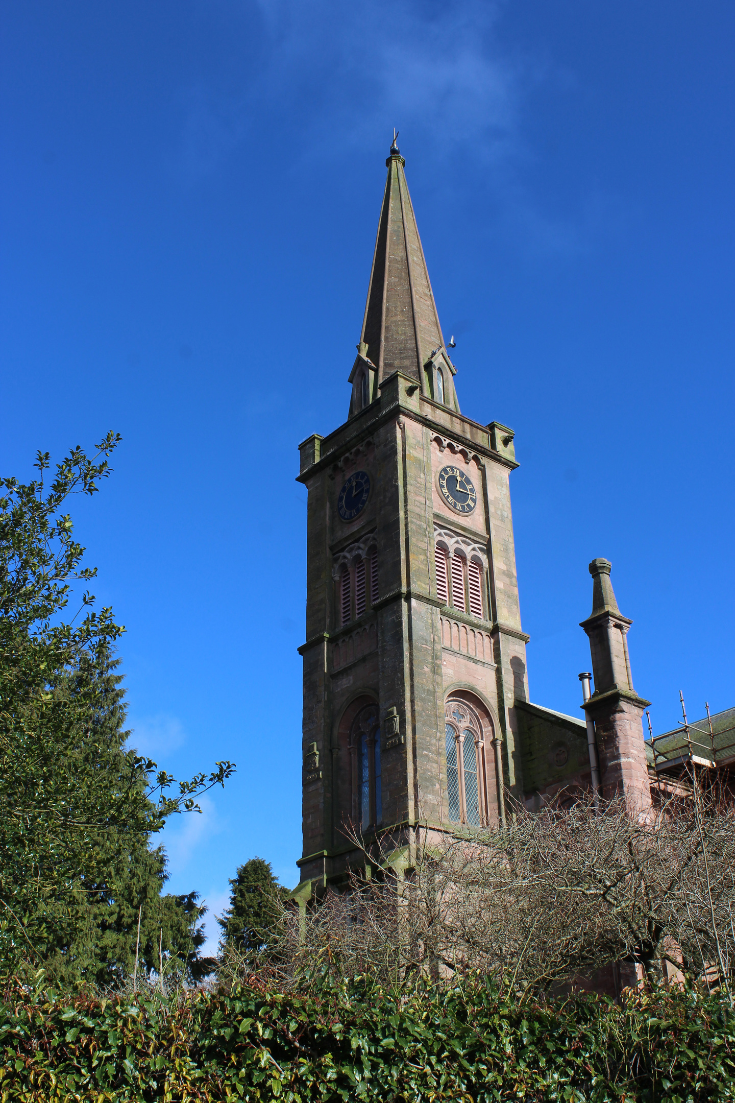
On the edge of Alyth, a grassy field-edge path and then a track took me round to Bamff Road, the route crossing Alyth Burn and climbing below the town’s parish church to a formal gateway leading back into the den, a second opportunity to savour this special spot before returning to the car park.
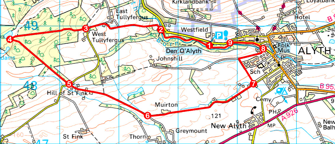
ROUTE
1. Descend path from car park and go right, following Alyth Burn upstream through den, remaining on right bank, to meet road.
2. Cross bridge and walk 1.4km west on road (signed Drimmie Woods) to West Tullyfergus.
3. Go through gate and continue west on track through woodland to Glendams.
4. Turn left (signed Alyth) and follow grassy path running by wall and fence to gate. Go straight ahead on track, descending to road.
5. Cross road and continue ahead, descending track by houses and between fields.
6. Turn left (signed Alyth) and follow track east by Muirton Farm to Alyth.
7. At 30mph signs, turn left (signed Johnshill Road) and follow field-edge path then track, descending past houses to junction. Go right, along track.
8. Turn left, crossing Alyth Burn, and follow Bamff Road up to Den of Alyth gates.
9. Bear left through gates and follow den path to car park.
INFORMATION
Distance: 10.4km/6½ miles
Ascent: 225m/740ft
Time: 3 hours
Grading: Easy low level route following paths, tracks and a stretch of minor road through woodland, farmland and forestry with some well graded ascent. Keep dogs on the lead where signs request
Start/finish: Den of Alyth car park, 1km west of centre of Alyth on Bamff Road (Grid ref: NO 235487)
Map: Ordnance Survey 1:50,000 Landranger sheet 53; Ordnance Survey 1:25,000 Explorer sheet 381
Tourist Information: Blairgowrie Information Centre, 26 Wellmeadow, Blairgowrie PH10 6AS (Tel 01250 872960)
Public transport: Stagecoach bus service 57 links Alyth with Dundee and Perth