When aeronautical pioneer Vincenzo Lunardi took off amid much fanfare from Edinburgh in his hot air balloon on what was to become Scotland’s first notable flight he probably had little idea where he would end up.
Driven by the winds, the adventurous Italian soared to an altitude of over 1,000 feet, drifting out across the Forth Estuary before making landfall at Lower Largo, on the Fife coast.
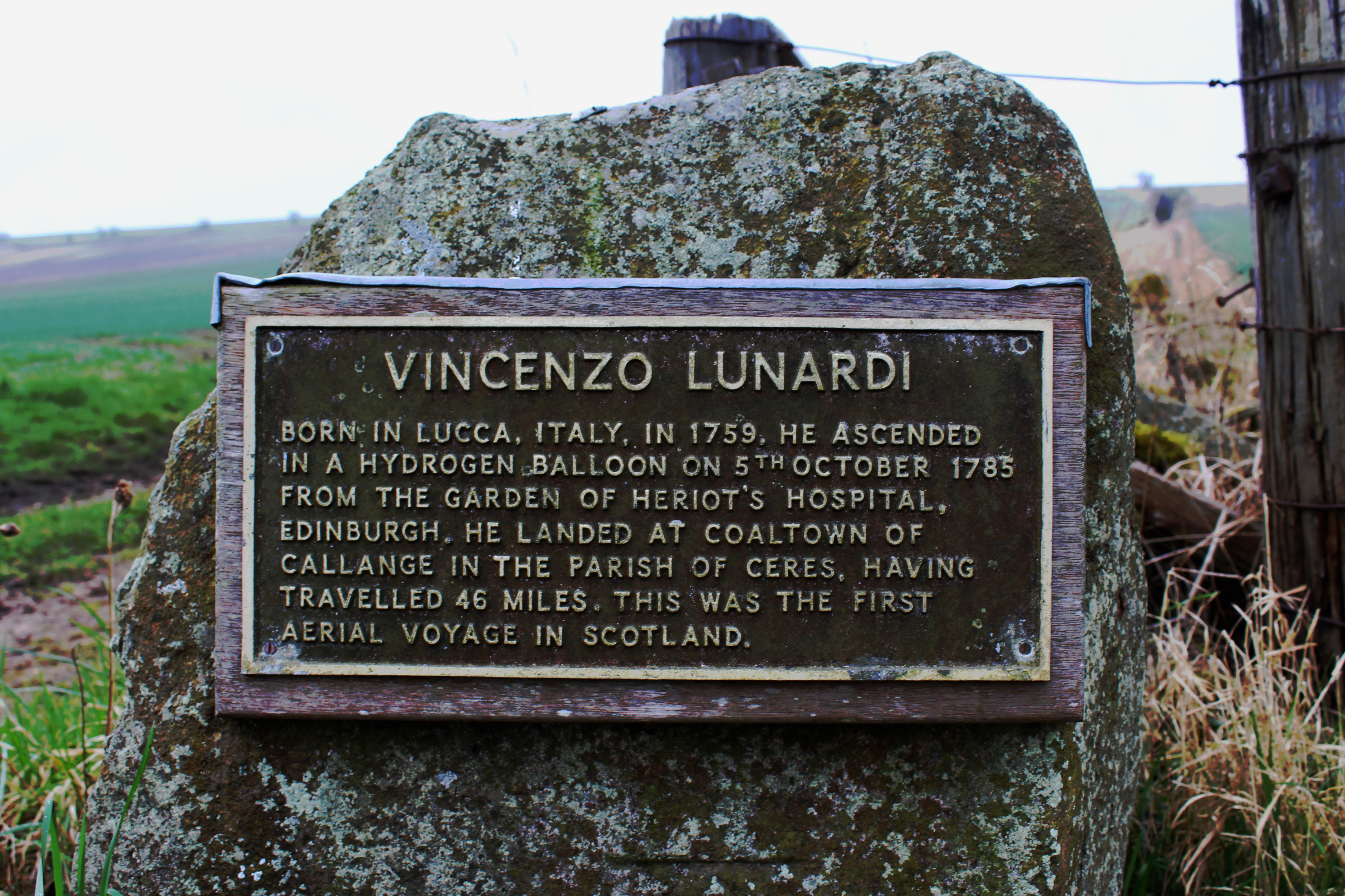
After a 46-mile journey blessed by clear skies, he finally touched down in a field to the east of the village of Ceres. A plaque marks the spot where the epic flight of October 5, 1785, ended.
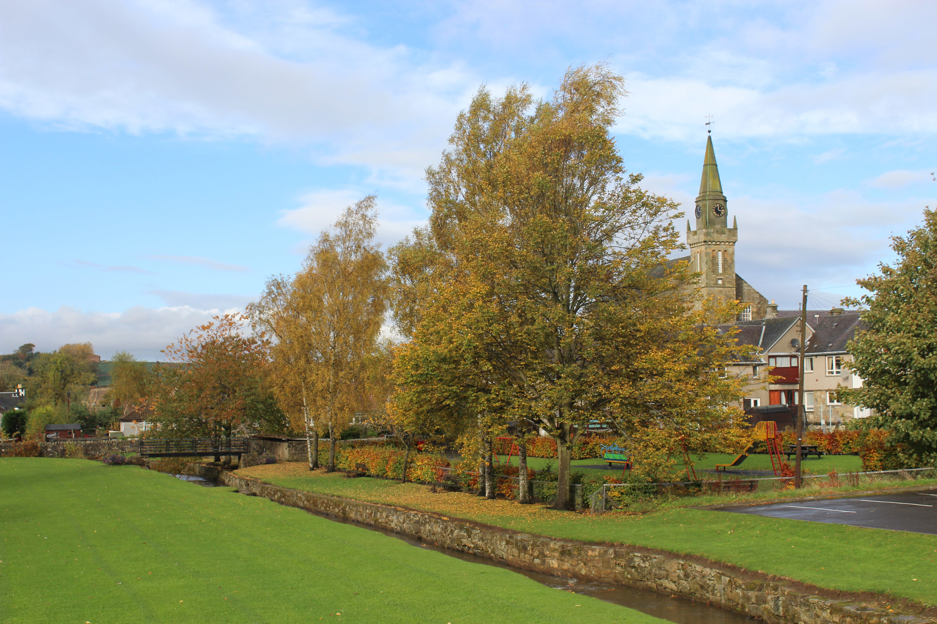
Crossing the same ground, albeit at a lower altitude and under cloudier skies, my course was ironically clearer – from the historic packhorse bridge in the centre of Ceres I planned to hike east through agricultural lands to the summit of Drumcarrow Craig, a little hill with big views.
Wandering along narrow village lanes of pretty cottages, I picked up the path to Callange – where Lunardi landed – at the end of Schoolhill.
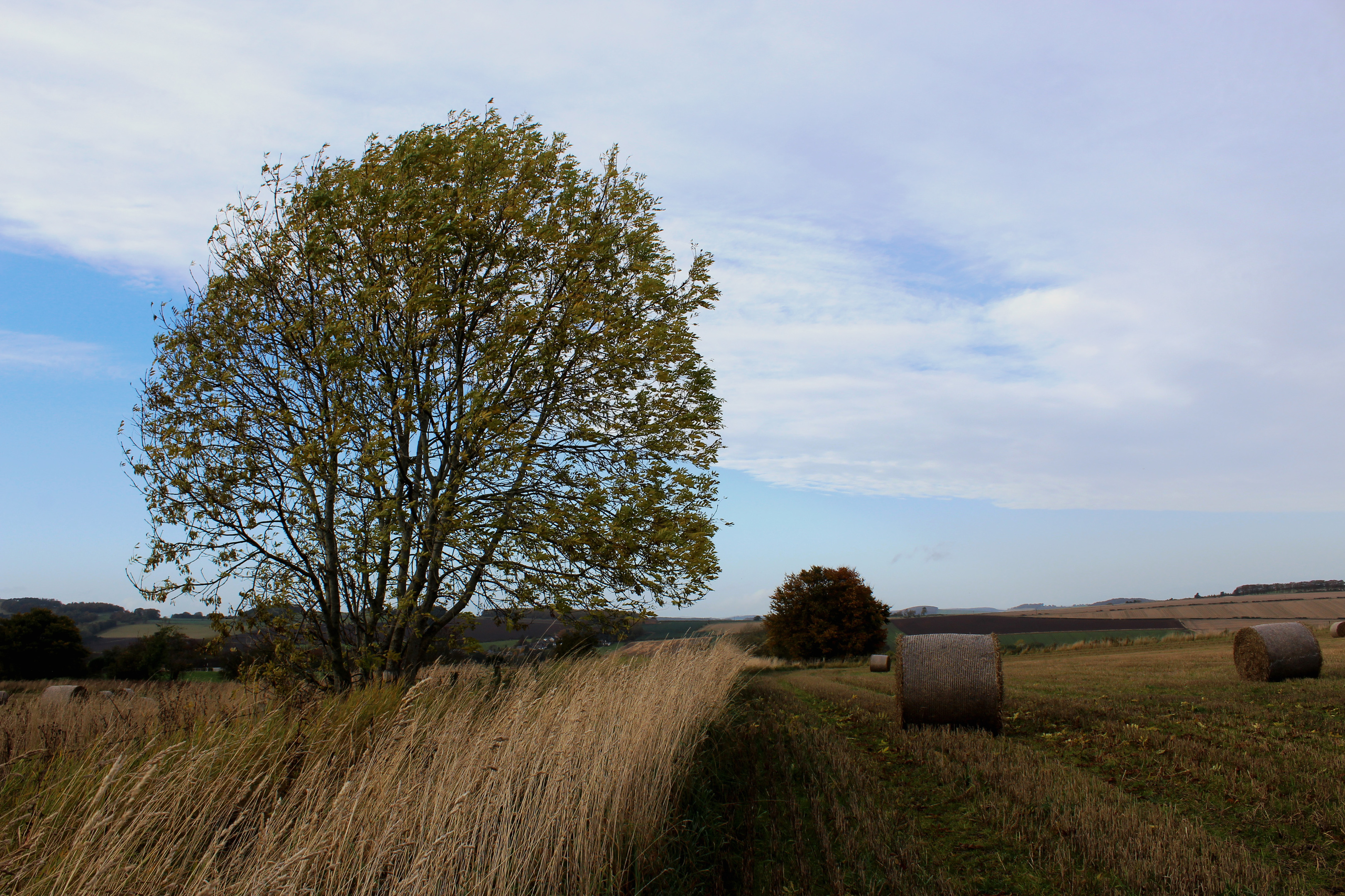
Following the course of an ancient pilgrims’ route linking the abbeys of Culross and Dunfermline with St Andrews Cathedral, the way skirted the edge of a field, a broader track rising above Newbigging of Ceres Farm into a copse of slender pines.
Crossing the top of the next field, a stile guided me into scrubby woodland, the track running on to meet the B940 by Lunardi’s plaque, a small tribute to mark a lofty achievement.
Quickly dispatching a brief stint of road walking, I maintained my heading east, another farm track passing scattered houses and cutting between fields to Burnsquare, Drumcarrow Craig visible ahead.
Beyond a cow byre and cattle grid, the track curves left into private grounds. However, a path branches right, passing above an ornamental pond before dipping to cross the less refined Wilkieston Burn.
With a footpath sign for Cameron keeping me on track, I passed through Wilkieston Farm, meeting a minor road south of Drumcarrow Craig.
Anticipating a kilometre and a half tramping hard asphalt, my feet were as relieved as I was to discover a field-edge path complete with stiles and a waymarker arrow forking left where the road dipped.
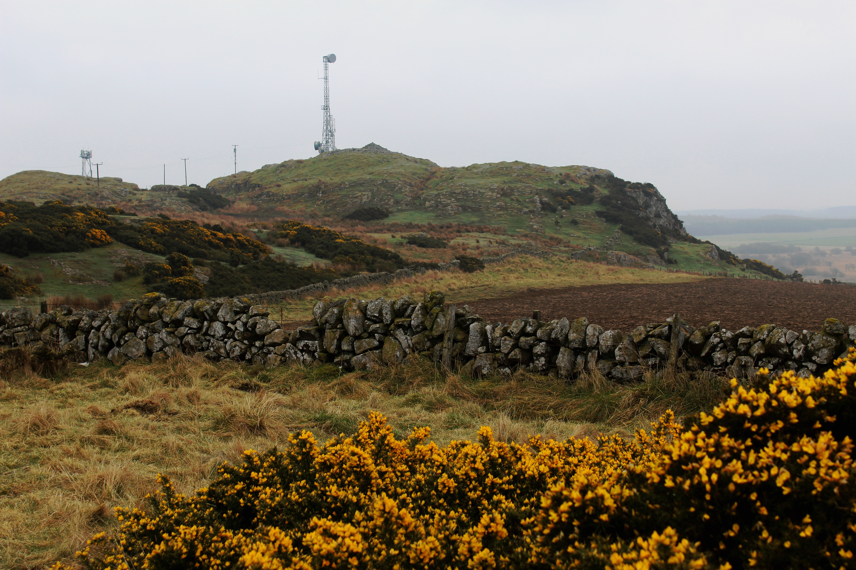
The track below the rocky summit of Drumcarrow Craig negotiates two locked gates but both are easily dealt with thanks to gaps between the posts and adjacent wall and I was soon standing by the cairn and trig point (and communications masts) atop the hill.
The prevailing low cloud denied me views to perhaps rival those Lunardi enjoyed from the air, but I could just about make out the Eden Estuary, to the north, and Cameron Reservoir, to the south.
Daredevil Lunardi clocked up five flights over Scotland, his final one ending badly when he was forced down into the water off the Isle of May and had to be rescued by the crew of a passing fishing boat. The experience, however, did not deter him and he toured Europe with his magnificent flying machine.
Various trails radiate west over the grassy, gorse-encrusted high ground where ponies grazed and, sticking close to a line of overhead power cables, I picked up a track leading down to Drumcarro Farm and my route west over Kinninmonth Hill to Kinninmonth Farm and Ceres beyond.
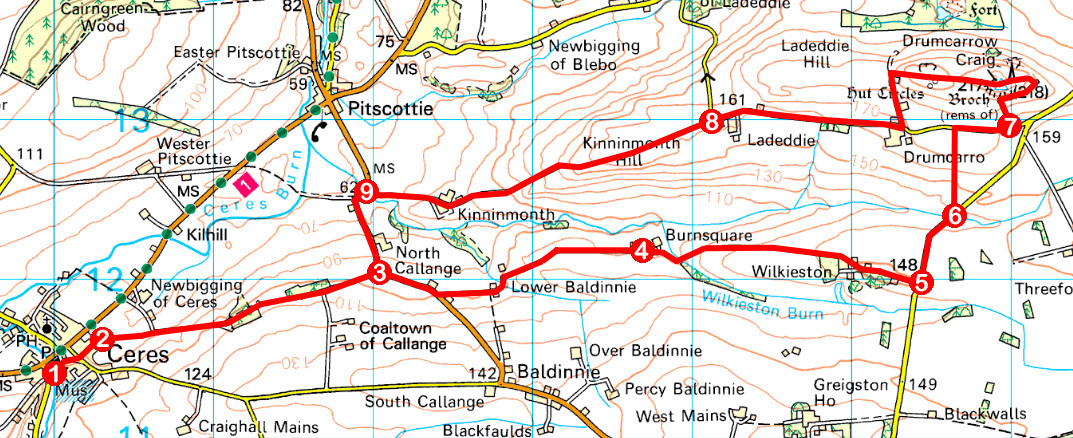
ROUTE
1. Cross Bishop’s Bridge, go left past Bishop Cottage then turn right, following Castlegate to Craighall Terrace. Cross, bearing left, and continue along Schoolhill.
2. Go right through wooden gate and follow footpath (signed Callange).
3. Turn right, walk 400m along B940 then branch left, following track east to Burnsquare.
4. At junction beyond cattlegrid, go right on path, descending to cross stream, and follow path (signed Cameron) then track east to meet road beyond Wilkieston Farm.
5. Walk 500m north on road.
6. Bear left, crossing two stiles, and follow field-edge path north to minor road. Go right along road.
7. Ascend track north through two gates, looping up to trig point on Drumcarrow Craig. Continue west below powerline to meet track descending to farm, then go right on minor road to Ladeddie.
8. Continue west on track (signed Kinninmonth) to B940.
9. Turn left, follow B940 up to point 3 and retrace steps to Ceres.
INFORMATION
Distance: 15km/9¼ miles
Ascent: 280m/924ft
Time: 4 hours
Grading: A moderate route following tracks, paths and minor roads through farmland with some well graded ascent. Stout footwear recommended as some sections can be muddy underfoot. Keep dogs under close control over grazing land
Start/finish: Public car park (next to Fife Folk Museum), South Croftdyke, Ceres (Grid ref: NO 399114)
Map: Ordnance Survey 1:50,000 Landranger sheet 59; Ordnance Survey 1:25,000 Explorer sheets 370 and 371
Tourist Information: St Andrews iCentre, 70 Market Street, St Andrews KY16 9NU (Tel 01334 472021)
Public transport: Stagecoach bus services 41 and 64 stop next to car park


