At first glance – whether on the ground or on the map – the summit of Innerdouny Hill appears cut off from the rest of the world by blanket forestry.
Peeping out above the treeline, the top is an island in an all-consuming sea of conifers. There is, however, a way through, a route that does not require the walker to do battle with branches or negotiate needles.
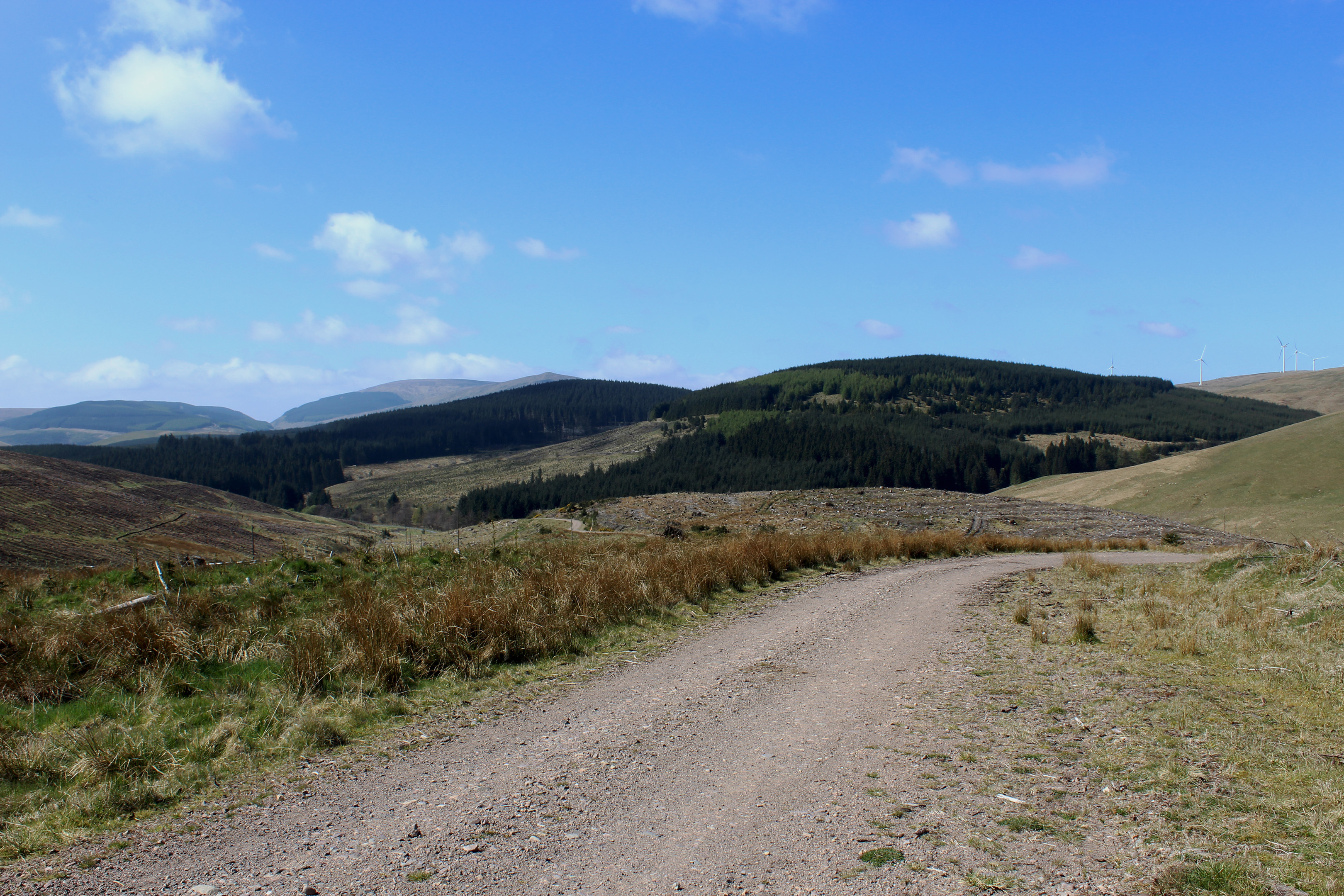
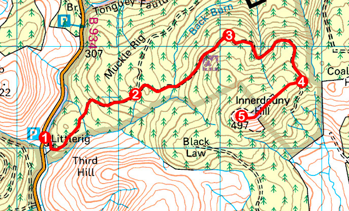
It starts on the Dunning Glen road, at Littlerig, from where a Forestry Commission track rises steadily on a stealthy approach that rounds the hill’s northern flank before targeting the top from the east. And, thanks to some extensive felling, there are plenty of views to enjoy along the way.
Harvesting is evident from the outset, the track crossing open ground where a mesh of stumps and branches are all that remains of this portion of the plantation.
Across Back Burn, the slopes of Third Hill are being planted out and doubtless the bit of hillside I was traversing will also end up under forestry once again.
In the meantime, as height is gained, views open out to the west over Dunning Glen and Glen Devon to the main plateau of the Ochils where the higher, more popular peaks lie in neighbouring Clackmannanshire.
Ahead of me, however, Innerdouny Hill remained very much tree-covered and, branching off the waymarked trail leading to Middle Rig, I rounded a knoll bristling with yellow gorse before dipping to cross Back Burn.
Climbing steadily, the track skirts between conifers to the right and felled ground to the left and, pausing at a layby at the top of the incline, I sat on a stump and took in the vista over the valley of Water of May, small farms and redundant steadings occupying clearings in the extensive plantation.
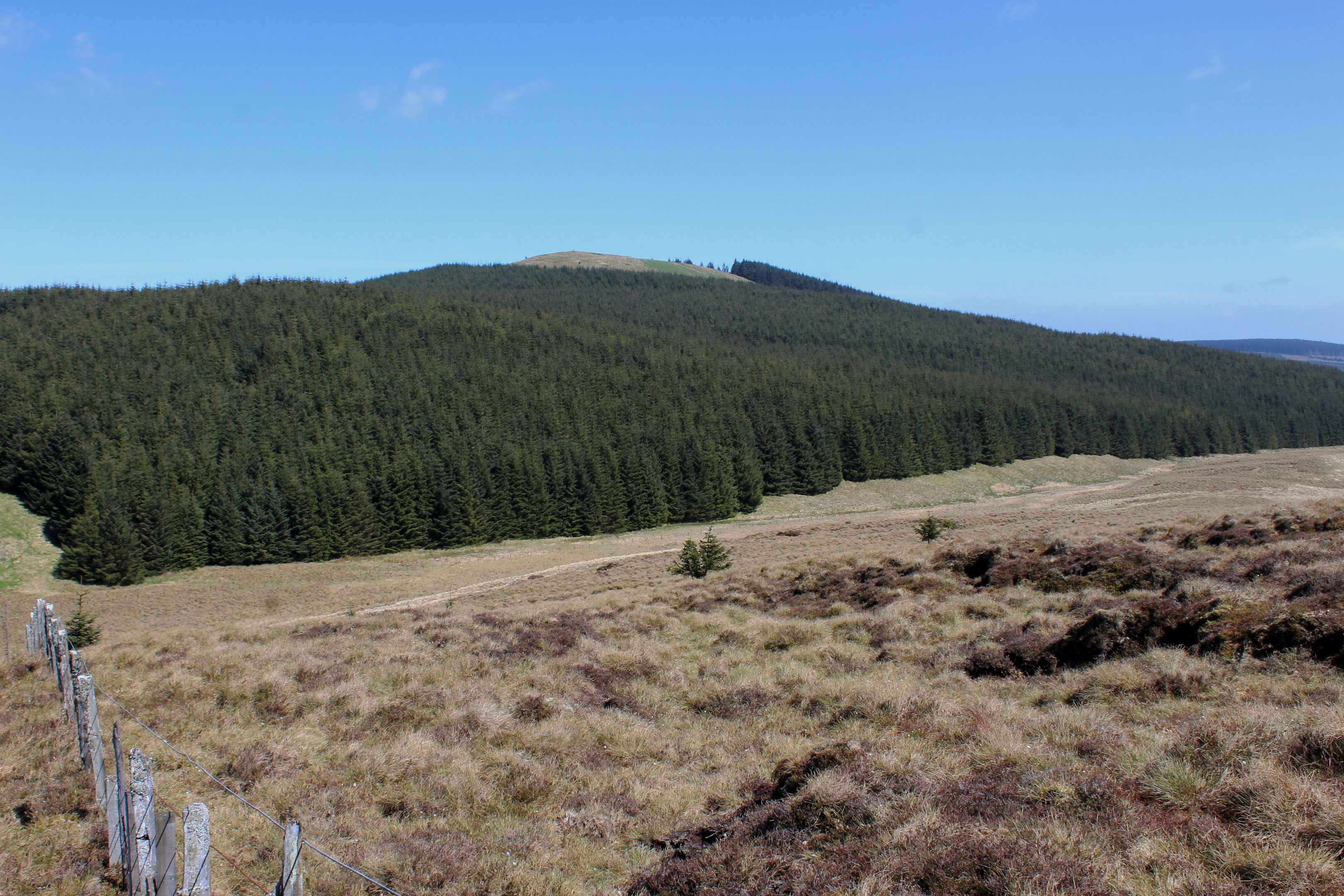
Crossing Mid Burn, I felt, for the first time in the walk, I was entering the forest, trees now flanking me either side as I looped round Scowling Craig Hill and mounted the north-east shoulder of Innerdouny Hill.
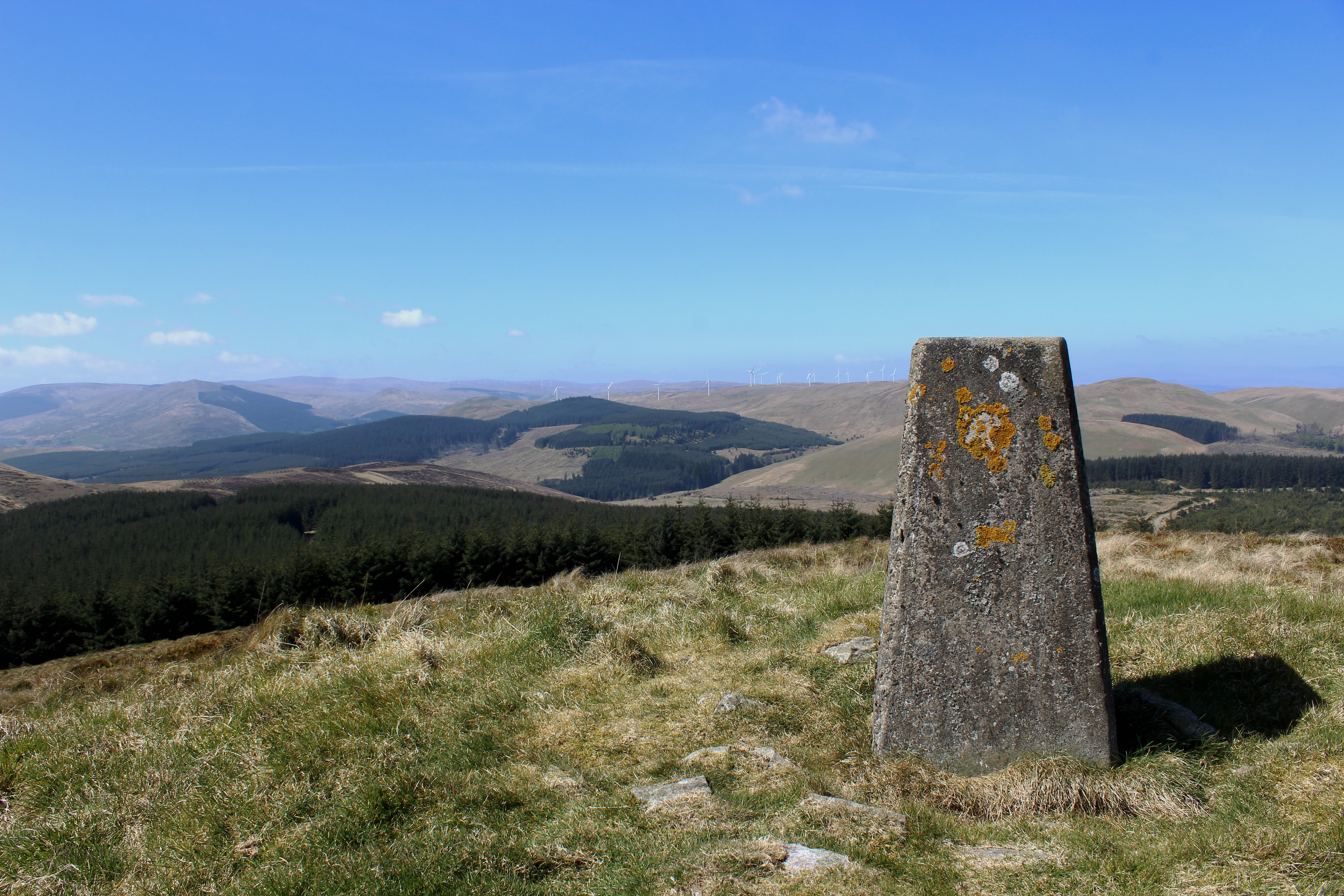
At its highest point, the track crosses a clear strip not marked on the map and, to the left, beyond neighbouring Coalcraigy Hill, the distant peaks of the Lomond Hills, in Fife, were visible.
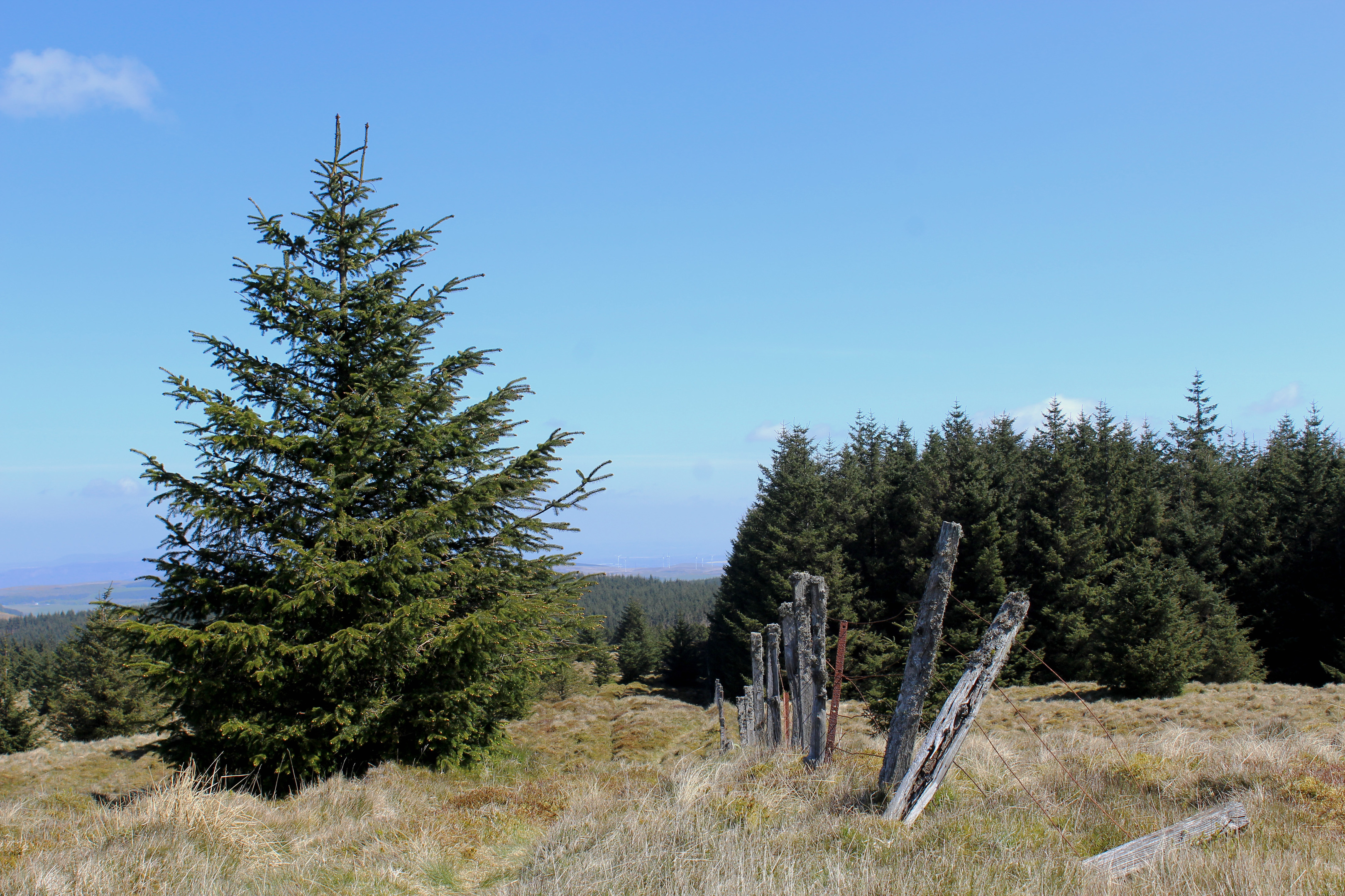
To the right, a slender grassy path striking west off the forest road climbs by an old fence bordering the trees, passing through a gap in a wall before heading over open ground to the trig point.
Innerdouny Hill may not be particularly lofty but, on a clear day, it boasts a panoramic outlook. Alongside the Lomonds, Benarty Hill and Loch Leven now feature while more distant Ochil Hills summits to the west enjoy sharper focus.
The peak can also claim some historical significance as it was the highest point in the former county of Kinross-shire (now part of the Perth & Kinross council area). It also attracts folk intent on bagging Marilyns, a list of over 1200 hills of varying heights with one common attribute – they share a drop of at least 150 metres on all sides of the summit.
While I was tempted to scout out an alternative way off the hill via the firebreaks snaking through the forest below me, the prospect of becoming ensnared in spruce led me to return to Littlerig via my tried and tested route of ascent.
ROUTE
1. Pass round locked gate and ascend forest track (signed as path to Middle Rig) over felled ground.
2. At track junction with waymarker arrow post, fork right and continue along forest track, dipping to cross Back Burn before ascending between forest on right and felled ground to the left to layby viewpoint.
3. Continue along track as it loops right to cross Mid Burn before curving up the north-east shoulder of Innerdouny Hill.
4. On reaching gateway in fence, turn right and ascend grassy path running parallel with fence on edge of plantation through clearing. Pass through gap in wall and continue by fence briefly before following path over open hillside to trig point.
5. Retrace the route of ascent back to Littlerig.
INFORMATION
Distance: 9km/5½ miles
Ascent: 300m/990ft
Time: 3 hours
Grading: Moderate there-and-back route with well-graded forest track and path ascent to summit of low hill
Start/finish: Small track-end parking area at Littlerig on B934 Dunning Glen road (Grid ref: NO 012070). This is the more southerly of two parking areas with Forestry Commission Littlerig signs
Map: Ordnance Survey 1:50,000 Landranger sheet 58; Ordnance Survey 1:25,000 Explorer sheet 369
Tourist Information: Perth iCentre, 45 High Street, Perth PH1 5TJ (Tel 01738 450600)
Public transport: None


