A century ago, Major Peter Norman Nissen, of the British Army’s 29th Company Royal Engineers, invented his eponymous hut and it has since become one of the world’s most recognisable military structures.
The low cost, quick to assemble half-cylindrical Nissen Hut was first deployed to the battlefields of northern France in 1916, serving as barracks, bomb stores, hospitals and even churches during both the first and second world wars.
Simple yet sturdy, many have survived the test of time and one of the greatest concentrations of these humble huts is to be found hidden away in the Perthshire countryside at Cultybraggan.

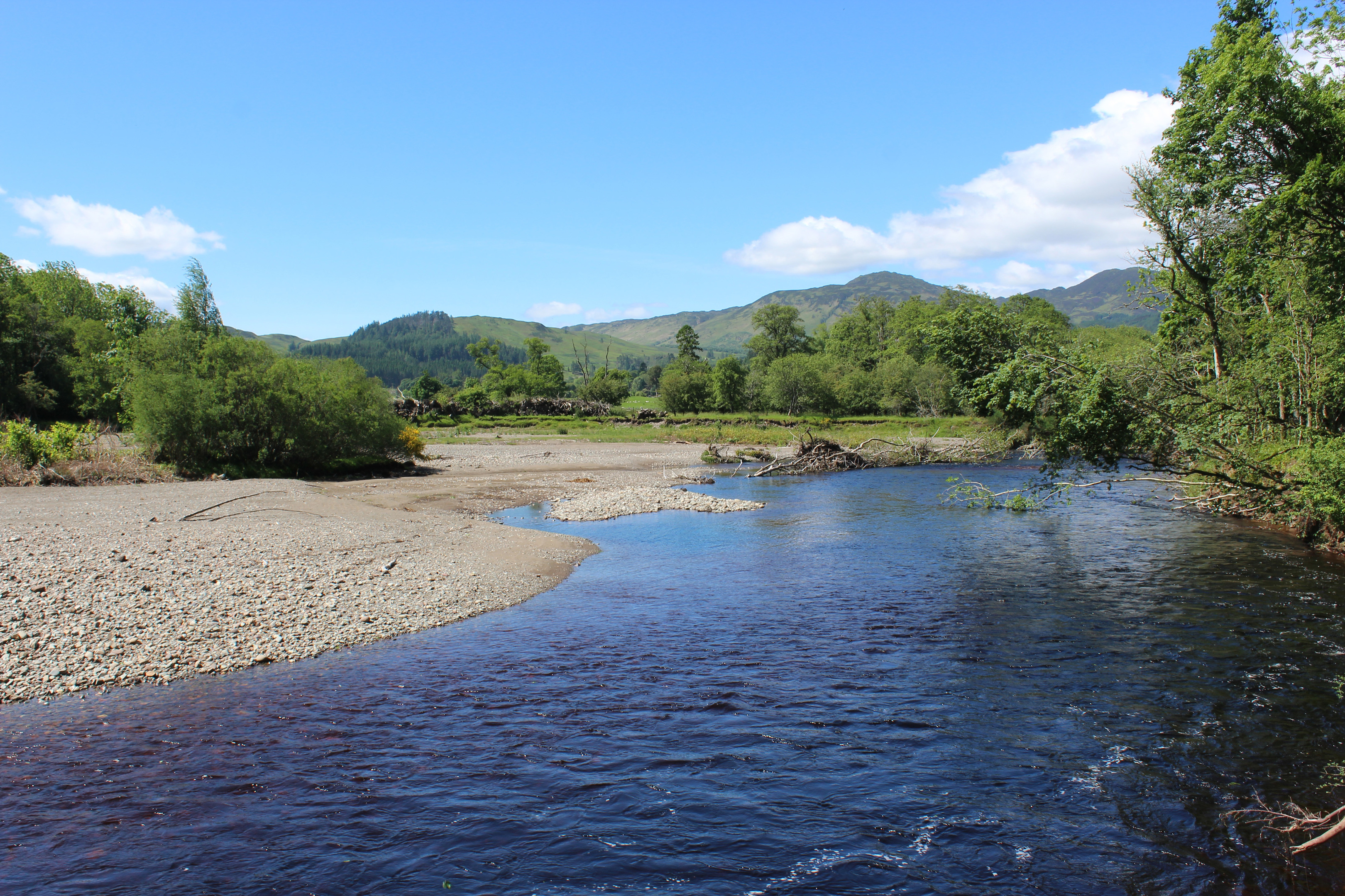
Occupying an arc in the meandering course of Water of Ruchill, this former prisoner of war camp sits upstream from the village of Comrie.
Picking up some last-minute supplies in the village, I joined the riverside trail to Cultybraggan below Dalginross Bridge, a crossing point that dates from the 1720s, although the current bridge spanning the River Earn was built in 1904.
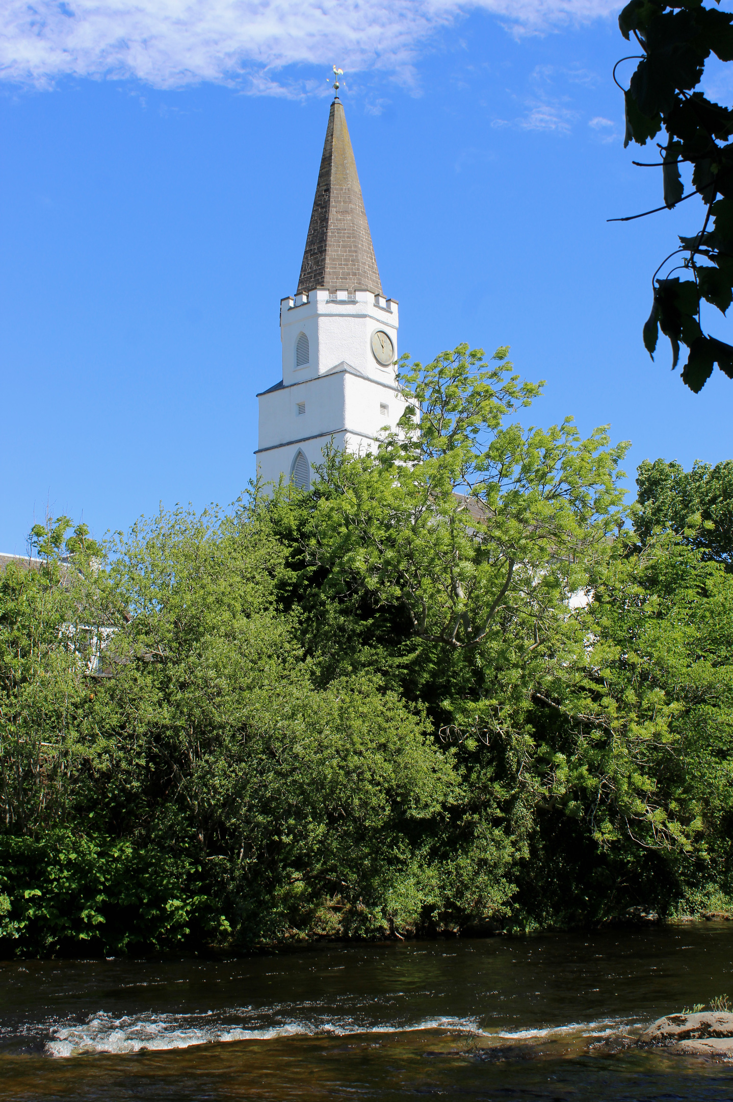
The path heads out along the bank of the Earn initially, the tower of White Church poking above the trees on the far side, before switching allegiance to Water of Ruchill, a river that rises on the mountainous slopes of Ben Vorlich and Stuc a’Chroin.
Never straying very far from the flow, the way weaves through deciduous trees before skirting along the western edge of a meadow. Thereafter, it alternates between strips of woodland and field edges, occasional signs keeping walkers on the right track.
With the camp visible over to the left, the route narrows, squeezing past a former sewerage plant before clambering through oak, sycamore and beech flanking a rather livelier stretch of tumbling white water.
It emerges from the trees just short of Cultybraggan Farm and, on the left, a tiny cemetery marks the site of Tullichettle Old Parish Church, a peaceful place to pause before heading on past the farm buildings.
The minor road beyond leads north-east to the camp entrance and the first Nissen Hut encountered – the former guardroom – houses a small heritage centre. Beyond that, visitors are free to wander around the labyrinth of over 80 huts and other wartime buildings, although a former cold war nuclear bunker at the back of the site, now privately owned, remains off-limits.

Constructed in 1941, Camp 21 as it was called during the war, was a maximum-security stockade, designed to hold 4000 German prisoners of war, among them some of the most zealous Nazis.
After the war, the site became an army training camp and it is now owned by the local community, allotments and an orchard occupying some of the land while businesses operate out of huts converted into workshops and offices.
Escaping the confines of the camp, I marched back towards Comrie, Lord Melville’s Monument, a prominent stone obelisk standing atop Dunmore, in clear view above the village.
Approaching the fringes of the community, I branched off the road at a standing stone, known as the Roman Stone as it marks the site of a Roman camp. From here, a path crosses fields to Cowden Road then continues through a strip of trees to The Bishop’s Planting, beech woodland flanking a cemetery to the east and the only barrier that stood between me and Strowan Road, my route back to Dalginross Bridge.

ROUTE
1. At northern end of car park, bear left to cross River Lednock and continue ahead to meet track. Turn left (signed Village Centre).
2. Turn right along Drummond Street (A85), then go left on Bridge Street, crossing Dalginross Bridge.
3. Turn right into Field of Refuge and go right, through pedestrian gate, to join riverside path. Follow it west then south (signed periodically for Cultybraggan).
4. Continue ahead on narrower riverside trail.
5. Emerging from trees, go through gate and, bearing right at farm sheds, follow track to road then turn left.
6. Visit Cultybraggan Camp then continue north-east along road.
7. Turn left and follow B827 north to standing stone.
8. Turn right (signed Muirend) and follow path between fields then through wooded strip.
9. Go left over footbridge on path (signed Strowan Road) leading north to South Crieff Road. Cross and follow Strowan Road north to Dalginross Bridge, then retrace steps to car park.
INFORMATION
Distance: 8km/5 miles
Ascent: 60m/200ft
Time: 2 hours
Grading: Moderately easy, low level walk following good, well-signed paths with some road walking. Allow additional time to explore Cultybraggan Camp
Start/finish: Laggan Car Park (signed for golf club and recycling point) accessed from A85 at eastern end of Comrie (Grid ref: NN 776223)
Map: Ordnance Survey 1:50,000 Landranger sheet 57; Ordnance Survey 1:25,000 Explorer sheet OL47
Tourist Information: Perth iCentre, 45 High Street, Perth PH1 5TJ (Tel 01738 450600)
Public transport: Stagecoach bus service 15 from Perth serves Comrie