In 2005, to celebrate the 200th anniversary of the founding of Scone on its present site, locals created a trail leading up on to Murrayshall Hill.
Now well established, the route weaves through a leafy den and over wooded slopes to an exposed summit where views over the surrounding countryside vie with a pair of landmark monuments for attention.
The approach, via Den of Scone, begins at Scone Old Parish Church where a marker at the entrance to the adjacent car park points the way. On the ground guidance is initially sparse but as the walk progresses most junctions are signed (follow pointers for MacDuff’s Monument on the outward leg).
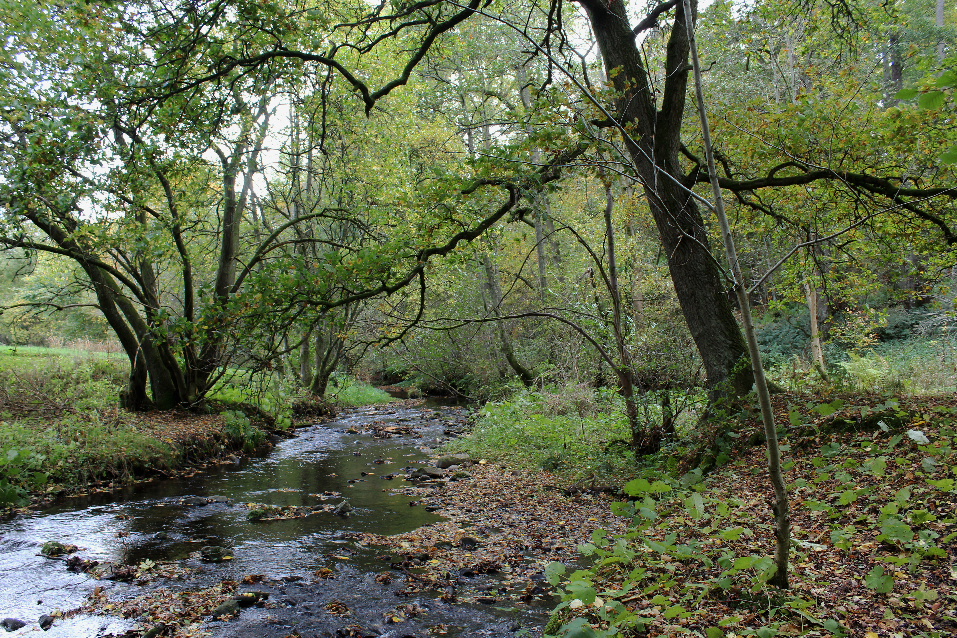
Beginning on Burnside, I crossed Perth Road at lights adjacent to Scone Arms and, heading into the village, soon found the entrance to Den of Scone. Branching right by a children’s nursery, Den Road is less a road, more a track that follows Annaty Burn upstream, passing houses to the left and a park on the right.
The medieval community of Scone was abandoned at the start of the 19th Century when the land was cleared for the construction of Scone Palace. Buildings, including the old parish church, were moved east, stone-by-stone.
Ignoring a bridge accessing the park, I remained on the gravel lane, spotting a heron on the water, until the track neared private grounds where a path strikes right, a wooden footbridge crossing the burn.
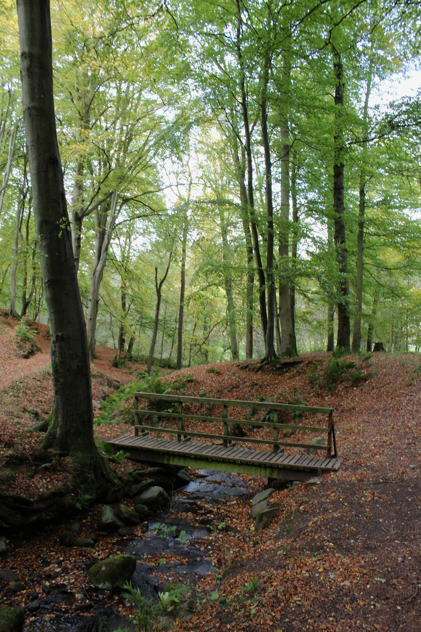
Rising below mature beech and oak to a second bridge spanning a smaller stream, the way follows the flow up to meet a country lane which, in turn, leads to the start of the next stretch of footpath, adjacent to the entrance of Bonhard House.
It climbs through a band of trees to a higher road along which, beyond Balcraig House and an impressive beech hedgerow, a track takes up the reigns.
Bordering woodland initially, the way ascends through Scots pine and silver birch to Balcraig Service Reservoir from where a path cuts up through strips of gorse to MacDuff’s Monument.
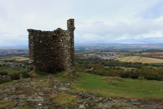
A bench beside the 18th century folly, erected by the MacDuff family of Bonhard House, offers a place to rest and enjoy views over Scone and the Perthshire countryside.
The day’s second landmark is visible to the east and, negotiating broom and gorse, the trail dips through a gate below an old oak tree, before climbing to the Lynedoch Obelisk.
Erected in 1853 atop Murrayshall Hill, the pillar is dedicated to Thomas Graham, Lord Lynedoch, a wealthy landowner with an illustrious military career who died in 1843.
From this high point, a grassy path descends to Lynedoch Golf Course. Crossing the first fairway encountered, a gravel path loops down before the way branches left at a ‘Next Tee’ sign into a wooded strip, a right turn at the foot of this revealing a gate and road beyond.
Signs for Balgarvie guided me west along the slender lane to Twomile House where I descended a track protected from the adjacent golf driving range by a high fence, then the access road to Murrayshall House Hotel, emerging on to another country lane at a gate lodge.
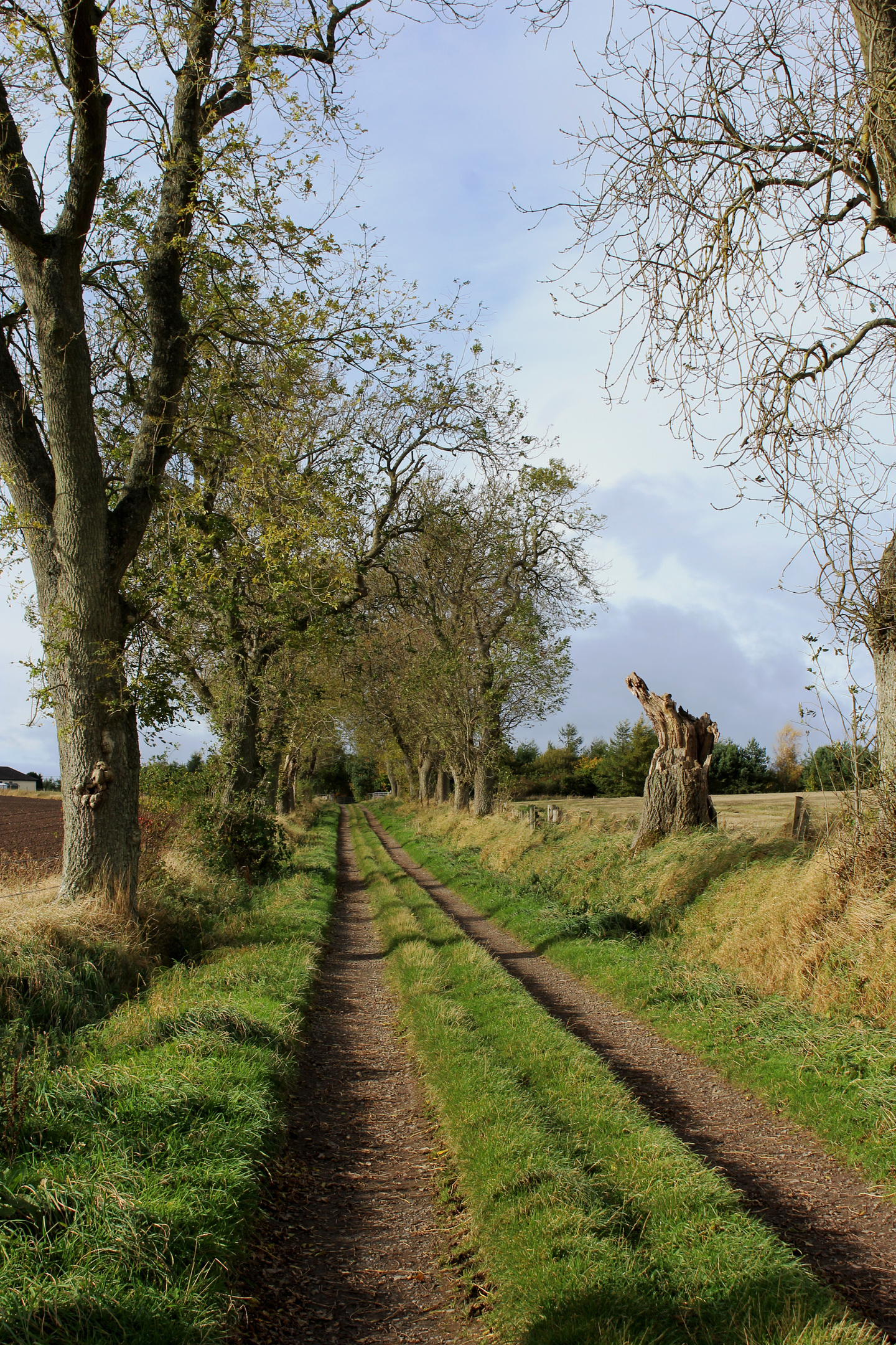
A short stint on asphalt delivered me on to a farm track that cut between fields, rising to Balgarvie Farm, on the eastern edge of Scone, a final tramp along village streets ending my outing.
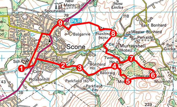
1. Follow Burnside to Perth Road. Cross, turn left then, in 160m, go right on Den Road, following track 750m through den.
2. Cross bridge (signed MacDuff’s Monument) and ascend over second bridge, bearing right up to road.
3. Go left 100m along road then right on footpath, ascending to road. Turn left and walk 700m along road.
4. Turn right and ascend track to reservoir then path to MacDuff’s Monument.
5. Walk east to Lynedoch Obelisk.
6. Descend path to golf course then track and path to road.
7. Turn left, walk 400m on road then turn right (signed Balgarvie), descending by driving range fence to hotel driveway. Descend left to road and turn right.
8. In 380m, turn left on track (signed Balgarvie). At junction beyond cattle grid, bear left up to cottages then turn right, descending road, steps and path to Angus Road.
9. Turn left into Scone. Turn right on Stormont Road then, in 200m, go left, following Abbey Road to start.
INFORMATION
Distance: 9.6km/6 miles
Ascent: 275m/900ft
Time: 3 hours
Grading: Moderate hike following good tracks, paths and minor roads through woodland and over hillside with some ascent, strenuous in places, and good signage. Keep dogs on lead over golf course
Start/finish: Car park adjacent to Scone Old Parish Church, accessed via Burnside and signed for David Douglas Memorial (Grid ref: NO 131255)
Map: Ordnance Survey 1:50,000 Landranger sheet 58; Ordnance Survey 1:25,000 Explorer sheet 369 or 380
Tourist Information: Perth iCentre, 45 High Street, Perth PH1 5TJ (Tel 01738 450600)
Public transport: Stagecoach bus service 7 links Perth and Scone


