Scurdie Ness Lighthouse has been protecting coastal shipping and safely guiding boats into the port of Montrose for almost 150 years.
Occupying a prominent headland at the southern end of Montrose Bay, it is just one of several historic landmarks encountered on this bracing coastal walk.
Setting out from the centre of Ferryden, once a busy fishing village, I wandered along waterfront streets, picking up a path signed for the lighthouse.
Climbing to the aptly named Beacon Terrace, where this road ends a track known locally as ‘lighthouse road’ leads east above the estuary of the River South Esk. Along the rocky shoreline below, gulls, oystercatchers, razorbills and seals are often spotted.
The route passes a viewpoint and two concrete pillboxes built to protect the estuary during the Second World War. A little further on, the remains of brick-built gun shelters, manned by the Home Guard, stand forlornly in a field.
For those interested in war-time relics, where the track passes a metal bench, a detour down the grassy embankment reveals the concrete frontage of a gun emplacement complete with a plaque inscribed by its Polish builders (a metal grill across the opening thwarts further exploration of this subterranean bunker).
Ahead of the lighthouse, the way passes a white conical stone tower, one of two navigational aids (the other is below the lighthouse) designed to assist ships negotiating the estuary. Known as the East and West Beacons, they date from the 18th century.
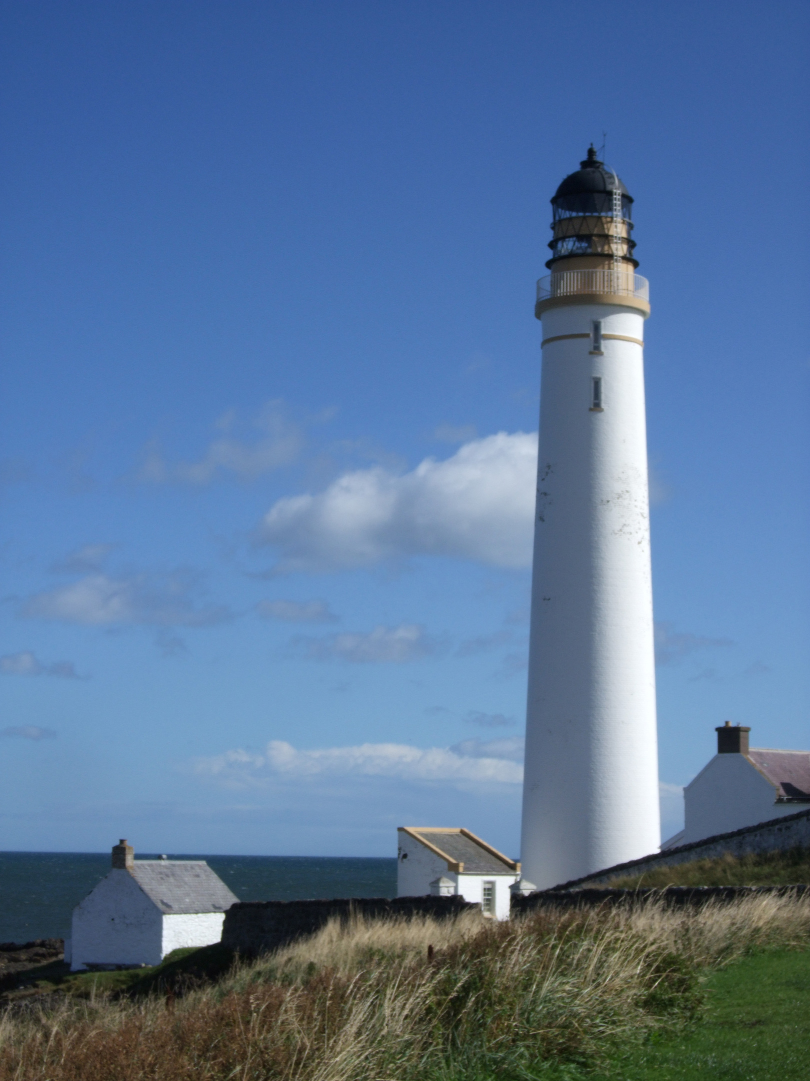
The lighthouse itself was built by David and Thomas Stevenson and was first lit on March 1, 1870. Automated in 1987, it now stands in private grounds, an information board pinned to the compound wall illuminating its history.
In the shadow of the 39-metre high white tower, the coastal path negotiates a kissing gate and continues over coastal grassland, staying close to power lines as it passes a rare strip of sand, known as Sandy Braes, before heading up to the farmyard at Mains of Usan.
Crossing a stream, a track leads back to the shoreline, passing the ruins of Chapel Mill and, down to the left, a tiny burial ground marking the site of a long-lost chapel dedicated to St Mary.
Entering the next field, the way borders wave-lapped rock and shingle, skirting the grassy periphery of farmland before rising from the shoreline beyond a stone stile, a slender field-edge path and track climbing to Usan.
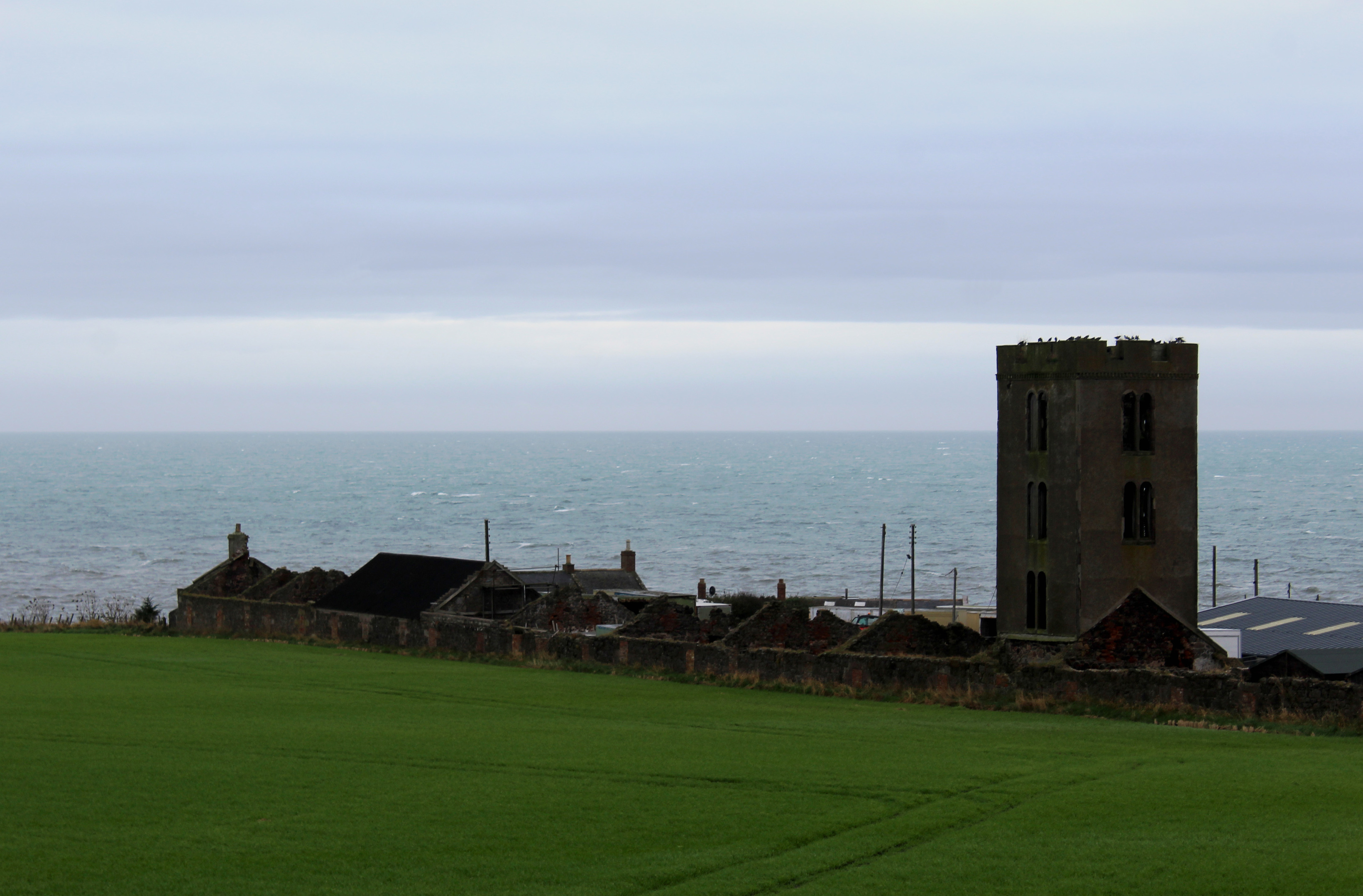
To the left, the dark, melancholy outline of Fishtown of Usan cuts between sea and skyline, its derelict signal tower and roofless cottages the gaunt, soulless relics of a traditional 19th century fisher village. Wild salmon, however, continues to be netted from the natural harbour here.
The return to Ferryden is along country lanes, passing the wooded policies of 19th century Usan House. However, rather than descend direct into the village beyond steadings at Inchbrayock, I branched right on a grassy track, again signed for the lighthouse.
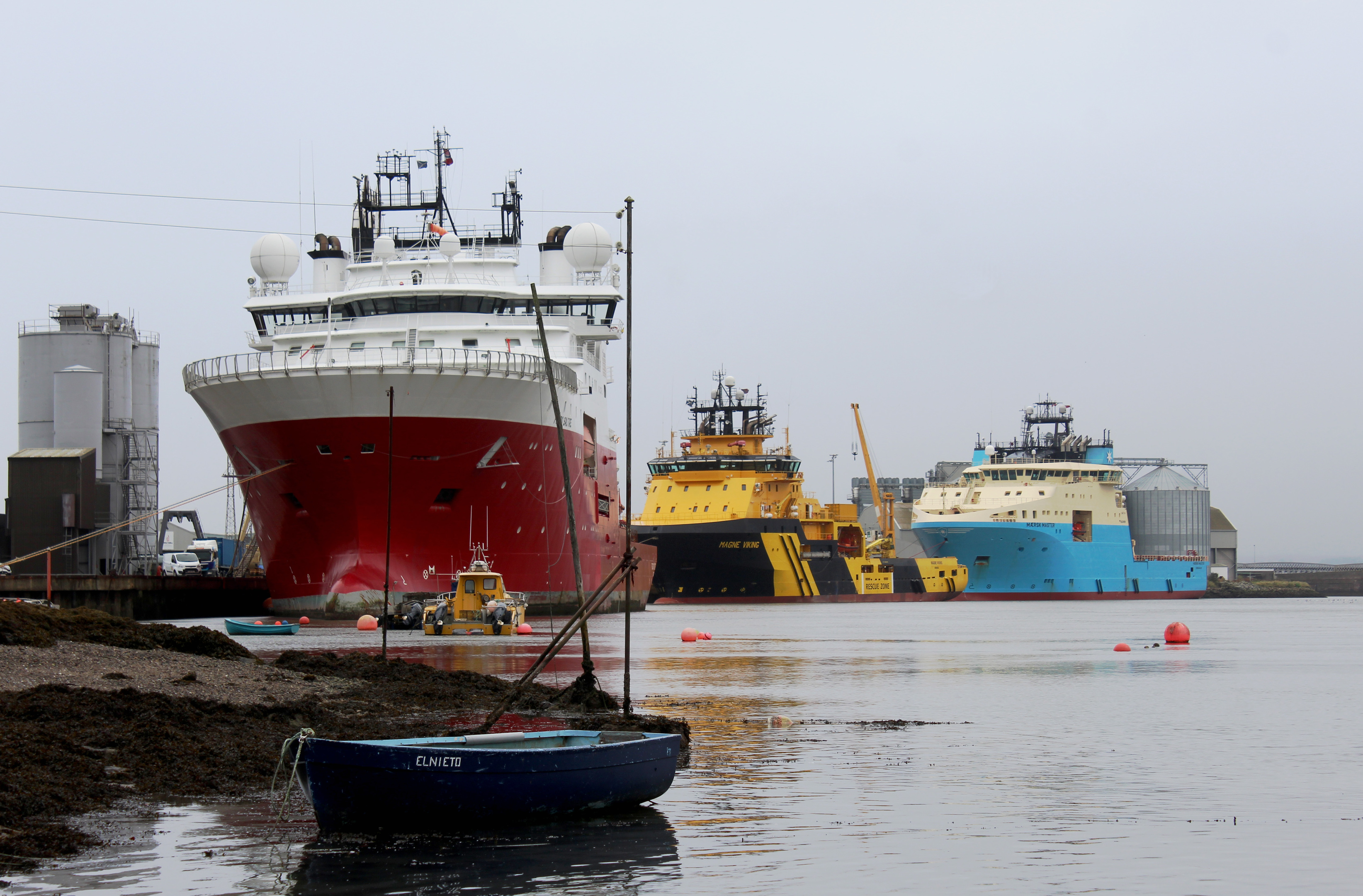
This is a worthwhile deviation, offering an elevated view of the river and Montrose Bay before a narrower path dips to re-join the lighthouse road, steps by the viewpoint tempting me down to the edge of the water where fishing huts, creels and small boats are dwarfed by the huge offshore supply and cargo vessels that ply the river, aided, of course, by the lighthouse.

ROUTE
1. Walk east on William Street and King Street. Turn right (signed Lighthouse) then go left by black shed, ascending path to Beacon Terrace. Turn left and walk east.
2. Ignoring path branching right, continue ahead to lighthouse.
3. Go through gate (signed Mains of Usan) and progress along coastline. Pass through gate and continue to Mains of Usan.
4. Go through gate, immediately turn left through second gate and follow track by derelict steading over grazing land.
5. Cross wooden stile and continue along coastline.
6. Cross stone stile, turn right and follow fence up and along edge of field to gate. Go through and ascend track to Usan.
7. Turn right, follow road through farm and walk 900m north on road.
8. Turn right by bridge over railway and walk 300m east on road then go left for 1km on road.
9. Turn right (signed Lighthouse) and follow grassy track then path to point 2. Turn left and retrace steps to start.
INFORMATION
Distance: 9km/5½ miles
Ascent: 100m/330ft
Time: 2-3 hours
Grading: Easy low-level route following tracks, paths and minor roads and crossing coastal pasture where muddy ground may be encountered, particularly around gates. Keep dogs under close control over grazing land
Start/finish: William Street public car park (free), Ferryden (Grid ref: NO 718567)
Map: Ordnance Survey 1:50,000 Landranger sheet 54; Ordnance Survey 1:25,000 Explorer sheet 382
Tourist Information: Arbroath iCentre, Harbour Visitor Centre, Market Gate, Arbroath DD11 1PS (Tel 01241 872609)
Public transport: Stagecoach/MW Nicoll bus service 47 links Montrose and its railway station with Ferryden