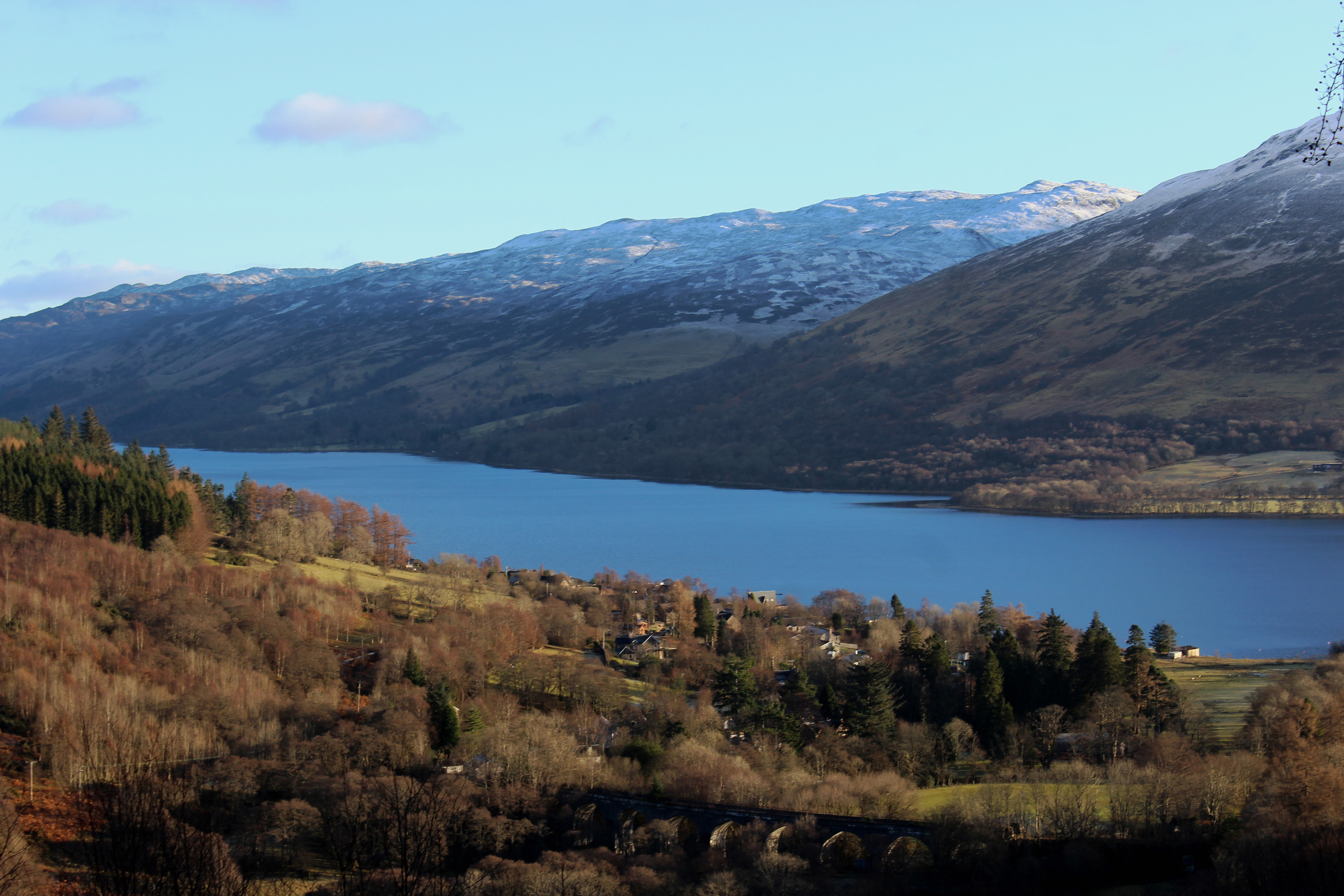
Glen Ogle, Lochearnhead, Stirling
Described as the Khyber Pass of Scotland by Queen Victoria during her travels through the Highlands in 1842, Glen Ogle has long been an important link between north and south.
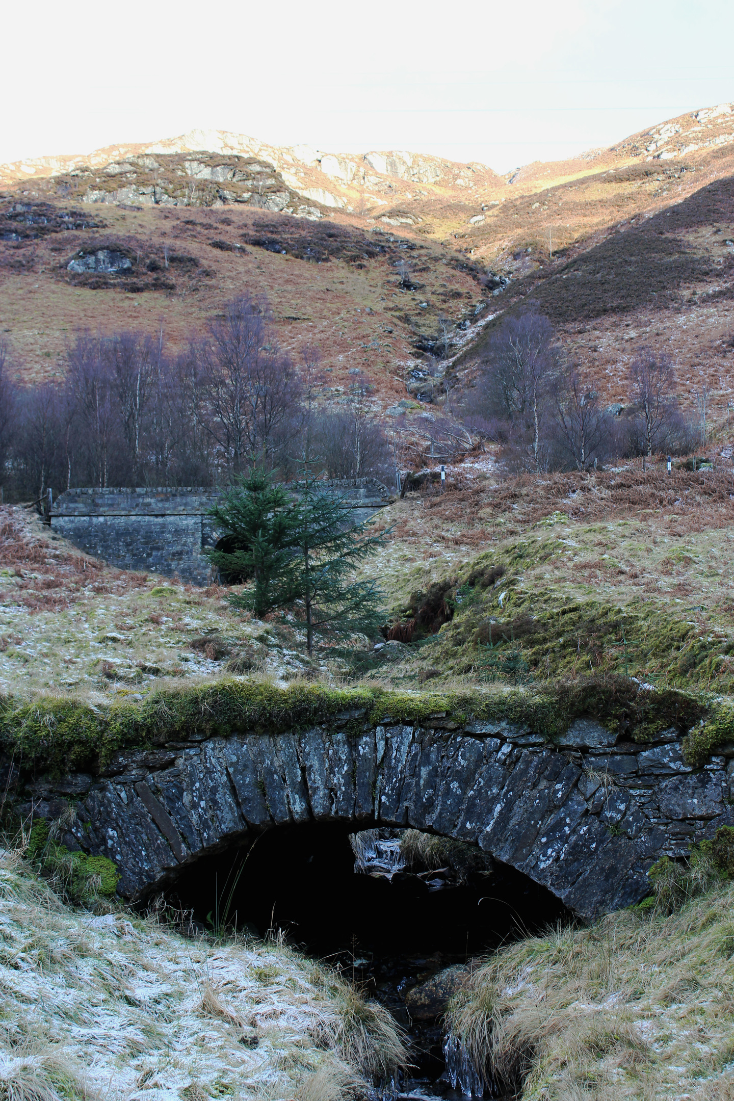
In the 1750s Major William Caulfield drove a military road through the valley, part of a route between Stirling and Fort William, and then, in the 1860s, Callander & Oban Railway Company engineer John Strain laid down tracks on the hillside above.
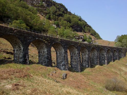
It was an ambitious undertaking for what was a cash-strapped enterprise, one that included the construction of a mighty 12-arch stone viaduct. The line long closed, the bridge remains a prominent landmark and, together with a section of Caulfield’s highway, forms part of a circular trail that roams through a glen Queen Victoria recorded in her journal as boasting the ‘wildest, finest and boldest scenery’.
At the southern end of the valley, where the Ogle Burn flows into Loch Earn, the village of Lochearnhead was my starting point, a convenient car park with public toilets sitting just off the main road.
Following the A85 over the stream and out of the community, I joined the waymarked trail at a pedestrian gate and information board just beyond the abutments of another disused railway bridge.
Striking out over grazing land, the way soon swings right, crossing the stream once again by a wooden footbridge before rising through quiet woodland, swathes of pasture beckoning beyond a stile.
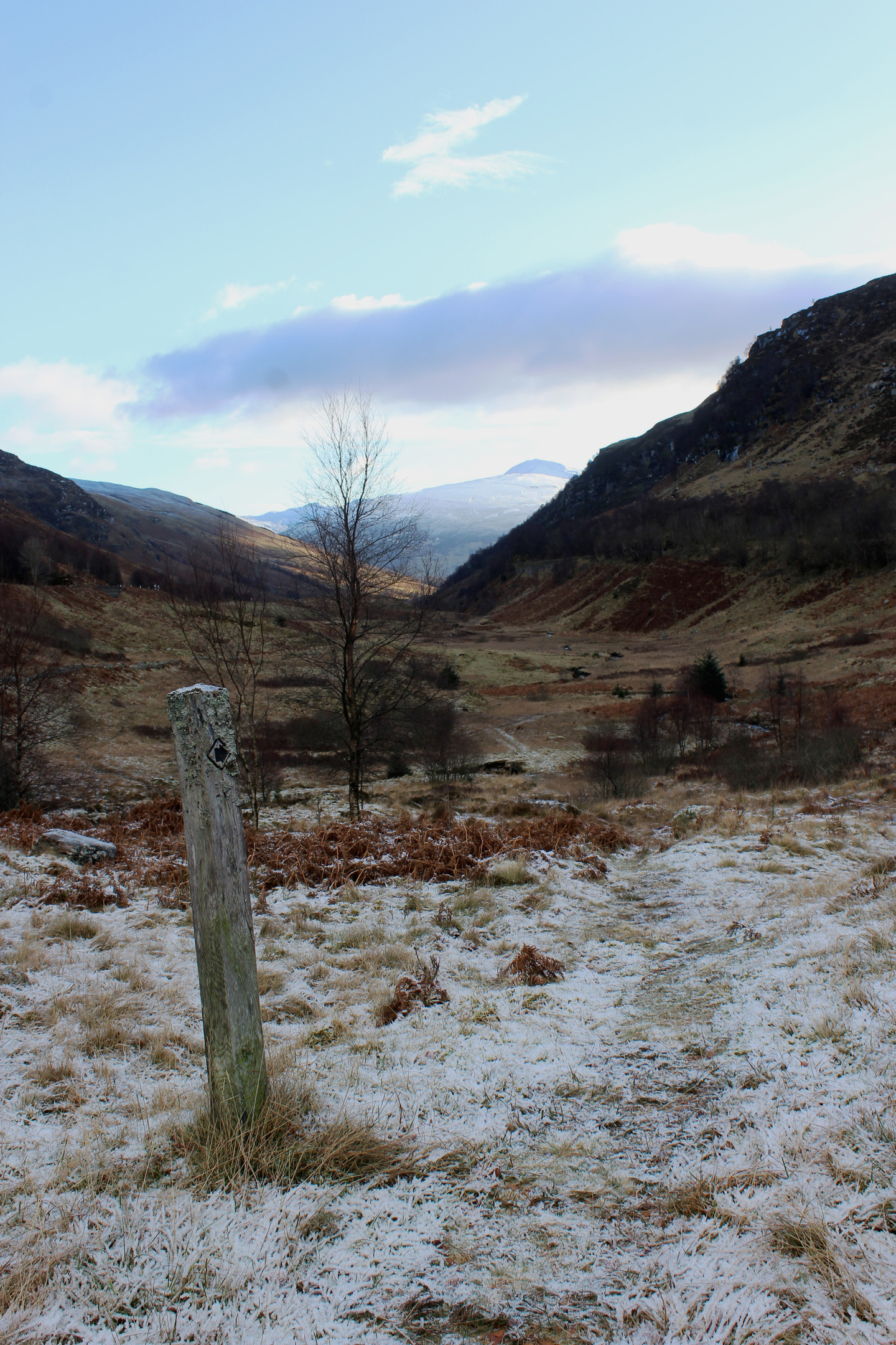
The onward route is distinct enough but there are arrow posts aplenty to keep walkers on the right track and, as height is gained, it is worth pausing periodically and turning around to enjoy views south to Ben Vorlich.
Negotiating a stream and a couple of stiles below a sheepfold, the trail soon meets the A85. It is a busy thoroughfare so cross with care to re-join the path on the other side.
Now following the line of the military road, the way initially runs parallel with the modern-day asphalt before dipping to the base of the valley where, amid shrubby trees, the terrain is rougher and rather wetter underfoot, the legacy of a landslide some years ago.
Stay with the marker posts, however, and the ground becomes firmer and Caulfield’s route more defined as it climbs grassy slopes towards the pass, crossing one of his original stone-arch bridges which remains well preserved.
It is not, however, quite as impressive as the railway viaduct, now in full view spanning a cleft in the craggy slope up to the left.
After a final stiff pull, path and burn converging as the valley narrows towards its col, the trail meets the trackbed of the former railway and, from here, it is downhill all the way back to Lochearnhead.
Incorporated into a long-distance cycle route and the Rob Roy Way, the surface is good, the walking easy as the line gradually descends, passing over the viaduct and an adjacent bridge. The view from the parapets is every bit as breath-taking as the one from below.
Overshadowed by steep, rocky slopes, precariously placed crags and boulders above offer a clue to the eventual fate of the line. Scheduled for closure in November 1965, a landslip in September of that year brought services over the section between Callander and Crianlarich to a premature end, leaving walkers to tread where the trains once travelled.
ROUTE
1. Walk 500m west on A85 to junction with A84.
2. Turn right and walk 250m north on A85.
3. Pass through pedestrian gate and continue ahead on track. Approaching electricity sub-station, bear right. Pass through wooden gate and cross footbridge over Ogle Burn.
4. Bear left up into woodland and follow waymarked path north.
5. Cross stream, stile, track below stone sheepfold, then second stile and continue north on waymarked path to meet A85.
6. Cross A85 with care, climb over wooden fence panel and continue north on waymarked path.
7. Cross bridge over stream and bear left up to stile. Cross to join former railway, turn left and walk south on good track following line of railway.
8. Ignore track branching left and continue south.
9. Turn left and descend steep path to A85 then retrace steps to car park.
INFORMATION
Distance: 10km/6¼ miles
Ascent: 300m/990ft
Time: 3-4 hours
Grading: Moderate route following waymarked paths up through valley, returning on well surfaced line of former railway. Stout footwear recommended as some sections can be wet and boggy underfoot. Keep dogs under close control over grazing land
Start/finish: Public car park, Lochearnhead (Grid ref: NN 592238)
Map: Ordnance Survey 1:50,000 Landranger sheet 51; Ordnance Survey 1:25,000 Explorer sheet OL46
Tourist Information: Callander iCentre, 52-54 Main Street, Callander FK17 8BD (Tel 01877 330342)
Public transport: Kingshouse Travel C60 bus service from Callander to Killin (no Sunday service)


