Pittenweem to Elie, Fife
I have yet to walk the 117-mile long Fife Coastal Path in its entirety. Over the years I have, however, covered much of the ground, enjoying shorter hikes between the towns and villages that lie along the trail.
The East Neuk is a favourite haunt, Kincraig Point and the rocky scramble that is the Elie Chainwalk just one of the highlights I find myself drawn to time and time again.
The shoreline to the north of the seaside town I have devoted less attention to so, on a bright but bitterly cold winter morning, I set off for Pittenweem, determined to make amends.
A car park at West Braes, on the edge of the fishing community, offers convenient access to the waymarked way which cuts between a restored crazy golf course and the town’s open air, tidal swimming pool.
With the early morning air temperature struggling to stay much above zero, the icy waters of the pool did nothing to tempt me and I hot-footed it along the trail, pausing briefly to chat with local dog walkers.
On a clear day the whole length of the seaboard strip between Pittenweem and Elie can be seen up ahead, distant Lady’s Tower my end goal for the day.
Closer at hand, another prominent landmark is St Monans Windmill, constructed in the 1770s to pump sea water up into salt pans, the remains of which lie on grassland below the tower.
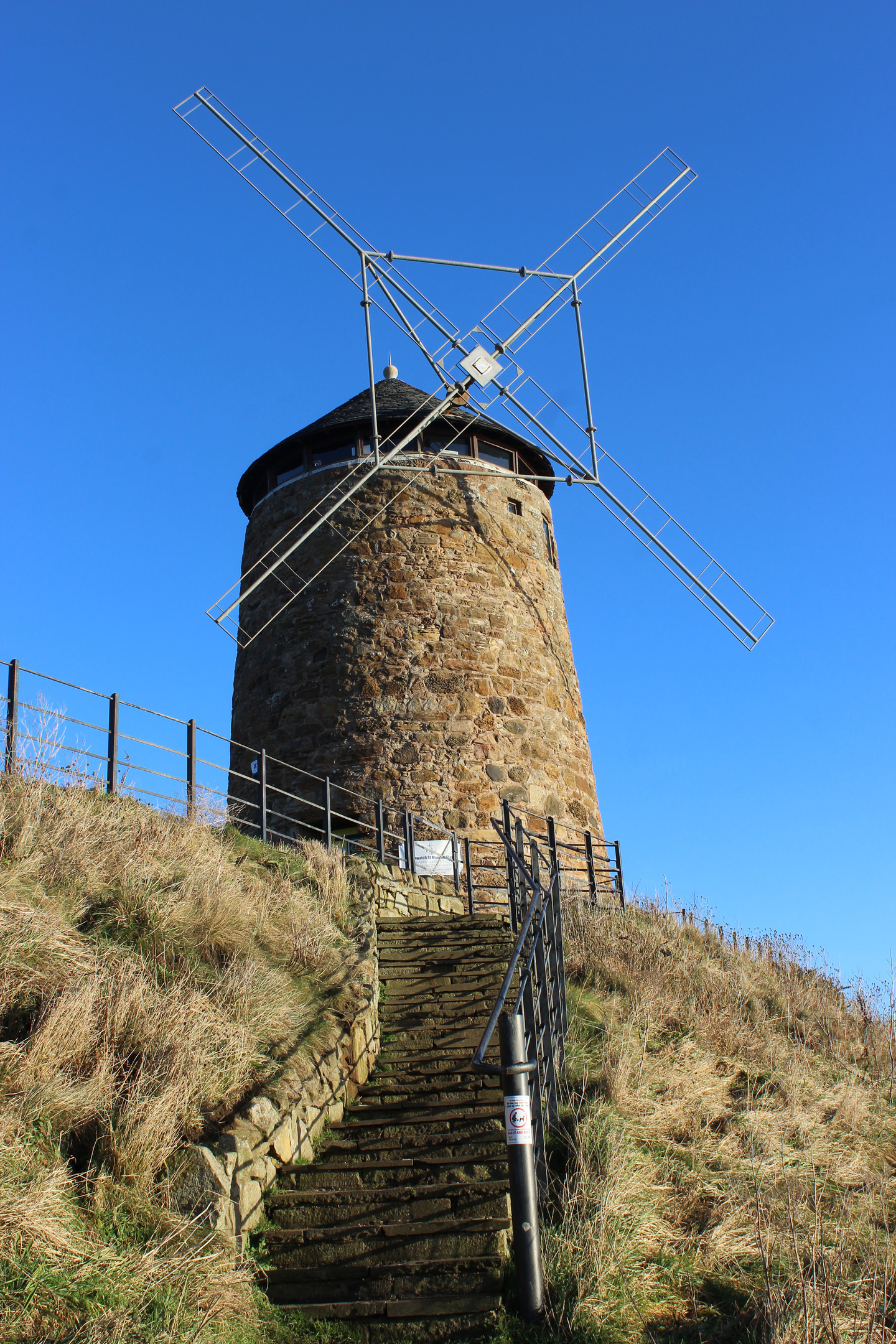
Interpretative boards offer an insight into an industry that, while less than glamorous, was, during the 17th and 18th century, one of the main sources of employment along the kingdom’s south coast.
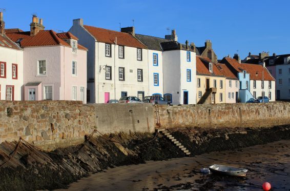
St Monans too has a tidal bathing pool which I duly skipped past on my way into the village. Like Pittenweem, the village grew up around fishing, but it also boasted a thriving boatbuilding industry, one that ended in the 1990s.
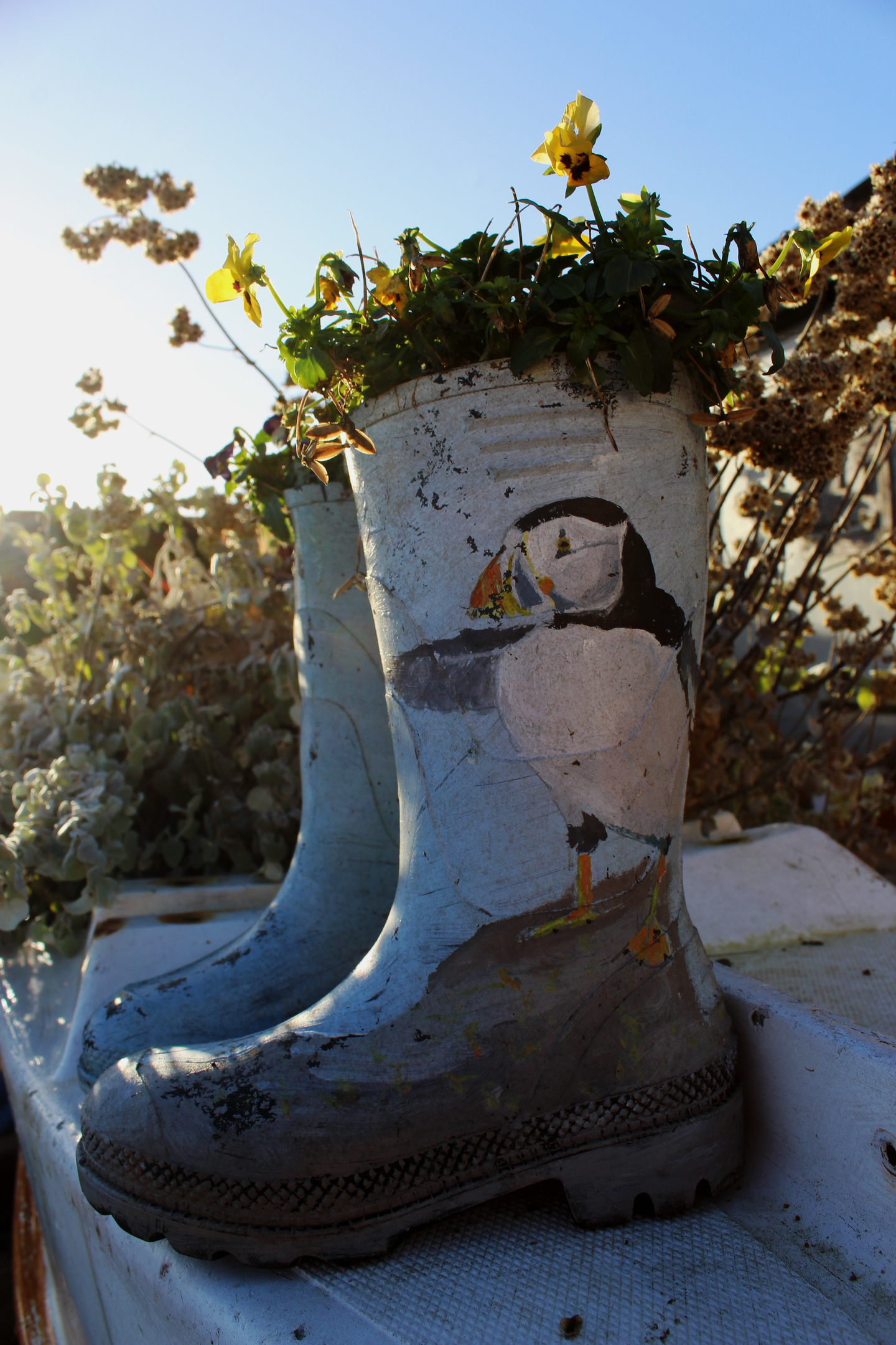
Across the basin, the western pier has acquired a new, quirky occupant – the Welly Boot Garden. Dozens of pairs of old wellies, some painted and all planted with flowers, grasses and foliage, inject colour into the old concrete slipway.
Leaving St Monans, an alternative high tide route heads inland but, with the waves someway off, I crossed Inverie Burn via an old stone bridge and, following steps hewn into the rock, skirted below picturesque 14th century St Monans Kirk and its graveyard.
The trail passes the dramatic ruins of Newark Castle and then the rather less prominent remains of Ardross Castle before dipping into dunes, a fine strip of golden sand leading on towards Lady’s Tower.
The 18th century summerhouse of Lady Janet Anstruther, wife of politician Sir John Anstruther, formerly of Elie House, lies just off the official route of the coastal path but the deviation around the low-lying headland, which also takes in Elie Ness Lighthouse, is worth making.
Below the derelict circular tower, the vaulted chamber where Lady Janet disrobed before bathing in the sea remains intact. It is said she indulged a passion for skinny-dipping.
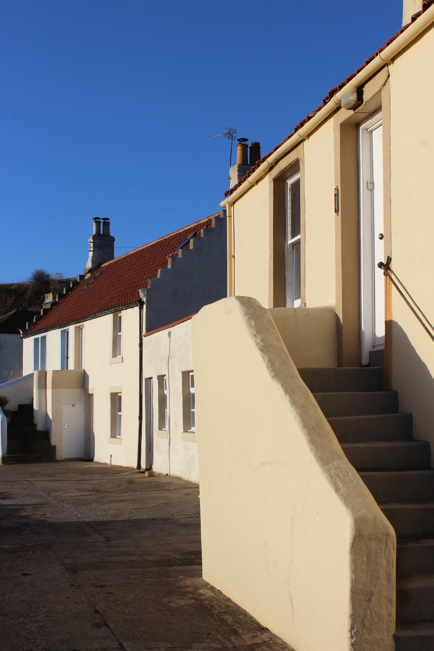
Paths converge once again at the Ruby Bay car park from where it is a short walk into Elie, slender streets lined with grand houses and quaint cottages leading me to Earlsferry Beach where I enjoyed a quiet stroll over the sand before wandering into town to catch the bus back to Pittenweem.

ROUTE
1. From public toilets, follow path seaward to meet Fife Coastal Path (FCP). Bear right and follow FCP west to St Monans.
2. Enter St Monans on Rose Street and bear left down Forth Street to harbour. Continue past harbour and up West End before branching left down path to church.
3. Cross stream, bear left on carved steps and continue along FCP.
4. Bear right past Newark Castle ruin and continue ahead.
5. Ascend to Ardross Castle ruin before dipping through dunes.
6. Branch left off FCP at junction and follow path to Lady’s Tower. Continue round headland, passing Elie Ness Lighthouse, to Ruby Bay car park.
7. Turn left along car park access road then go left down Admiralty Lane to The Toft.
8. Turn right along The Toft then go left along The Terrace and South Street.
9. Bear right up Fountain Road then go right along Bank Street to centre of Elie.
INFORMATION
Distance: 7.6km/4¾ miles
Ascent: 70m/230ft
Time: 2-3 hours
Grading: An easy, low-level linear route following the Fife Coastal Path, returning by bus. Stout footwear recommended
Start: Fife Coastal Path car park (signed from A917) at West Braes, Pittenweem (Grid ref: NO 543022). Finish in centre of Elie
Map: Ordnance Survey 1:50,000 Landranger sheet 59; Ordnance Survey 1:25,000 Explorer sheet 371
Tourist Information: St Andrews iCentre, 70 Market Street, St Andrews KY19 9NU (Tel 01334 472021)
Public transport: Stagecoach bus services 95 and X60 link Elie and Pittenweem


