Wormit to Balmerino, Fife
The village of Balmerino, on the banks of the River Tay, grew up around its abbey, founded in the early years of the 13th century by monks from Melrose under the patronage of William the Lion’s widow, Ermengarde.
It was a thriving centre of worship and work until the Reformation of the 16th century when the monastery was attacked and burned. Plundered for its stone in the years that followed, today, only an atmospheric ruin remains, a peaceful place to pause and reflect on the past.
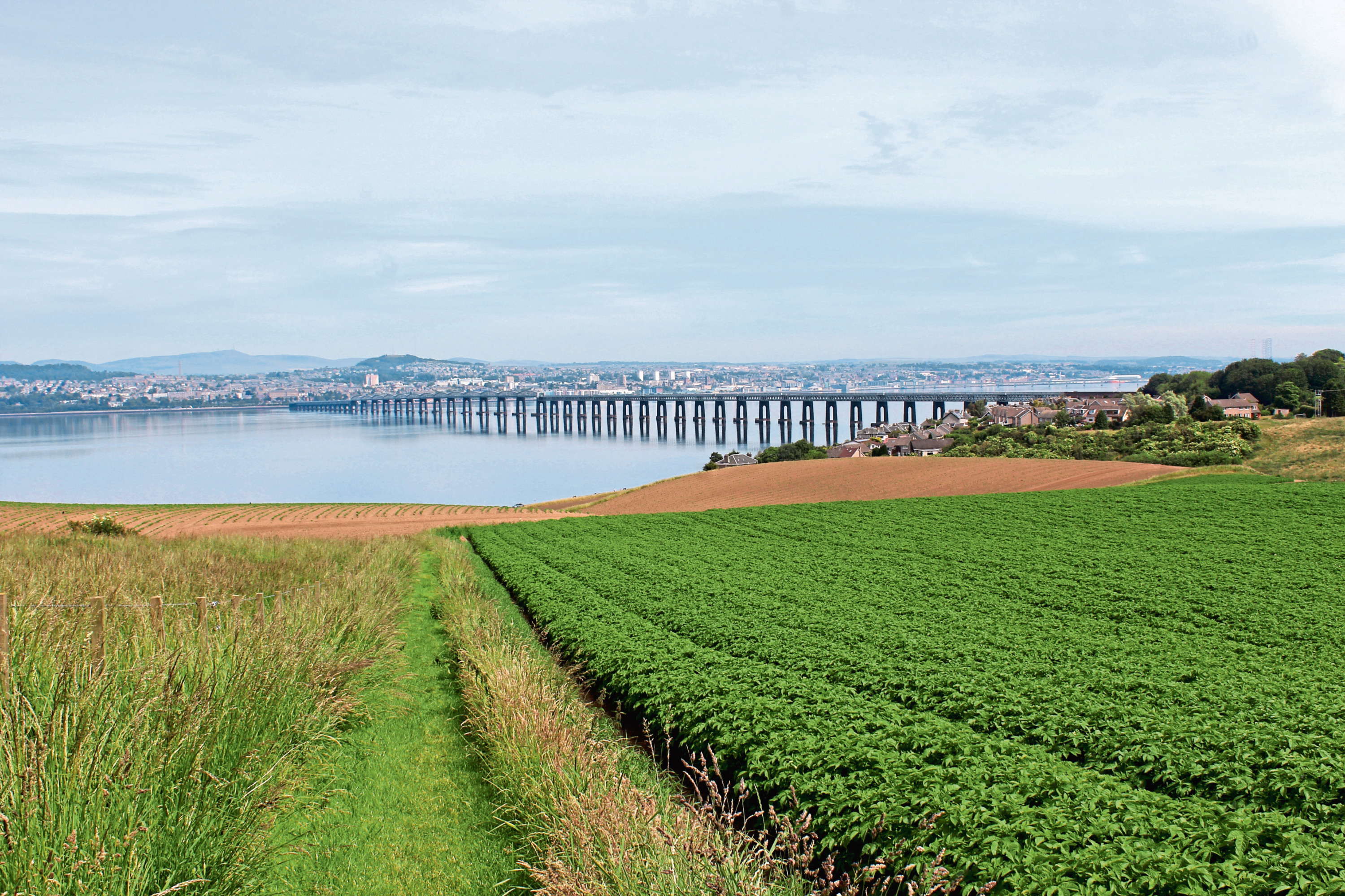
Seeking this solace, my abbey pilgrimage began downstream, at Wormit Bay, in the shadow of another great landmark, the Tay Rail Bridge. Here I joined the Fife Coastal Path, my guide to Balmerino.
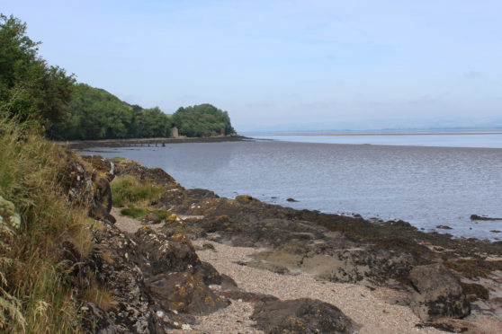
Passing a granite memorial to those who perished when the first railway crossing over the estuary collapsed during a storm on the night of December 28, 1879, the waymarked trail runs above the bay’s shingle beach to a carved wooden seal sculpture where it climbs through a band of vegetation.
Emerging into the open, there are river views aplenty as the way progresses over sloping grassland dotted with clumps of gorse, purple foxgloves and wildflowers.
Below the farm at Kilburns, the path dips to cross a trickling stream in a leafy den then, after roaming the lower fringes of fields, enters woodland proper.
Approaching Balmerino, the river beckons once again, the path leaving the trees and following the foreshore past the former salmon station at Nether Kirkton and old waterfront fishing bothies, now pretty cottages.
While salmon netting brought prosperity to the community in the 19th century, the river had long been an important part of village life. In the 1750s a harbour was constructed here to ship lime quarried in the Fife hills to Dundee. Wheat and barley was also exported and there was a twice weekly ferry service to the city.
Leaving the Fife Coastal Path to continue its journey west, I hiked up through Balmerino, past Bridgend, to the abbey, which is now in the care of the National Trust for Scotland.
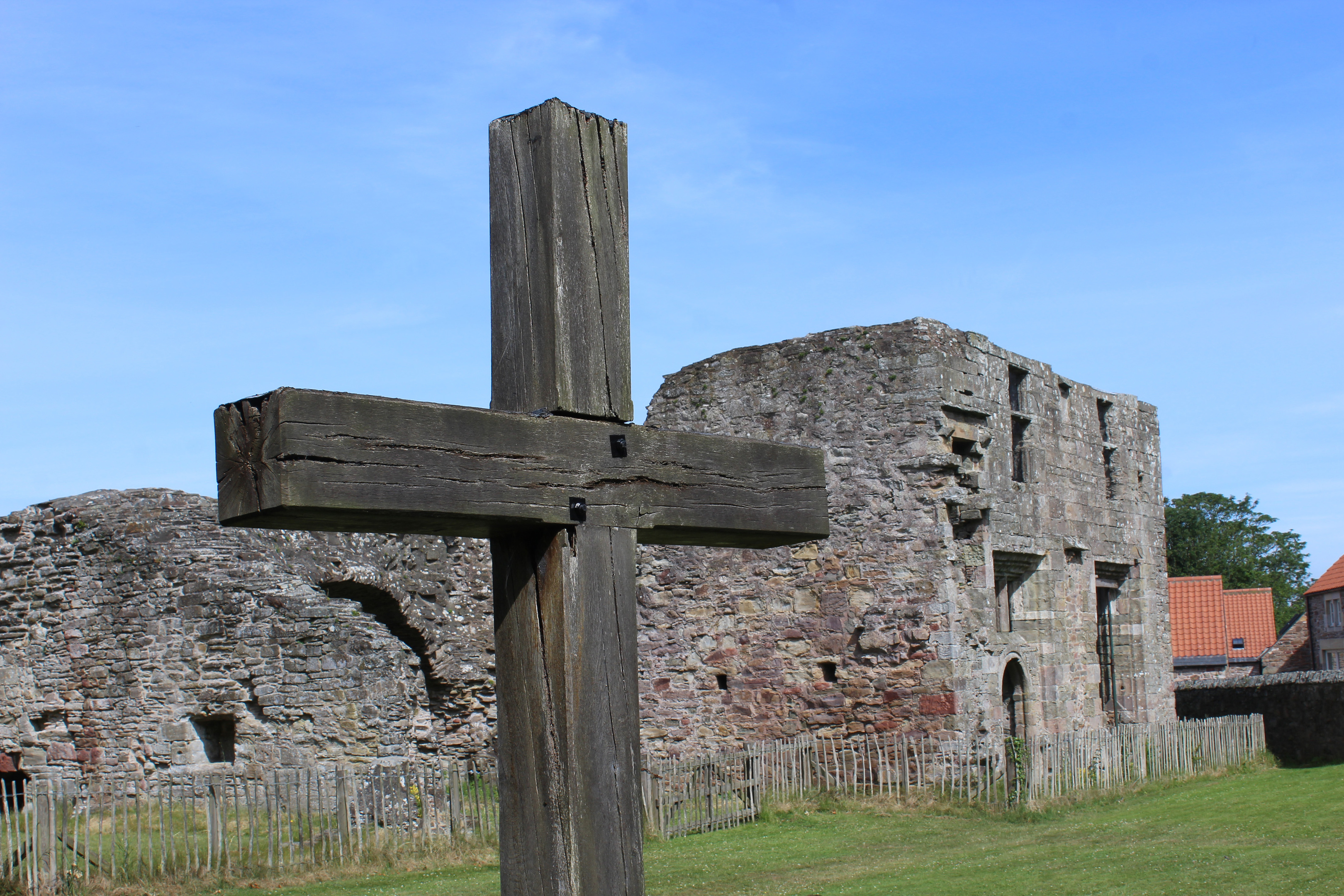
While there are physical remnants of ancillary buildings such as the chapter house, the abbey church is all but gone, a wooden cross identifying the site of the high altar and marker stones in the grass indicating where the nave and aisle were. Within the grounds, a 450-year-old chestnut lays claim to the title of the oldest tree in the kingdom.
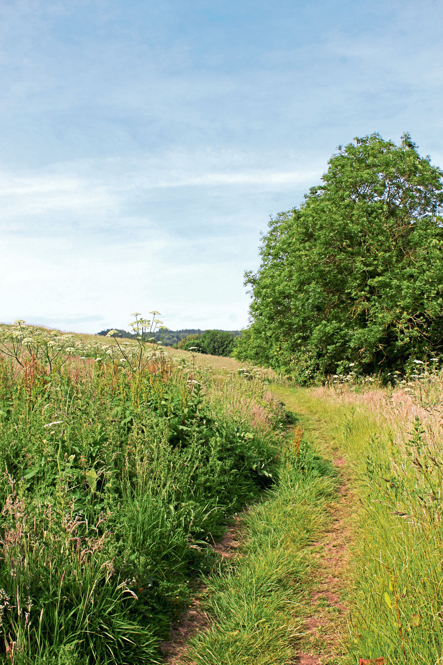
After sitting awhile on the old stones, enjoying the morning sunshine and tranquillity, I sought out a path known locally as Monks’ Road for my return to Wormit. Branching off the road below Bridgend, the slender trail, an ancient coffin road over which the dead were carried, crosses a meadow, meanders through woodland and skirts by fields and paddocks to Naughton Farm.
Here I joined the modern-day road for a brief tramp along asphalt to Peacehill Farm. The country lane is quiet enough and a blind bend just before the turn off to the farm can be avoided by straying briefly into the field on the right.
Approaching the agricultural sheds of Peacehill, a sign for Wormit led me around the eastern periphery of the farm, a mown grass strip descending past poultry sheds, across arable land and along the edge of a tiny reservoir to Wormit Bay.
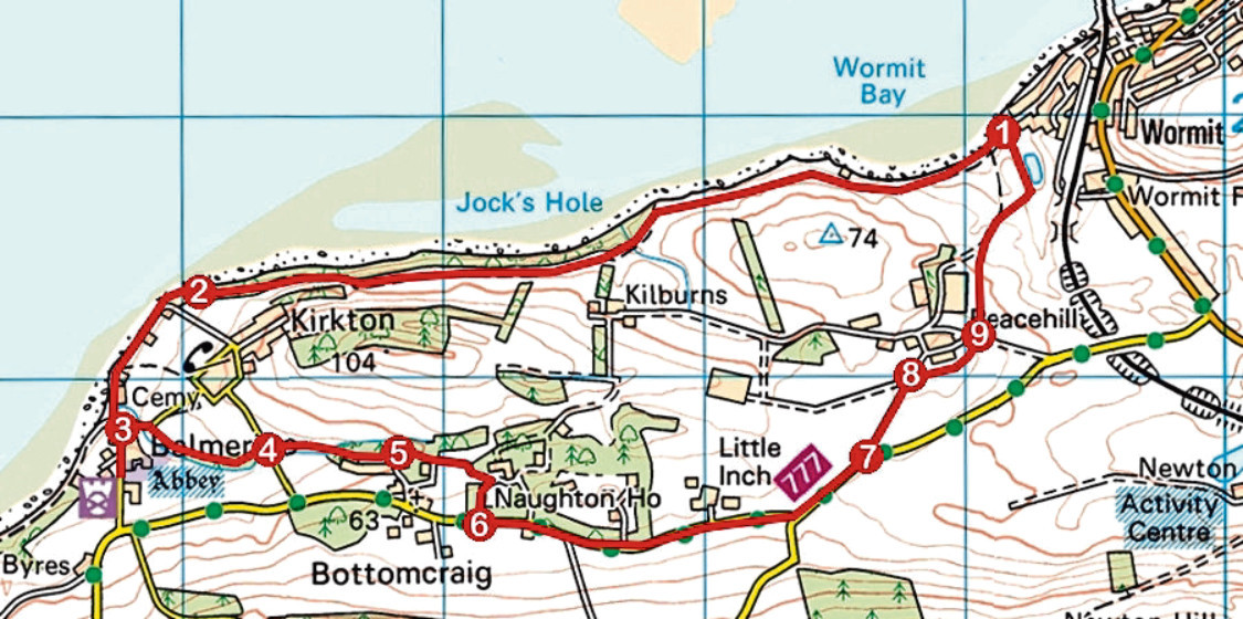
ROUTE
1. Follow Fife Coastal Path (FCP) west to Balmerino.
2. Go through gate and continue along FCP, passing to right of Nether Kirkton, to Balmerino.
3. Leave FCP and walk up to road junction with post box at Bridgend. Continue up road to abbey then return to junction and go right, descending to cross stream. Branch right through gate and follow path (signed Monks’ Road).
4. Cross road and follow path above reservoir, along field edge then through woodland to meet track. Go left to Uppercraig.
5. Turn left on path initially running alongside high wooden fence to Naughton Farm. Approaching farm, go right along track to road.
6. Turn left and walk 1.5km along road towards Wormit.
7. Go left and ascend farm track.
8. Turn right (signed Wormit) along grassy field edge path to meet track.
9. Cross track and descend grassy path to Wormit Bay, heading along left side of reservoir at foot of slope.
INFORMATION
Distance: 9km/5½ miles
Ascent: 150m/500ft
Time: 2-3 hours
Grading: Easy low-level route following tracks, paths and minor roads. Keep dogs under close control where livestock is encountered
Start/finish: Wormit Bay Car Park, at the foot of Bay Road, Wormit (Grid ref: NO 392259)
Map: Ordnance Survey 1:50,000 Landranger sheet 54 or 59; Ordnance Survey 1:25,000 Explorer sheet 371
Tourist Information: St Andrews iCentre, 70 Market Street, St Andrews KY16 9NU (Tel 01334 472021)
Public transport: Stagecoach bus service 77 links Dundee and Wormit and Moffat & Williamson bus service 92 runs from St Andrews to Wormit