Craig Hill, Kenmore, Perth & Kinross
Overlooking the valley of the River Tay, Craig Hill is a peak of two distinct halves. While the northern slopes are cloaked in timber, the southern aspect is more open, grouse moor and rough grazing land sweeping down to the Urlar Burn.
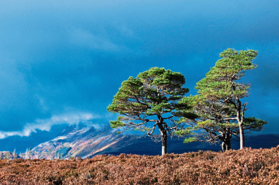
The summit itself is a delightful mix of the two, gnarled old pines and sheltered clusters of larch dotted across the heathery high ground, plentiful breaks in the cover revealing distant mountains.
Approaching from the small car park at Kenmore Hill, accessed by a slender strip of single-track road that snakes steeply up from the village of Kenmore, it is not long before the trees beckon.
A short tramp up the road from the car park, I joined the Rob Roy Way at Tombuie Cottage, the track descending past Tombuie House to the edge of the plantation where a prominent trail sign guided me to my entry point.
Commercial plantation it may be, but the species are mixed and the walking perfectly pleasant, bronzed bracken and the yellowing leaves of silver birch a reminder of autumn’s steely grip.
Emerging on to open ground, where sheep grazed by venerable Scots pine, Loch Tay, Taymouth Castle and Appin of Dull lay below me, a brief vista to savour before I disappeared back into the trees.
A line of electricity pylons drawing near, the way crosses open ground again, weaving up below the cables before leaving the Rob Roy Way to continue its course to Aberfeldy and climbing into the conifers.
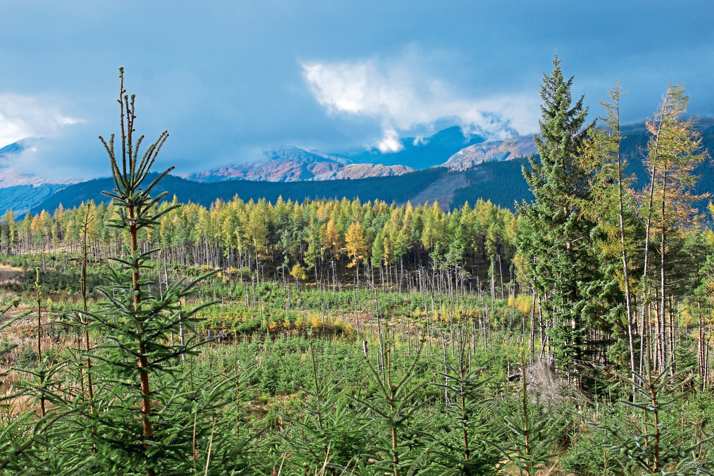
Here, the hike becomes more demanding of legs and lungs, the forest track ascending through the pines, spruce and larch of Tullichuil Wood and, nearing the top of the plantation, the Lawers range reveals itself across felled and replanted ground.
The route to Craig Hill branches left off the main forest road, a steeper, less refined track staying to the left of a high fence as it climbs to a gate separating the two halves of the hill.
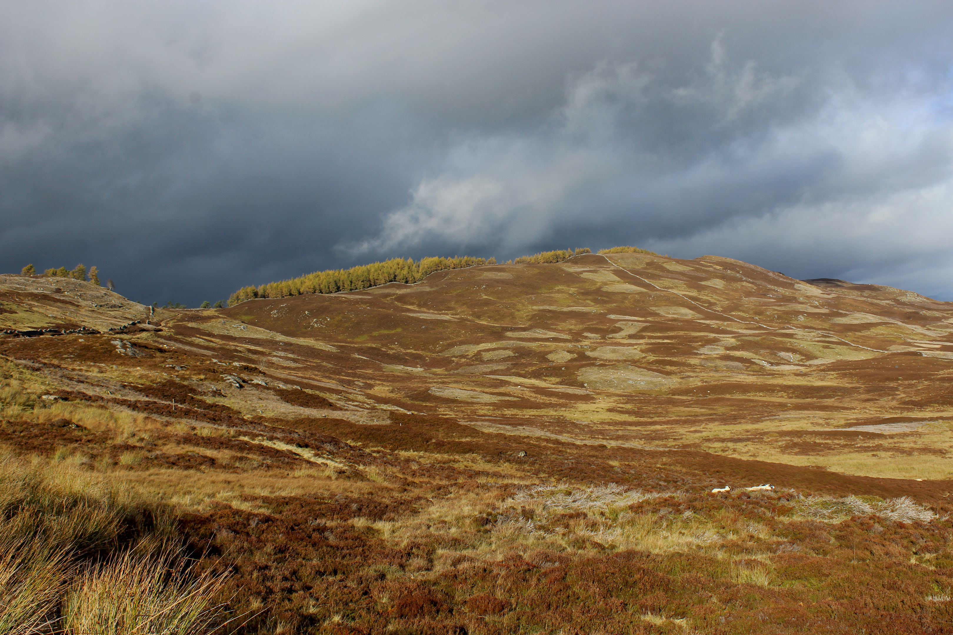
Emerging into the open, I contemplated making a bid for the summit from here but the prospect of entangling myself in the wiry heather prompted me to progress along the track, across the col, in search of a better option.
And, where the way passes through a wall, I found one. Branching left, a well-defined set of all-terrain vehicle tracks rose alongside the dyke. Higher up, these pass through a break in the wall and, beyond the next rise, where the way begins to dip, the remnants of an old cairn atop a grassy mound of larch to the right marks the summit.
It took a bit of finding but, satisfied it was the high point, I wandered down through chaotic woodland bordering the wall, re-joining the track as it led south above grouse moor.
Across the valley, the rolling landscape of low hills is dominated by human influence and our need for power, the stark, white wind turbines of Griffin Forest visible beyond the striding pylon line encountered earlier in the day.
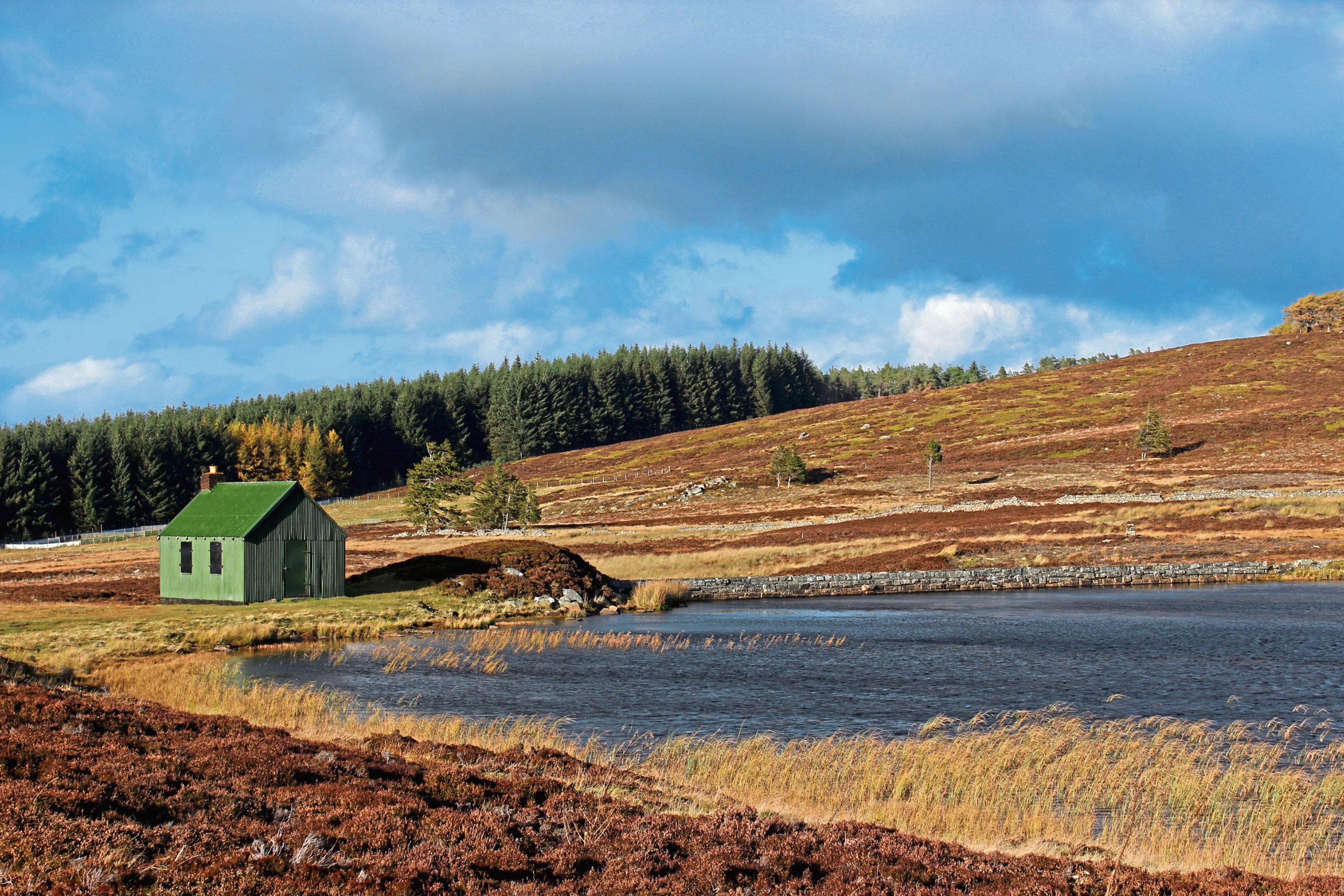
Turning west I found solace in a tranquil wee reservoir and corrugated iron bothy (sadly locked) bordering the road home, Schiehallion a sight for sore eyes to the north, the mountains of Glen Lyon and Ben Lawers and her sisters lining up alongside for a real visual treat at the end of a great day out.
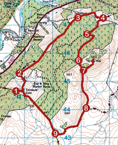
ROUTE
1. Descend car park access track, turn right and follow road to Tombuie Cottage. Go left through gate (signed Aberfeldy) and follow track north, descending past Tombuie House to forest.
2. Branch right on path (signed Rob Roy Way), ascend through gate to meet track and follow it north-east for 3km to Tullichuil.
3. Turn right (signed Aberfeldy) and ascend track, passing below pylon line to junction.
4. Turn right, leaving Rob Roy Way, and ascend track. Ignore track branching left and continue up to quarry. Enter forest at adjacent gate and proceed to next junction.
5. Turn left and ascend track for 1.3km.
6. Nearing top of plantation, where main track swings right through gate, branch left up rougher track, exit plantation at gate and follow heathery track over col to wall.
7. Detour left, ascending track by wall to summit, before following main track south.
8. Turn right and follow track to road.
9. Turn right and descend road to car park.
INFORMATION
Distance: 14km/8¾ miles
Ascent: 460m/1500ft
Time: 4 hours
Grading: Moderate upland route following good tracks, paths and minor roads through woodland and over moor with some strenuous ascent. Keep dogs under close control to protect livestock and ground nesting birds
Start/finish: Kenmore Hill car park (signed Woodland Walks), on minor road a mile southeast of Kenmore (Grid ref: NN 786445)
Map: Ordnance Survey 1:50,000 Landranger sheet 52; Ordnance Survey 1:25,000 Explorer sheet 379
Tourist Information: Perth iCentre, 45 High Street, Perth PH1 5TJ (Tel 01738 450600)
Public transport: Sweeneys service 91 offers a limited bus service between Aberfeldy and Kenmore (Mon, Thu and Fri only)
ENDS}