Coultra Hill, Balmerino, Fife
This lovely wooded circuit, beginning by the ruins of Balmerino Abbey and wandering along the banks of the River Tay and over Coultra Hill, was one of the first walks I wrote up for publication.
Back in 2004, it appeared in a now out of print self-published account of routes within easy reach of Dundee and, remiss of me I know, I have not returned since.
Over 15 years on, I decided to rectify this, keen to see if there had been any changes on the ground. One of the most significant is that the outward leg, through Birkhill Woods, now forms part of the Fife Coastal Path.
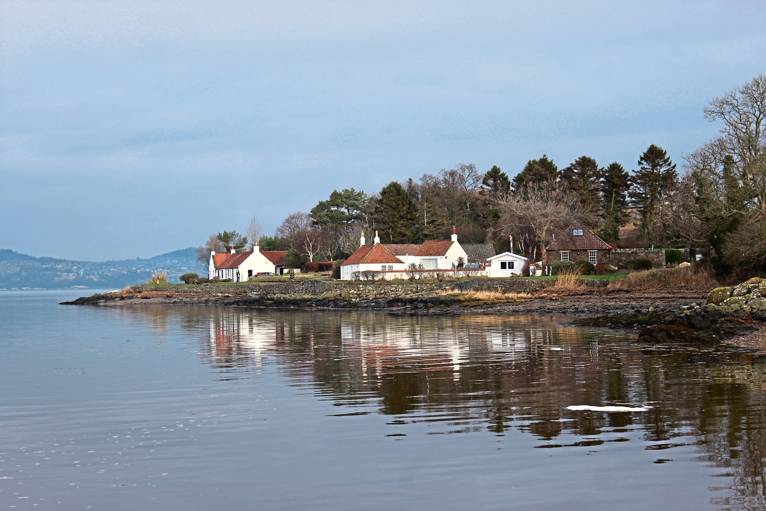
While I originally set off from the remains of the 13th century abbey along the periphery of the farmyard opposite, the way today leads west along the shoreline from the end of the public road.
Skirting above pebble beach, past the remnants of an 18th century pier from where grain and lime were once shipped across the river to Dundee, the trail enters the trees at a set of steps.
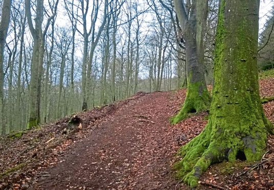
Weaving through woodland, the path never strays too far from the river, footbridges spanning gulches and gorges where tiny streams gurgle down to join it. I recalled that some of the crossings had seen better days when I last walked this way but, thanks to the Fife Coastal Path, they are now all in fine fettle.
There are points where it is possible to escape the trees and dip on to the shingle to enjoy views across the Tay to the Carse of Gowrie and Sidlaw Hills beyond.
Savour them for the path soon rises away from the water to meet a length of wooden fencing where arrows steer walkers left, away from the private policies of Birkhill Castle, and up the edge of a field to meet a track.
 At this point you can shorten the route by turning left and following the track east to meet the road to Balmerino, by cottages at Byres. To continue to Coultra Hill, however, go right to a fork in the track.
Just ahead of the split, by a metal gate on the left, a wee path branches left then right through a band of shrubbery to a post from where I ascended the edge of the field to a gate and ladder stile. These were rendered redundant by a large gap in the fence where the track leading round the northern flank of Green Hill – more substantial than the path I remember – cuts through.
Rising below familiar if fatter beeches, the incline is steady and, at the top of the slope, a waymarker post suggests deviating left. However, investigation revealed this to be a seldom walked path, probably because of the maze of wind-felled trees that lies beyond a murky stream crossing.

Instead, I stayed with the track, curving past a pond and rising through a gate, beyond which the path over Coultra Hill branches left, a sheltered trail passing through a break in a wall above Coultra Farm before following the line of a fence.
Beyond a pair of gates, the last hump offers glimpses through larch of the Tay far below before the descent towards the river begins, the path dipping to a junction where I kinked right, meeting the road to Balmerino at Priorwell.
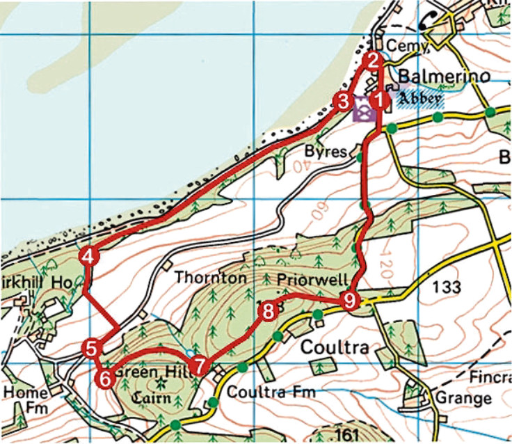
ROUTE
1. Follow road north, forking left at yellow Bridgend House.
2. Turn left (signed Fife Coastal Path) and follow path along shoreline.
3. Ascend steps (signed Fife Coastal Path) into woodland and follow path west.
4. Ascend to wooden fence and bear left to junction. Go left, emerging from woodland, and follow field edge path up to track. Go right for 250m to fork.
5. Branch left off track by gate then immediately turn right up to post. Turn left and ascend edge of plantation to gate and stile.
6. Turn left into plantation, ascending track. Ignore waymarker post pointing left, descend past pond on left and pass through high gate.
7. Just beyond gate, branch left on path, ascending through break in wall and running alongside fence.
8. Pass gate and stile on left and continue ahead through next gate, over Coultra Hill and down to meet road at Priorwell.
9. Turn left and descend road to Balmerino.
INFORMATION
Distance: 6.4km/4 miles
Ascent: 230m/760ft
Time: 2-3 hours
Grading: Easy route following good tracks and paths through woodland and along field edges, returning via minor road, with one short section of strenuous ascent and some longer but less demanding inclines
Start/finish: Balmerino Abbey, Balmerino (Grid ref: NO 357246). Roadside parking in front of abbey
Map: Ordnance Survey 1:50,000 Landranger sheet 59; Ordnance Survey 1:25,000 Explorer sheet 371
Tourist Information: St Andrews iCentre, 70 Market Street, St Andrews KY16 9NU (Tel 01334 472021)
Public transport: Stagecoach bus service 77 from Dundee to Gauldry stops at Balmerino road end