On a bright sunny day, the glorious sands of Tentsmuir, in north-east Fife, are a popular spot but stray south from the Forestry Commission car park at Kinshaldy and you quickly leave the crowds behind.
While many visitors – whether they be walkers, cyclists or simply sun worshipers – tend to head north along the beach or into Tentsmuir Forest, where there is a network of waymarked trails, a much smaller proportion seem to venture down the coast towards the Eden Estuary.
Walk this way and you quickly discover that the vast expanse of golden sand is every bit as enticing while Reres Wood, close to the mouth of the river, has its own tracks and trails to explore.
With the weather warm enough to break out the shorts and sunscreen, I made a beeline for the beach but, while most people were heading straight out on to the sand, I branched right over a footbridge spanning languid pools, the onward path leading through the dunes to the shoreline.
With the tide receding, I aimed for firm sand close to the lapping brine and struck a course south, quickly leaving the handful of others who had wandered this way in my wake.
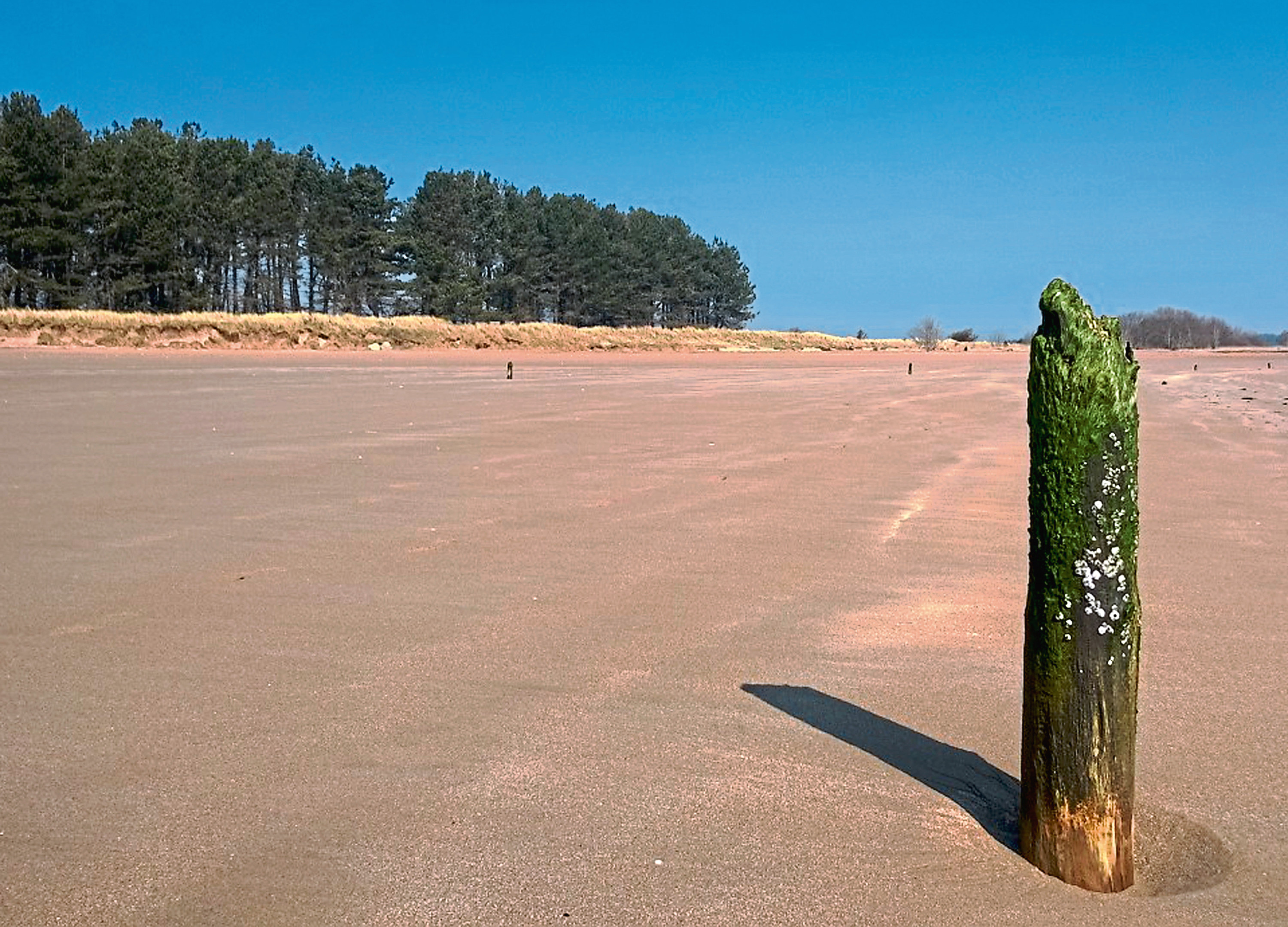
With the beach pretty much to myself, I skipped on towards lines of poles embedded in the sand, all that now remains of a once-thriving coastal salmon netting industry.

Here the beach starts to narrow so I deviated up towards the high tide line to avoid the offshore sand banks and channels carved out by the River Eden as it approaches the North Sea. A good place to spot grey and common seals, they can easily catch unwary walkers out.
Above the dunes, beyond a line of wartime concrete anti-tank blocks, the tall pines of Reres Wood border the coast and, nearing the perimeter fence of the British Army’s Leuchars Station, I turned inland.
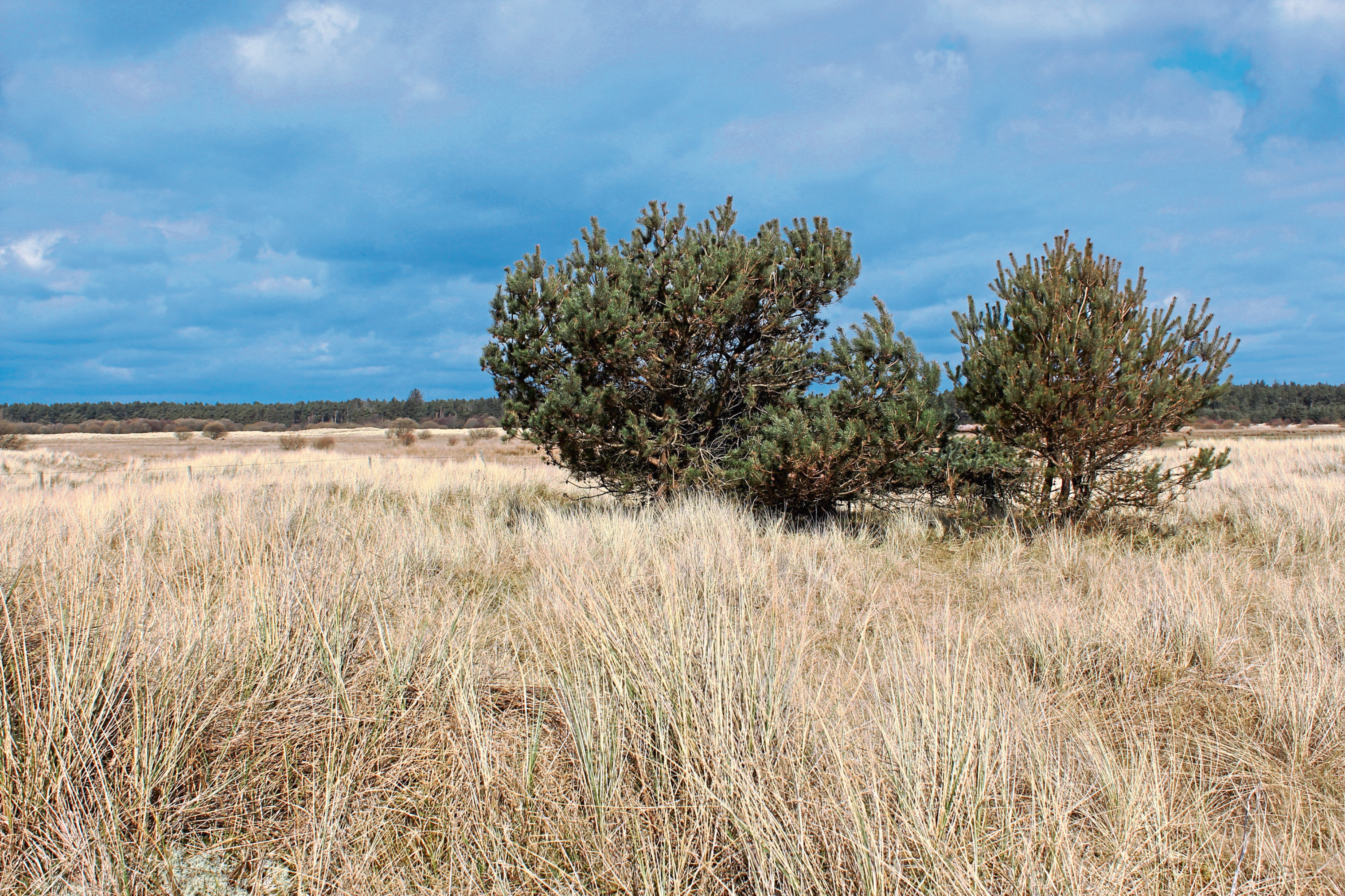
A delightful wee trail runs along the southern edge of the plantation, weaving through naturally regenerating young trees as it crosses a slim strip of heath lying between the forest and the military base.
The way soon converges with the high perimeter fence where, crossing over a track, a grassy path led me through a break in the trees to the northern edge of the wood.
The grazing land of Earlshall Muir beyond is a peaceful place today but, during the Second World War, it was pressed into service as a decoy for the adjacent airbase, a dummy airfield known as Eden Mouth designed to draw German bombers away from the real thing. The only relic of this clever deception is an abandoned brick, concrete and corrugated iron bunker on the eastern side of the site.
Wandering along the fringe of Reres Wood back towards the sea, I picked up the coastal path by the line of anti-tank blocks and followed it north through the dunes, important coastal habitat lying within the Eden Estuary Local Nature Reserve.
The rolling dunes, reedy marsh and rush-lined pools attract birds like the shelduck, godwit, redshank and teal and is hunting ground for both Tentsmuir Forest’s resident sea eagles – Britain’s largest birds of prey – and visiting osprey.
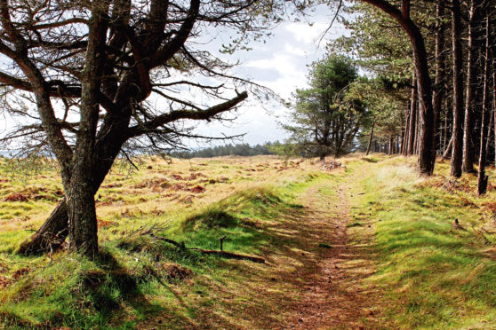
The reserve extends north to Tentsmuir Forest where a track in the lee of the trees led me back to the car park and the crowds.
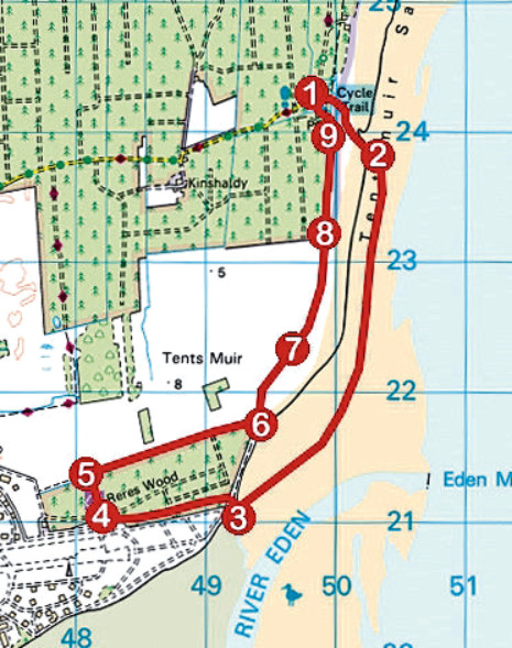
ROUTE
1. From the south-east corner of the car park, follow path seaward (signed To the Beach). Cross footbridge on right and bear left, following path by stream through dunes to beach.
2. Bear right and walk 3km south along beach.
3. Bear right, heading inland to south-east corner of Reres Wood and follow path west along southern edge of plantation.
4. Cross track and follow grassy path north through break in trees.
5. Turn right and follow path along northern edge of Reres Wood to junction by anti-tank blocks.
6. Turn left, following path running parallel with anti-tank blocks north through dunes.
7. Passing marshy ground, ignore a slender trail lined with white posts branching right and continue ahead.
8. Leave nature reserve at information post and continue ahead on track running along edge of Tentsmuir Forest. Ignore tracks branching left into forest and continue to T-junction.
9. Turn left, returning to car park via toilet block.
INFORMATION
Distance: 9km/5½ miles
Ascent: 60m/200ft
Time: 2-3 hours
Grading: Easy, low-level hike along sandy beach, woodland trails and coastal path. Stout footwear recommended
Start/finish: Tentsmuir Forestry Commission Car Park, three miles north-east of Leuchars (Grid ref: NO 498242). £2 parking charge payable at automatic barrier gate on approach road. Car park open daily 8am to 8.30pm
Map: Ordnance Survey 1:50,000 Landranger sheet 54 or 59; Ordnance Survey 1:25,000 Explorer sheet 371
Tourist Information: St Andrews iCentre, 70 Market Street, St Andrews KY16 9NU (Tel 01334 472021)
Public transport: None