Calendar An icon of a desk calendar. Cancel An icon of a circle with a diagonal line across. Caret An icon of a block arrow pointing to the right. Email An icon of a paper envelope. Facebook An icon of the Facebook "f" mark. Google An icon of the Google "G" mark. Linked In An icon of the Linked In "in" mark. Logout An icon representing logout. Profile An icon that resembles human head and shoulders. Telephone An icon of a traditional telephone receiver. Tick An icon of a tick mark. Is Public An icon of a human eye and eyelashes. Is Not Public An icon of a human eye and eyelashes with a diagonal line through it. Pause Icon A two-lined pause icon for stopping interactions. Quote Mark A opening quote mark. Quote Mark A closing quote mark. Arrow An icon of an arrow. Folder An icon of a paper folder. Breaking An icon of an exclamation mark on a circular background. Camera An icon of a digital camera. Caret An icon of a caret arrow. Clock An icon of a clock face. Close An icon of the an X shape. Close Icon An icon used to represent where to interact to collapse or dismiss a component Comment An icon of a speech bubble. Comments An icon of a speech bubble, denoting user comments. Comments An icon of a speech bubble, denoting user comments. Ellipsis An icon of 3 horizontal dots. Envelope An icon of a paper envelope. Facebook An icon of a facebook f logo. Camera An icon of a digital camera. Home An icon of a house. Instagram An icon of the Instagram logo. LinkedIn An icon of the LinkedIn logo. Magnifying Glass An icon of a magnifying glass. Search Icon A magnifying glass icon that is used to represent the function of searching. Menu An icon of 3 horizontal lines. Hamburger Menu Icon An icon used to represent a collapsed menu. Next An icon of an arrow pointing to the right. Notice An explanation mark centred inside a circle. Previous An icon of an arrow pointing to the left. Rating An icon of a star. Tag An icon of a tag. Twitter An icon of the Twitter logo. Video Camera An icon of a video camera shape. Speech Bubble Icon A icon displaying a speech bubble WhatsApp An icon of the WhatsApp logo. Information An icon of an information logo. Plus A mathematical 'plus' symbol. Duration An icon indicating Time. Success Tick An icon of a green tick. Success Tick Timeout An icon of a greyed out success tick. Loading Spinner An icon of a loading spinner. Facebook Messenger An icon of the facebook messenger app logo. Facebook An icon of a facebook f logo. Facebook Messenger An icon of the Twitter app logo. LinkedIn An icon of the LinkedIn logo. WhatsApp Messenger An icon of the Whatsapp messenger app logo. Email An icon of an mail envelope. Copy link A decentered black square over a white square.

This is how much Dundee waterfront has changed over the years

Dundee waterfront has changed drastically in the past century.

A dive into the history of Dundee’s waterfront has shown just how much it has changed over the centuries.

To celebrate the opening of the V&A in September, the Registers of Scotland has researched the area’s past  and shared images detailing the changes over the course of about 700 years.

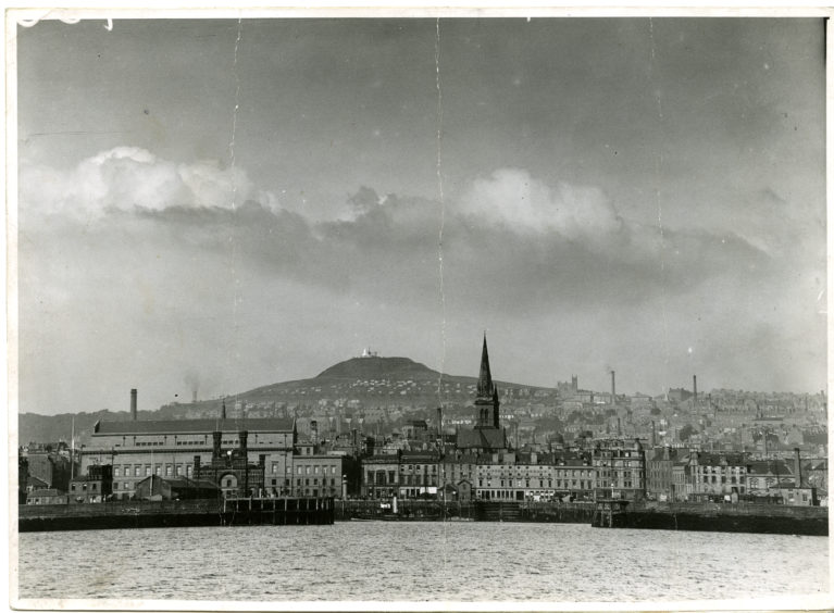
In its report, the governmental department says: “Thanks to its location on the Firth of Tay leading into the North Sea, Dundee has had an important maritime history.

Picture courtesy of Dundee Waterfront.

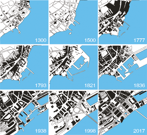
“It was second only to Edinburgh in terms of commercial prosperity during the medieval period, and has continued through the heyday of jute, jam and journalism to today.”

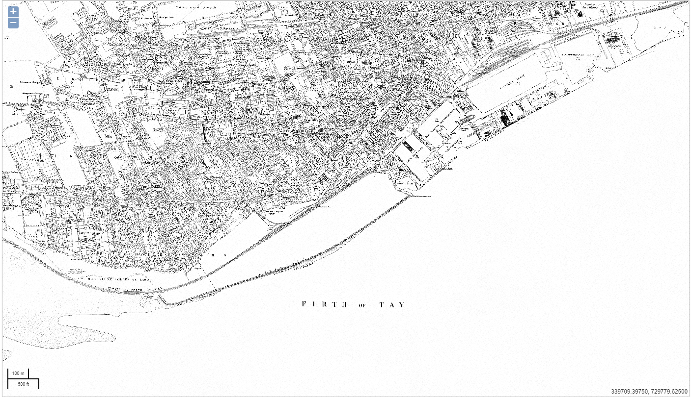
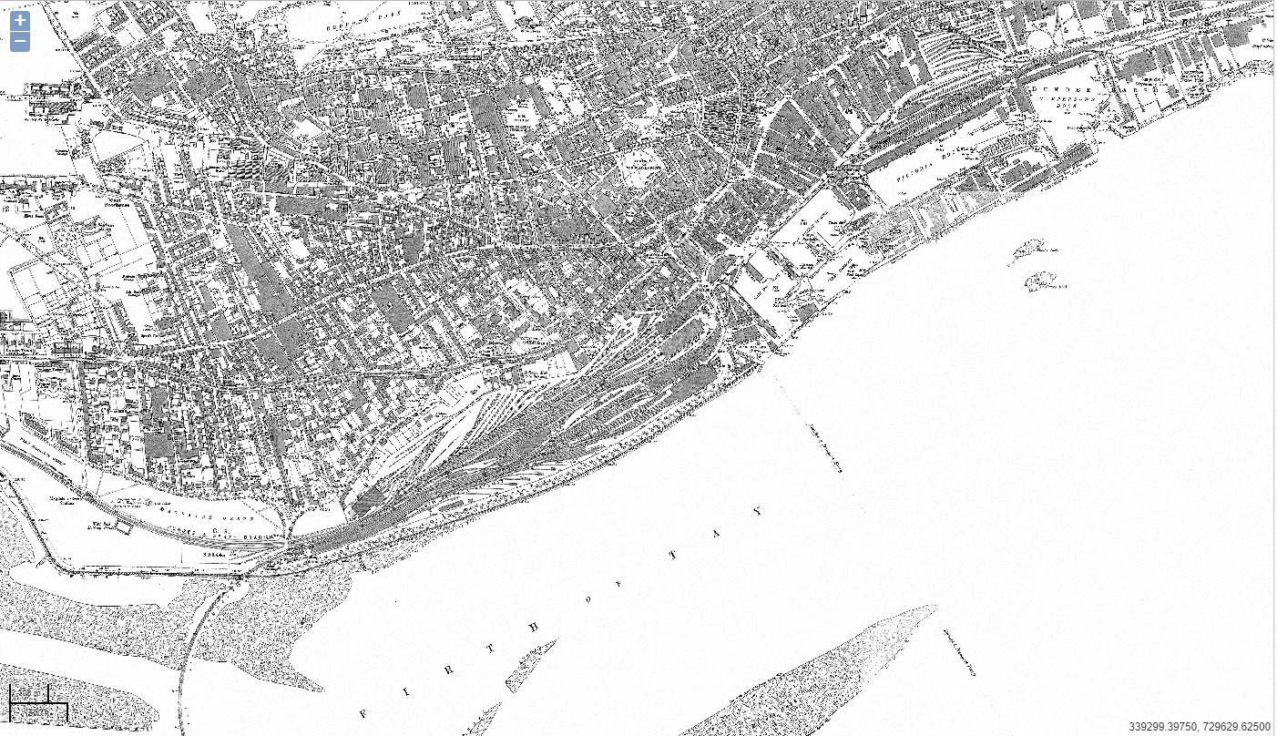
Among the collection are maps that show just how quickly railway lines came to dominate the area directly west of the V&A.

One, dated 1881, shows little train infrastructure, however just 22 years later it was a defining feature.

A map of the waterfront in 1881. Picture courtesy of Registers of Scotland.

One significant addition was the Tay Bridge. Just two years prior to the 1881 map, the original crossing collapsed in high winds. However, by 1887 the new bridge was built and operational.

Map from 1903. Courtesy of Registers of Scotland.

The maps also show how the area has grown over the years. The earliest harbour is thought to have been at the junction of Gellalty Street and Seagate.

Where the first dock was within the context of how the waterfront is today. Courtesy of Registers of Scotland.

The report notes: “A quick glance at the map shows just how far this is from the current waterfront, a testament to the scale of change engineered by reclaiming land.”

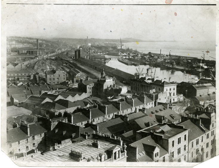
The harbour of today began to take shape by the 19th Century, including Victoria Dock and Camperdown Dock.

Dundee’s waterfront, with the Royal Arch and Earl Grey Dock in view circa 1949.
View of Dundee from St Pauls, November 3 1925.<br />H260 1925-11-03 View from St Pauls (C)DCT<br />Dundonian.

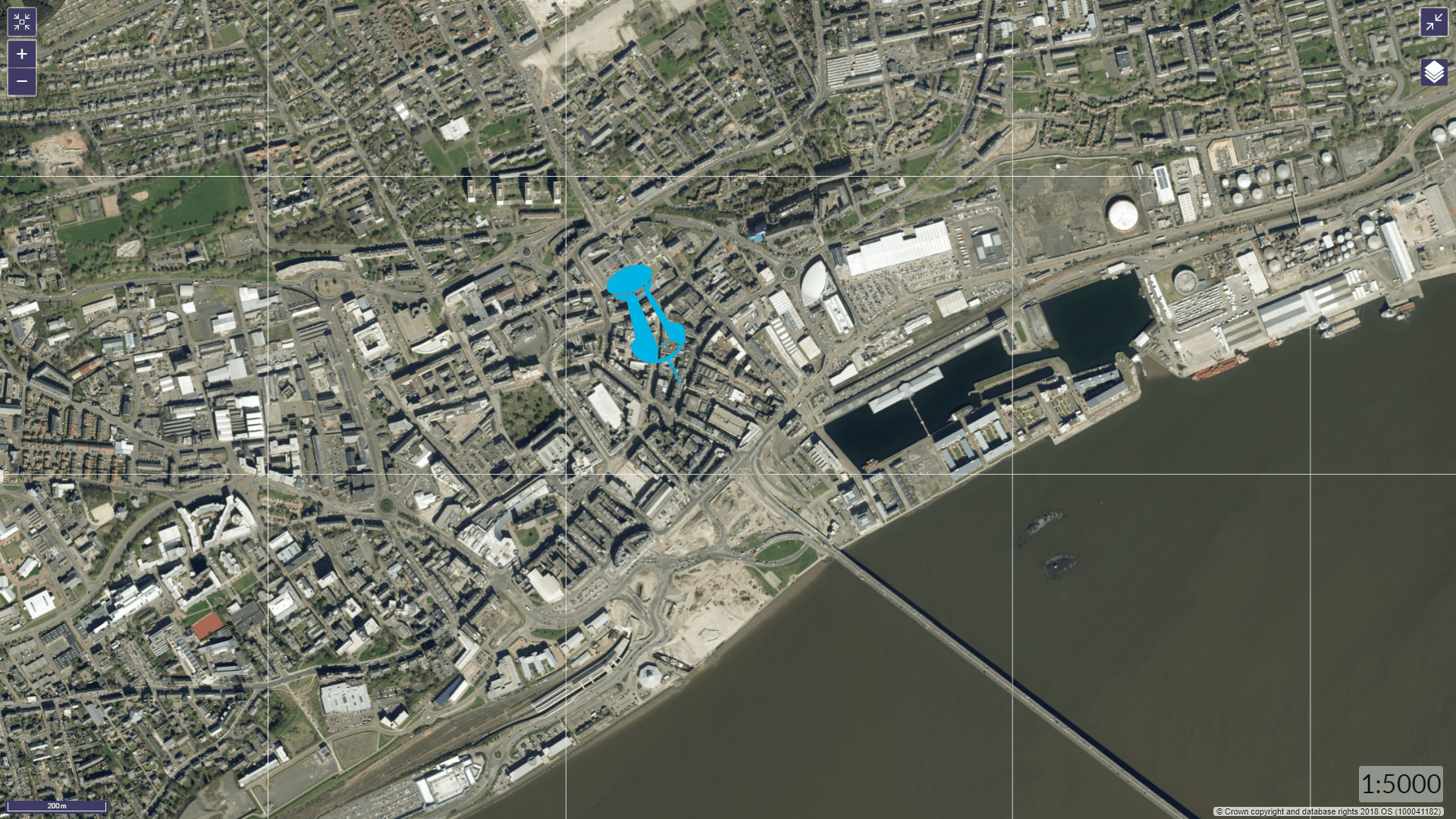
The land that the V&A is built on was acquired by the council from the Crown Estate.

The westernmost part of the site used to be Craig Harbour, built in 1821 by Thomas Telford to house the Tay Ferries to Newport and filled in to allow the museum to be built.

In a short space of time railways quickly overcame the waterfront area. Courtesy of Registers of Scotland.

In leasing the land, the Crown included provisions to ensure the site provides a “long-term benefit” for the people of Dundee.

Dundee waterfront,<br />22/3/1990.

In the agreement, the site is permitted for “no use other than the operation of a museum, with normally free entry to the general public, except for special exhibitions and events”, according to the Registers of Scotland.

The group look after 20 of Scotland’s land and property registers, including the centuries-old General Register of Sasines.