Calendar An icon of a desk calendar. Cancel An icon of a circle with a diagonal line across. Caret An icon of a block arrow pointing to the right. Email An icon of a paper envelope. Facebook An icon of the Facebook "f" mark. Google An icon of the Google "G" mark. Linked In An icon of the Linked In "in" mark. Logout An icon representing logout. Profile An icon that resembles human head and shoulders. Telephone An icon of a traditional telephone receiver. Tick An icon of a tick mark. Is Public An icon of a human eye and eyelashes. Is Not Public An icon of a human eye and eyelashes with a diagonal line through it. Pause Icon A two-lined pause icon for stopping interactions. Quote Mark A opening quote mark. Quote Mark A closing quote mark. Arrow An icon of an arrow. Folder An icon of a paper folder. Breaking An icon of an exclamation mark on a circular background. Camera An icon of a digital camera. Caret An icon of a caret arrow. Clock An icon of a clock face. Close An icon of the an X shape. Close Icon An icon used to represent where to interact to collapse or dismiss a component Comment An icon of a speech bubble. Comments An icon of a speech bubble, denoting user comments. Comments An icon of a speech bubble, denoting user comments. Ellipsis An icon of 3 horizontal dots. Envelope An icon of a paper envelope. Facebook An icon of a facebook f logo. Camera An icon of a digital camera. Home An icon of a house. Instagram An icon of the Instagram logo. LinkedIn An icon of the LinkedIn logo. Magnifying Glass An icon of a magnifying glass. Search Icon A magnifying glass icon that is used to represent the function of searching. Menu An icon of 3 horizontal lines. Hamburger Menu Icon An icon used to represent a collapsed menu. Next An icon of an arrow pointing to the right. Notice An explanation mark centred inside a circle. Previous An icon of an arrow pointing to the left. Rating An icon of a star. Tag An icon of a tag. Twitter An icon of the Twitter logo. Video Camera An icon of a video camera shape. Speech Bubble Icon A icon displaying a speech bubble WhatsApp An icon of the WhatsApp logo. Information An icon of an information logo. Plus A mathematical 'plus' symbol. Duration An icon indicating Time. Success Tick An icon of a green tick. Success Tick Timeout An icon of a greyed out success tick. Loading Spinner An icon of a loading spinner. Facebook Messenger An icon of the facebook messenger app logo. Facebook An icon of a facebook f logo. Facebook Messenger An icon of the Twitter app logo. LinkedIn An icon of the LinkedIn logo. WhatsApp Messenger An icon of the Whatsapp messenger app logo. Email An icon of an mail envelope. Copy link A decentered black square over a white square.

Mapping the City: National Library map curator to talk about Dundee’s history

A map of Dundee from 1794.

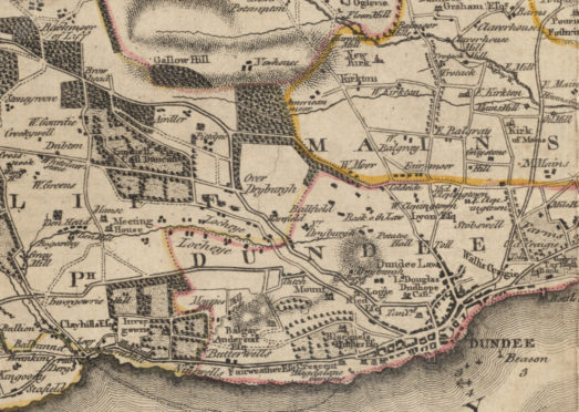
The story of Dundee will be told through its historic maps in an event led by the National Library of Scotland this week.

Map curator Chris Fleet will use the documents to illustrate how the city — and the lives of its residents — has changed over the centuries.

The Dundee: Mapping the City event, organised by Dundee Civic Trust, will feature maps dating as far back as the 14th Century and right through to the 20th Century.

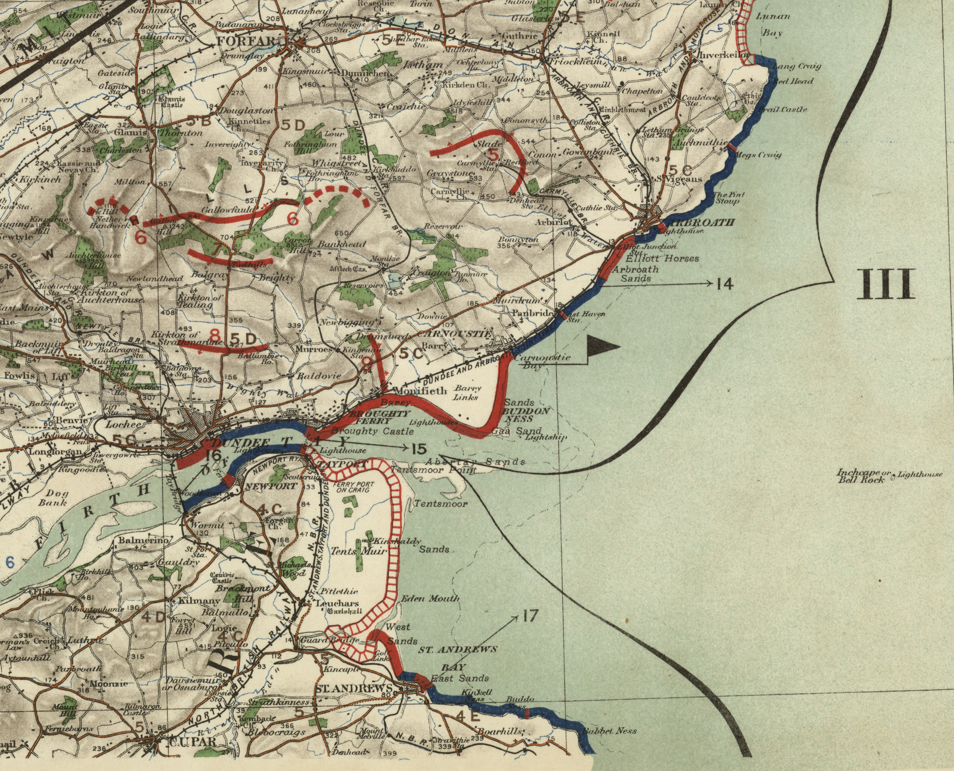
One military map from 1907 will even highlight the risks of a seaborne invasion on the Tay.

A map of the city drawn up by Charles Edward in 1846.

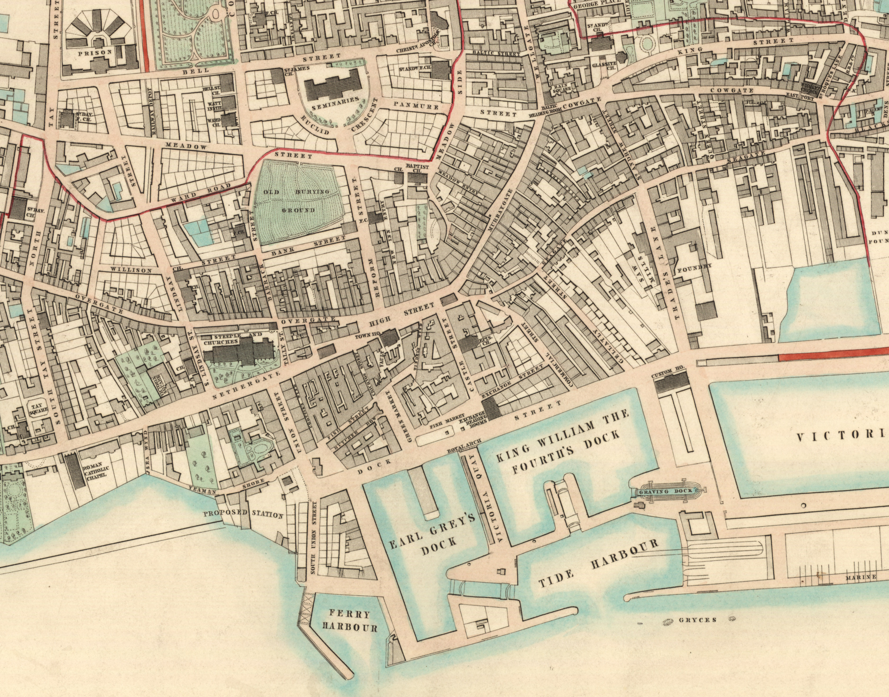
Mr Fleet is responsible for the National Library’s map archive, where hundreds of plans of Dundee can be viewed online.

His latest book, Scotland: Defending the Nation, includes military maps spanning five centuries.

Mr Fleet said: “There are few documentary sources as immediate, captivating and rich as maps in providing insights into the history of Dundee.

“At a simple level they offer us a basic graphic impression of the place at a point in time, but they can be interpreted at many deeper levels too.

Chris Fleet, map curator at the Collections and Research Department in the National Library of Scotland.

“As we jump through time with these maps, we don’t just see graphic illustrations of the nature of the town, but also the perspectives of the different map-makers and their historical context.”

Mr Fleet said shifting priorities over time resulted in the creation of maps for many different reasons, including for navigation and trade, transportation, civic improvements and urban regeneration.

“These different perspectives resulted in very different styles and content to the mapping,” he added.

A 1907 military map showing the risks of an invasion.

“We should not underestimate the value of maps in forming real impressions of Dundee, especially impressions in the past.

“Maps are all around us today, but before the 18th Century, they were relatively rare documents and therefore they would have had a much more profound influence on their readers, very much creating the image people held in their minds of the city.”

Dundee Civic Trust spokesman Roderick Stewart said the group was looking forward to a good attendance at the event and was always keen to attract new blood.

He said: “Dundee Civic Trust promotes the protection and conservation of Dundee’s historic environment as well as supporting new developments which improve the local environment.

“A strong membership is essential to give the trust the necessary credibility. New members are always welcome.”

The talk will take place on Thursday January 17 at 7pm in the Dundee Arts Society base at 17 Roseangle.