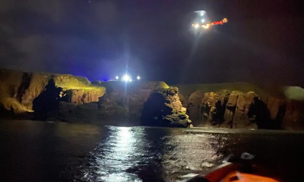
The growing threat of climate change has put the Angus and the Mearns coastline at the heart of a new multi-million flood warning scheme.
More than 169,000 homes and businesses in Scotland are now estimated to be at risk of flooding by 2080, prompting the Scottish Environment Protection Agency (SEPA) to establish 19 new warning schemes.
Of those, 11 will cover Orkney and another eight will stretch along the north-east and Angus coast, including Stonehaven, Inverbervie, St Cyrus and Montrose.
The new flood warning areas will extend SEPA’s Floodline service to include almost the whole of the east coast of Scotland and an additional 2,589 properties.
Householders in the affected areas will be issued with advanced notice to help prepare communities for the impact of coastal flooding.
Environment Secretary Roseanna Cunningham said: “Scotland’s climate is changing, and this means extreme weather events, including floods, are expected to occur more frequently in the years ahead.
“The Scottish Government realises that it’s vital that we work alongside partners like SEPA and local authorities, to do everything in our powers to improve resilience against issues like flooding, in some of our most vulnerable communities.
“We have committed £420 million over 10 years to protect homes in many of Scotland’s most flood-prone communities, in places like the Orkneys, and North East of Scotland.
“We know that we can’t control the weather, but we can change how we respond to it. These coastal flood warning schemes provide an invaluable tool for doing that.”
The North Sea has crept 70 metres closer to Montrose Links over the past 30 years and the championship course has already been altered to take account of recent devastation.
The town was singled out as an example of the threat of climate change and coastal erosion arising from storm surges and rising sea levels in a study carried out by the Climate Coalition in February.
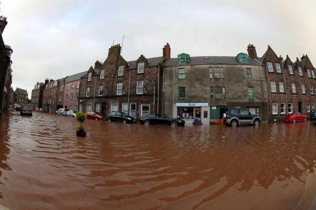
Storm Frank swept the country on December 30 2015, bringing torrential rain that flooded homes and destroyed roads across Angus and Aberdeenshire.
The main access to the village of Catterline was covered by a landslide after one particularly heavy spell of rain.
Stonehaven narrowly avoided serious damage as the water level on the River Carron remained just below the town’s flood defences.
The seaside town was badly hit by flooding in 2009 and 2012 when a number of properties were damaged after the river burst its banks.
Vincent Fitzsimons, head of Hydrology and Flooding Services at SEPA, said: “Scotland needs to be prepared more powerfully for weather extremes and rising sea levels, which as we know, is only ever-increasing as a result of climate change.
“As sea levels rise all around the UK coastline, it brings with it the risk of coastal erosion and more frequent flooding for Scotland’s exposed coastal communities.”