Calendar An icon of a desk calendar. Cancel An icon of a circle with a diagonal line across. Caret An icon of a block arrow pointing to the right. Email An icon of a paper envelope. Facebook An icon of the Facebook "f" mark. Google An icon of the Google "G" mark. Linked In An icon of the Linked In "in" mark. Logout An icon representing logout. Profile An icon that resembles human head and shoulders. Telephone An icon of a traditional telephone receiver. Tick An icon of a tick mark. Is Public An icon of a human eye and eyelashes. Is Not Public An icon of a human eye and eyelashes with a diagonal line through it. Pause Icon A two-lined pause icon for stopping interactions. Quote Mark A opening quote mark. Quote Mark A closing quote mark. Arrow An icon of an arrow. Folder An icon of a paper folder. Breaking An icon of an exclamation mark on a circular background. Camera An icon of a digital camera. Caret An icon of a caret arrow. Clock An icon of a clock face. Close An icon of the an X shape. Close Icon An icon used to represent where to interact to collapse or dismiss a component Comment An icon of a speech bubble. Comments An icon of a speech bubble, denoting user comments. Comments An icon of a speech bubble, denoting user comments. Ellipsis An icon of 3 horizontal dots. Envelope An icon of a paper envelope. Facebook An icon of a facebook f logo. Camera An icon of a digital camera. Home An icon of a house. Instagram An icon of the Instagram logo. LinkedIn An icon of the LinkedIn logo. Magnifying Glass An icon of a magnifying glass. Search Icon A magnifying glass icon that is used to represent the function of searching. Menu An icon of 3 horizontal lines. Hamburger Menu Icon An icon used to represent a collapsed menu. Next An icon of an arrow pointing to the right. Notice An explanation mark centred inside a circle. Previous An icon of an arrow pointing to the left. Rating An icon of a star. Tag An icon of a tag. Twitter An icon of the Twitter logo. Video Camera An icon of a video camera shape. Speech Bubble Icon A icon displaying a speech bubble WhatsApp An icon of the WhatsApp logo. Information An icon of an information logo. Plus A mathematical 'plus' symbol. Duration An icon indicating Time. Success Tick An icon of a green tick. Success Tick Timeout An icon of a greyed out success tick. Loading Spinner An icon of a loading spinner. Facebook Messenger An icon of the facebook messenger app logo. Facebook An icon of a facebook f logo. Facebook Messenger An icon of the Twitter app logo. LinkedIn An icon of the LinkedIn logo. WhatsApp Messenger An icon of the Whatsapp messenger app logo. Email An icon of an mail envelope. Copy link A decentered black square over a white square.

Flood alerts and weather warnings in place as Tayside and Fife prepares for thunderstorms

Locals across Tayside and Fife have been told to brace for thunderstorms and flooding on Tuesday evening.

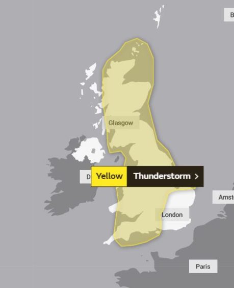
The Met Office has issued a yellow warning for thunderstorms across all of Courier country.

Heavy rain and thunderstorms are expected to bring flooding to Courier country.

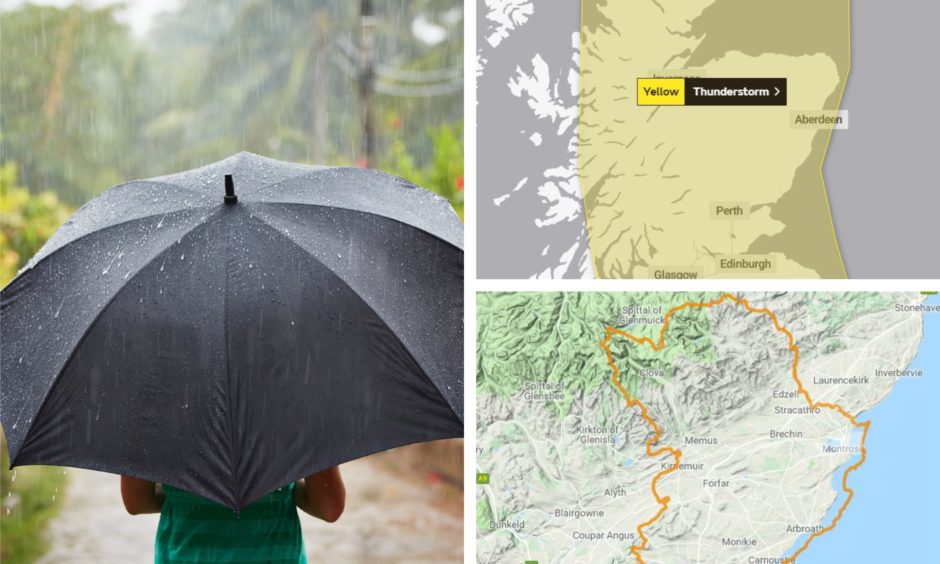
It will be in place in most of Scotland and much of England and Wales between 6pm tonight and 9am tomorrow.

And on Tuesday afternoon the Scottish Environment Protection Agency (Sepa) issued flood alerts for Dundee, Angus and Fife.

The organisation said urban areas and the transport network will be most at risk from the heavy rainfall.

Though the worst of the downpour is expected to be “localised”, Sepa says rivers could overflow and low-lying land and roads could also be affected.

The flood alerts for Dundee, Angus and Fife read: “A flood alert has been issued for Dundee and Angus.

“Thunderstorms are expected across Scotland from midnight on Tuesday and through Wednesday morning, which could cause flooding impacts in this Flood Alert Area.

“However, the heaviest showers will be localised, so not all areas will be affected. The greatest risk is if these occur over urban areas and the transport network, which could see flooding from surface water.

“This could include flooding to low-lying land and roads, difficult driving conditions and flooding of properties.

“There is also a risk of localised flooding from small or fast-responding rivers should the heaviest showers occur over these areas.”

The Met Office says scattered thunderstorms are expected to affect parts of south-west and southern England this evening, moving north quickly across the UK overnight, clearing Scotland and eastern England by mid-morning on Wednesday.

The warning says: “Although some places will miss the thunderstorms altogether, where they do occur there is the potential for frequent lightning, hail and gusty winds, as well as sudden downpours in a few places.”

It adds: “Scattered thunderstorms moving north tonight and early Wednesday could lead to some power cuts and travel delays.

“There is a slight chance that power cuts could occur and other services to some homes and businesses could be lost.

“There is a small chance of damage to property from lightning strikes, hail or strong winds.

“There is a small chance of a few homes and businesses likely, leading to some damage to buildings or structures.”

“There is a small chance driving conditions will be affected by spray, standing water and/or hail, leading to longer journey times by car and bus.”