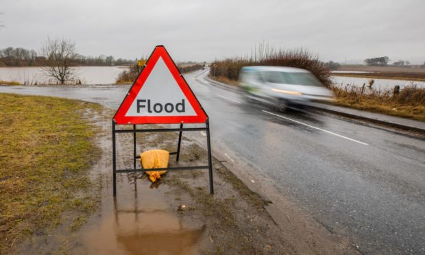
Perthshire roads have been forced to close due to flooding caused by rising river levels – with major trunk routes also affected.
Heavy rain and melting snow combined to cause chaos for drivers in parts of Tayside from Friday into Saturday.
And river levels are expected to remain high throughout the day, with further rain forecast.
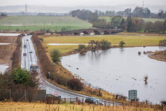
The B846 Aberfeldy to Weem road was closed due to flooding on Saturday after the River Tay burst its banks.
The B984 Meikleour to Coupar Angus route was also shut due to water from the surging River Isla.
The B846 Aberfeldy to Weem road is closed due to flooding from the River Tay. The A984 Bendochy to Meikleour Road is also closed due to flooding from River Isla
— Perth & Kinross Council (@PerthandKinross) February 20, 2021
Elsewhere, on Friday night police told motorists to “avoid” the A923 Blairgowrie to Coupar Angus road due to flooding. This was also due to the River Isla overflowing.
Perth and Kinross Council said: “The A923 Coupar Angus to Blairgowrie Road has been closed due to flooding from the River Isla.”
The B954 Alyth to Meigle road was also closed due to the deluge.
Flooding A923 Cupar Angus, Perthshire.
Police Scotland would like to advise motorists of flooding on the A923 between Coupar Angus and Blairgowire, Perthshire. It is advised that the road is avoided if possible. pic.twitter.com/G2NCHjqV7a
— Tayside Police (@TaysidePolice) February 20, 2021
The A923 Coupar Angus to Blairgowrie Road has been closed due to flooding from the River Isla
— Perth & Kinross Council (@PerthandKinross) February 20, 2021
A9, A85 and A84
The A84 Lochearnhead to Kilmahog road on the western fringes of Perthshire was totally closed on Saturday at about 12.30pm following major flooding.
Traffic Scotland posted: “The A84 is closed in both directions between Lochearnhead and Kilmahog due to flooding.
“Road users should should follow the signed diversion route and expect longer than normal journey times.”
Traffic Scotland put out a warning on two major Perthshire trunk roads.
The A85 between Perth and St Fillans was hit by flooding on Friday evening but is said to be “passable with care”.
The A9 Perth to Inverness road was restricted northbound near Dunkeld due to flooding on Friday evening.
Traffic Scotland posted: “The A9 northbound at the A822 Dunkeld is currently restricted due to flooding affecting the carriageway.
“Road users should exercise caution on approach.”
The rivers Isla, Earn, Lyon,the upper Tay and the South Esk are among those which surged as a result of the weather conditions.
Milder temperatures have moved into Scotland following a prolonged spell of sub-zero conditions which brought chaos to the area.
Flood warnings
The Scottish Environment Protection Agency (Sepa) has issued 20 flood warnings covering Perthshire and Angus.
They span the following areas:
- The River Isla at Coupar Angus
- Upper Tay
- Pitlochry to Ballinluig
- Logierait to Jubilee Bridge
- Kenmore
- Kemphill to Bridge of Isla
- Innerpeffray to Bridge of Earn
- Glen Lyon
- Crieff to Innerpeffray
- Carse of Lennoch to Lochlane
- Bridge of Ruthven to Leitfie
- Bridge of Earn to the River Tay
- Blairgowrie to the River Isla
- Ballinluig to Logierait
- Almondbank
- Aberbothrie
- Kinnaird/Bridge of Dun
- Finavon and Tannadice
- Callander to Stirling
- Callander
A yellow Met Office rain warning covering Perthshire and Angus is in place from noon on Saturday until 3am on Sunday.