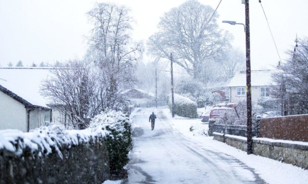
Almost 1ft of snow could land in parts of Scotland later this week as forecasters warn of the return of freezing conditions.
A Met Office yellow warning will come into effect across almost all of Tayside and Fife from Wednesday at 5am until Thursday at 9pm.
Locally, only Dundee and the Angus and Fife coasts fall outwith the danger zone highlighted by the forecaster.
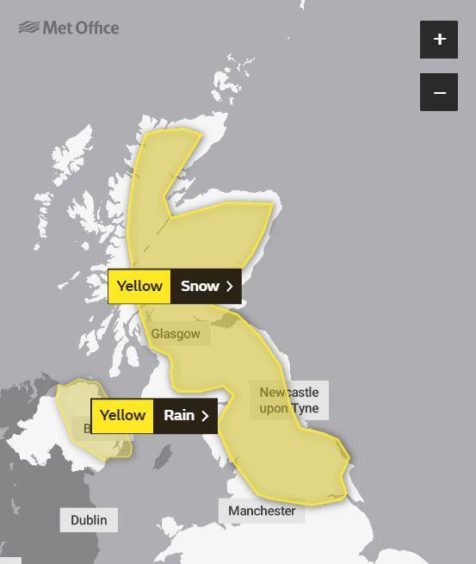
The snow warning states that up to 11in of snow is possible in the highest regions, with about 2in possible at the lowest levels.
A Met Office statement reads: “An area of rain pushing north-eastwards is expected to increasingly fall as snow, at least for a time, as it encounters colder air across Scotland and parts of northern England.
“Heavier snowfall is more likely above 150m (492ft), where 5-15cm (1.9in-5.9in) of snow may accumulate, and possibly as much as 30cm (11.8in) of snow in a few locations.
“At lower levels 2-5 cm (0.8in-1.9in) may accumulate but there remains a possibility that milder air makes more inroads, with the snow turning back to rain more widely, in this case snowfall would largely be restricted to the highest ground.
“A brief period of freezing rain, which would bring areas of ice, is possible in the western, especially south-western, part of the warning area on Wednesday morning.”
Will there be further #rain and #snow in places this week?
Here is the week ahead forecast with all the details 👇 pic.twitter.com/0YyKP2NFu8
— Met Office (@metoffice) January 11, 2021
A Met Office ice warning will also be in place from 3pm on Monday until 11am on Tuesday.
Accidents and injuries are possible as rain and snow clears overnight, prompting a “rapid freeze”. The forecaster said ice will become “widespread over northern Scotland from around dusk”.
Is a 2021 ‘Big Freeze’ possible?
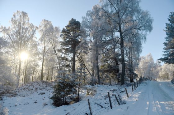
It comes after sub-zero temperatures brought sheet ice to roads and pavements across Tayside and Fife last week.
It was so chilly that ice hockey fan Ben Stark, 9, managed to practise his skating outside his home in Inchture – while in Dundee local figure-skaters took to a frozen stretch of water in Caird Park.
The freezing conditions don’t look likely to subside any time soon, with forecasters warning of the coldest January in nine years in Scotland.
Last week’s weather fuelled speculation of another big freeze in Scotland similar to the Beast from the East in 2018.
A sudden stratospheric warming event has taken place; however forecasters are still unsure if it will lead to an enduring cold spell.
Last week Met Office spokesman Oli Claydon said: “What has caused people to get a bit excited is the sudden stratospheric warming event, which is what caused the so-called Beast from the East in 2018.”
He added that the outcome is “uncertain”, and that such events do not always lead to long spells of cold weather.
Mr Claydon said: “That has happened but what that means is uncertain. In 2019 we had a sudden stratospheric warming event and saw record mild temperatures. It might be too far ahead to say at the moment.
“We know that sudden stratospheric warming event has happened. It can be two to three weeks or so to see any impact on the surface.”
However he added there is an “increasing likelihood of cold conditions”.