Calendar An icon of a desk calendar. Cancel An icon of a circle with a diagonal line across. Caret An icon of a block arrow pointing to the right. Email An icon of a paper envelope. Facebook An icon of the Facebook "f" mark. Google An icon of the Google "G" mark. Linked In An icon of the Linked In "in" mark. Logout An icon representing logout. Profile An icon that resembles human head and shoulders. Telephone An icon of a traditional telephone receiver. Tick An icon of a tick mark. Is Public An icon of a human eye and eyelashes. Is Not Public An icon of a human eye and eyelashes with a diagonal line through it. Pause Icon A two-lined pause icon for stopping interactions. Quote Mark A opening quote mark. Quote Mark A closing quote mark. Arrow An icon of an arrow. Folder An icon of a paper folder. Breaking An icon of an exclamation mark on a circular background. Camera An icon of a digital camera. Caret An icon of a caret arrow. Clock An icon of a clock face. Close An icon of the an X shape. Close Icon An icon used to represent where to interact to collapse or dismiss a component Comment An icon of a speech bubble. Comments An icon of a speech bubble, denoting user comments. Comments An icon of a speech bubble, denoting user comments. Ellipsis An icon of 3 horizontal dots. Envelope An icon of a paper envelope. Facebook An icon of a facebook f logo. Camera An icon of a digital camera. Home An icon of a house. Instagram An icon of the Instagram logo. LinkedIn An icon of the LinkedIn logo. Magnifying Glass An icon of a magnifying glass. Search Icon A magnifying glass icon that is used to represent the function of searching. Menu An icon of 3 horizontal lines. Hamburger Menu Icon An icon used to represent a collapsed menu. Next An icon of an arrow pointing to the right. Notice An explanation mark centred inside a circle. Previous An icon of an arrow pointing to the left. Rating An icon of a star. Tag An icon of a tag. Twitter An icon of the Twitter logo. Video Camera An icon of a video camera shape. Speech Bubble Icon A icon displaying a speech bubble WhatsApp An icon of the WhatsApp logo. Information An icon of an information logo. Plus A mathematical 'plus' symbol. Duration An icon indicating Time. Success Tick An icon of a green tick. Success Tick Timeout An icon of a greyed out success tick. Loading Spinner An icon of a loading spinner. Facebook Messenger An icon of the facebook messenger app logo. Facebook An icon of a facebook f logo. Facebook Messenger An icon of the Twitter app logo. LinkedIn An icon of the LinkedIn logo. WhatsApp Messenger An icon of the Whatsapp messenger app logo. Email An icon of an mail envelope. Copy link A decentered black square over a white square.

Met Office warns of “danger to life ” as it extends weather warning for Tayside and Fife

Stormy weather is predicted across Fife. Image: Supplied.

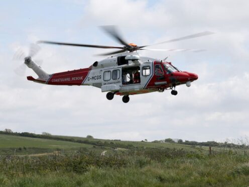
Forecasters have warned of “danger to life” as Scotland prepares to be battered by the remnants of a tropical storm.

Stormy weather from ex-Hurricane Ophelia will batter Scotland with winds of more than 70mph starting on Monday, with forecasters warning that Dundee and the surrounding area will be hit.

The Met Office has now extended its previous severe “yellow” weather warning for wind on Tayside and Fife. The stormy conditions are now expected from Monday into Tuesday afternoon.

Strathclyde, the Highlands, the Western Isles, The Borders, Lothian, Dumfries and Galloway are all subject to similar warnings.

The predicted path of the ex-hurricane has changed and will now affect parts of the east coast of Scotland and not the north-west.

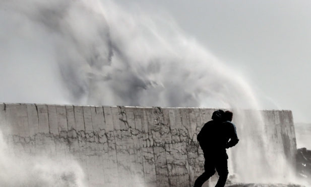
Forecasters have warned of travel disruption, 80mph winds, “danger to life” from flying debris and power cuts.

The worst of the weather in Courier Country is expected on Monday.

The Met Office said: “A spell of very windy weather is likely on Monday in association with ex-Ophelia.

“Road, rail, air and ferry services may be affected, with longer journeys times and cancellations possible.

“Power cuts may occur, with the potential to affect other services, such as mobile phone coverage.

“Some damage to buildings, such as tiles blown from roofs could happen, perhaps leading to injuries and danger to life from flying debris.

“Coastal routes, sea fronts and coastal communities may be affected by spray and/or large waves.

“The warning has been updated to extend the area at risk further east, taking in much of northern England and Wales along with parts of southern and central Scotland. At the same time, much of northwest Scotland has been removed.”

The Met Office’s chief forecaster added: “Very strong winds are forecast to affect most western and some central parts of the UK during Monday.

“These strong winds are forecast in association with the northward track of ex-Ophelia across or near to the west of the British Isles.

“Southerly winds are most likely to gust between 55 and 65 mph across much of the warning area with the potential for gusts of 80 mph in coastal areas, particularly on the eastern side of Northern Ireland.

“Please see separate amber warning for Northern Ireland. The very strong winds will probably extend to parts of northern England along with some southern and central parts of Scotland in the evening as winds veer more southwesterly across the whole warning area.

“Heavy rain is also possible in association with this system in parts of Northern Ireland and western Scotland.”