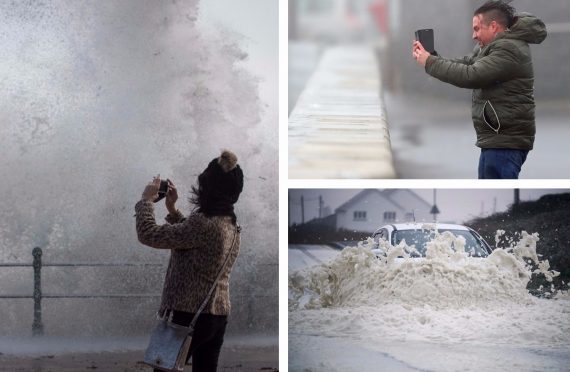
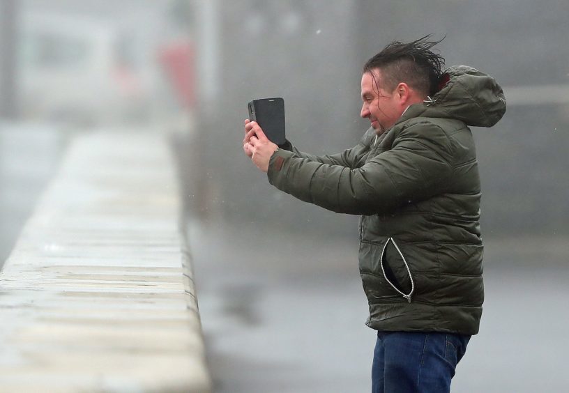
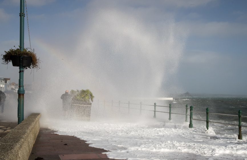
The deadly Storm Ophelia, which brought winds of almost 120mph to the Irish coast on Monday, is expected to die down as it moves into Tayside and Fife on Tuesday.
In Ireland the ex-hurricane led to the deaths of three people, left 360,000 without power, uprooted trees, blocked roads and tore off the roof of a primary school in the Douglas area of Cork.

Planes across the UK were forced to divert due to smoke and dust in the atmosphere, with flights from Scotland cancelled and ferry services called off at the last minute.
An Amber warning remains in place for south-west Scotland, Lothian, the Borders and Strathclyde until 11pm with the blustery conditions expected to continue into tomorrow afternoon.
Winds as strong as 80mph are forecast to batter the country bringing a “danger of life” from flying debris overnight.
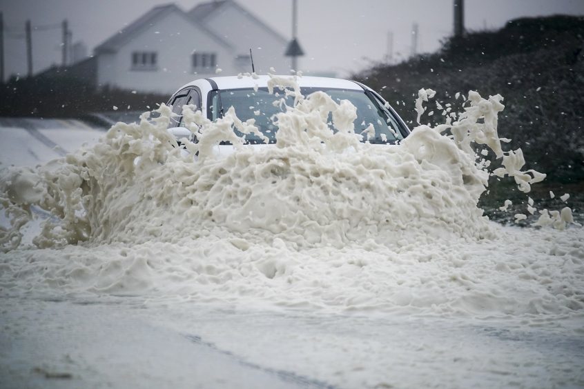
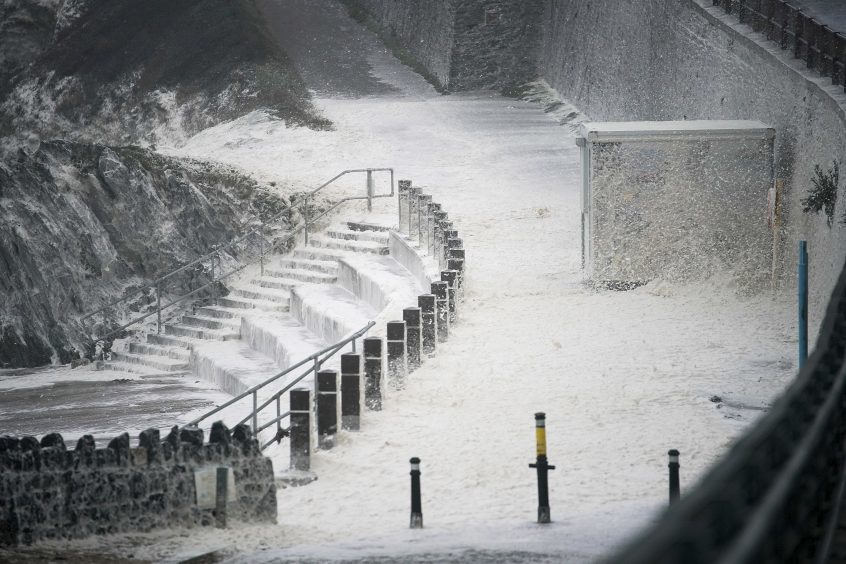
There are four flood alerts and a further 14 warnings put in place by the Scottish Environment Protection Agency (Sepa) across coastal regions vulnerable at high tide in Ayrshire, Arran and Dumfries and Galloway.
However the Met Office said the storm will be dying down on Tuesday morning as it makes its ways across the east coast into Tayside and Fife.
But spokesman for the forecasters, Grahame Madge, said winds of up 70mph could still batter the regions on Tuesday.
A yellow, or “severe”, weather warning for wind will remain in place for Tayside and Fife until 3pm on Tuesday with power cuts, travel disruption and building damage still possible.
Mr Madge said: “It has certainly passed to south-west Scotland and it (the centre) will start to cross Scotland before 9pm this evening.
“It will be affecting Scotland obviously overnight. Wind speeds are decreasing. The storm is losing some of its intensity, but it will still be a very powerful system.
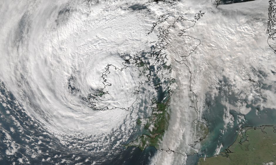
“It still will be a very powerful system and it has still got a lot of energy. It is going to be a system which is losing its energy. It has been all through the last 24 hours. You could still see gusts approaching 70mph across central parts of Scotland.”
He added that wind speeds will still be “very strong” in Courier Country, adding there is still a risk of “falling trees” and dangerous waves during high tides.
Mr Madge said: “This time tomorrow (late Tuesday afternoon) wind speeds will have dropped right down. It will have calmed down by then.”
UPDATED FORECAST HERE.
The Met Office’s chief forecaster said: “Very strong winds are forecast to continue to affect some parts of the UK during Tuesday.
“Southwesterly winds are most likely to gust between 50 and 60 mph across much of the warning area with the potential for gusts of 70 mph across the Central Belt of Scotland and parts of north-east England.
“Although the strongest winds are likely overnight they may last into the morning’s busy travel period across the Central Belt of Scotland and more especially north-east England.
“The worst of the winds should ease from Northern Ireland and northwest Wales in the early hours of Tuesday and from eastern areas of Scotland and northern England by early afternoon.”
Flybe was forced to cancel 170 flights throughout the day, with RyanAir calling off about 90 journeys. Belfast International Airport had to cancel 24 flights.
Journeys from Aberdeen, Edinburgh, Glasgow and Inverness to Belfast were among those affected.
A Flybe spokeswoman said: “As a result of adverse and resultant atmospheric weather conditions impacting normal operations due to Storm Ophelia today, Flybe has been forced to cancel some 170 flights, the full list of which is available at www.flybe.com/flight-info.
“This included all flights to and from Belfast City Airport, Scotland and the Channel Islands and the majority of its flights to and from Southampton this afternoon and evening.
“The safety of its passengers and crew is Flybe’s number one priority and the airline will, as always, do everything possible to minimise any disruption.
“Customers are asked to continue to check the airline’s ‘live’ flight information for the latest updates and can also use this link to rebook or receive a refund.
“Current plans are to operate a normal schedule tomorrow across the network.”
A Scottish Government Resilience meeting also took place as the country prepares to be battered by Ophelia.
Traffic Scotland has warned motorists to prepare for “high wind restrictions for major structures on the trunk road network” across the country.
A Scottish Government Resilience meeting also took place yesterday as the country prepared to be battered by Ophelia.
Traffic Scotland has warned motorists to prepare for “high wind restrictions for major structures on the trunk road network” across the country.
Scottish transport minister, SNP MSP Humza Yousaf, said: “The Met Office is telling us southwest Scotland in particular is going to see some difficult weather today and into tomorrow as a result of ex-Hurricane Ophelia. More generally, the whole of the west coast can expect some blustery conditions.
“The strongest winds are expected to reach southwest Scotland from around late afternoon and they will peak during the evening. Gusts of 55-65mph are expected quite widely, with gusts 80mph likely in places.
“The conditions are leading to transport disruption and we are urging people to take the weather into account if they are planning to travel.
“On the roads, there is the potential for disruption, especially on bridges and we people should check the latest information before they set-off, drive to the conditions and follow police advice.”