Calendar An icon of a desk calendar. Cancel An icon of a circle with a diagonal line across. Caret An icon of a block arrow pointing to the right. Email An icon of a paper envelope. Facebook An icon of the Facebook "f" mark. Google An icon of the Google "G" mark. Linked In An icon of the Linked In "in" mark. Logout An icon representing logout. Profile An icon that resembles human head and shoulders. Telephone An icon of a traditional telephone receiver. Tick An icon of a tick mark. Is Public An icon of a human eye and eyelashes. Is Not Public An icon of a human eye and eyelashes with a diagonal line through it. Pause Icon A two-lined pause icon for stopping interactions. Quote Mark A opening quote mark. Quote Mark A closing quote mark. Arrow An icon of an arrow. Folder An icon of a paper folder. Breaking An icon of an exclamation mark on a circular background. Camera An icon of a digital camera. Caret An icon of a caret arrow. Clock An icon of a clock face. Close An icon of the an X shape. Close Icon An icon used to represent where to interact to collapse or dismiss a component Comment An icon of a speech bubble. Comments An icon of a speech bubble, denoting user comments. Comments An icon of a speech bubble, denoting user comments. Ellipsis An icon of 3 horizontal dots. Envelope An icon of a paper envelope. Facebook An icon of a facebook f logo. Camera An icon of a digital camera. Home An icon of a house. Instagram An icon of the Instagram logo. LinkedIn An icon of the LinkedIn logo. Magnifying Glass An icon of a magnifying glass. Search Icon A magnifying glass icon that is used to represent the function of searching. Menu An icon of 3 horizontal lines. Hamburger Menu Icon An icon used to represent a collapsed menu. Next An icon of an arrow pointing to the right. Notice An explanation mark centred inside a circle. Previous An icon of an arrow pointing to the left. Rating An icon of a star. Tag An icon of a tag. Twitter An icon of the Twitter logo. Video Camera An icon of a video camera shape. Speech Bubble Icon A icon displaying a speech bubble WhatsApp An icon of the WhatsApp logo. Information An icon of an information logo. Plus A mathematical 'plus' symbol. Duration An icon indicating Time. Success Tick An icon of a green tick. Success Tick Timeout An icon of a greyed out success tick. Loading Spinner An icon of a loading spinner. Facebook Messenger An icon of the facebook messenger app logo. Facebook An icon of a facebook f logo. Facebook Messenger An icon of the Twitter app logo. LinkedIn An icon of the LinkedIn logo. WhatsApp Messenger An icon of the Whatsapp messenger app logo. Email An icon of an mail envelope. Copy link A decentered black square over a white square.

Storm Callum approaches: Scotland to be battered by 80mph wind and torrential rain…but locals could avoid worst

Tayside and Fife could avoid the worst of Storm Callum, which is predicted to batter much of Scotland with 80mph wind and torrential rain in the coming days.

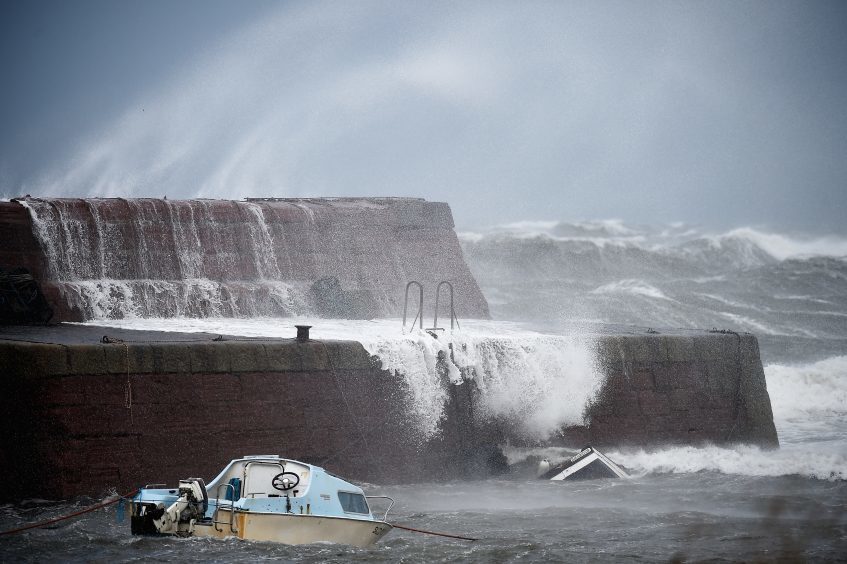
Widespread travel disruption and flooding is predicted across the country as conditions deteriorate from Thursday into Friday morning, with a series of Met Office weather warnings already in force.

Storm Callum is expected in the coming days.

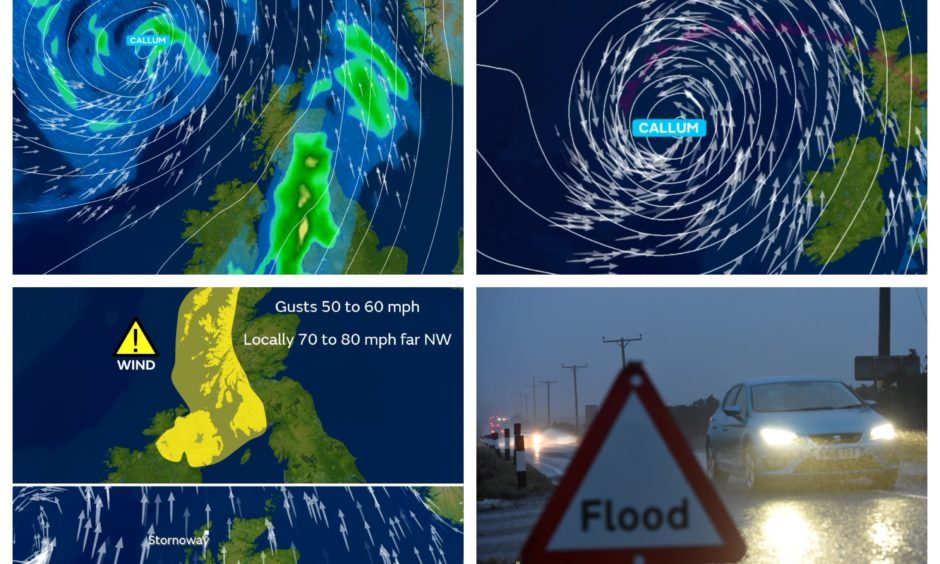
A Met Office yellow warning for wind comes into place across much of the west coast between 3am and midnight on Friday – with a section of western Perthshire falling within the danger zone.

Storm Callum, which was named on Wednesday, will also bring with it a downpour of rain on Saturday – which could cause flooding across the local area.

However forecasters say Tayside and Fife may well dodge the worst of the windy conditions come Friday.

Met Office meteorologist  Greg Dewhurst said: “Storm Callum is coming from the middle of the Atlantic. It is developing through the course of Wednesday night and Thursday and working its way slowly towards us over the next 48 hours.

“It is going to be a big change to the nice weather we had on Wednesday. We’re likely to see the effects of Storm Callum coming in from Friday morning.”

He said western Scotland will be the worst hit on Friday, adding: “The rainfall aspect is likely across the whole of Scotland. Wind will be very strong. Picking up from 5am-6am on Friday, (parts of Scotland) could see gusts right through the day of 60mph, 70mph or 80mph.


>> Keep up to date with the latest news with The Courier newsletter


“80mph is most likely on the Western Isles through the afternoon and evening on Friday. There could be transport disruption to the air network, rail and roads.”

However Mr Dewhurst said locals in Tayside and Fife are “not going to escape fully”, adding: “People will be waking up for work or school and it is going to be a cloudy, wet start to the morning. It is quite a wet and windy day on Friday itself with outbreaks of rain.

“For Tayside and Fife on Friday there are no warnings in force but the rain is going to continue across the area right into Saturday. On Saturday the rain could become even heavier.

‘Heavy, persistent rain’ will bring weekend flood risk, claims forecaster in week’s THIRD weather warning

“We could see rainfall totals building up quite a lot, 40mm-50mm (1.6in-2in) over higher ground. The main concern we are worried about for the area is the amount of rainfall throughout Saturday itself. There could be localised flooding issues.”

It comes after the UK enjoyed unseasonably high temperatures on Wednesday with Northolt, London, reaching 24.6C.

In Scotland, 20.1C was recorded in Kinloss while the mercury rose to 17.8C at Strathallan Airfield and 17C in Dundee.

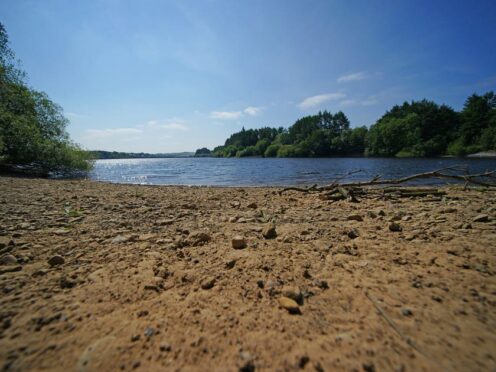
The average temperature for this time of year in the local area is between 11C and 13C.