Michael Alexander speaks to National Library of Scotland senior map curator Christopher Fleet about a forthcoming talk in Pitlochry about military maps.
There are over two million maps in the National Library of Scotland’s (NLS) map collection.
Many were inherited from the Advocates Library in Edinburgh which collected early maps and atlases from the 17th century – becoming the core of the collection when NLS was founded in 1925.
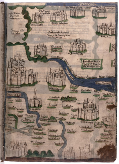
Many of the earliest maps that survive were drawn up on behalf of the church and had a reconnaissance, administrative, economic or resource interest for the wheels of state.
However, it’s the rich legacy of Scottish military maps over the last five centuries that NLS senior map curator Christopher Fleet will be specifically uncovering when he gives a Winter Words 2019 Literary Lunch session at Pitlochry Festival Theatre on February 17.
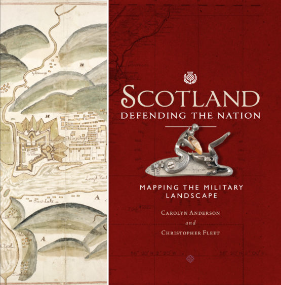
Yorkshire-born Chris, who has been with the NLS since 1994, recently co-authored the book Scotland: Defending The Nation.
And it’s the “hows, whys and who fors” of these military maps that the map digitisation expert will be delving into when he transcends 500 years of military mapping history – from the crude maps of the 15th and 16th centuries right up to modern Cold War-era times,
“The talk will be divided into four main themes,” said Christopher.
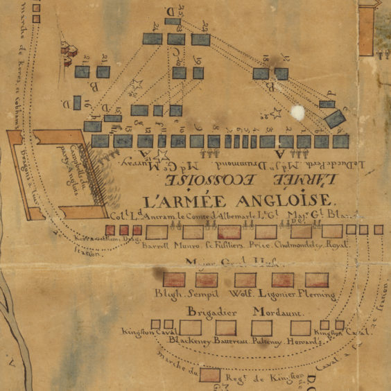
“The first is how Scotland’s enemies – the main attacking forces – change over time.
“From the 15th to the 17th century it was primarily England who were the main enemy.
“In the 18th century that switches very much to the Jacobites who are very much a threat within the Highlands of Scotland.
“Then it shifts by the late 18th century to France when France was planning an invasion during the Napoleonic wars.
“We then jump on to the 20th century and the threat of German attack during the Second World War, and then the Russians more recently.
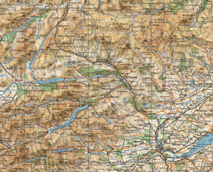
“Russian military mapping in the 1980s is some of the latest mapping in the book.
“The second theme of the talk is military technology. How canon balls have come and gone.
“They were very relevant until the 18th century then they were largely superceded by things like coastal defences, air defences and of course the nuclear age in the last half century has made a lot of those defences redundant as well.”
Christopher explained that the third theme in the talk will be how the geography of military activity in Scotland has changed over time.
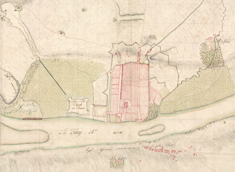
During the 16th century, the main focus of activity was very much on the borders – the southern ramparts of Scotland.
In the 18th century, after Culloden, there was a big shift to the Highlands – particularly to Inverness and the forts of the Great Glen.
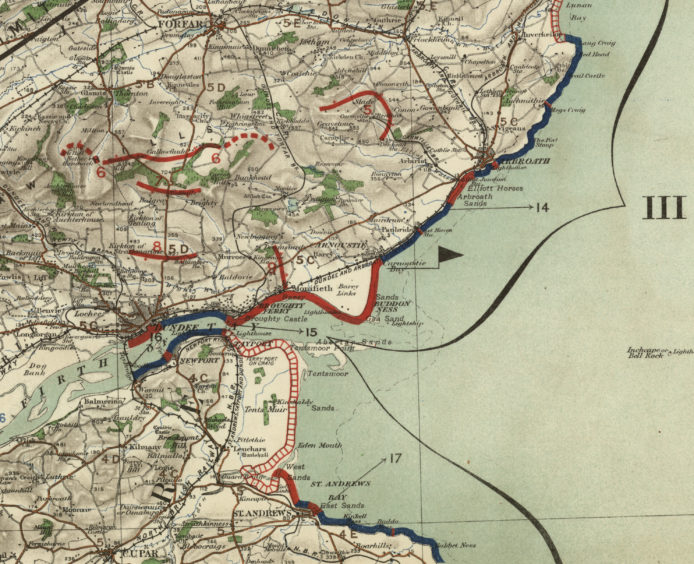
By the late 18th century that changes to the east coast which remains a major fortification zone from the Napoleonic wars right through to the Second World War.
“The fourth and final theme underlying all of these is how maps can kind of show more as well as less of the real world,” added Christopher.
“They show more in the sense that they are never a simple reflection of what was there at a point in time.
“Because of who made them and why they were made often show the bigger context to what was going on at the time.
“For example, the evacuation maps of 1939 give an insight into the broader history at the beginning of the Second World War.
“Something like the Harding map of the 1450s gives an insight into Harding’s main mission trying to encourage the then English king to attack Scotland which he was unsuccessful in persuading him to do.
“All of these maps consciously or unconsciously choose only certain things to be represented on the map.”
Of course all of these military maps, when they were made by military engineers for military purpose, highlight military features because that was the main purpose of them.
But they also often leave things out.
“It could be aspects of civilian life, it could be aspects of land ownership information, who lived where,” said Christopher.
“A lot of information we are used to seeing on standard modern maps were excluded from these military maps.
“Another exclusion is the whole issue of censorship – military maps often excluded things from everyday maps made for the man on the street. So this idea that maps can show more or less of the landscape is very important.”
*The Literary Lunch sessions for Winter Words 2019 at Pitlochry Festival Theatre, run at 12.45pm each day from February 14 to 17, and this year with a distinctly Scottish flavour. Each day of the festival a selection of speakers talk on their particular passion around a two-course lunch and a range of subjects, from nature to hillwalking, history and military with the lunches being of Scottish fayre.To book, call the Box Office team on 01796 484626 or go online at PitlochryFestivalTheatre.com