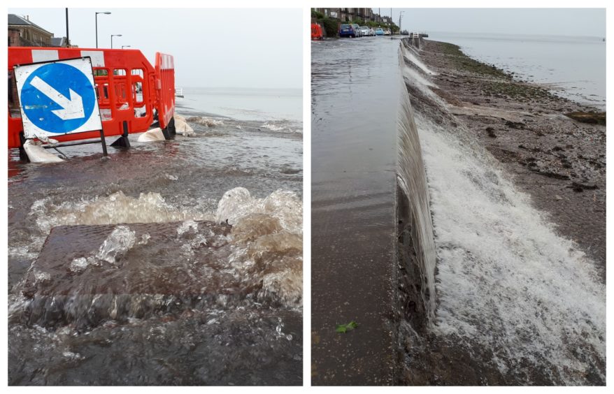
Locals are braced for further flooding after forecasters warned half a month’s worth of rain could batter Tayside and Fife on Friday.
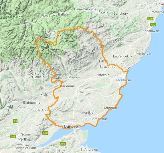
Two severe weather warnings are coming into effect across Courier country – along with flood alerts for Dundee, Angus, Fife, and Perth and Kinross – as the area prepares for three days of torrential rain, strong winds and thunderstorms.
Washout: Baxter Park event cancelled due to adverse weather for second year in a row

The Met Office says flooding is possible across the whole weekend with a yellow weather warning for rain in effect all day on Friday as a band of heavy rain pushes its way across Scotland.
Forecasters say the weather will cause travel chaos across the country, with power cuts and lightning strikes possible.
And Met Office meteorologist Becky Mitchell said some areas of Tayside and Fife will see an exceptional amount of rain during the worst of the weather on Friday.
She added: “There is a risk of flooding with heavy rain as you go through the next few days.
“Heavy rain is arriving from Friday morning. There is a risk more heavy rain is going to spread in from the south. There will be tricky travelling conditions on Friday morning.
“It will also be quite windy on higher routes so there is potential for disruption there with gusts of around 40mph in the morning. The winds will ease in the afternoon.
“Rain is continuing through the afternoon on Friday with 30mm-40mm of rain possible – half a month’s worth of rainfall. It is a cloudy and wet day.”
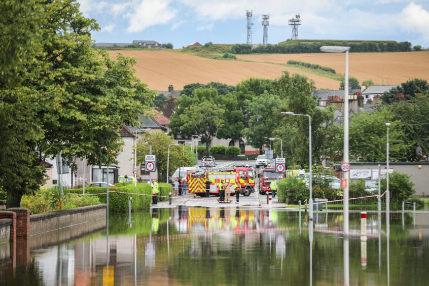
VIDEO: Residents rescued by boat as homes are evacuated in Fife flood chaos
Another Met Office yellow weather warning for thunderstorms will be in place from Saturday at midnight until Sunday at 6am with some of the downpours expected to be “torrential”.
Miss Mitchell added: “From the word go on Saturday morning there is a mixture of sunny spells and heavy thunderstorms and downpours.
“It looks like you’ll see some hail and some really dusty winds at times. They will be quite slow-moving, the showers. It looks like there will be up to another 30mm of rain in some locations.
“There will be further heavy showers throughout Saturday evening and overnight. Sunday daytime is fairly wet.”
The heavy rainfall hitting the UK is being caused by an area of low pressure which is moving across the country from the Atlantic, bringing with it humid air.
The Scottish Environment Protection Agency (Sepa) has also issued three flood alerts for Tayside and Fife.
It warns that homes, roads and low-lying land could be at risk from the rainfall and overflowing rivers.
The alert states: “A band of heavy, persistent rain will push northward through Friday. This may lead to localised flooding from surface water and smaller rivers.
“Built up areas and the transport network are at greater risk where possible impacts could include: flooding of low-lying land, roads, properties and disruption to travel throughout the day.
Heavy and thundery showers are likely to develop in the area throughout Saturday although not all places within the alert area will see them.
“Where these do occur this may lead to further localised flooding from surface water and smaller rivers.
“Built-up areas and the transport network are at greater risk where possible impacts could include: flooding of low-lying land, roads, properties and disruption to travel.
“Remain vigilant and remember, it is your responsibility to take actions which help protect yourself and your property.”