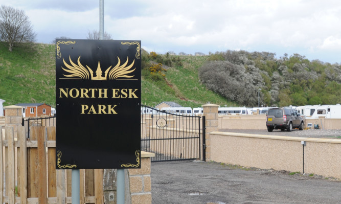
A shock new report claims that the unauthorised Travellers’ encampment in St Cyrus does not lie within a flood plain.
The risk of flooding was one of the main reasons that retrospective planning permission for the site was refused earlier this year.
However, a new report commissioned by the company behind the North Esk development, claims that a previous analysis overstated the flood risks at the site.
Consultants SLR were asked to undertake a new flood risk and drainage assessment by North Esk Investments Ltd who have submitted a new retrospective planning application for a 10-stance caravan park and touring site.
SLR’s analysis predicts that under current climate conditions the ‘post development’ site would remain free from flooding in response to a 1 in 200 year flooding event.
When the effects of climate change between 2025 and 2100 are added to the model then SLR find that “some limited flooding” can be expected in the most extreme conditions.
Their prediction shows the site would be “moderately affected” by flooding for three to four hours at the peak of a 1 in 200 year flood when climate change is taken into account. Other parts of the site will remain free from flooding.
The report recommends that residents at the touring site part of the encampment consider evacuation when there is a flood warning.
The permanent private parts of the site tend to be 60cm to 70cm above ground level and although the report still recommends that evacuation of this part is considered when there is a flood warning, their static mobile homes should provide a dry place of refuge.
SLR claims their hydraulic analysis should be preferred as the previous analysis was not based on a topographical survey of the river channel.
The report states: “The detailed analysis that has informed this assessment concludes that the developed site does not lie within the functional flood plain.
“There is no significant risk of pluvial flooding to the development.
“The development lies with a ‘low to medium’ flood risk area that is considered ‘suitable for most development’ by Scottish Planning Police and SG LSD8 (Flooding and erosion of the Aberdeenshire Local Development Plan 2012.”
Earlier this year retrospective planning permission was refused for six reasons, one of which was the risk of the site flooding.
Councillors sited the fact that an analysis showed the site and its access road were located within an undeveloped/sparsely developed functional flood plain which was subject to medium to high risk of fluvial and tidal flooding, which is classified as a one in 200 year probability.
The council also noted that the creation of the bund increases the risk of flooding from the existing minor watercourse/drain to the north-west and north of the site, to the adjacent property (Eskview Farm).
However, an appeal to the council’s enforcement notice relating to the soil bund has been upheld by the Scottish Government due to the notice being “ambiguous”.
The SLR report notes that this bund has been removed.
The retrospective planning application will be considered again by Aberdeenshire Council early next year.
Two other enforcement action appeals have been put on hold by the Scottish Government until the planning application has been determined.