Tullibole Witches Trail, Perth & Kinross
IT’S the time of year when thoughts turn to all things Hallowe’en, and perhaps the perfect moment to once again highlight the terrible injustice of those innocents convicted of witchcraft.
Thousands of people, the vast majority women, were tortured and executed in Scotland under the Witchcraft Act which remained in force from 1563 until 1736, and the fight for legal pardons goes on.
There are also calls for a national memorial to those who suffered: there are already several smaller memorials across the country which recognise and reflect on the fate suffered by these poor souls.
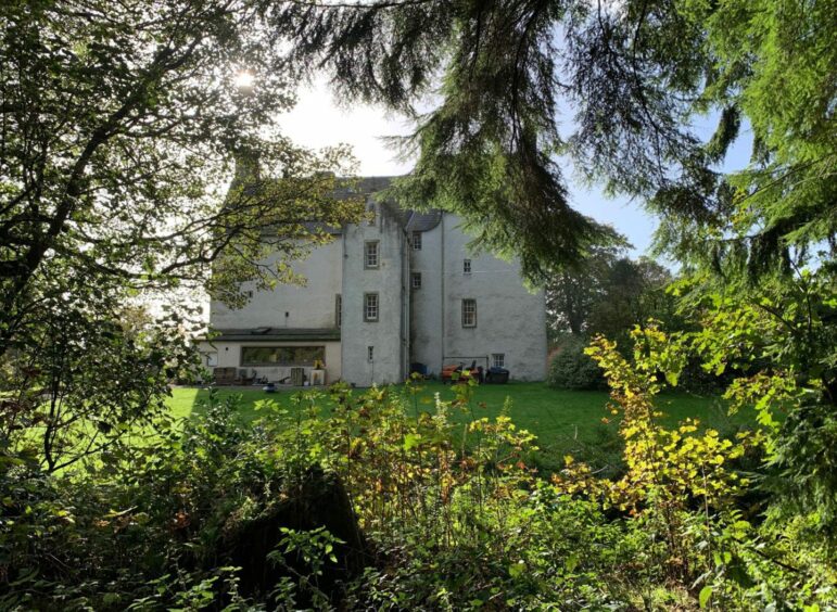
Tullibole Castle
One of the most prominent is in the grounds of Tullibole Castle which remembers the victims of the Crook of Devon witch trials.
In 1662, 11 women were executed during a reign of terror under the then-owners of the castle, William Halliday and his son John.
They were fanatical in their determination to rid the area of what they believed were covens.
As there were no memorials to these women in the village, the current owner of Tullibole, Lord Moncrieff, decided in 2003 to commission The Witches Maze in the castle grounds, a circular labyrinth of beech 33 metres wide.
There is also a stone pillar with the victims’ names etched on it.
Inside the Witches Maze
The peaceful setting of the maze is an effective tribute; adults will appreciate the serenity while children will love trying to find their way to the centre.
After a few failed attempts to make it to the middle, I began to wish I had had the logical mind of a child to assist. Next time, I shall bring some of the grandchildren along to ensure success.
The whole circular route from Crook of Devon doesn’t take long, and is generally well sign-posted.
There are a couple of busy roads to cross, and some pavement walking but otherwise it is easy going.
I parked at the village hall at the eastern end of the village, but if it is busy there are a couple of spots in nearby streets which could be used with consideration. There are also decent bus links.
Following the route
The route heads left down a lane, then left and left again to cross the B9097.
As the minor road through Drum starts to swing left, turn right along a somewhat overgrown track to a wooden gate and then continue along the very muddy edge of the next field to another gate which gives access to woods.
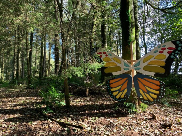
There’s no path at first, but stay to the left of the burn until you spot a prominent ruin on the left – do not cross the burn into the immediate vicinity of the castle – and then head uphill slightly to pick up a path adorned by a large, colourful wooden butterfly which leads to the maze.
Exit to the east, heading along a faint path in long grass towards a drystone wall and just before reaching the gate, turn left and follow the path to the old graveyard.
Head out the other side to a minor road and then up to the busy A977.
Once across, head uphill before taking a turn left opposite the entrance to Gelvan Farm. From here on, the walking is mainly on tracks and through grassy fields until you emerge back in Crook of Devon.

ROUTE
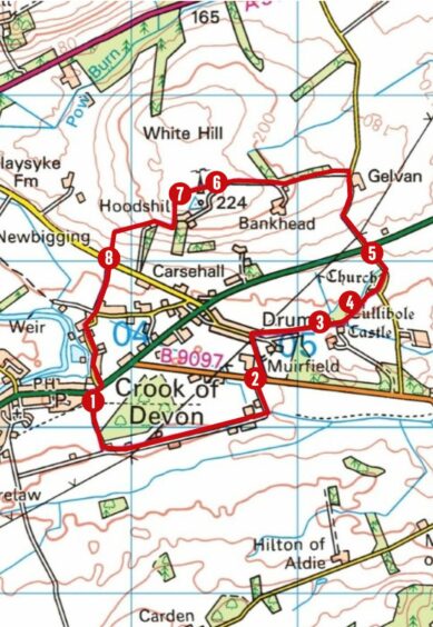
1. From Village Hall turn left down road, continuing on track past boarding kennels. Turn left at junction and follow track until it turns left again and walk out to main road.
2. Cross and take minor road to Drum. When road swings to left, turn right on rougher track, overgrown in places, which passes through wooden gate and along field edge to another gate.
3. Go through gate and turn left over burn, then head through trees (pathless for short section) until reaching ruin on your left. Head up past this to join woodland path with giant wooden butterfly sign which leads to maze.
4. Exit maze to east, taking grassy path and just before reaching metal gate in wall, turn left on path to follow fence on right. This crosses gap in old wall into graveyard, then exits on road. Turn left and walk up to main road.
5. Cross and head up minor road opposite to Gelvan Farm. Turn left beside farm entrance on access road signed for Hoodshill. Go right at t-junction and follow track as it swings left to reach farm gate leading into field (yellow core path arrow).
6. Walk along top edge of field with mobile phone mast to your right, continue downhill to metal pedestrian gate.
7. Go through and across grassy sheep field (pathless) to gate in bottom left corner for access to next field. Follow down edge with fence on your right to gate which opens at road.
8. Cross and take track opposite signed for Crook of Devon. Pass between houses then keep straight on, passing Fossoway School to reach main road.
INFORMATION
Distance: 6.5km/4miles
Ascent: 95m/310ft
Time: 1.5-2.5 hours
Grading: Short easy circuit for all the family, children will love the maze. Generally good signage round mix of tracks, paths, field edges and minor roads with two crossings of main roads. Very muddy in places, long grass and nettles in others, good footwear advised. Route passes through fields with sheep and cattle – dogs under strict control. Please remember to close all gates securely.
Start/finish: Crook of Devon village hall (Grid ref: NO 122017) also couple of spaces opposite hall and in some side streets with consideration.
Map: Ordnance Survey 1:50,000 Landranger Map 58 (Perth & Alloa); Ordnance Survey 1:25,000 Explorer sheet 369.
Tourist Information: VisitScotland, Perth iCentre, 45 High Street, Perth, PH1 5TJ (Tel 01738 450600).
Public transport: Buses to Crook of Devon on Stirling-Kinross route (X53).


Conversation