Calendar An icon of a desk calendar. Cancel An icon of a circle with a diagonal line across. Caret An icon of a block arrow pointing to the right. Email An icon of a paper envelope. Facebook An icon of the Facebook "f" mark. Google An icon of the Google "G" mark. Linked In An icon of the Linked In "in" mark. Logout An icon representing logout. Profile An icon that resembles human head and shoulders. Telephone An icon of a traditional telephone receiver. Tick An icon of a tick mark. Is Public An icon of a human eye and eyelashes. Is Not Public An icon of a human eye and eyelashes with a diagonal line through it. Pause Icon A two-lined pause icon for stopping interactions. Quote Mark A opening quote mark. Quote Mark A closing quote mark. Arrow An icon of an arrow. Folder An icon of a paper folder. Breaking An icon of an exclamation mark on a circular background. Camera An icon of a digital camera. Caret An icon of a caret arrow. Clock An icon of a clock face. Close An icon of the an X shape. Close Icon An icon used to represent where to interact to collapse or dismiss a component Comment An icon of a speech bubble. Comments An icon of a speech bubble, denoting user comments. Comments An icon of a speech bubble, denoting user comments. Ellipsis An icon of 3 horizontal dots. Envelope An icon of a paper envelope. Facebook An icon of a facebook f logo. Camera An icon of a digital camera. Home An icon of a house. Instagram An icon of the Instagram logo. LinkedIn An icon of the LinkedIn logo. Magnifying Glass An icon of a magnifying glass. Search Icon A magnifying glass icon that is used to represent the function of searching. Menu An icon of 3 horizontal lines. Hamburger Menu Icon An icon used to represent a collapsed menu. Next An icon of an arrow pointing to the right. Notice An explanation mark centred inside a circle. Previous An icon of an arrow pointing to the left. Rating An icon of a star. Tag An icon of a tag. Twitter An icon of the Twitter logo. Video Camera An icon of a video camera shape. Speech Bubble Icon A icon displaying a speech bubble WhatsApp An icon of the WhatsApp logo. Information An icon of an information logo. Plus A mathematical 'plus' symbol. Duration An icon indicating Time. Success Tick An icon of a green tick. Success Tick Timeout An icon of a greyed out success tick. Loading Spinner An icon of a loading spinner. Facebook Messenger An icon of the facebook messenger app logo. Facebook An icon of a facebook f logo. Facebook Messenger An icon of the Twitter app logo. LinkedIn An icon of the LinkedIn logo. WhatsApp Messenger An icon of the Whatsapp messenger app logo. Email An icon of an mail envelope. Copy link A decentered black square over a white square.

Time to batten down the hatches once again as Storm Henry approaches

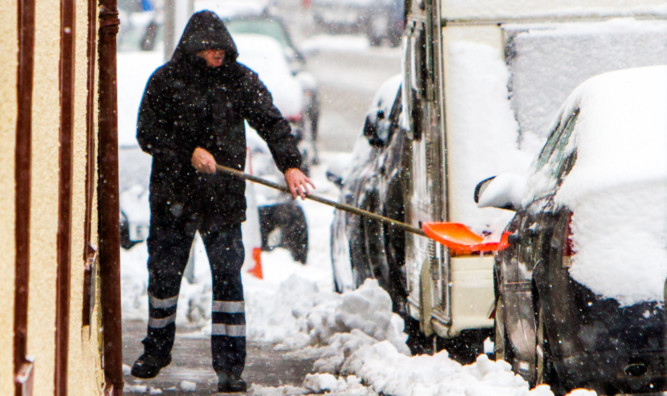
Clearing snow at the Feus in Auchterarder on Saturday.

Tayside and Fife are braced for yet more high winds and heavy rain with Storm Henry expected to strike this afternoon.

Gusts of up to 80mph are anticipated to return to the east coast after just 24 hours’ respite from the tail end of Storm Gertrude.

That system caused significant damage across Perthshire, Dundee and Angus last week and on Saturday, numerous routes were affected by snow.

Several roads had to be closed amid hazardous driving conditions, while there were a number of accidents, particularly on the A90 in Angus.

Now the Met Office has issued fresh yellow alerts for wind and rain this morning, with that escalating to an amber “be prepared” alert by early afternoon.

High ground and exposed areas could be affected by snow.

The amber alert will remain in place into tomorrow morning, with the wind expected to peak in the early hours,

Scotland’s Transport Minister Derek Mackay said there was “every likelihood” of disruption to roads, rail and ferry services over the coming days.

The west coast and Western Isles are expected to be worst affected by the gale-force winds, with gusts of up to 90mph likely in exposed areas.

He said: “The wintry weather is forecast to deteriorate with the arrival of Storm Henry.

“It carries an amber alert for high winds from Monday afternoon, continuing through the peak on Tuesday morning.”

The Met Office’s chief forecaster said: “An area of low pressure is moving east across the Atlantic, deepening as it does so, before arriving across the north-west of the UK on Monday.

“Gale to severe gale-force, west to south-westerly winds are expected to develop on the southern and western flanks of this system, firstly affecting western Scotland from late afternoon before progressing east through the evening and overnight.

“Storm-force winds are likely in the most exposed areas.”

The Met Office predicts that the system will begin to clear away to the north-east by around 9am tomorrow, though winds will still be very strong in places during the morning rush hour.

Thereafter, a period of more settled weather is expected, with a largely dry week predicted, although temperatures are not expected to rise above six degrees.