Still just one lottery jackpot win away from buying my own secluded Scottish estate, the opportunity to wander through the tranquil wooded policies of someone else’s is always time to treasure.
South of the meandering River Earn, near Forteviot, Invermay Estate nestles in the folds of the Ochil Hills. While the big house is largely concealed from view, the mixed woodland that surrounds it offers a delightful stroll through the valley of the Water of May.
On a cold winter morning, I set out from Forteviot, a curious wee community that can trace its history back to the Bronze Age – archaeologists unearthed a 4000-year-old royal tomb containing, among other artefacts, a bronze knife and gold dagger, here a decade ago.
In the ninth century, thanks to its fertile lands, it was a major Pictish stronghold, one of Scotland’s earliest kings, Kenneth MacAlpin, said to have established a palace here.
While investigations continue to discover its location, the Pictish tradition of stone carving is celebrated in the new Forteviot Cross, unveiled in the centre of the village last year.
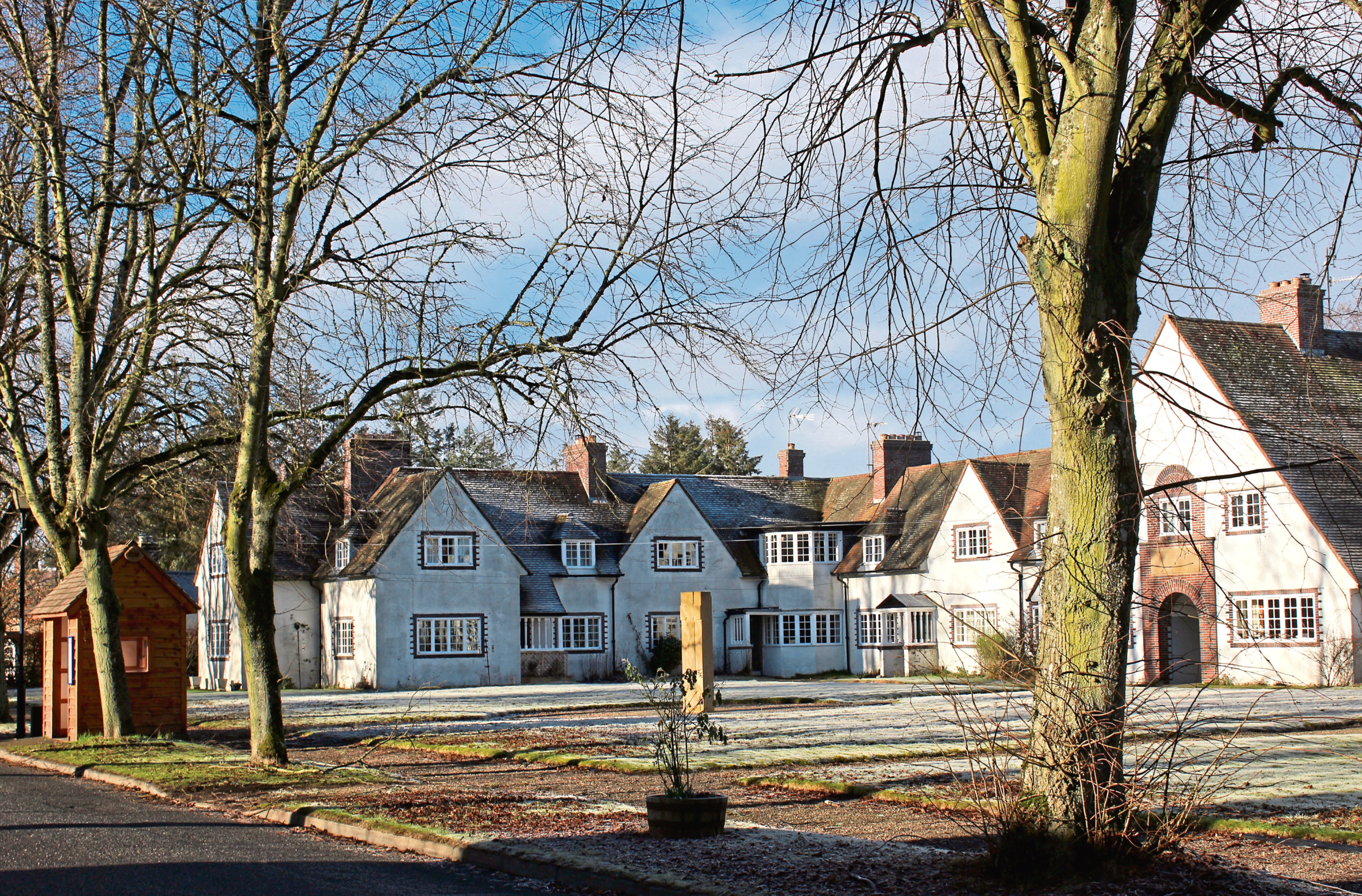
Despite ancient roots, the Forteviot of today dates from the 1920s when it was rebuilt as a model village in the style of an English garden city by John Alexander Dewar, son of the founder of the Dewar’s whisky brand.
At the west end of the main street, by the 18th century parish church, a snowdrop lined track and then path lead south through farmland to Green of May where, approaching the road, the signed trail cuts through the garden of a cottage. Affording the residents their privacy, I opted to skirt left round the edge of the property to meet the road at a metal gate.
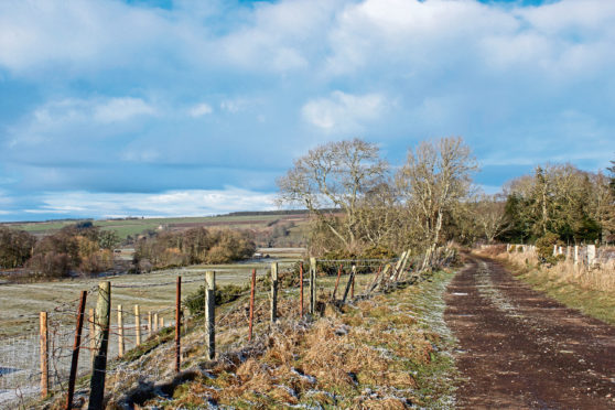
Across an icy Water of May, I entered the estate by the gates of the North Lodge and hiked along the driveway which runs parallel with the river below tall firs up to Scott’s Bridge and, above it, another possibly older but now closed crossing.
Staying on the south side of the water, I continued up to a fork in the roadway, one arm leading to Invermay House, the other – my route – climbing through the trees and past fields towards Home Farm.
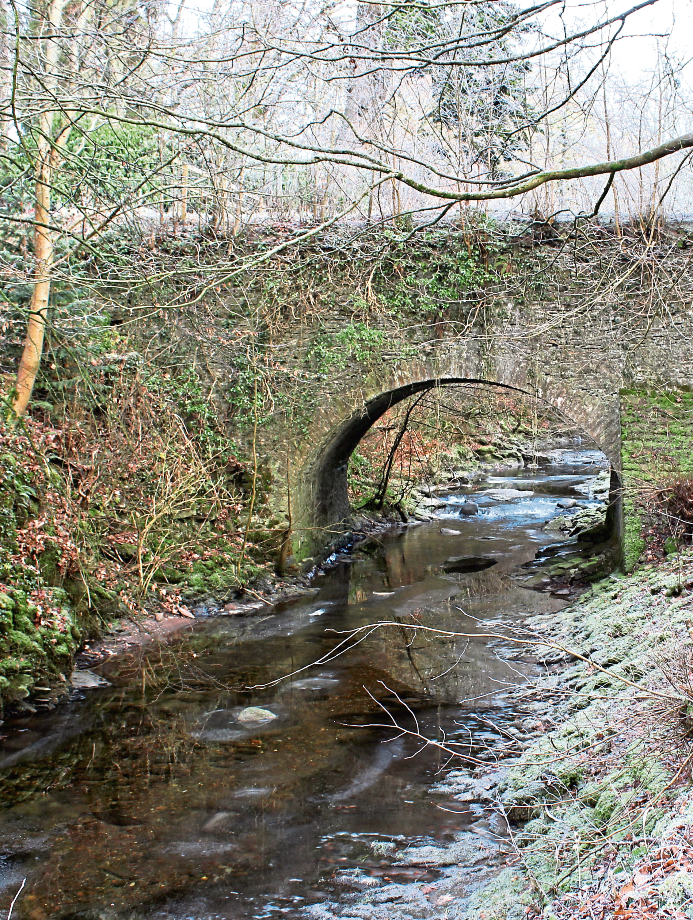
Crossing a frozen pond, the way curves steeply up to a steading at Hill of May where I branched left past a wood shed, the track looping down to cross a tiny stream before progressing through the mature oaks and beeches and tall pines of Birks of Invermay.
The river is initially out of sight but, fork left at a junction below a sturdy treehouse, and it is soon spotted weaving through the gorge down to the left.
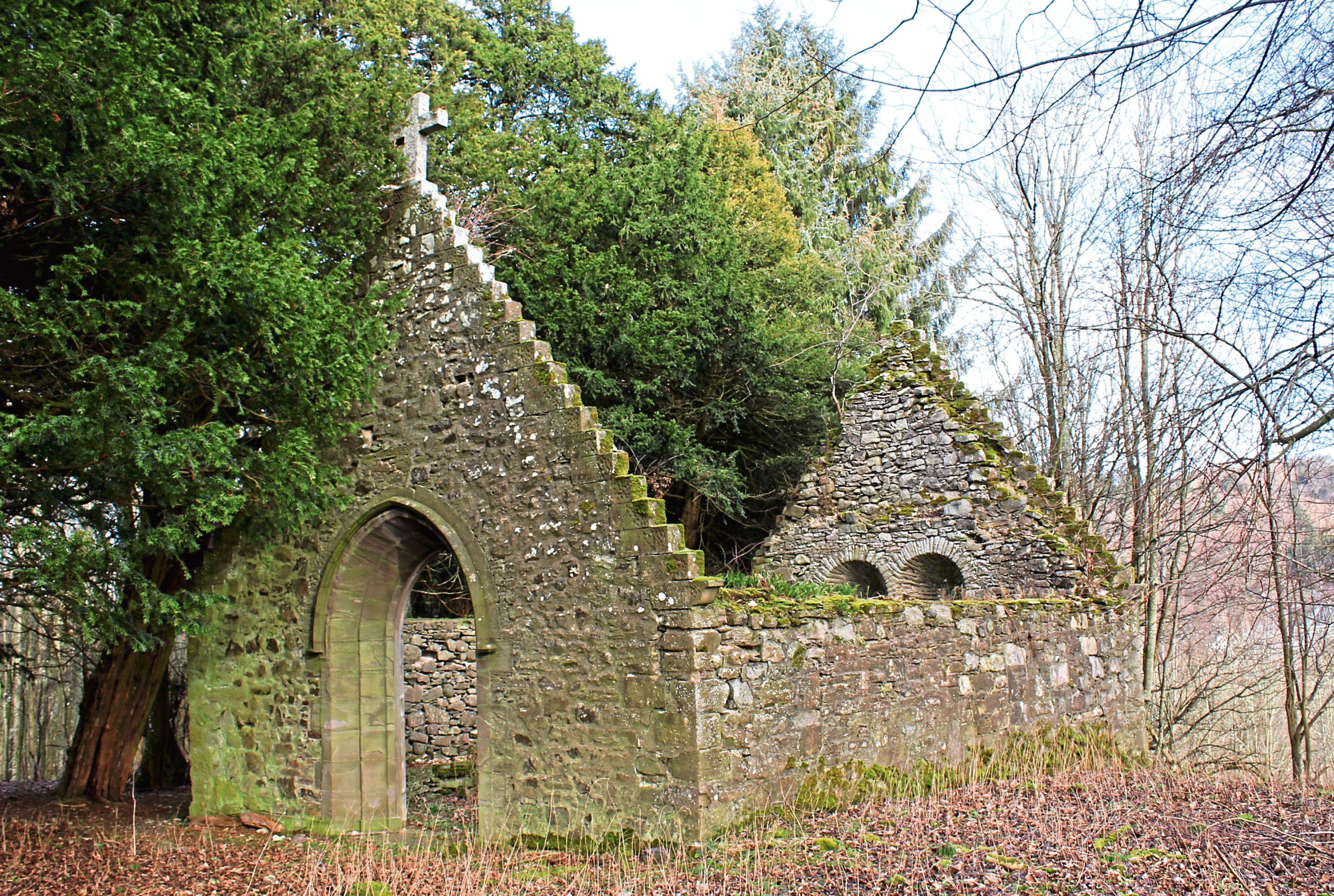
The track, however, retains its elevated course, squeezing through a slender strip of trees flanked by farmland to tiny Chapel of Muckersie, a ruined mid-19th century burial vault overgrown with yews.
Below the chapel, I left the estate at its south lodge and dipped to cross Water of May before circling the quiet enclave of Ardargie where modern villas have replaced demolished Ardargie House and its gardens.
The old mansion’s North Lodge survives and here I turned west, following a quiet country lane then track back to Water of May and Scott’s Bridge, snatching a couple of brief glimpses of Invermay House along the way.
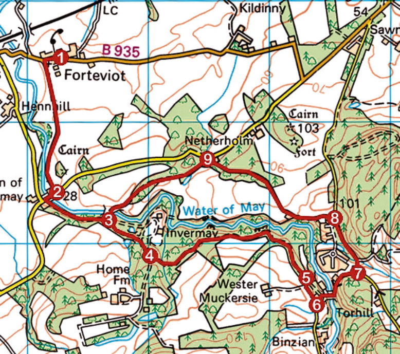
ROUTE
1. Follow track (signed Green of Invermay) 1.1km south from church to meet minor road.
2. Turn right, crossing Water of May, then go left through estate gates and progress along driveway.
3. Pass above two bridges on left to next junction, turn right (signed Hill of Invermay and Home Farm) and ascend track up past pond to steading.
4. Turn left past wood shed and follow track east through woodland, ignoring tracks branching right, to reach ruined chapel.
5. Go through metal gate, turn left and descend track to road.
6. Turn left, descend road, crossing Water of May, then ascend road to junction.
7. Turn left (signed Forteviot) and walk 500m north along road.
8. Turn left at North Lodge (signed Forteviot) and walk 1.2km along road to Invermay Cottage.
9. Go left, climbing over metal gates, and walk 1km west along estate track. Cross Scott’s Bridge over Water of May to point 3, turn right and retrace steps to Forteviot.
Distance: 9km/5½ miles
Ascent: 150m/500ft
Time: 2-3 hours
Grading: Easy, low-level route following tracks and minor roads through farmland and woodland with some ascent. Keep dogs on lead where signs request
Start/finish: Forteviot Parish Church, at the west end of the village (Grid ref: NO 051174). Parking by bowling club
Map: Ordnance Survey 1:50,000 Landranger sheet 58; Ordnance Survey 1:25,000 Explorer sheet 369
Tourist Information: Perth iCentre, 45 High Street, Perth PH1 5TJ (Tel 01738 450600)
Public transport: Stagecoach bus service 17 links Perth with Forteviot