One of the many ways in which Dundee is fortunate is its location.
Scotland’s Sunny City southwardly touches the Tay and rises in all directions north to give many residents a bright vantage of Scotland’s longest and grandest river.
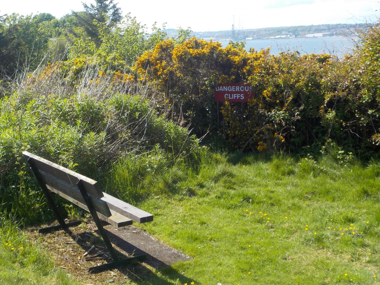
The Sidlaw Hills are to the north, a range of peaks are in Fife to the south and a wide estuary opens to generous sandy beaches at Broughty Ferry to the east and Tentsmuir to the south-east.
All this means that Dundee’s buildings and landmarks can be seen in many locations both in and out of the city.
Here is a list of the best spots to see glorious Dundee – from Fife, Angus, Perthshire and the city itself – including details on where to park and walk.
Dundee
1. Dundee Law
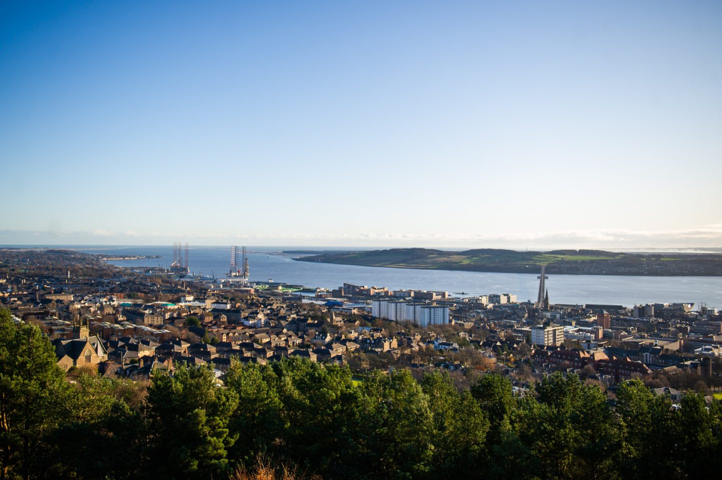 What Dundee Law is a volcanic sill and the city’s most distinctive landmark. It sits 170 metres above sea level yet is little over a mile from the city centre and River Tay. There is a wooded area beneath the summit.
Where Dundee Law – Google Maps link
Access There is a car park at the top accessible from Law Road so even those unable to walk up hills can enjoy the view.
View of Dundee on a clear day Unmatched, with both Tay bridges and many of the city’s commercial and residential buildings clearly recognisable. The 360-degree perspective also covers almost 45 miles over the city to Fife, Perthshire and the Sidlaw Hills to the north.
Walk Its central location means there are a range of walking options to reach Dundee Law. Law Steps is a direct route up from Lochee Road, while Walk Highlands suggests a walk from Discovery Point taking two to three hours.
2. Dudhope Park
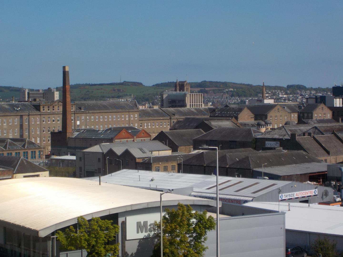 What Dudhope Park stretches upwards towards the Law, overlooking the city centre. It features medieval tower house Dudhope Castle, tennis courts, playground and a skate park.
Where Dudhope Park – Google Maps link
Access Parking at Dudhope Castle.
View of Dundee on a clear day Within the park you can see the Tay Road Bridge and some of the city’s taller buildings of the city. A more enlightening view can be found at the top of the footpath opposite Smellies Lane that links Lochee Road to the park. Here you have a fine vantage of Dundee’s former jute mills as well as Dundee University.
Walk If you want to have a stroll All Trails suggests a one-mile loop in the park.
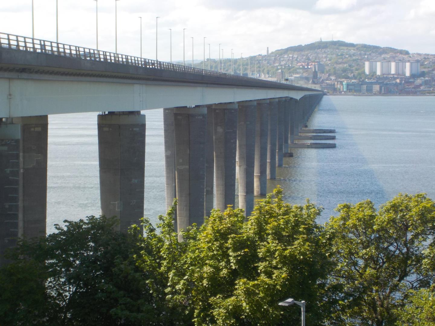
3. Tay Road Bridge
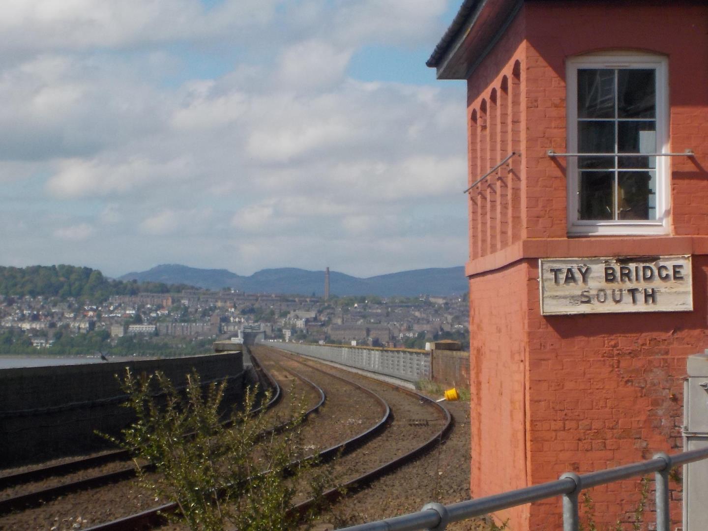
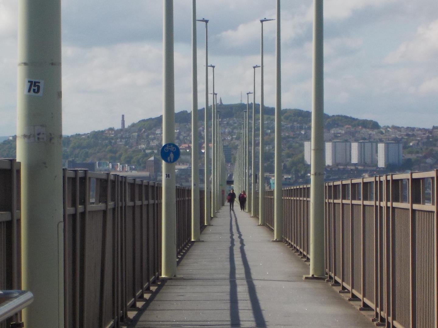 What Tay Road Bridge links Dundee with Fife. Pedestrians can use an enclosed path in the middle of the 1.4-mile-long structure.
Where Tay Road Bridge – Google Maps link
Access The bridge is easily accessible from Dundee city centre and parking is also available at the snack bar on the Fife side.
View of Dundee on a clear day Obviously the best view of Dundee comes while walking towards the city, which almost ushers you in as you get closer. Walking in either direction offers great Tay landscapes, including the rail bridge, as well as the structure of the bridge itself.
Walk In 2018 Charlie Watts, 7, walked the entire length of the bridge 20 times in a charity fundraiser. Failing this, you could just do ‘there and back’ for a refreshing walk of almost three miles.
Fife
4. Newport-on-Tay
What Newport-on-Tay is a village directly opposite Dundee on the south side of the Tay, immediately west of Tay Road Bridge. There are several viewpoints along Tay Street, including the Victorian water fountain.
Where Newport-on-Tay – Google Maps link
Access Parking in the village is limited so the Tay Road Bridge snack bar is not only a safe alternative but an iconic viewpoint in its own right.
View of Dundee on a clear day Dundee is blessed to have an area this close where so much of the city can be seen on all but the foggiest of days. It is hard not to be impressed by the outlook.
Walk Fife Coastal Path passes though, and Newport-on-Tay Traders Association has this suggested route to explore the village while enjoying the views.
5. Tayport
What Tayport is on the south side of the Tay estuary, almost five miles east of Dundee. There are views across the Tay along the Fife Coastal Path and also in Commonty Road, with seating at the end of the Fairy Lane link to the main Albert Street. Tayport has two lighthouses – east and west – that also offer a panorama.
Where Tayport – Google Maps link
Access There is a small parking area at West Lights.
View of Dundee on a clear day This is a good spot to get a perspective on the industry of Dundee Docks, while also showing the sprawling coastline of Broughty Ferry and Monifieth.
Walk The Courier’s James Carron came up with this walk of almost four hours that takes in many vantage points. The Fife Coastal Path passes through the village.
6. Wormit
What Wormit bounds the Tay just over two miles south of Dundee as the crow flies. Bridgehead Place abuts the railway line and gives a view of the beginning of Tay Bridge as it heads towards the city.
Where Wormit – Google Maps link
Access Parking area by the shore of the Tay at the end of Bay Road.
View of Dundee on a clear day Being so close to Tay Bridge adds a special dimension to what is already a grandstand perspective of the city.
Walk A circular walk from Walk Fife takes in the coastline, including part of the Fife Coastal Path, and the countryside between Wormit and Balmerino.
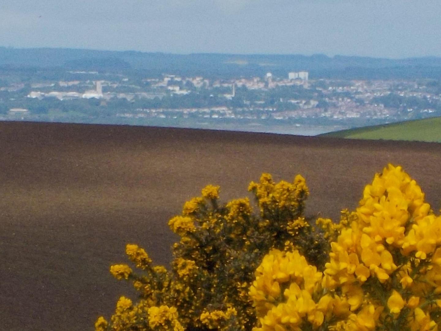
7. Norman’s Law
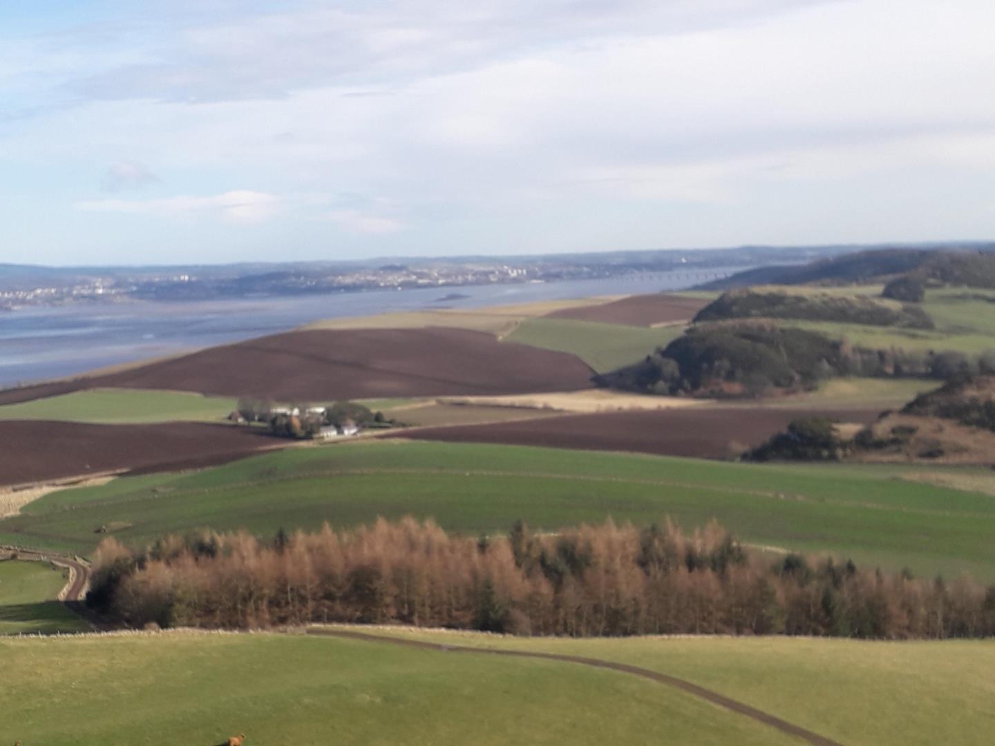 What Norman’s Law is a prominent hill at the far eastern end of the Ochil Fault. At 285m above sea level, it is the 11th highest hill in Fife, around four miles north-west of Cupar. As the crow flies, it is around 11 miles from Dundee city centre.
Where Norman’s Law – Google Maps link
Access Reaching Norman’s Law requires a walk up the hill, so parking depends on the route taken. To the east, you can park in a small layby at Pittachope, or Luthrie Village Hall. To the west, there is parking in the layby on A913 opposite the Glenduckie turning.
View of Dundee on a clear day Up here the city seems quite a distance away but the sprawling urban area is clearly visible and Tay Bridge particularly so.
Walk Fife Walking has a choice of five walks to Norman’s Law, with options to include Glenduckie Hill (218m), Prospect Hill (188m), Whirly Kipps (167m) and Emily Hill (154m) in the route.
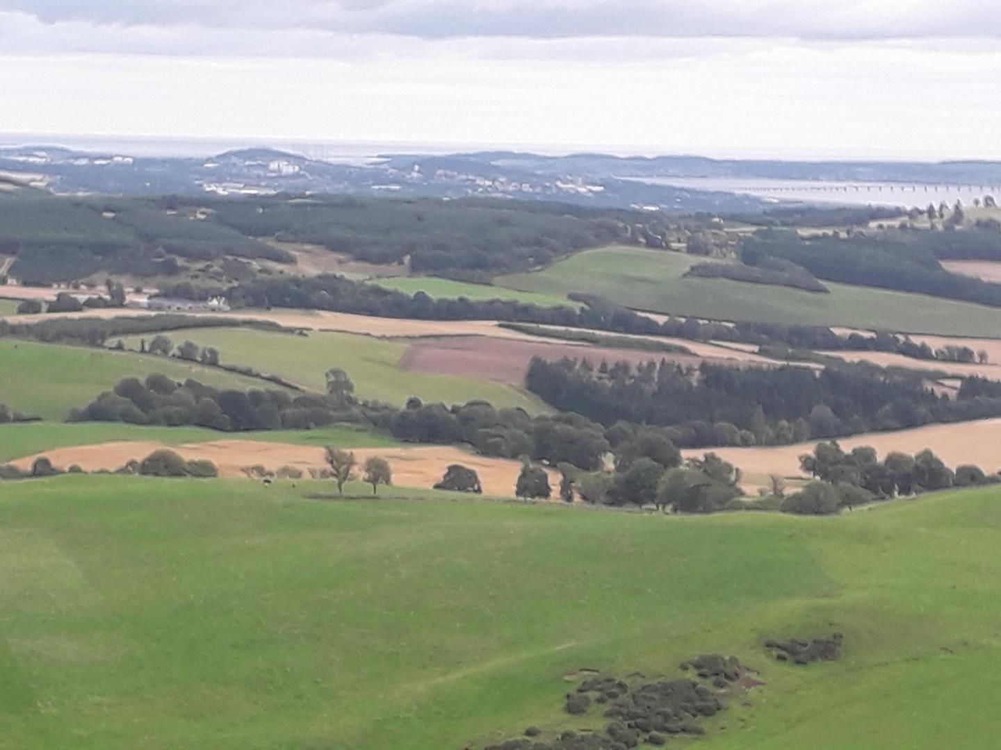
8. Whirly Kips
What Whirly Kips is a small stretch of the Fife Coastal Path, close to Norman’s Law. It is 10 miles from the centre of Dundee.
Where Whirly Kips – Ordnance Survey link
Access Parking is available in a small layby at Pittachope.
View of Dundee on a clear day Much of the western part of the city, including some of the multis, are visible to form a delightful contrast to the rolling countryside immediately below.
Walk From Pittachope, follow the Fife Coastal Path to the west. The view opens up as you climb towards the woods of Lindamus Hill. This section is Whirly Kips.
Angus
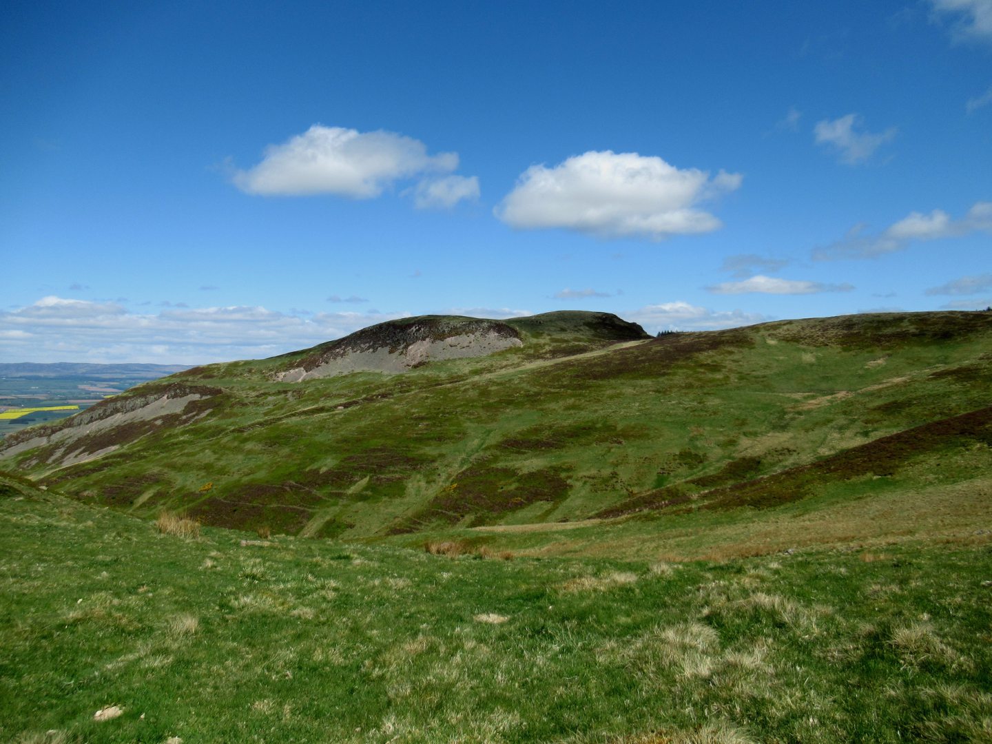
9. Craigowl Hill
 What Craigowl Hill is little more than five miles north of Dundee. At 455m it is the highest of the Sidlaw Hill. The masts on its summit are a prominent landmark for miles around.
Where Craigowl Hill – Google Maps link
Access The parking spot depends on which way the hill is accessed. There are usually plenty of spaces at Balkello Community Woodland car park.
View of Dundee on a clear day Impressive. Rolling farmland gives way to an urban panorama and there is also a good view of Dundee Law from a distance.
Walk Ambitious Dundonians can choose to walk from the city via Emmock Road and past Preston Farm. The well-surfaced path makes this feasible. Alternatively, Walk Highlands has a route from Balkello Community Woodland that also takes in Auchterhouse Hill and Balkello Hill.
Perthshire
10. Craig Rossie
What Craig Rossie is a 410m summit on the northern edge of the Ochil Hills, near Auchterarder. Visible from the A9, it is 30 miles south-west of Dundee.
Where Craig Rossie – Google Maps link
Access Craig Rossie can be accessed by walking from Pairney, where there are a few parking spaces.
View of Dundee on a clear day Due to its distance from the city this isn’t a destination to see much in detail but it is a surprise to see the distinctive oil rigs of Dundee Port from the summit.
Walk Walk Highlands has a route that is steep and sustained but grassy, making for an enjoyable circular walk with extensive views.
Home
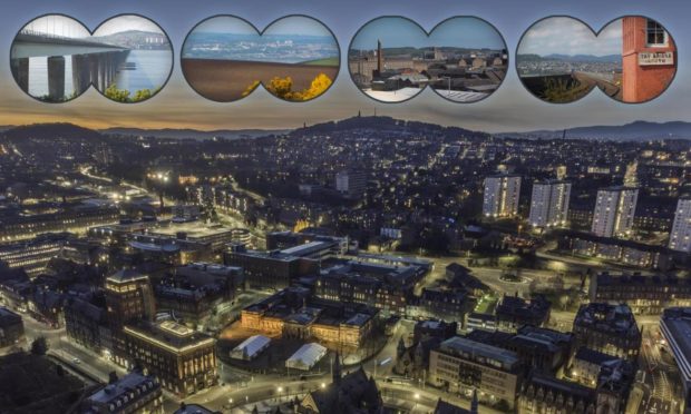
11. From the air

If all this seems too much effort, take a look at the drone images produced by Dundee-based photographer Ben Hirst. Hear also what he has to say about his project: