A community council’s efforts to build a sea wall and prevent a cairn on a popular Angus walking route from toppling into the sea could be in jeopardy because of ownership issues.
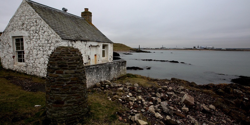
The cairn was installed at Ferryden to mark the end of the Great Outdoor Challenge and provide a place for trekkers to celebrate, but has been left perilously close to the waves because of erosion.
David Wilson, who lives in the lighthouse, sought advice on protecting the area around the cairn and the community council was considering putting up a concrete sea defence to protect the land from the waves.
However ownership issues mean it may now be outwith their “remit and capabilities to proceed.”
Secretary Gordon Paterson said, “We have been advised that the area forms part of a Site of Special Scientific Interest (SSSI) and as such Scottish Heritage will need to become involved and also anything that we do will require planning permission.”
Mr Paterson has also heard part of the land may be owned by the Crown, and as such the community council would need to involve the relevant department in any discussion.
“There was also talk that the lighthouse authority may own some, David Alston may own part of the land and that our own David Wilson may own part of the land.
“With these developments concern was raised by a number of councillors that this project was rapidly moving from that which had originally been organised and was now such that it was outwith our remit and capabilities to proceed.”
The community council will also further investigate sources of funding.
Mr Paterson went on, “However, before proceeding any further we need to ascertain exactly who owns which parcel of ground and it may be that a project committee will need to be formed involving all parties to provide a co-ordinated way forward.
“We have been advised that the area forms part of a Site of Special Scientific Interest (SSSI) and as such Scottish Heritage will need to become involved and also anything that we do will require planning permission.”
“Once this is done it was agreed that we could arrange for a meeting with all the relevant parties, preferably at the lighthouse area to look at what is required and what is the best way to achieve this.”
The coast-to-coast Great Outdoor Challenge takes place every October, with entrants walking from a dozen starting points in the west to finishing points along the coast between Arbroath and Fraserburgh. It attracts hundreds of participants every year.
Hard rock beneath the soil in that area makes the extent of the erosion all the more surprising.
Chairman Gordon Brown said, “Because there are so many interested parties developing here I’m beginning to think it’s a bigger project than we should be taking on on our own, although we’d be looking to have some input where we can.
“In the long-term, whoever has responsibility for the SSSI should show an interest in preserving it.
“With coastal erosion whoever are the interested parties should be showing an interest, and from the cairn side of it we should be showing support but we shouldn’t be the main driver for it.”
Much of the Montrose coastline is experiencing erosion and a Dundee University team has been under-taking a two-year study of its impact with a view to finding a solution.
One of the options is replenishing the beach with sediment dredged from the Montrose harbour navigation channel.
The findings of the second phase of the report will be presented to the Montrose Beach Study Stakeholder Group, comprising the port authority, Montrose Golf Links, Angus Council, Marine Scotland, Scottish Natural Heritage, Montrose Basin Local Nature Reserve and the Scottish Environment Protection Agency (SEPA).
As well as exploring options to slow the erosion the study will investigate funding options.