Fife is not overly blessed with hills. Away from the tapering eastern end of the Ochils and the Lomonds, where West Lomond stands proud as the highest point in the kingdom, summits are scant and scattered.
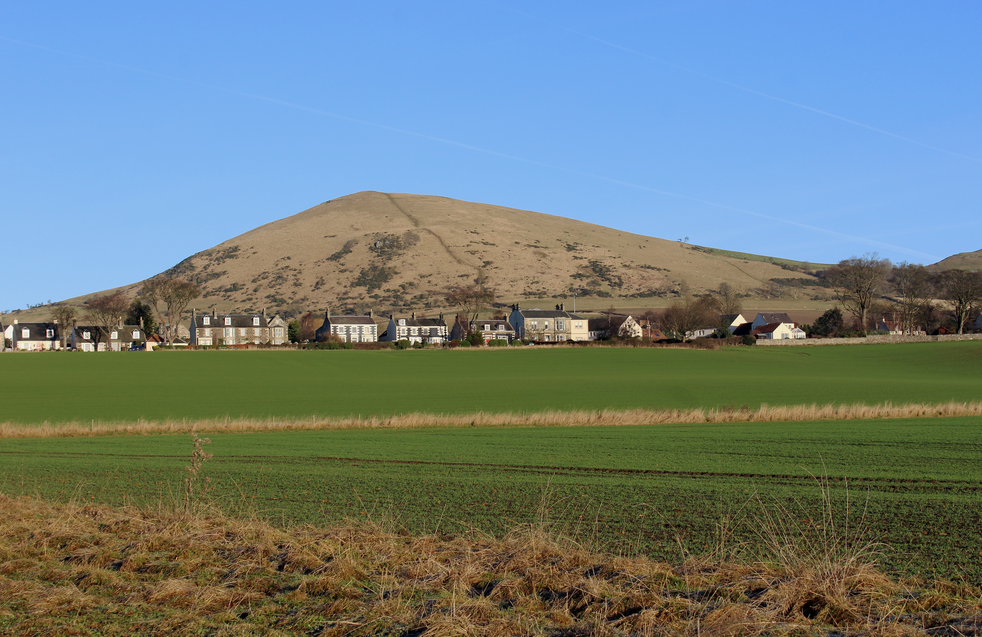
One particularly prominent peak is Largo Law, all that now remains of a once mighty volcano overlooking Largo Bay and the Firth of Forth and, as might be expected, views simply erupt from the summit.
Attaining the top, however, is not without its challenges and entrails a strenuous climb, particularly if, like me, you start the approach at sea level.
Selecting a crisp, clear winter day, in the hope of savouring the best of the panoramas promised, I set off from the seafront car park in Lower Largo, walking east along the road to join Serpentine Walk, a snaking path that leads north through fields towards Upper Largo.
Once the main route between the two communities, local tradition has it that the trail was well used in the summer months by Victorian ladies residing at Largo House – derelict since the 1950s – who wanted to bathe in the sea.
Where the path ends at a gate, a pavement continues, rising by the side of the road to Upper Largo where, passing the local hotel and garage, I branched on to North Feus, wandering through the quiet lane of cottages to the village cemetery.
Here, at the far end of a small car park, by an information board, a path then track – often quite muddy – run east to Chesterstone Farm where signs keep walkers on the right track. Staying to the left of the farm sheds, I skirted round the edge of the yard, striking up a track which, beyond a wind turbine, gate and stile, delivered me on to open hillside.
Here the path begins to climb sharply up the grassy slope and there is little respite from the leg-grinding gradient until the hill’s southern top is grasped.
In terms of outlook, it really does not get much better than this, with extensive vistas rolling out in all directions. To the north-west I can see the Lomonds while, to the south, the Bass Rock is visible across the Forth. Quite a treat, and it can all be enjoyed before the summit is conquered – it lies to the north, across a deep gully, and is crowned by a trig point.

Carefully retreating down my route of ascent – a steep descent is often harder on the knees than the ascent – I returned to the cemetery in Upper Largo but, rather than head south into the village, I walked north, up the road to join a waymarked path that cuts between fields to Keil’s Den, passing above the overgrown ruins of 18th Largo House.
This woodland gorge really blossoms in the spring and summer, wildflowers like bluebells and primroses carpeting the slopes beneath a leafy canopy of ash, beech, oak and sycamore.
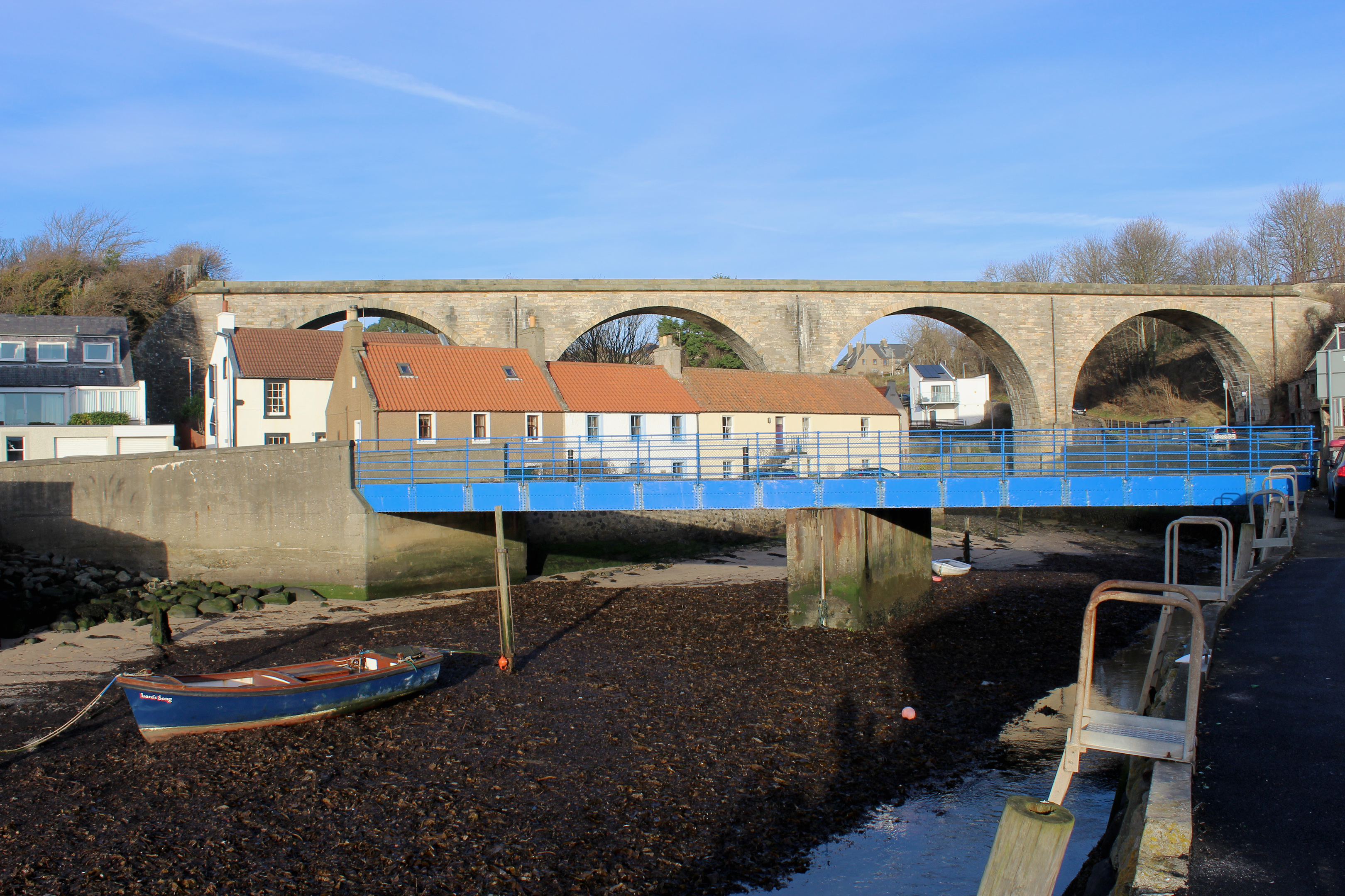
At the base of the slender valley, the Keil Burn skips south towards Lower Largo and I did likewise, dipping across a footbridge spanning the stream, before following the trail out to meet Cupar Road.
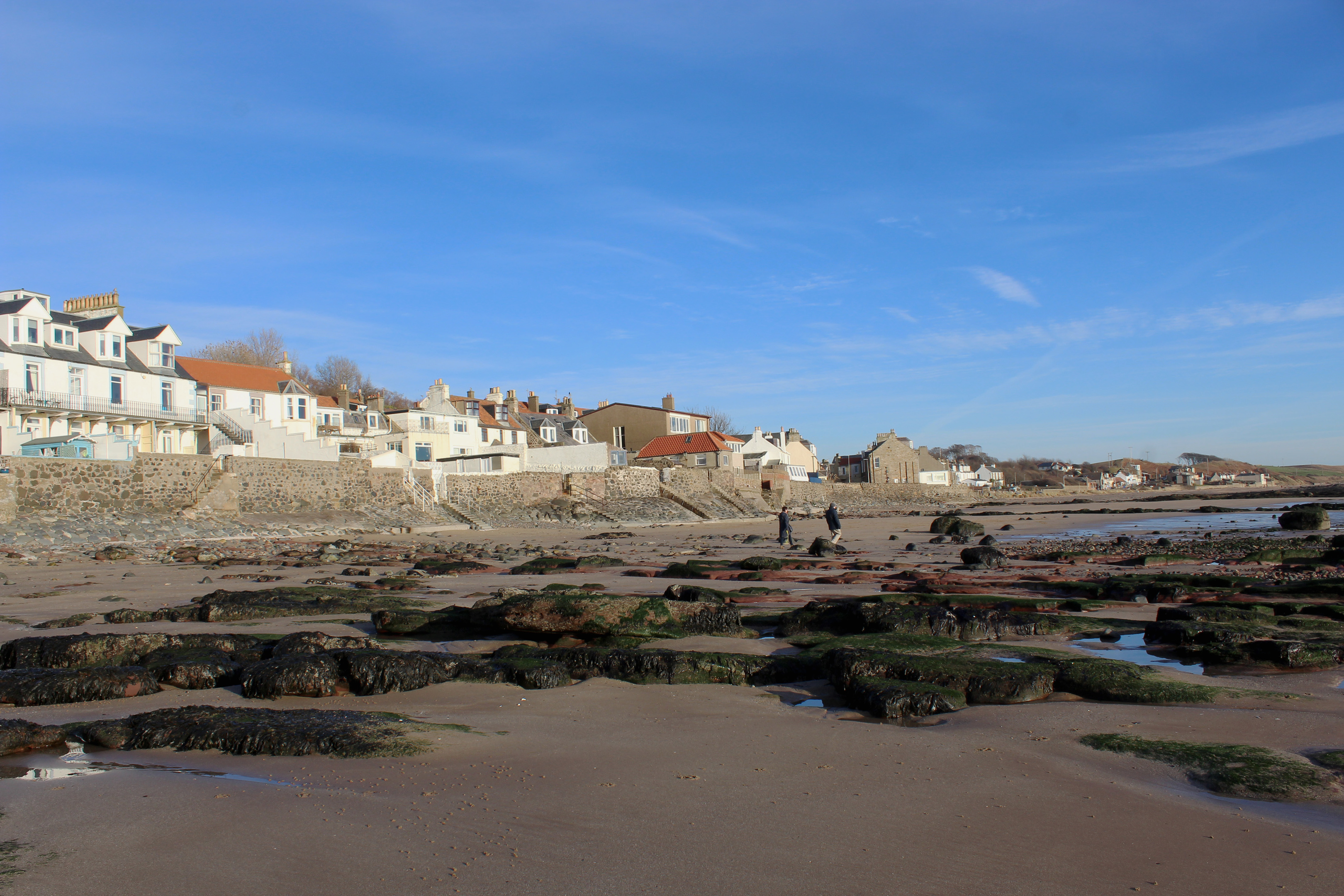
Parting ways briefly, I later renewed acquaintance with the stream as it fanned out into the ocean beyond Lower Largo’s picturesque harbour and, heading through a pend to the left of the Crusoe Hotel, enjoyed a sandy shoreline stroll back to the car park.
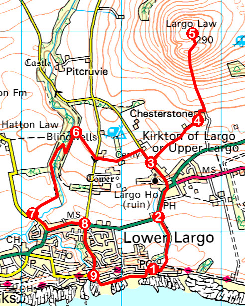
ROUTE
1. Walk 120m east on road and fork left (signed Serpentine Walk). Cross Fife Coastal Path, ascend concrete ramp and walk north on path.
2. Ascend pavement into Upper Largo, cross A915 and go left on North Feus to cemetery.
3. Go right, through gate, and follow path then track to Chesterstone Farm.
4. Bear left round edge of yard. Turn left, ascending track then path to summit of Largo Law.
5. Return to point 3 and walk 150m up road. Turn left, following path west. Cross road by caravan park and continue ahead on path.
6. Go left on path then, beyond bench, turn right, descending to cross bridge. Ascend to junction, go left and follow path south then west.
7. Turn left on Cupar Road then go left along Largo Road (A915).
8. Turn right and follow Harbour Wynd south.
9. Bear left at hotel and walk east on beach to car park.
INFORMATION
Distance: 8.6km/5½ miles
Ascent: 310m/1020ft
Time: 3 hours
Grading: Moderate route with strenuous ascent to summit of Largo Law. Keep dogs under close control through farmland and on hill where livestock grazes (no dogs on hill between March and November, at request of farmer)
Start/finish: Fife Coastal Path car park at eastern end of Main Street, Lower Largo (Grid ref: NO 422026).
Map: Ordnance Survey 1:50,000 Landranger sheet 59; Ordnance Survey 1:25,000 Explorer sheet 371
Tourist Information: St Andrews iCentre, 70 Market Street, St Andrews KY16 9NU (Tel 01334 472021)
Public transport: Stagecoach service 95 (St Andrews to Leven) stops in Lower Largo