This hike through the Sidlaw Hills, to the north of Dundee, was born of a sunny Spring afternoon stravaig which, as any seasoned walker or scholar of the Scots tongue will tell you, is simply an aimless wander.
It is something I do from time to time, setting off without purpose – no pre-planned route or destination in mind. Instead, I let my feet guide me, following tracks and trails to see where they lead, discovering places I might not otherwise have thought to visit along the way.
The eastern peaks of the Sidlaws are a fertile stomping ground for such an adventure and, from the Forestry Commission car park at Balkello Community Woodland, I idled up towards the base of Balkello Hill.
Emerging from the trees, uplands beckoning, I cut west below a pylon line to join an old hill track leading north to Denoon, a cluster of farms nestling in Denoon Glen, on the other side of the range.
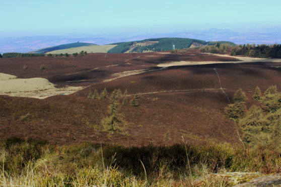
Winding up over the heathery western flank of Auchterhouse Hill, the trail breached a wooden gate and stile at its highest point before descending through a waymarked junction to cross a trickle of a stream.
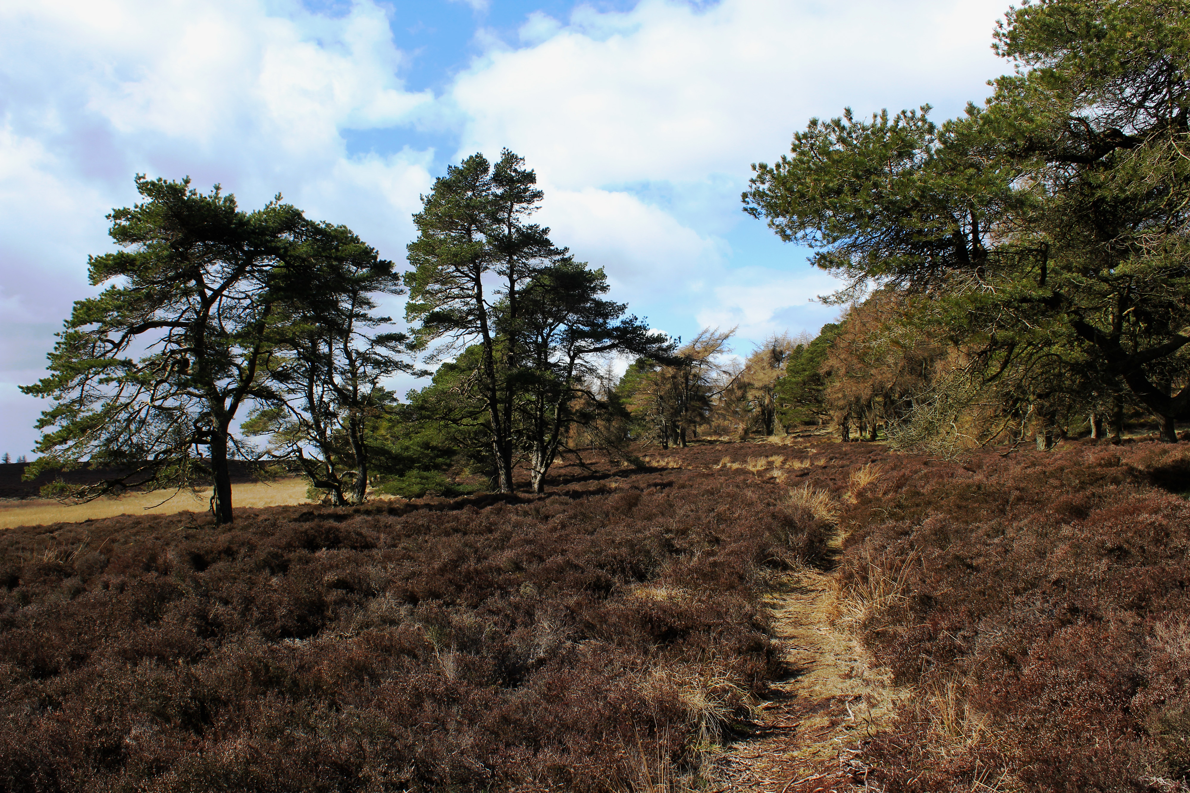
Leaving the road to Denoon here, I branched left, following the burn upstream on to the moorland plateau above, a slim path weaving through scattered Scots pine and larch bordering the edge of woodland.
The way passes an informal wild camping spot enjoying the shelter of the trees to reach a junction where a rough track branches left on to Scotston Hill. Spotting distant Kinpurney Tower, I pushed on ahead, leaving familiar ground, fingers crossed that I could find a way through both a quarry and the blanket of forestry draped over Henderston Hill.
The omens were good, a gate in the wall bounding the plantation affording easy access, the path beyond leading through a broad gap in the trees, skirting around the top of the abandoned workings before descending to the right of a wind turbine to a forest road below.
Branching left through a wooden gate part way up the initial incline, I found a path over the unmarked summit of Henderston Hill and re-joined the track further on.
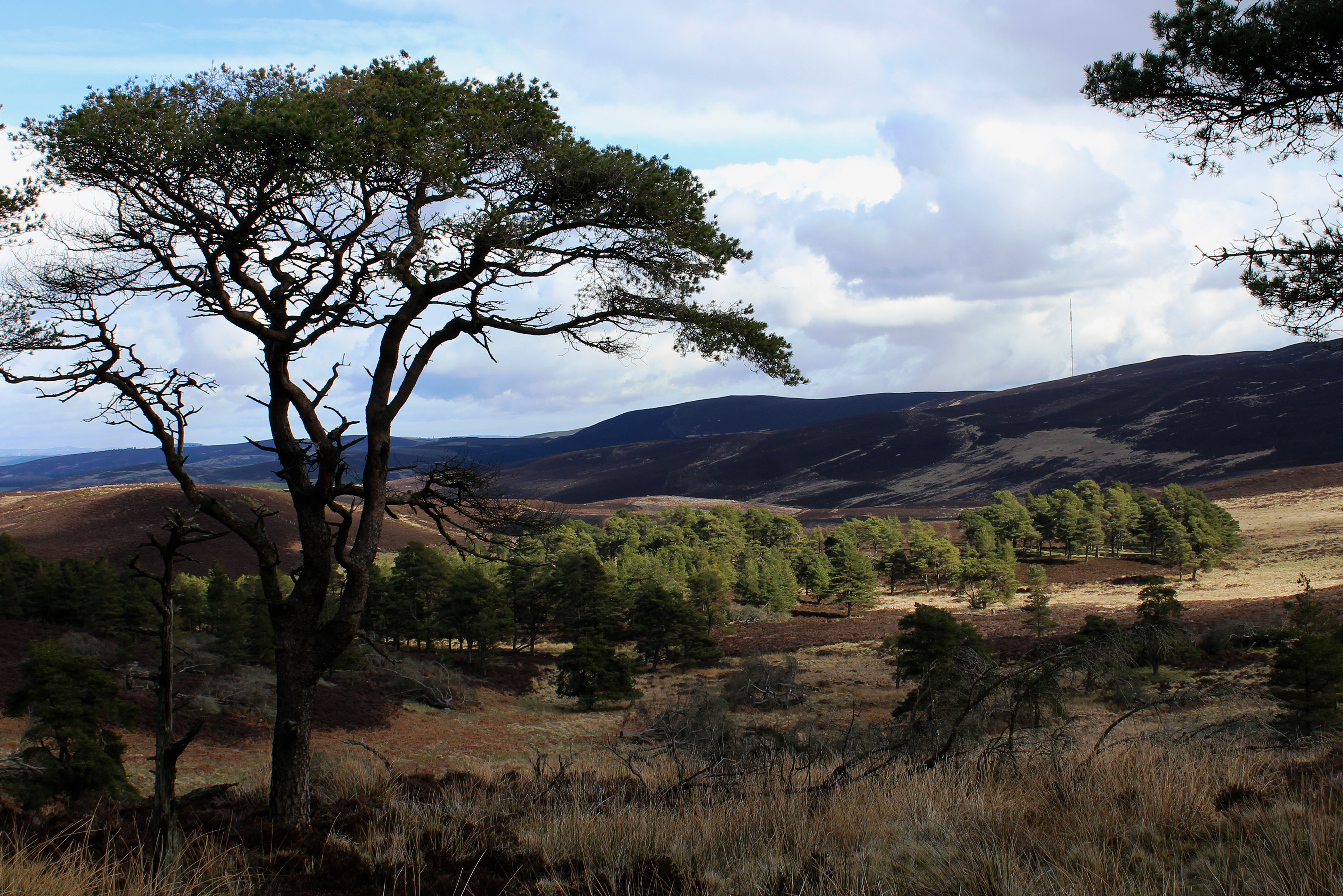
Next task was to plot a way out of the conifers and on to Kinpurney Hill and, briefly glimpsing the tower beyond the trees, I got the break that I needed – a fire break to be precise.
A peaty path running alongside rough vehicle tracks leading down to a fence and stile offered an easy exit, views opening out across Strathmore towards distant Kirriemuir and the Angus Glens.
What began as a stravaig suddenly gain purpose – to climb to the tower on Kinpurney Hill – and, with a clear path sweeping left through the heather, I cantered along the edge of a band of windswept larch, dipping left by the next copse of trees to a meeting point of wall and fences.
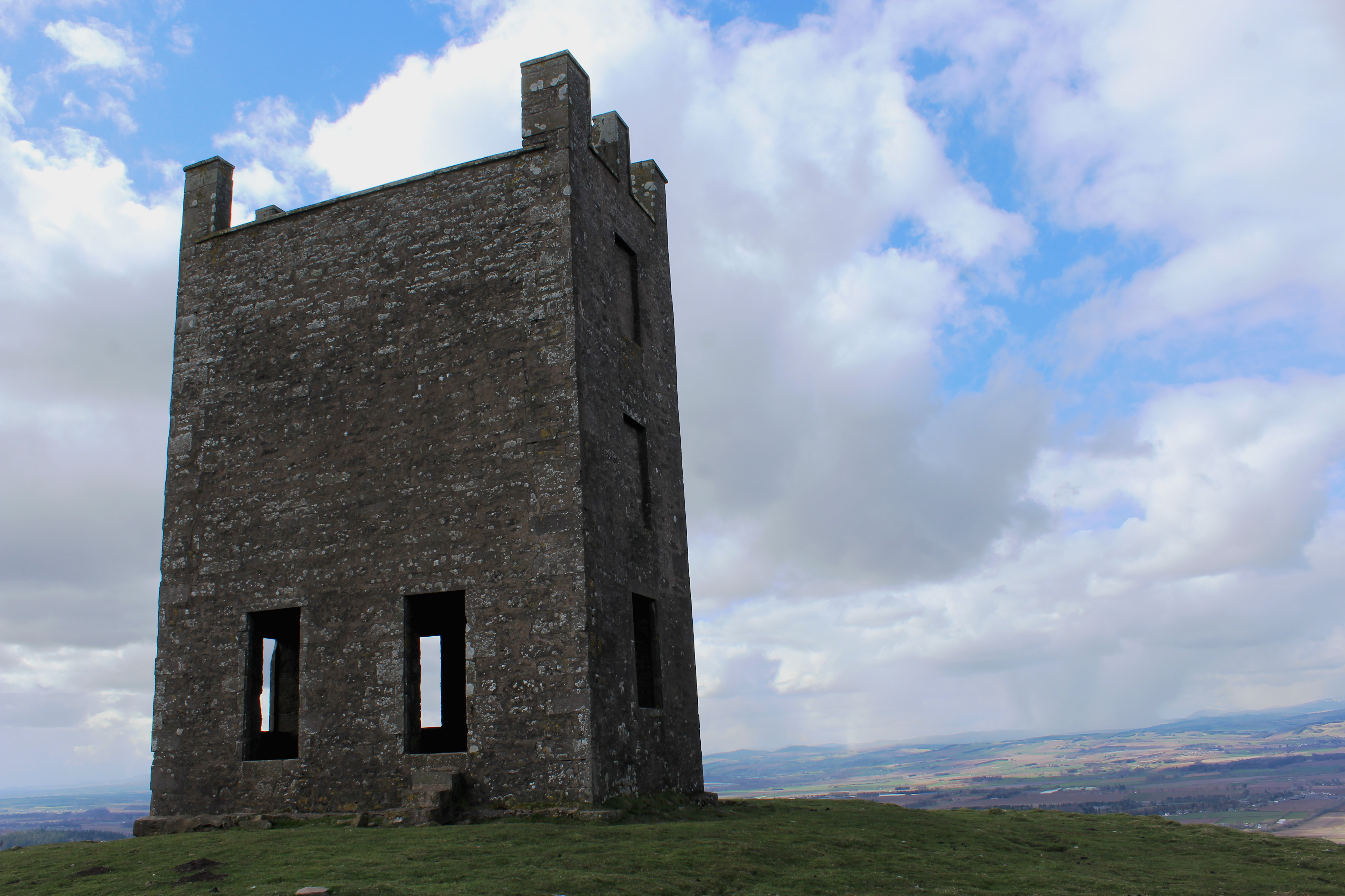
A simple stile spans an electrified wire here and, after squeezing through a gap between the adjacent wall and another fence, I made a beeline for the summit, a grassy path topping out at the tower.
Here, standing below the former 18th century observatory, a little out of puff but happy, I gazed back over the ground covered on my itinerant outing.
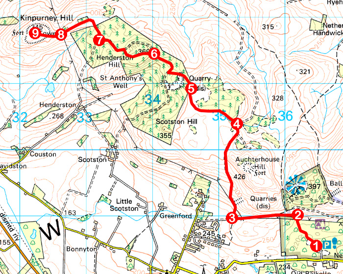
ROUTE
1. From information board, follow path bearing left to pond then right to junction. Fork left and follow path up through break in wall to northern edge of woodland.
2. Bear left up to gate and follow path by wall west up through col and down to signed junction.
3. Turn right (signed Denoon) and ascend path north to gate/stile. Cross stile and descend to waymarked junction. Bear left, dipping to cross stream.
4. Go left, cross stile and follow path west to junction. Continue ahead, curving right to gate in wall.
5. Go through gate and continue through break in trees to quarry. Descend path to track, turn right and ascend track for 600m.
6. Go through gate on left and ascend path over Henderston Hill. Descend, bearing right to re-join track. Turn left and follow track past pond on right to layby on bend.
7. Go right through break in trees to forest edge. Cross fence and bear left along path.
8. Cross fences below pylon line and ascend path to tower.
9. Retrace steps to Balkello.
INFORMATION
Distance: 14km/8¾ miles
Ascent: 520m/1700ft
Time: 4-5 hours
Grading: Moderate there-and-back route following tracks and paths through woodland and over open hillside with some strenuous ascent. Keep dogs under close control to protect wildlife
Start/finish: Balkello Community Woodland Car Park, two miles east of Kirkton of Auchterhouse on minor road to Tealing (Grid ref: NO 365385)
Map: Ordnance Survey 1:50,000 Landranger sheets 53 and 54; Ordnance Survey 1:25,000 Explorer sheet 380
Tourist Information: Dundee iCentre, 16 City Square, Dundee DD1 3BG (Tel 01382 527527)
Public transport: Xplore Dundee bus service 138 from Downfield to Kirkton of Auchterhouse (no Sunday service)